Quick Facts
Company Name: McConnell Dowell Constructors (Aust) Pty Ltd
Project Name: Various
Location: Australia
Project scope: Large scale infrastructure projects
Products used:
About McConnell Dowell
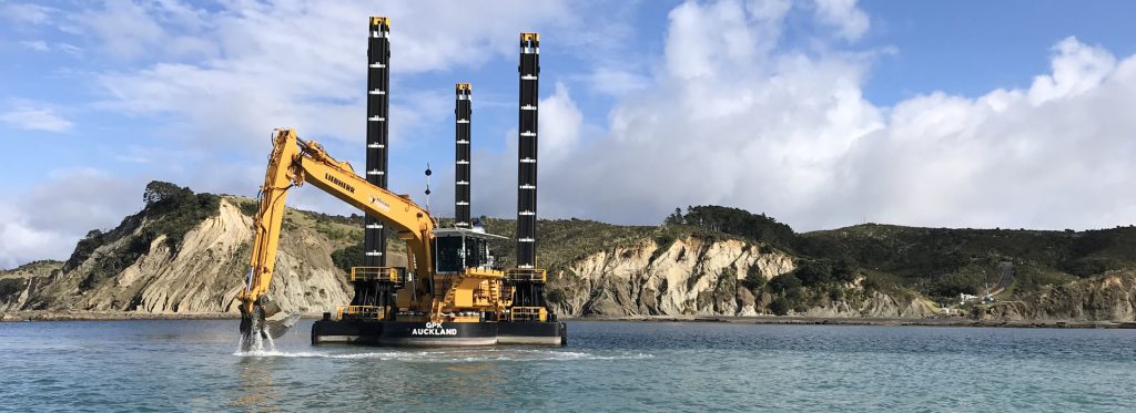
McConnell Dowell is a major construction contractor delivering large-scale civil infrastructure projects across Australia, including major public road and rail upgrades. The goal of these projects is to accelerate traffic and improve safety by building new roads, rail tracks, bridges and underpasses.
Many of the company’s projects are delivered using an alliance model where an integrated team is formed with representatives from McConnell Dowell, the government , the train operators and designers. The team works collaboratively to develop, design and deliver the works.
Kyle Mortimer is an Alliance General Manager overseeing a number of rail projects being delivered in this way. His day-to-day focus is on ensuring that the many gears that make up the Alliance move in lockstep, while “keeping an eye on the long-term” to make sure they’re “building towards a better and improved way of doing things over time.”
“How do we actually make sure we’re creating an outcome that achieves long-term benefits for the community and benefits for the state as a whole?”
Challenges: Improving project-wide visibility and communication
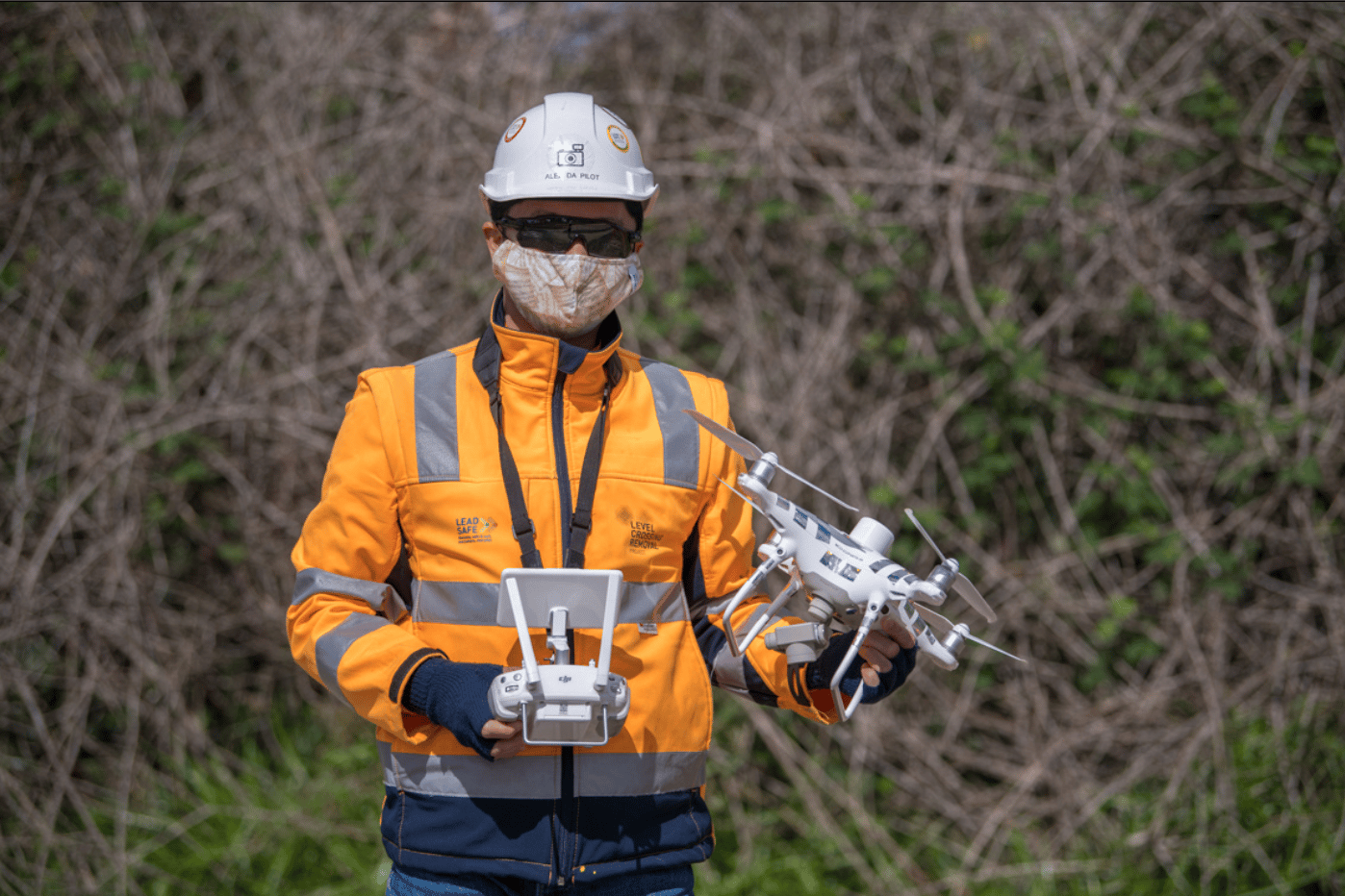
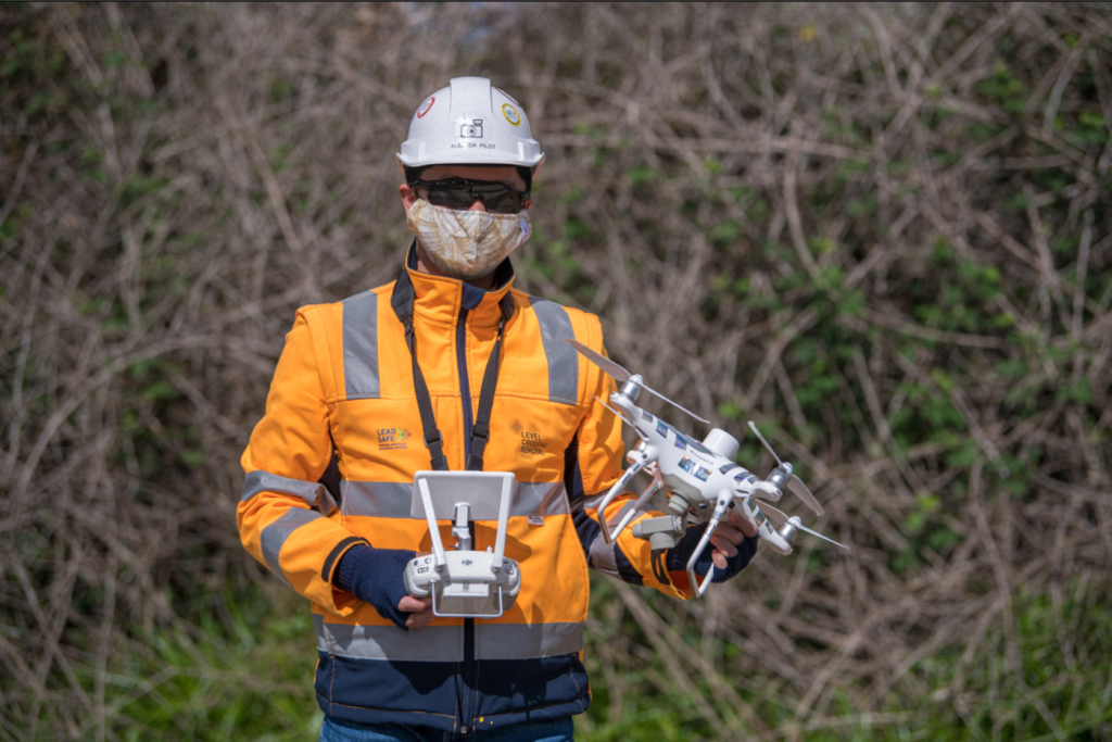
Alex Wong (pictured below) is the Senior Digital Engineer at McConnell Dowell. On previous jobs, Wong was resorting to taking snapshots of the site with a digital camera when asked to capture the state of the project. He describes these images as serving a “limited use case.” They lacked topographical information and context, requiring everyone to fill in the gaps with assumptions.
“A lot of the communication was happening via photography or just verbally delivered,” said Mick Mongan, a project director for McConnell Dowell. “You’d be depending on a supervisor to clearly articulate progress.”
Previously, McConnell Dowell relied on a surveyor to come out and topo the entire site through traditional means. This workflow would have proven too slow and ineffectual for this project’s demands.
In addition, without consistent visual progress being communicated, McConnell Dowell lacked an efficient way to monitor potential hazards and maintain their standard for safety on their projects.
“We’re constantly working within live transport environments with trains, cars and trucks whizzing past us in very close proximity to our sites, at 100km an hour,” says Mongan. “We often have a lot of people in the plant spread across the road or rail corridor. So, making sure everybody’s conducting their work in a safe way can be a challenge.”
Solution: Drone surveys and a collaborative platform to analyze them
Making data capture faster and more seamless
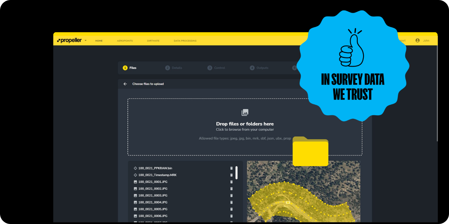
To overcome the dearth of useful imagery and topographical data, Wong and his team turned to Propeller’s drone surveying solutions. Despite not being a trained surveyor, Wong is able to fly their Phantom 4 RTK drone himself at least once a week for some of McConnell Dowell’s major project sites in Victoria.
While previously wasting hours taking static photos of his site for use in progress reports, he’s now, with a drone, capturing imagery that will be used to generate a georeferenced, interactive 3D model of his site—and he’s doing it all significantly faster than he was before.
After his flights, all Wong needs to do is upload the data for processing by Propeller. His site model is ready to analyze within 24 hours. No more context-less snapshots, no more outdated information.
Improved safety across the board
With drones, Wong has been able to document the site faster and more frequently, but it’s also allowed him to do so from a comfortable, cautious distance.
“Imagine you’re walking throughout the site and you need to navigate yourself through all this machinery. That, for us, is a big safety risk. Instead, I can safely launch the drone, do a quick flight, come back, and upload the information.”
And it’s not just Wong who benefits. A huge reason McConnell Dowell invested in drone technology is its potential to improve safety standards project-wide.
With so much survey-grade data able to be seamlessly shared in the platform, McConnell Dowell has been able to keep members of their team, as well as other internal and external stakeholders, off the busy jobsite. They’ve even shared access to their platform with subcontractors who are required to perform pre-planning work prior to arriving on site.
Not only does this save them time having to travel to the site, it also keeps them out of harm’s way.
Mongan also sees value in the ability to catch potential hazards quickly by observing their 3D models and leaving annotations in the platform for everyone to see.
Increasing visibility and communication
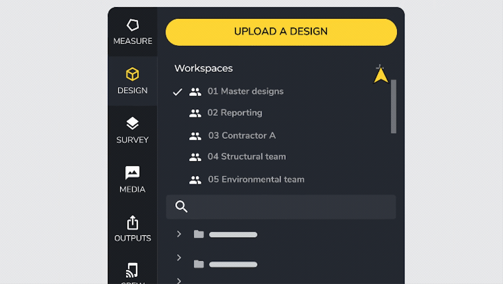
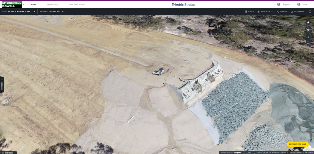
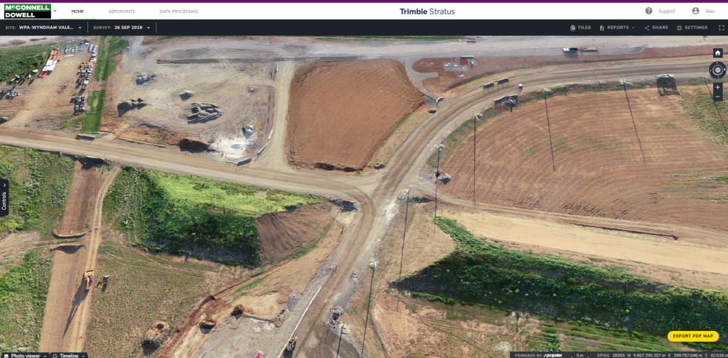
McConnell Dowell visualizes their site surveys in our interactive, cloud-based platform and uses a suite of measurement tools to easily track their material movement. They can measure their progress between surveys, and, by uploading surface design files, calculate how much remaining work they have to do before they meet spec.
It’s a tool that can be used to keep everyone on the same page in terms of site progress —whether it’s in line with the original design intent or whether there are any issues that are emerging. The users can zoom in relatively closely and get a view of the area they may be concerned about.
With these photorealistic models of their site—a new one available every time Wong and his team flies—Mongan has been able to communicate progress to his leadership team in a clear, visually engaging way.
“I’ve sort of used it as evidence to what we’re doing on a day-to-day basis and communicate the progress we’re making and some of the challenges we have,” says Mongan. “I use it from that perspective and to show other people that aren’t familiar with our projects what we are doing and what it actually looks like on the ground.”
“They’ve got full transparency on where we’re at and what’s happening,” says Mortimer. “They’re never more than two or three days out in terms of where the progress truly is, despite when the myriad of (probably outdated) spreadsheets is telling them.”
McConnell Dowell has literally brought hundreds of on-site and office personnel from all corners of the organization onto the platform, empowering them to assess the site themselves—something made possible by the ease of the platform’s interface.
Mortimer, whose aim is to continually improve the efficiency of every aspect of the project, sees real value in the accessibility of actionable surveys Propeller offers. For example, instead of having to go on site themselves or request a new survey when they need to update a design, Mortimer notes that the engineering department can now jump onto the platform and pull information themselves.
“We’re removing some of the administrative tasks from their job—freeing them up to concentrate on planning and getting more value-add out of their day,” says Mortimer.
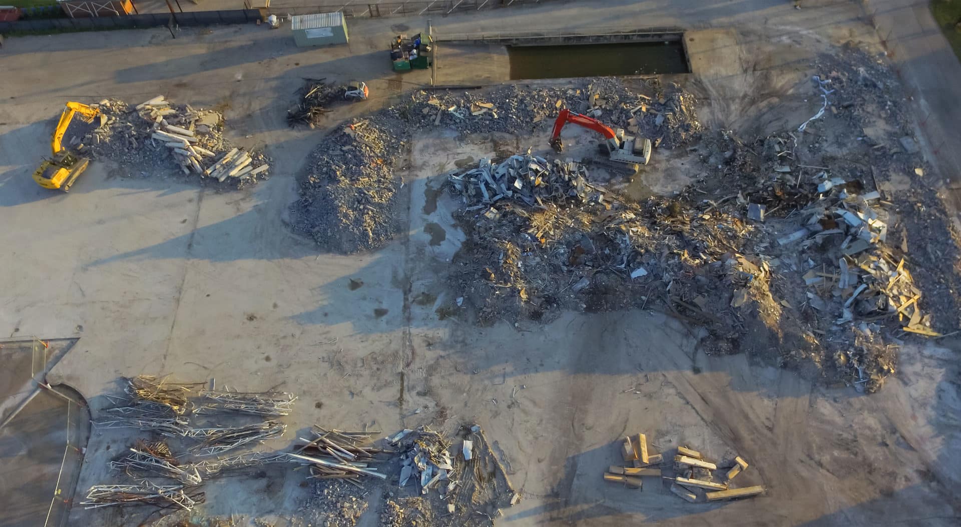
In one instance, we were able to use the model and platform’s measurement tools to detect issues with the spacing of railroad ties on a project that the crew might otherwise have missed by on site.
Propeller was used to measure the centers between the ties, and they weren’t right. So a quick call was made to the construction manager on site to alert them to the issue. They were amazed that the issue had been detected in the way it was.
That’s the sort of thing that helps to keep people on their toes, as well. It’s not that we’re trying to be the policemen, but it’s about trying to help to bring everybody up to a constant and acceptable standard.
Site analysis from a new point of view
In addition to the visual transparency that Propeller powers, McConnell Dowell is finding new uses for their 3D models every day. Their projects teams primarily uses the volumetric measurement tools in the platform to track material movement between surveys, but they’ve also used the platform for graded calibration, logistics planning, quality control, and site supervision.
And for McConnell Dowell’s corporate leaders, these surveys are filling in the gaps in between site visits, and enabling them to get, literally, a more of a strategic view of their entire portfolio of projects without having to travel. A Fundamental part of this whole initiative is: turning data into usable information and insights.”
Impact: Improving McConnell Dowell’s reputation for project excellence
McConnell Dowell is awarded projects, in part, because of their commitment to project excellence and transparency, but their openness to digitization certainly plays a role. Because their projects are often taxpayer-funded, everyone involved sees it as their mission to complete the work as efficiently—meaning on-time, under budget, and to spec—as possible.
“First and foremost, we’re showing that we come in as an honest contractor, and we’re willing to work with you in all honesty to get the job done right,” says Wong.
McConnell Dowell’s embrace of drone surveying and Propeller has played a large part in the consistent, superior work they’ve performed so far, and is a signifier of their continued success in the industry.

McConnell Dowell is using Trimble Stratus, powered by Propeller. Trimble the global leader in positioning technologies, was an early partner of Propeller. With SITECH, the global distributor of Trimble solutions, we work to deliver Trimble Stratus’s survey-grade drone data capabilities to contractors of all sizes in the heavy civil industries.