Predict how rainfall will impact your site before a drop falls
Hydrology solutions
Combine drone surveys, machine telematics, and automated reporting into a single integrated platform built for rainfall projects.
Key benefits
Visualize rainfall scenarios on site
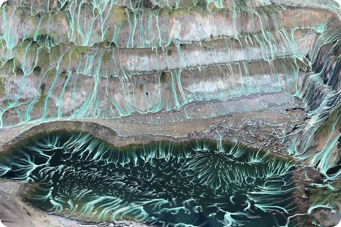
Visualize water flow in 3D across your site for any rainfall scenario
Identify areas of risk
Identify ponding and erosion hotspots before construction begins
Plan more efficiently
Optimize grading and drainage designs to reduce operational risk
Support decision-making
Make confident decisions as a team, backed by clear visual proof on a single map
Why it matters
Unexpected rain can halt work, damage surfaces, and create costly delays. Propeller’s rainfall simulation tool gives you a clear, actionable view of water movement across your site under any scenario. Instead of guessing where water will collect, your team sees exactly where drainage or erosion could become a problem and can act in advance.
How our rainfall simulation function works
Step-by-step
- Upload site survey data from drones, LiDAR, or AeroPoints
- Select rainfall intensity and duration (e.g., 10-year storm, 24-hour storm)
- Run the simulation—Propeller calculates runoff, ponding, and flow paths automatically
- Review results in 3D or 2D to see high-risk areas clearly
- Adjust grading or drainage plans based on the simulation and share maps with your team
Use cases
Earthworks crews
Know exactly where to adjust slopes or build drainage
Quarries and mines
Prevent water accumulation that slows production or creates hazards
Construction managers
Provide clear evidence for safe planning and regulatory compliance
Environmental and civil teams
Evaluate erosion risks to protect surrounding land