AeroPoints:
Smart ground control points
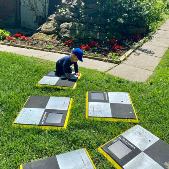
Built for beginners and validated by experts, AeroPoints are the industry’s only smart ground control points. Now, you can use with any drone on any worksite to capture survey-grade data when you fly.
Easy
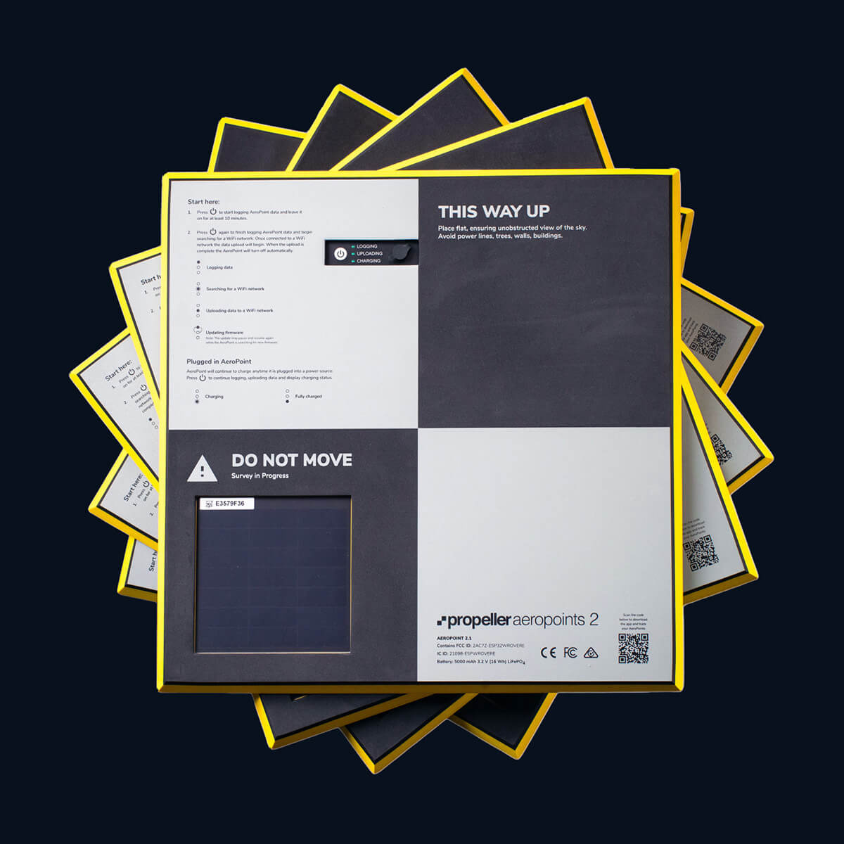
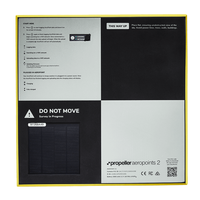
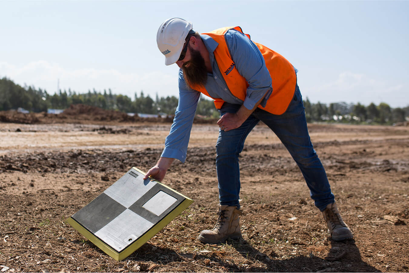
Lay them out, press a button, and they’ll start recording their position automatically.
Integrated
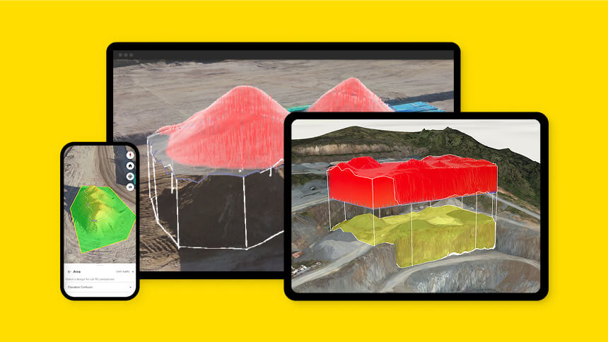
Pair with Propeller for an unmatched, all-in-one mapping solution that allows you to transition from capture to volume calculations.
Accurate
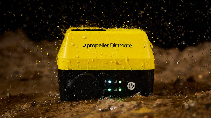
Map with centimeter-level accuracy that’s easy to prove using a dual-frequency GNSS receiver that’s protected by a durable outer shell.
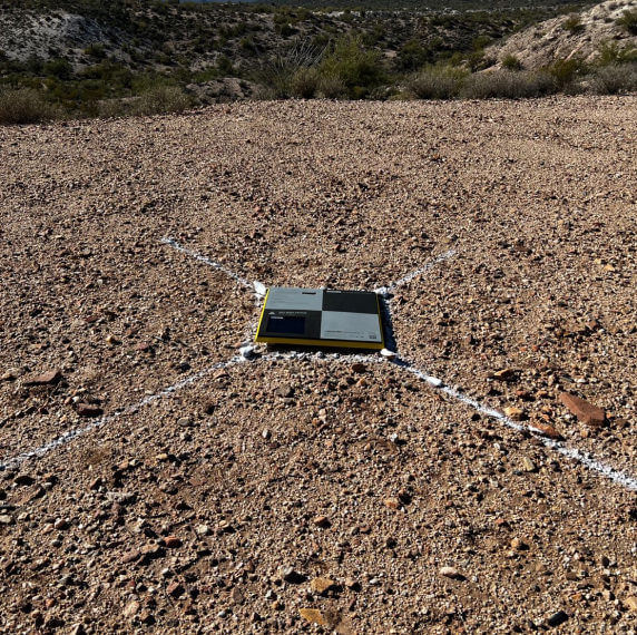
Designed to collect data
Got a job?
See how AeroPoints are up to the task
10 minutes**
10 minutes**
10 minutes**
Vertical: 20mm + 1ppm
5 hours (charger)
*Known Point Method
**Propeller Corrections Network
Propeller Corrections Network
Automatically process and correct our survey data from anywhere within the Propeller Corrections Network. Check your coverage in the map.
Learn how to map with AeroPoints
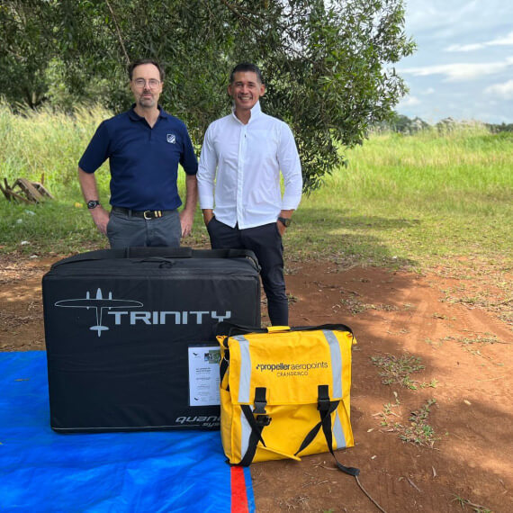
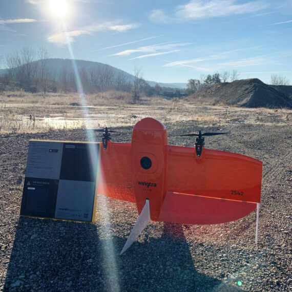
Pair AeroPoints (ground control points) with our platform and compatible drones for a complete 3D mapping workflow.
See AeroPoints in action
“What’s new in AeroPoints 2? A new Wi-Fi chip delivers fast, reliable connectivity. Dual-frequency GPS, shorter flight times, better positioning. Upgraded battery performance and plug-in charging provide more flexibility in the field.”
– Andrew Auer, Territory Sales Manager at Propeller Aero
“After a long day of collecting data with our Wingtra, we let our 3 year old sync the Propeller Aero aeropoint data to the cloud! Life’s easy when you pair the world leading VTOL fixed-wing Wingtra with Propeller Aero!”
– James Donaldson, District Manager at EagleView
“When accuracy and precision is the most important thing in aerial mapping quality.”
– Yovist Taufan, Owner & Director at PT Quantindo
“Got a set of AeroPoints to help me create a topography study of my 154 acre listing. I’ll have a preliminary siteplan for an approval of a special use permit with the County and a roadway easement with the BLM. The current interstate highway expansion is going to be helpful secondary right of ways.”
– Bryce Perez, Realtor
Want to see more?
Survey processing
Our experts process your survey data to create a 3D model of your site.
All your FAQs, answered.
You can buy them either directly from Propeller Aero or from one of our partners. Buy online here, or contact us to find a partner near you.
You can purchase any quantity of AeroPoints – Ground Control Points through the store individually or in bundles of 5 or 10. AeroPoints are known to deliver reliable, accurate data every time. The more AeroPoints you use, the more coverage you’ll receive through redundancy if they are accidentally moved or covered. Additionally, more AeroPoints means even higher accuracy and extra data for checkpoint verification.
Yes. To use AeroPoints, you need an active subscription to the Propeller Corrections Network. This subscription is included with your AeroPoints purchase for the first 12 months. After that, if you have a current Propeller Platform license, the Network subscription continues at no extra cost.
If you are not using the Propeller Platform, you can subscribe to the Corrections Network separately for $1000 USD per year. This subscription covers published coordinate systems only and does not include local calibrations.
Yes. We offer a warranty for defects in material and workmanship for a period of one year from the date of activation.
The date of activation is defined as either:
- a) the date an activation code is used to activate a new AeroPoint group containing that AeroPoint, or
- b) the date an unactivated AeroPoint is moved into an already activated AeroPoint group by a Propeller employee.
If Propeller Hardware Support determines an AeroPoint to be defective within the warranty period, Propeller may, at its discretion, exchange the defective AeroPoint free of charge. Only Propeller Hardware Support can make this determination, and proof of purchase may be requested to verify warranty eligibility.
Any AeroPoint replaced under warranty will be covered for the remainder of the original warranty period.
For customers using base station networks, you can get data in as little as 30 minutes., depending on the network you are using. For customers using the known-point method, corrections can be available instantly.
In all other cases, data are available within 24 hours after uploading. This varies based on local providers and, in many places, it’s much faster – contact us to find out typical times in your area.
AeroPoints work from 14ºF (-10ºC) up to 122ºF (50ºC) ambient temperature.
AeroPoints are dust proof, and can tolerate moderate rain.
AeroPoints are currently in stock and ship following a 48-hour processing period. Shipping times do vary based upon your location. If you would like to order some AeroPoints, please get in touch with the team to place your order.
If you’re using the latest model of AeroPoints (AeroPoints 2), the minimum capture time is 10 minutes.
For customers using the older generation of AeroPoints, we recommend they stay active for at least 45 minutes to record enough positioning data sets to be survey-grade accurate.
If you’re using a mixed fleet of AeroPoint 1s and 2s, you should follow the 45-minute guideline to achieve the best results.
Yes. AeroPoints work globally, as long as they have access to open sky with at least 15° of visibility above the horizon. If they’re within range of the Propeller Corrections Network, they’ll automatically deliver survey-grade accuracy. If not, there are other workflows you can use. Read here to learn how.
Ground control is one of the most important elements of an aerial mapping project because it ensures accuracy. Find out how to optimize your ground control point placement for drone surveying.
The height in the report is the top of the AeroPoint. That’s the point you use in the georeferencing process when you have the AeroPoint in the survey images.
If you’re processing images that contain a stencil mark or ground marker (i.e. the point the AeroPoint was placed over), you will need to subtract the thickness of the AeroPoint from the report height:
- AeroPoint 1s are 32mm
- AeroPoint 2s are 26mm
You can download the survey report in CSV format and use Excel to subtract 0.032m or 0.026m (0.105ft) from the elevation you use.
Note that if you use Propeller’s cloud processing, we’ll handle this for you.
AeroPoints customers have access to tech support. This includes 24-hour chat support through the AeroPoints processing portal and email support during Propeller business hours (7am–5pm MST; 9am–5pm AEST).
With the release of AeroPoint 2s, there are now two distinct versions of the AeroPoint smart ground control product. You can use both together when capturing drone survey data. In general, when using a mixed fleet of AeroPoints, we recommend defaulting to the best practices for data capture using AeroPoint 1s.
If you plan to add or replace AeroPoints in your fleet, it’s important to understand how the different versions will function together. You can learn more about the differences between the two versions here.
The AeroPoints app is not compatible with the original AeroPoints 1. To take advantage of the app, you will need to upgrade to AeroPoints 2.
The European Union has passed legislation restricting the use of hazardous substances in electrical and electronic products.
This legislation, known as the Restriction on Hazardous Substances (RoHS) directive, places restrictions on the use of lead, hexavalent chromium, cadmium, mercury, polybrominated biphenyl (PBB), and polybrominated diphenyl ethers (PBDE).
In accordance with this directive, Propeller Aerobotics Pty. is pleased to announce that AeroPoints are being manufactured as RoHS-compliant.
Download a PDF of the Declaration of Conformity here.
If you are buying secondhand AeroPoints, please be aware that they may not be covered under manufacturer’s warranty.
The seller should guarantee that the secondhand AeroPoints are of an acceptable quality. Meaning that they are:
- Safe and free from defects
- Acceptable in appearance and finish
- Capable of adequately performing the job that the user would expect
Before you buy, it is a good idea to:
- See if the products have a current manufacturer’s warranty that you can take over
- Ask questions about the product’s age, any wear and tear, or faults – keep a copy of the seller’s answers
- Ask the seller if they kept the original receipt or a copy of it
- Confirm with the previous owner if there is a valid AeroPoints subscription and be prepared to pay the $999 annual fee if a valid subscription does not exist