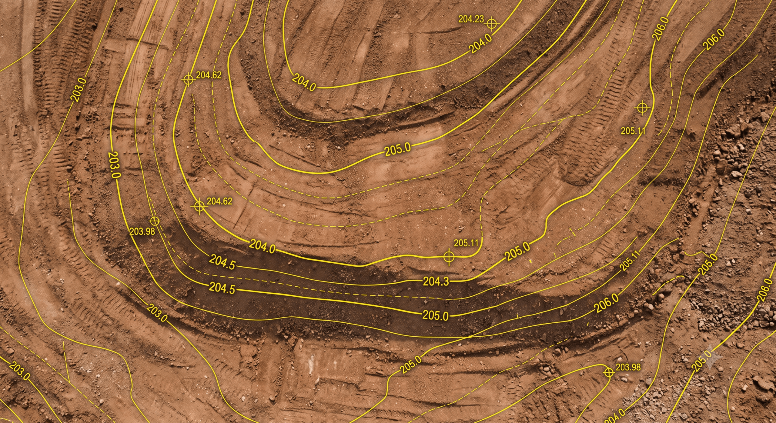
Data center construction delays are expensive because facilities run on a power-on date, and a 60MW data center delay can cost up to $14.2 million a month in lost revenue. Most of that risk originates in the earthwork phase, where grading, cut/fill, and drainage set the pace for the foundations, MEP, and long-lead transformer installs that follow. Teams reduce this risk by using a live site map to compare surfaces to design, track cut/fill and stockpiles across the campus, and make grading decisions in days instead of waiting on the next scheduled survey.
Resource Center


Filter by Type or Topic


Get Propeller news + updates
Stay in the know with the latest from Propeller, including industry news, customer stories, webinars, videos, and more.
You may unsubscribe from these communications at any time. For information on how to unsubscribe, as well as our privacy practices and commitment to protecting your privacy, please review our Privacy Policy.