Turn raw drone data into survey-grade maps with PPK drone mapping
PPK, or post-processing kinematic, is a high-precision workflow that ensures your drone imagery is accurately geolocated. Using AeroPoints and high-accuracy drones, processing with Propeller’s PPK makes survey-grade mapping reliable, repeatable, and simple.
Why unreliable survey data is costing you more than just time
If your team is relying on a constant RTK signal in remote or complex terrain, you’re betting your margins on a connection that can drop at any moment. A single data gap leads to unreliable surveys, which means:
Rework risk: Grading to the wrong elevation because of vertical drift
Wasted labor: Sending crews back out to place more ground control points (GCPs)
Communication breakdowns: Disputes between the field and office over which numbers are right
Easy
Capture geolocated imagery with minimal setup using our PPK workflow
Scalable
Survey small or large sites at any frequency while collecting consistent geospatial data
Accurate
Achieve consistent survey-grade accuracy with post-processing kinematic techniques
Insightful
Validate your data with clear reports and expert review
How it works
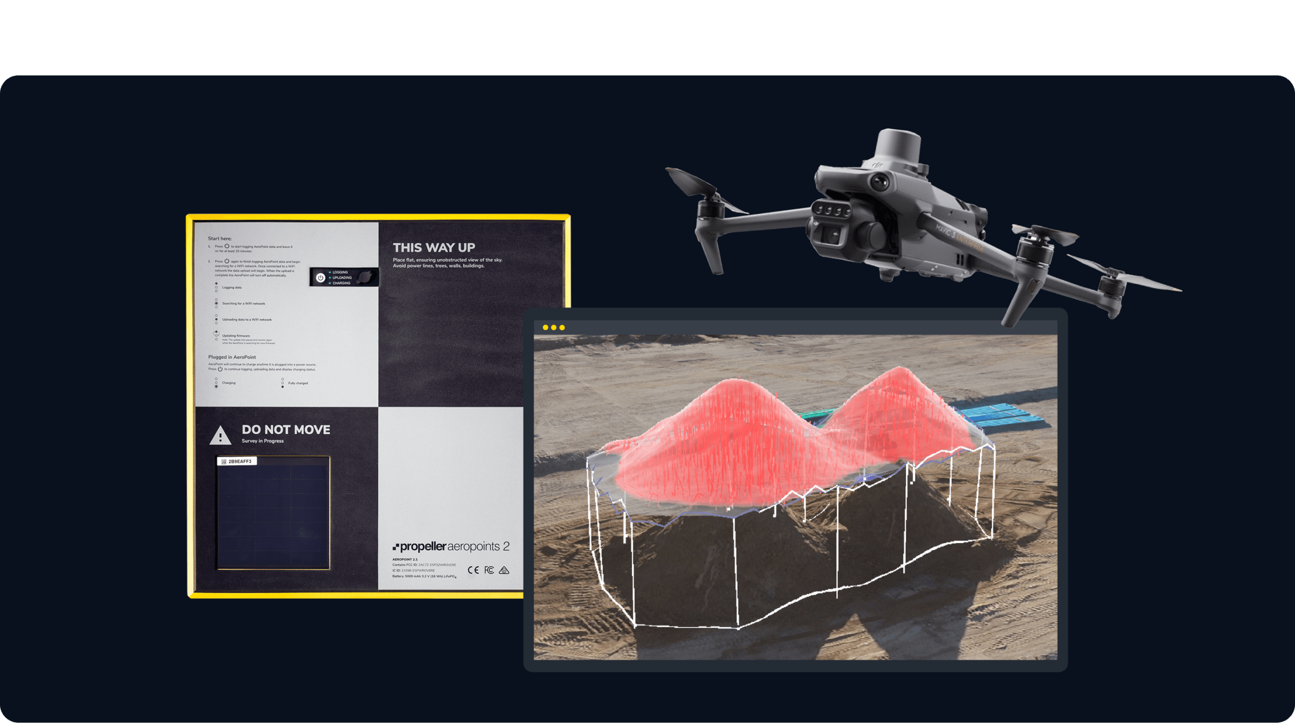
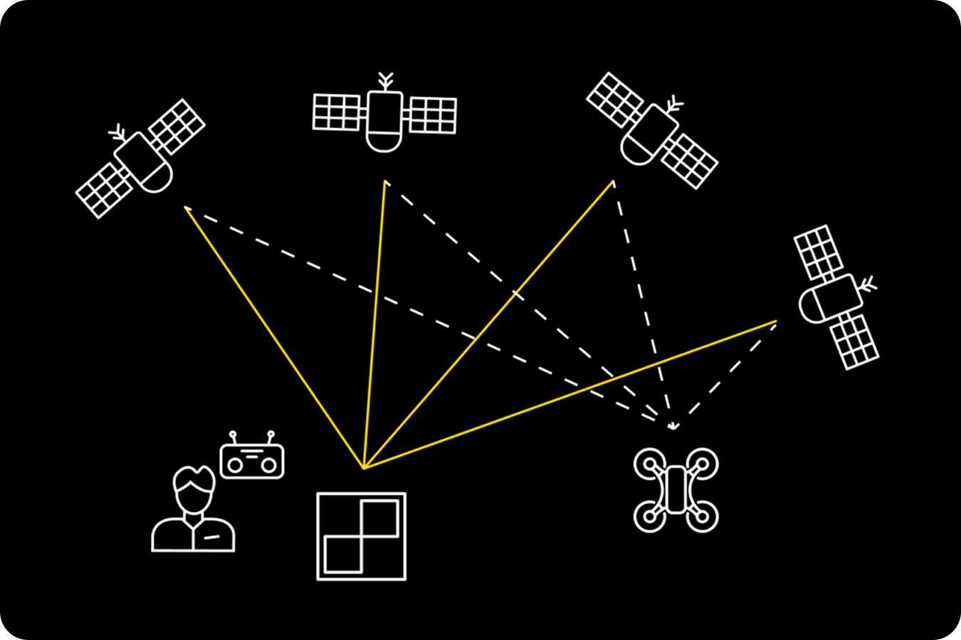
Lay your AeroPoints
Place AeroPoints on-site to record precise ground positions
Gather drone data
Fly RTK-enabled drones along an automated flight path, then process with PPK
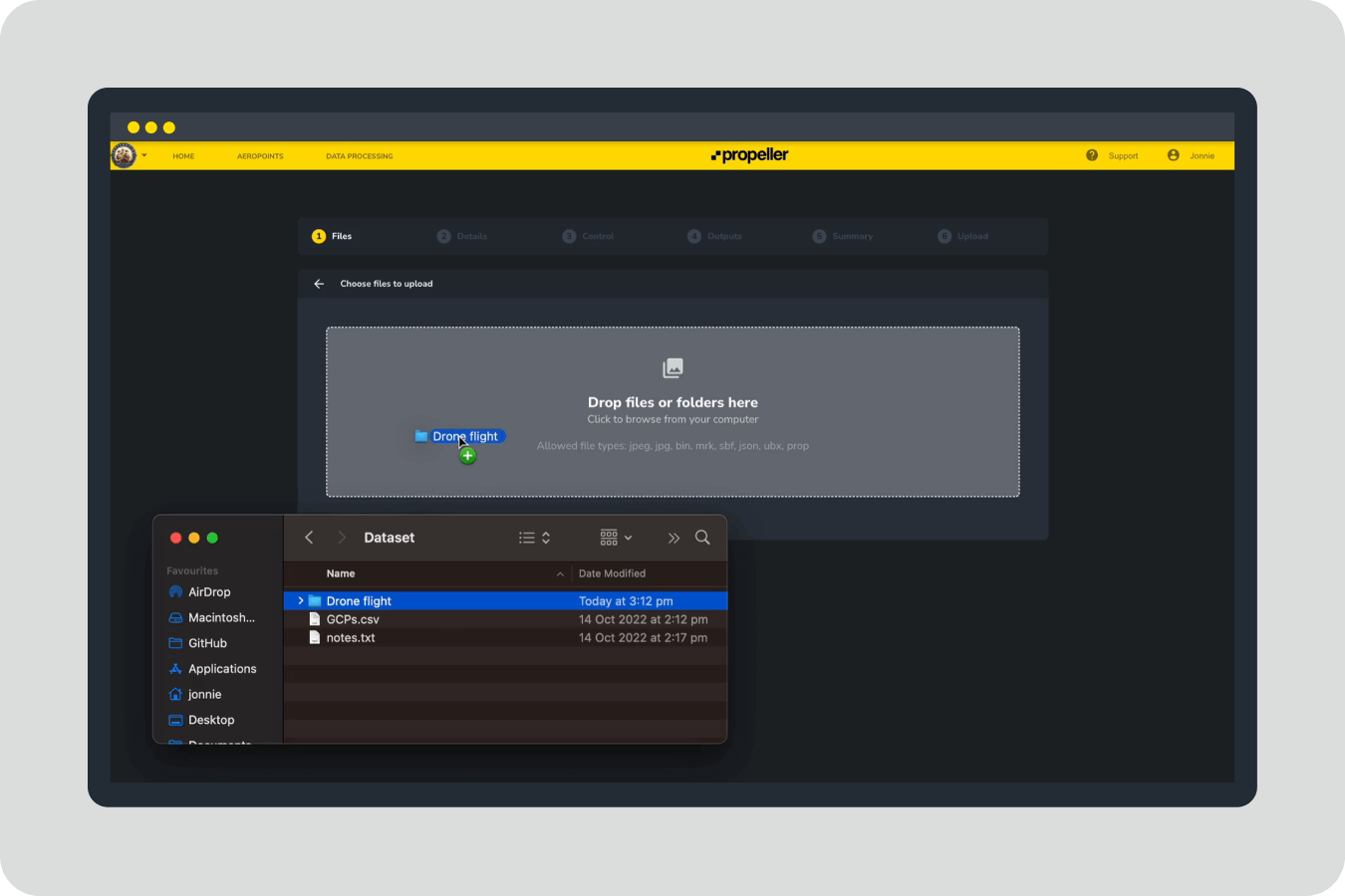
Upload your data
Transfer the collected data to Propeller for processing
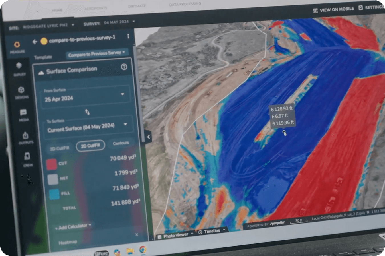
Receive processed data
Get a high-resolution 3D map, point cloud, and orthophoto
Why PPK matters
- Remove reliance on real-time GNSS connections that can drift or fail
- Achieve consistent survey-grade accuracy across multiple flights and large sites
- Reduce errors and rework by validating imagery against precise ground control
- Make confident, data-driven decisions for planning and reporting
- Scale easily across projects while maintaining repeatable results
How does PPK drone mapping work to ensure high-precision results
We’ve removed the complexity from the processing. You capture the data; we handle the heavy lifting.
| Feature | RTK (Real-time) |
PPK (Post-Processed) |
|---|---|---|
| Signal Dependency | Needs constant connection | No live link required |
| Reliability | High risk of data gaps | Most stable data capture |
| Accuracy | 3cm (if signal holds) | 3cm (consistent) |
| Best for | Open sites with clear LOS | Remote, vegetated, or complex sites |
Verify your data
Along with your processed dataset, you’ll receive a summary report detailing:
- GNSS corrections applied to each photo
- Ground control accuracy
- Overall survey precision
FAQs
PPK drone mapping is a post-processing kinematic workflow that improves the accuracy of drone surveys by combining aerial imagery with precise ground control.
Unlike real-time kinematics (RTK), PPK performs corrections after the flight, making it more reliable and accurate, especially for large or complex sites.
Use recommended drones with AeroPoints, follow the PPK workflow, and validate your data with Propeller’s geospatial data processing.
PPK drone surveying captures images with precise GPS data from AeroPoints and the drone, then applies post-processing kinematic corrections to produce survey-grade 3D maps.
PPK ensures precise, repeatable results for planning, reporting, and compliance, even on sites with vegetation, rough terrain, or complex features.
Using Propeller’s PPK workflow and recommended equipment, surveys can reach 1/10ft (3cm) accuracy.
RTK-enabled drones and AeroPoints are required for full PPK integration and high-precision survey results.