Drone surveying has revolutionized construction progress tracking, providing precise, up-to-date data that transforms how worksites are mapped, measured, and managed.
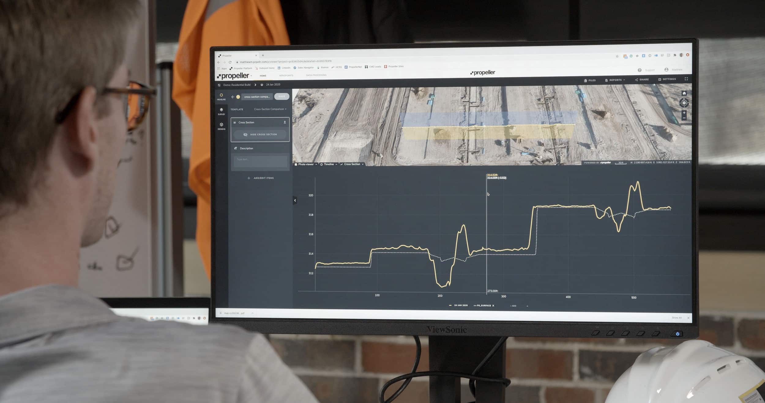
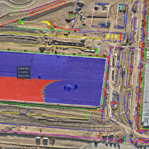
Drone survey data is processed into a 3D map, a visual tool that anyone can use to calculate volumes, surface areas, and elevations. Users can point and click to gather measurements (without tapping surveyors or PMs on the shoulder) or compare those measurements against different surfaces like designs or past surveys.
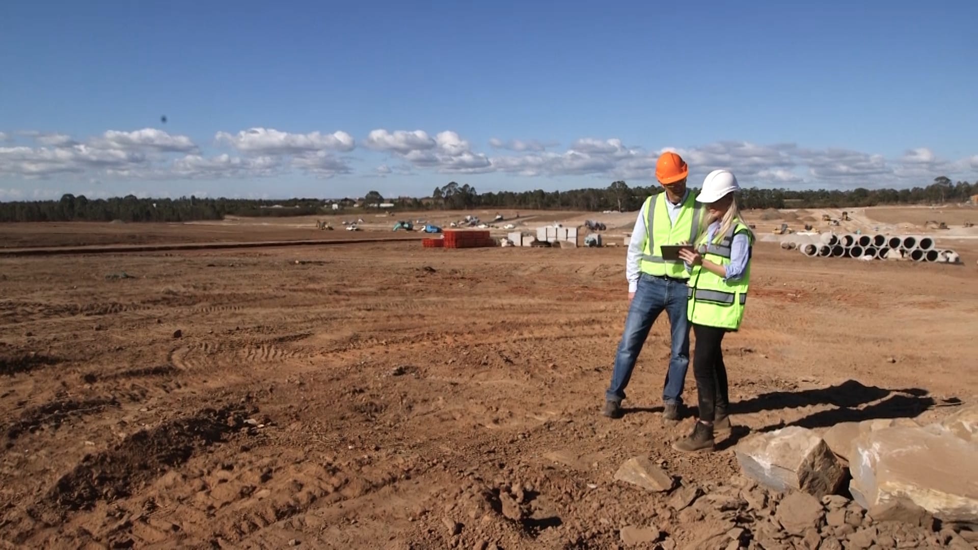
But the map isn’t just about making measurements; it’s also a project meeting ground. On the map, internal and external teams can collaborate seamlessly around the same source of truth and make better decisions about what comes next.
And when we say the map is for everyone, we mean everyone—technical and non-technical workers alike. Propeller is so easy to use, you don’t have to be a surveyor or an engineer to get actionable data.
In this post, we’ll discuss the wide range of users who can use Propeller to get the data they need to do their best work.
Estimators
Bid more accurately
Project estimators walk a notoriously fine line. They have to correctly estimate the costs necessary to complete a job based on the design, but they can’t guess too high or they’ll be easily undercut by the competition.
Volume calculation errors, inaccurate existing ground files, and elevation miscalculations can all lead to inaccurate estimates, so it’s critical to start any bid with the best possible data.
Drone survey data can help estimators:
- Accurately estimate a project’s size and scale.
- Build models including cut/fill analysis.
- Precisely measure elevations.
- Quickly calculate worksite length, area, and volume.
- Overlay designs against existing ground data to calculate required material movement.
Review past bids to improve future estimates.
Supervisors
Hit production targets consistently
Frequent data collection makes it easier for foremen and superintendents to achieve daily production goals and improve their processes as they work. With the extra time they save by having accurate site data accessible on mobile, they can spend more time making the big-picture decisions that affect the project team’s output.
Here are just a few of the benefits supervisors get from 3D survey maps:
- Quicker decision-making with data-driven insights.
- Improved team communication and collaboration.
- More accurate cut/fill volumes and design conformance checks.
- Better coordinated daily site activities to optimize labor.

Project managers
Keep projects on track
Project managers need precise data to interpret what’s happening on the worksite and make informed decisions about what to do next. Without accurate and timely data, projects will fall behind. PMs need a digital map that helps them determine next steps, minimize mistakes, and avoid costly rework.
With a drone survey processing tool, project managers can:
- Save time on data collection and analytics.
- Assess cut/fill progress without waiting on the survey manager.
- Make quick, data-driven decisions to keep production moving and minimize rework.
- Easily share updated info with other project stakeholders, including customers.

Environmental and safety teams
Stay compliant and keep workers safe
Environmental teams ensure that projects meet regulations and follow sustainable practices as site work progresses. These include following government-mandated designs, protecting vegetation and wildlife, and addressing air pollution concerns. Safety teams also look ahead, hoping to proactively spot hazards and make early corrections to keep workers out of harm’s way.
Drone surveys help these teams take proactive steps by:
- Helping anticipate a project’s impact on natural resources (e.g., wildlife migration corridors, natural drainage features, protected forests, etc.).
- Identifying potential issues from the current topography.
- Improving overall site safety by monitoring haul routes and flagging potential hazards.
- Keeping surveyors out of high-risk areas.

Business owners
Stay ahead of the competition and increase margins
Business owners can increase both productivity and revenue by keeping everyone on the same page, ensuring seamless communication and collaboration across the business.
Providing all teams with a single source of truth leads to:
- Improved project efficiency, reducing rework and downtime.
- Enhanced reputation and customer attraction through efficient operations.
- Better project budgeting and optimized ROI.
Surveyors
Save time and preserve focus
While surveyors will still need to complete high-precision surveys by hand at critical points in the project, drone surveys greatly reduce the pressure to be everywhere at once. With democratized drone survey data that everyone on the team can interpret, surveyors’ time and energy are preserved for their most critical tasks.
While surveyors don’t have to be the ones who fly, they can use drone survey data to:
- Keep survey data accurate and up-to-date, reducing the time spent making manual measurements.
- Collaborate more effectively with other team members.
- Quickly identify and address any discrepancies or issues on-site.

Bringing it all together
Propeller’s map-based workflows make it simple for every project stakeholder to view a worksite from different perspectives, take direct measurements, and make informed decisions based on current drone survey data.
Wondering if Propeller is really that easy to use? See for yourself! Request a demo today.