It’s true that industry slow-downs and project delays have led many to consider worst case scenarios and feel uneasy about what the future holds. But, there’s another side to this coin: increased bandwidth to try and learn new things you never had the time to explore before. Like sharpening your drone skills and know-how.
At Propeller, we’re taking this time to work on us and refine our operations for when (not if!) we come out on the other side of the COVID pandemic. And trust us: we’ll come out refreshed and ready to support the worksite resurgence.
For existing customers, it’s the perfect time to dig a little deeper into your Propeller toolbox and try out that mobile maps add-on you’ve been hearing so much about.
And for those of you still on the fence, wondering if 3D maps and drone analytics tools even have a place on your site, there’s plenty of educational materials available to help you answer those hard questions and improve your drone knowledge.
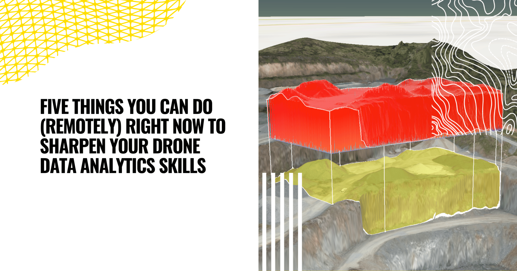
Here are five easy things we recommend doing to improve your drone analytics skills during your downtime. The best part? They’re all things you can do from your couch.
1. Dive into our platform demo videos
If you’re new to aerial data, there’s no better way to explore the benefits than with our self-guided demo journey. You’ll get to see exactly what’s behind the Propeller Platform login, how you can use interactive 3D maps to make real-world measurements, and all the amazing things you can do in just a few clicks.
After a short intro video, you’ll choose your own path from there, delving into the worksite tools you’ve always wondered about—terrain editing, progress tracking, road grades, stockpile volumes, and more.
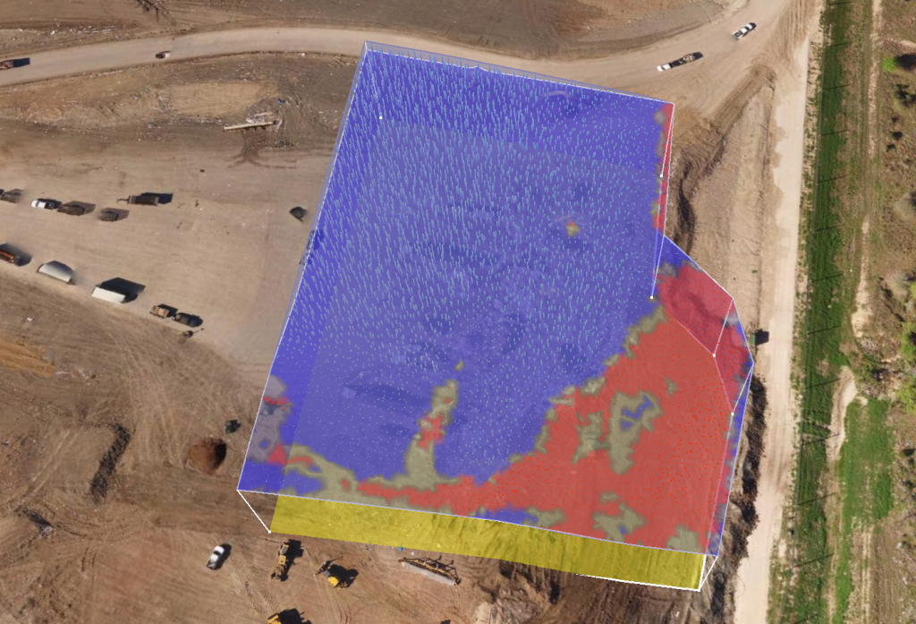
Even if you’re already familiar with our tools, these videos are a great way to refresh and sharpen your in-platform skills. Without the pressure of your usual day-to-day, you’ll have the chance to experiment with design files and perfect your progress tracking workflow, so that when things normalize, you’re ready to hit the ground running.
Start your demo journey here!
2. Read about how your peers are using Propeller
Long story short: we have a ton of customer case studies.
Reading about how worksites just like yours are using their drone skills and leveraging Propeller products helps to paint a better picture of where you can expect to see real ROI. We have a healthy mix of stories, ranging from family-run operations like Fiore to ENR 400 champions like Hensel Phelps.
We believe the Propeller story is best told by our customers. These are some of the ways existing customers are using drone data to make life easier for their team.
Fast, Frequent Surveys Keep Fiore’s ‘Red Rocks’ Project On Schedule, On Budget
As a family-owned construction company, Denver-based Fiore & Sons Construction is committed to delivering superior, consistent work on every project. It’s their reputation for precision and project excellence that has led clients to seek them out again and again.
In March, Fiore broke ground on a huge, 300-acre earthwork project in Morrison, CO they’ve labeled the “Red Rocks” project. Over the course of the project, they will move a little over five million cubic yards of dirt in a year. That’s a massive undertaking for Fiore, and would be for any self-performing earthmover.
To show off how Fiore is using Propeller to improve their earthwork operations across the board, we’re documenting the entire Red Rocks project for a new video series.
You can check out the first part of this series above to hear how Russell is using Propeller to survey faster, get more out of his day, and improve communication with his team.
Read the whole case study here!
Easy-to-Understand Visuals Become the Bridge Between Blasting Contractor and Quarry
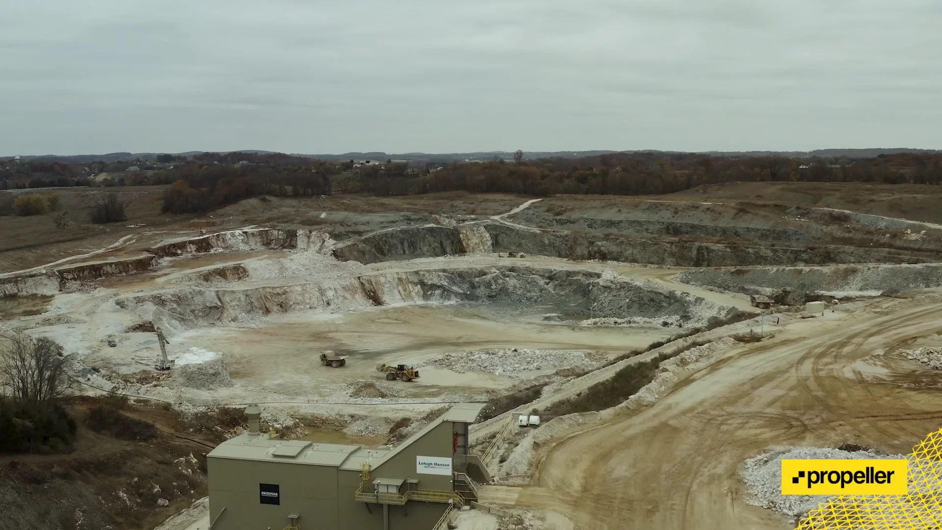
For Orica, it wasn’t just about keeping their team out of harm’s way and being more strategic with blasts; it was strengthening the working relationships with their clients.
One of their clients, a quarry nestled in Union Bridge, Maryland, surveyed once a year, depending on that data for quality assurance and progress reporting. But, when you’re moving 10,000 tons of material a day, survey data becomes obsolete as soon as it’s collected.
By going from yearly to monthly surveys, Orica’s made major strides in takeoff reporting, and their client finally has the up-to-date data they need to audit their site regularly.
Read the whole case study here!
Hensel Phelps Is Using Propeller to Track Earthwork, Share Data on Hawaii State Hospital Build
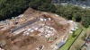

Although Hensel Phelps’s home base is in Colorado, they have projects all over the map, including a long-term project building a state hospital in Honolulu, Hawaii.
They’re just beginning to self-perform earthwork, and one of the first things they realized when they started down that path was that they needed additional software to help them track and measure material movement. That’s what led them to Propeller.
Before using Propeller, they were hiring subcontractors to help plan work: where they’d excavate, how they were going to grade, and how they’d backfill.
Surveying their Hawaii site, every two to three days with Propeller, means “we’re able to see production. We’re able to make reports based on what had actually happened each day,” said Field Engineer Erik Johnson of using up-to-date data to make decisions.
Read the whole case study here!
Suez’s Hallam Road Landfill Site in Australia Among the First to Test DirtMate

As some of you know, we just released a new productivity tracking system called DirtMate in beta phase.
Just months after installing DirtMate on 20 machines, they have been able to:
- Measure volumes moved on a daily basis, quickly and cost-effectively.
- Optimize vehicle routes and improve the efficiency of vehicles working.
- Reduce reliance on contractors for progress data and start collecting the data themselves.
- And quickly identify traffic management issues, such as pinch points and areas of high risk, using the snail trail feature.
Suez Australia marks the beginning of DirtMate’s mission to land on every worksite across the globe.
3. Watch a webinar and learn something new
Each month, we host a webinar on a range of rotating topics. Sometimes we’re talking drone skills and surveying workflows; sometimes we’re talking data processing. But each session has one thing in common: It’s delivered by an expert and was inspired by some common pain point that frequently comes up in the civil resource space.
We recently hosted a Drone Surveying 101 webinar where we laid out some UAV basics, including:
- The benefits of drones in construction and earthwork
- How photogrammetric drone surveying works
- What it takes to get survey-grade measurement with drones
- Launching a drone program (getting the skills to get licensed, selecting hardware, etc.)
- Why NOW is the time for smaller businesses to invest in drones
You can watch the recording of the webinar right here:

All of our webinars are available for to watch after we stream them live, but if you attend them when they air you can ask our hosts questions in real time. Our team loves to talk drones, surveying, and anything involved with earthwork, so come ready with questions!
4. Download an eBook
This is an activity better-suited for those of you who are just getting your feet wet in the drone surveying space.
Our guides and ebooks are designed to walk you through the ins and outs of drone surveying, whether you’re just getting started or looking to get more out of the drone data you collect on site.
The Propeller blog is a great resource, but these guides dissect each topic to drill into the technical nuances. You’ll learn something new and (hopefully) be entertained in the process.
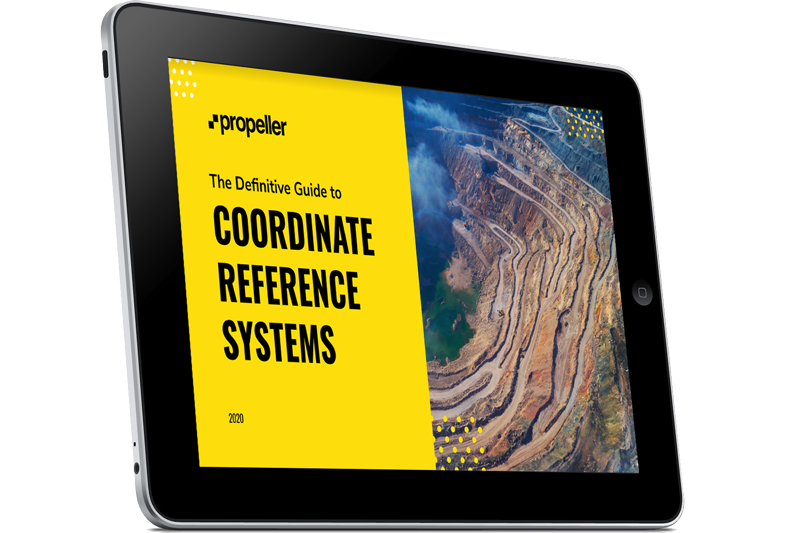
Start by checking out Beginner’s Guide to Coordinate Reference Systems. In this handy ebook, we lay out in layman’s terms some of the basic concepts concerning the world of coordinate systems, including:
- Why we need coordinate reference systems
- The problem with projecting 3D surfaces onto 2D maps
- How we use ellipsoids and geoids
- Using vertical datums to calculate elevation
- Why surveyors prefer local coordinate systems
5. Mess around with one of our free tools
Last but not least, let’s talk about free tools.
From time to time, our development team takes a break from the neverending journey toward platform improvements to create some really useful widgets. Here are three great tools you can use right now for free:
Coordinates Converter
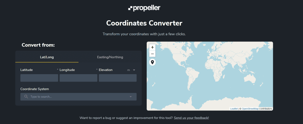
Coordinate system transformation is a complicated mathematical process involving trigonometry, vector algebra, and some more exotic math.
In our mission to make using site survey data easier, we at Propeller have built a handy coordinate converter to use whenever you need.
Use the Coordinate Converter tool here!
GSD Calculator
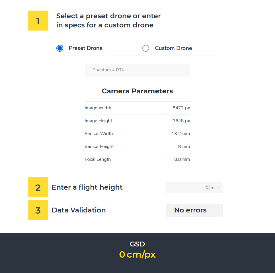
If you’re working with or are considering working with drones to capture your site, you may have come across the term, ground sample distance (GSD).
It’s an important drone skills concept to understand, as it can affect the accuracy of your survey. Here’s a simple tool to help you calculate your GSD.


