Ground control is one of the most important elements of an aerial mapping project because it ensures accuracy. RTK- or PPK-enabled drones are adept in the air, but their accuracy does not automatically translate to accuracy on solid ground.
What are ground control points?
In drone surveying, ground control points (or GCPs) are points on the ground with known coordinates that a surveyor can precisely pinpoint, and with these, you’re able to accurately map large areas with a drone. Essentially, GCPs reduce the margin of error from a scale of meters to centimeters.

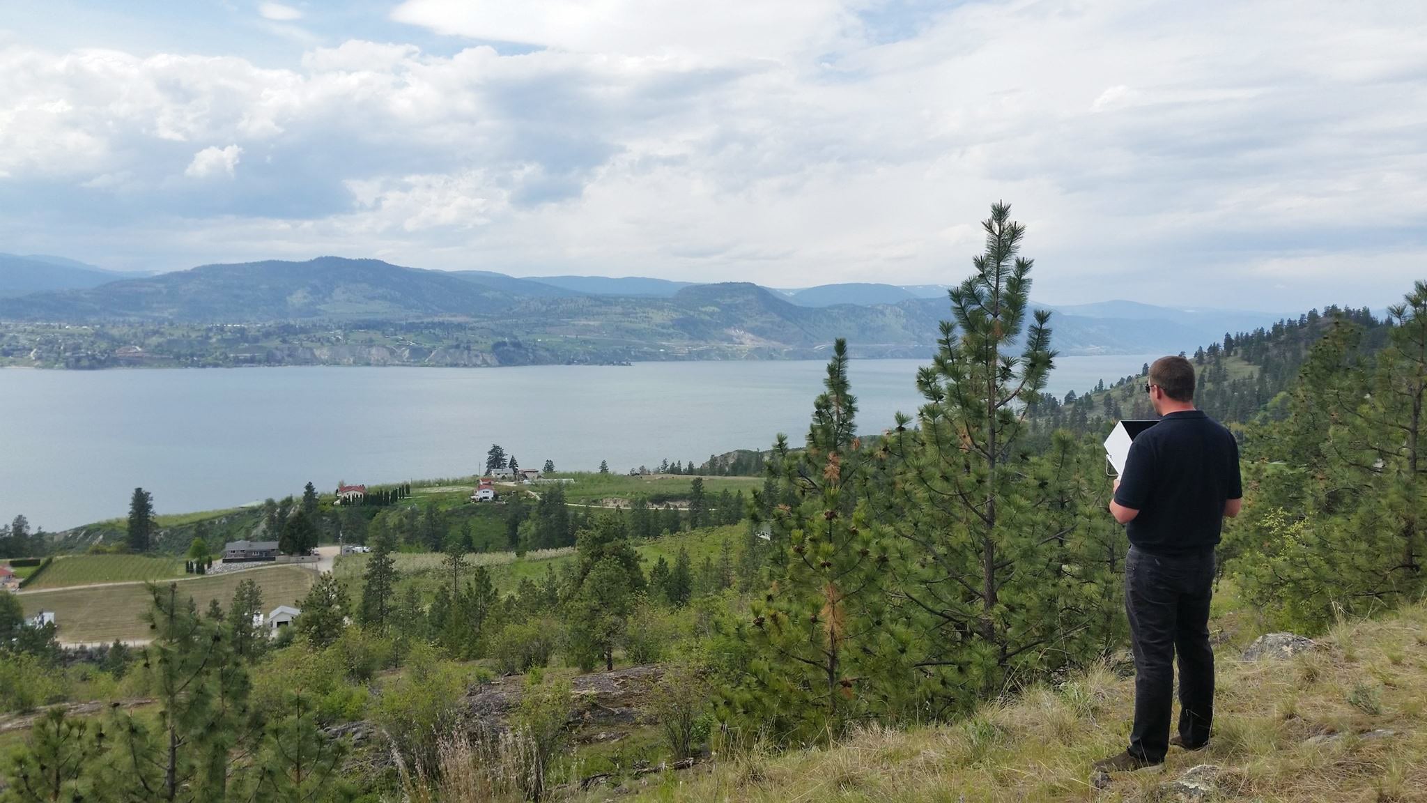
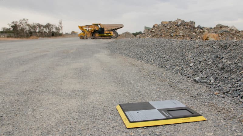
AeroPoints are smart GCPs that you can place around your site to capture vital ground control data. Propeller sells them in sets of ten for better absolute accuracy and to save time on aerial surveying. But the big question is: where should you put them?
The basics of ground control placement
Think about pinning down the whole survey of your site, like weighing down a tarp over an object. If you don’t have weights (GCPs) evenly spaced all around the edge, the entire tarp becomes distorted and clustered weights will drag the tarp toward a single area. You also need a few weights in the middle to hold the tarp snug and flat (no “air pockets”), so no part slips off or is pulled up by the wind.
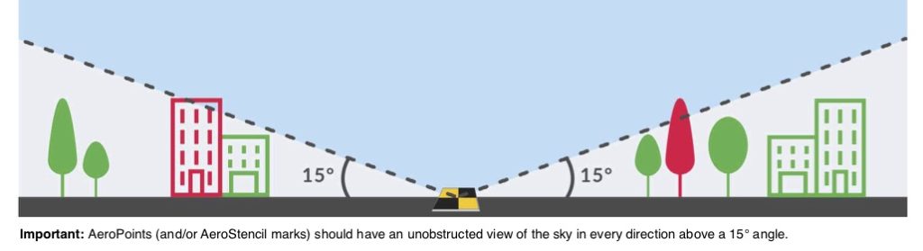
When planning GCP placement, look for possible line-of-sight obstructions. Set down all of your GCPs in clear view of the sky and avoid putting them under trees, near fences, or any other obstacles.
Commonly asked questions about ground control
Should I put more AeroPoints in spots I need the most accuracy?
The short answer is no—not only does it not increase accuracy, but it can corrupt the accuracy of your entire survey. Here’s how this works:
It’s reasonable to think that the more AeroPoints in one spot means even better precision. The image below is how you might set up a site, applying that thinking.

But this common misconception leads to inaccurate results.
Notice that only nine of the AeroPoints are being used, and they’re not surrounding the entire site. There aren’t any on the tallest point and some of them are clustered together around important sections.
The sections with poor GCP coverage actually pull the sections with good coverage out of place, rendering the entire model unusable. Since this survey can’t be properly corrected, it leads to inaccuracy. This means you’ll likely have to refly the site and potentially miss the opportunity to capture the site in its present state.
What is the best placement?
What you need is an optimal geometry of GCPs across the entire surveyed area.
This is crucial, much more so than the number of GCPs in a particular geographic location. Placing points on the ground closer together in one spot doesn’t saturate their accuracy. Think of performing a site calibration; you cover your whole site, not just the “important” parts.
The goal is to create a shape bounding your entire site and place GCPs throughout the middle as equitably as possible, including placing AeroPoints at the lowest and highest elevations. If you have a giant “air pocket” in the middle with no AeroPoint on it, “pinning down” the aerial photos to that survey area will be difficult.
What’s a good example of ground control point placement?
Here’s the same site again, but now with GCPs distributed with optimal geometry.
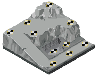
Notice that you can connect the dots and draw a shape around the whole site without taking your pencil off the paper—and the middle is covered. All ten AeroPoints are used in this example.
Naturally, you’ll need different configurations depending on the shape of your worksite.
When planning placement, remember the AeroPoints need to be set around the perimeter and throughout the middle. You don’t want the imaginary tarp you’re anchoring down to wrinkle too much, or worse, flap in the wind. Those cases would make your aerial data highly inaccurate or even unusable.
How should I make sure I am correctly placing my ground control points for UAV surveying?
Propeller recommends using one to three AeroPoints for sites up to 150 acres. To ensure you are following the proper ground control point placement, ask yourself, “do my ground control points have a clear view of the sky, away from buildings, vehicles, metallic interference, and surrounding terrain?” If the answer is “yes” you’re ready to start surveying with your UAV. You should also choose a location where your ground control points will not be disturbed by active site features, such as earthmoving machinery or stockpiles that change from day to day. Remember, when you place your AeroPoints, you’re forming a network of exact locations. AeroPoints contain GPS chips that will accurately locate their point on your job site when drone surveying.
How Does Propeller Help With Optimizing Ground Control Placement?
Propeller offers a suite of resources to help ensure that you are properly optimizing your ground control placement. The first of these resources is the Propeller knowledge base that can help train you and your team to make sure that everyone is as educated as they can be on the fundamentals of ground control placement and the fundamentals of drone surveying in general.
Beyond this, Propeller also offers industry leading customer support and customer success teams that ensure that you have the resources you need to ensure that your team fully understands and optimizes their ground control placement for the highest level of survey accuracy possible. Regardless of your level of experience every Propeller customer with an active software license is assigned a customer success engineer. We understand that every company and customer has different workflows, requirements, and limitations. Our customer success engineers understand Propellers capabilities inside and out and will make sure that you will always have the support you need regardless of your situation. Their sole job is to make sure our users are best served by Propellers capabilities, if you have any questions or concerns about your ground control point placement they will be able to guide you through the entire process.
Ready to fly your site
Drone flights using AeroPoints are flown like any other flight. The difference being that you’re now also capturing GCP target data in your imagery that will later be used to increase the accuracy of your aerial map. Be sure your camera is focusing properly. If the GCPs are not in focus, the process will not result in high accuracy. Ensure you have good weather over the area you will be flying that day. High winds, low clouds, or precipitation can make flying and mapping difficult.