So, you’re curious about Propeller. Maybe you’ve had a conversation with someone from our team already, maybe you haven’t. Either way, deciding to change something up in your worksite management or site surveying workflow is a big decision.
We want you to feel confident about your decision to commit, and confidence begins with understanding.
Our sales team recently shared the most common questions they get from customers like you, wondering how we differentiate and establish ourselves as a single source of truth for worksites around the globe.
Hopefully, the answers to those questions will help you understand Propeller a little better.
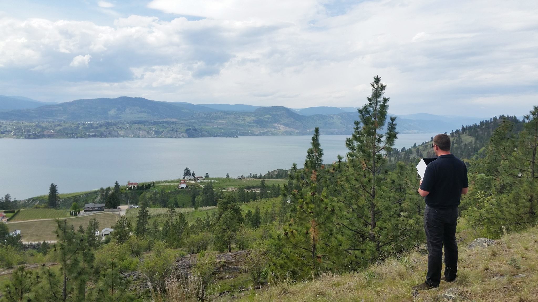
What kind of drone do I need to use to get high-accuracy data? Can I use any drone with Propeller?
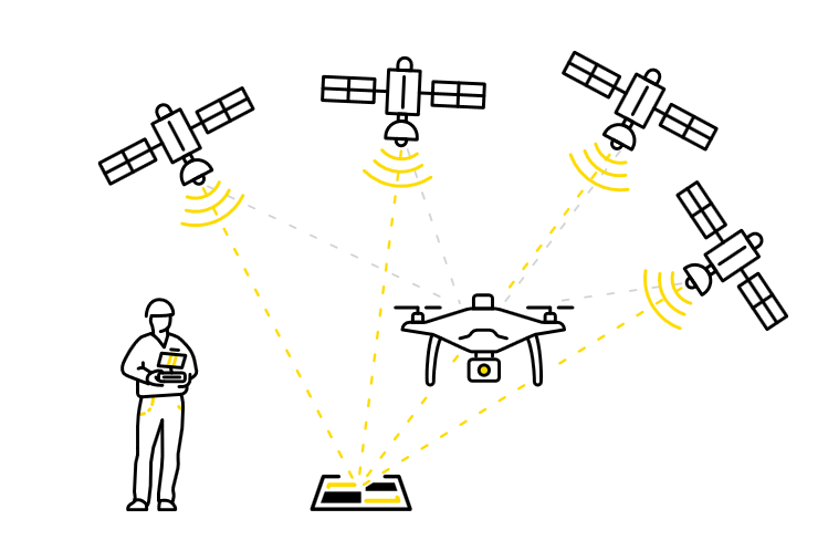
To answer the first question—an RTK drone is currently the best the market has to offer because it delivers the highest degree of accuracy. RTK stands for real-time kinematics, which facilitates real-time data collection during flyovers.
As you’re surveying, the RTK uses a built-in GPS corrective technology that locates each captured image along the coordinate reference system its calibrated to and geotags the image in that exact moment. Having an in-flight dataset alleviates some of the pressure of ground control, even though a micro amount of distortion still occurs.
The most accurate workflows (even with an RTK drone) combine two perspectives during processing: the drone’s perspective and the ground’s perspective. Mixing these datasets together gets you unparalleled precision, every time you fly, and without the heavy-lifting of traditional methods. We’ll dig deeper into the accuracy in a later question.
Although, RTK has undoubtedly changed the drone surveying game, it’s also instigated an entirely new workflow that uses post-processing kinematics, coined the PPK workflow.
Not all Propeller customers use PPK though, and that’s completely okay. AeroPoints work with practically any drone and any software of your choosing, and you can upload self-processed data to the Propeller Platform. Propeller’s hardware and software scales to you.
If you decide to go with the Propeller PPK solution, or want to purchase a drone from us, you’ll receive DJI’s Phantom 4 RTK, along with one AeroPoint. Our partnership with DJI gives us access to the best drones and we pass that power onto our customers.
Do I have to process my own data/what is the data processing process?
You can (finally) say goodbye to self-processing. We do everything for you. All you have to do is upload your AeroPoints and drone data to the Propeller Platform, and you’re off the races.
We’ve always wanted to make life easier for our customers, and to do that, we’ve analyzed the hardest parts of their work day. As it turns out, processing survey data has been way harder than it needs to be for too long.
Customers often tell us about their pre-Propeller processing—how data processing absorbed their time and computers for several days, how there was no surefire way of finishing reliably. That’s why we’re giving worksites an out, a hands-off way to process confidently.
All processed surveys are returned within 24 hours. We have an entire team of data experts who make sure everything’s lining up, so that when you receive your data, you can start making measurements and actionable observations about your site immediately.
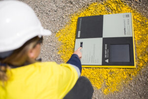
Why are AeroPoints necessary?
Walking the terrain, lugging around your rover, and manually shooting points. This is a familiar story for most surveyors. AeroPoints simplify that narrative.
AeroPointsare lightweight, durable, and solar-powered, “smart” ground control points that find their exact location on whatever coordinate reference system your worksite operates on.
You put them down, press a button, and leave them out for 45 minutes, and they’ll collect all the geolocation data you need to establish accurate ground control for your flyover.
Why is the PPK workflow better?
We can sum this up with one metric: 3cm.
Historically, 1/10ft accuracy was possible, but extremely difficult to achieve. The PPK workflow reaches this level of accuracy without any stress on the surveyor’s end.
Apart from that, Propeller PPK is an integrated approach to drone surveying. Bringing software and hardware together completely eradicates compatibility issues from the equation. Your AeroPoints, DJI Phantom 4 RTK, and Propeller Platform represent a continuous loop of worksite data.
Propeller PPK is better because it makes life a whole lot easier for your crew. No more battling for ground control and no more problematic processing. It’s a means to a faster, more actionable end. You’re spending less time on preliminary collection steps, the necessary evils, and more time analyzing your progress on site and pinpointing areas for improvement.
If you need more background information on the what, how, and why of PPK, this article digs into the fine details of it all.
What kind of accuracy does Propeller provide?
This depends. Because Propeller’s products come in many different combinations, shapes, and sizes, the level of accuracy depends on your level of engagement.
We’ll tell you this—any combination helps you achieve the same (if not higher) level of accuracy in way less than time than alternative workflows.
Every surveyor lays out ground control a little differently. With AeroPoints, you’re using the same context, the same way every time. We conducted a little relative accuracy test of our own to see how AeroPoints compare to a total station. Here’s where we run through the results.
We found that even in a cityscape, where there’s a higher probability of multipath errors, AeroPoints outperformed the total station.
The highest accuracy is a byproduct of Propeller PPK. The unified approach to site surveying delivers 1/10ft accuracy. Using two different interpretations of the flyover (ground-level data and aerial data), you get much better accuracy.
If I need support, how quickly can I get a response?
Your ability to successfully collect, process, and get answers about your site is our priority. That’s why we offer 24/7 support. It doesn’t matter where you are around the world, or how late you’re up pondering snafus in your drone data workflow, we’re here for you.
You’ll receive a response within 20 minutes of reaching out, and we’ll work through whatever problem you’re having together.
Do you have a lot of customers in my industry?
As a matter of fact, we do.
Rather than trying to introduce a blanket solution that blindly serves a wide user base, we decided to immerse ourselves in earthwork exclusively.
We’ve dissecting the surveying pain points exclusive to the aggregates , construction , mining , and waste management industry to engineer a software-hardware combination that makes worksite day-to-day much easier.
Our case studies will give you a better idea of how we’ve helped customers just like you.
- Aggregates: Kentucky-based Haydon Materials Uses Propeller for Quarry End-of-Month and More
- Landfills: California Landfill Calculates Remaining Airspace, Tracks Compaction with Propeller
- Construction: Big D Construction Uses Propeller for Faster Oil Pad Building in Texas
Long story short, all of these industries encounter the same issues and information silos when it comes to tracking quantities and tracking progress. Our customers are making quick measurements, layering progress against design, and visualizing their site in 3D in just a couple clicks.
Everything at Propeller is designed with your industry-specific roadblocks in mind.
What types of benefits does Propeller offer?
We’re very much a hardware and software provider that shapes to your needs. We recently covered thetop ten things Propeller gets you post-survey, but there’s other deliverables that Propeller offers, even before you fly.
As we see it, the site management workflow is a culmination of three fluid steps: collect, process, and, lastly, get answers. It’s up to you where in the cycle you want to jump in.
If you’re just collecting, we’re delivering survey-grade hardware that reduces in-field time to get you up-to-date data about your site much faster than manual surveying, without compromising accuracy.
Maybe you have your own drone, and you’re sick of self-processing. That’s totally fine. At that point, we’ll deliver processed aerial imagery within 24 hours of you uploading your datasets. It’s reliable, it’s fast, and it won’t keep you up at night anymore.
On top of that, you can import your data in geoTIFF, DXF, DWG, KML, and KMZ or export as JPEG, TIFF, DXF, or LAZ files
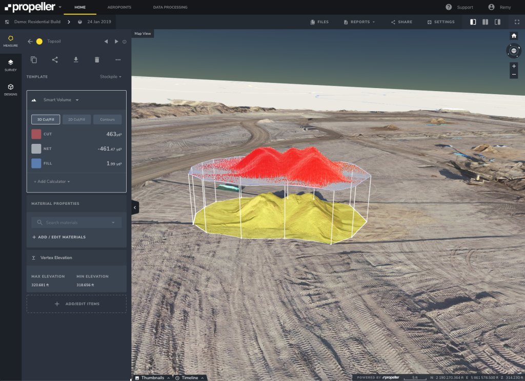
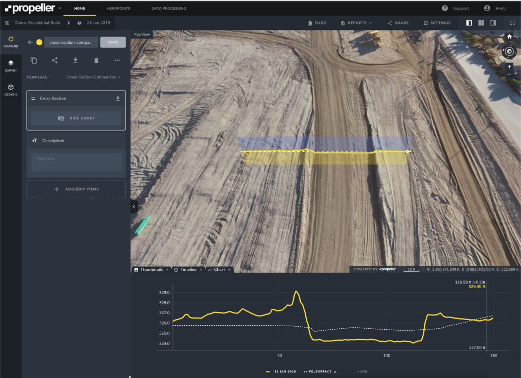
The “get answer” checkpoint takes a variety of forms. On a micro-level, you can make cut/fill measurements, edit terrain, upload design documents to gauge progress.
On a macro-level, you’re asking the hard questions about your site efficiency to get answers that you can share across your worksite network. Everyone on-site benefits from a more informed approach to project management.
Discuss these questions with your team (and reach out when you’re ready)
If nothing else, let this article be food for thought. If there’s any questions we missed or you’re now curious how Propeller would deliver over at your site specifically, let’s have a conversation.
Like everyone else, we’re still learning. Each day our customers share new ways aerial data helped eliminate an operational deficit, and that’s exciting for us.
Yes, we’re building connected worksites, but more importantly, we’re giving you and your team the data and share capabilities that keep you connected to your worksite, from wherever you are in the world.