With drone data quickly accessible in the cloud, and powerful, easy-to-use earthwork software like the Propeller Platform, the job of estimating, planning, and conducting civil earthwork at any scale is made much easier.
Let’s explore some of the most impactful ways you could use drone data and Propeller on your next earthwork project.
Estimate Earthwork Volumes More Accurately
Accurate estimation of an earthmoving job can be the difference between winning and losing the tender. It can also mean the difference between a profitable and an unprofitable job.
Making mistakes is costly, for example:
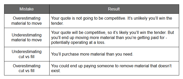
All of these scenarios will shrink your profit margin and, depending on the size of the job, could end up costing you hundreds of thousands of dollars.
But Propeller can help you avoid all these mistakes, and get accurate estimates every time. Here’s how:
Calculate cut/fill volumes using Propeller
Fly a drone over your site, then have us do the photogrammetry grunt work for you. (Propeller has delivered more than 30,000 surveys, so we’re pretty good at it!)
Once your data is processed (within 24 hours), a few clicks is all it takes to calculate cut and fill volumes for the current terrain against reference levels and design surfaces.
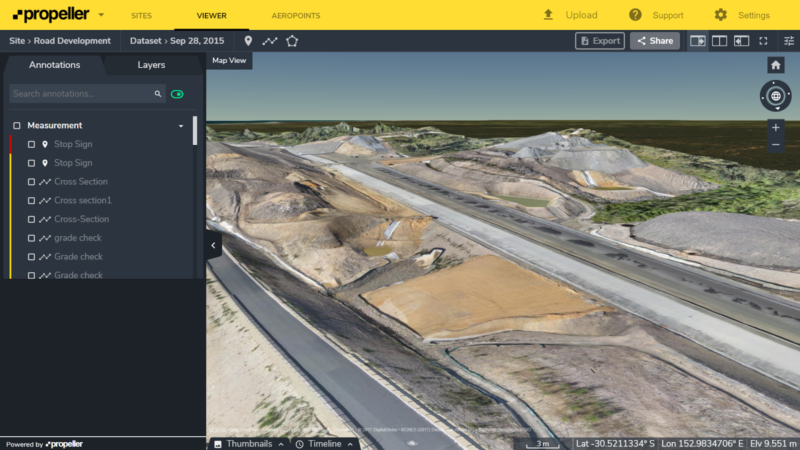
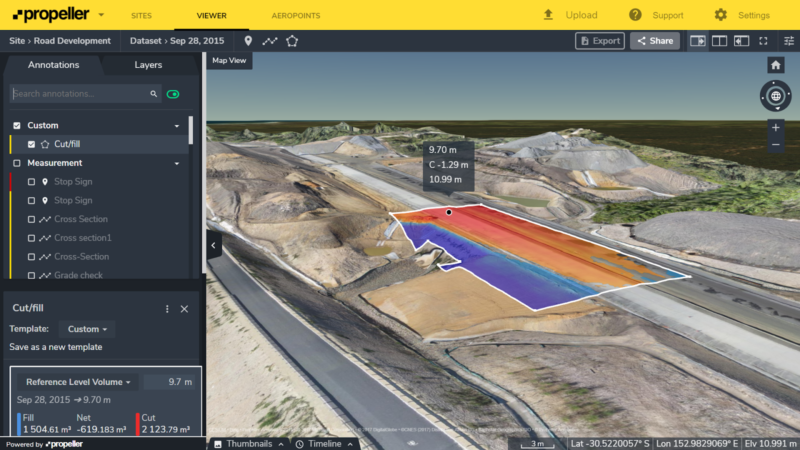
See how it would work in this roadworks job:
First, you’d upload your design surface. Then select the Polygon tool and simply click around the area you’re interested in. Choose Volume Comparison (to compare the selected area against the design surface) and voilà! Your cut and fill volumes are calculated instantly.
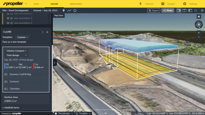
Every calculation is also displayed visually (in high-res and 3D), so there’s no confusion about what the numbers represent.
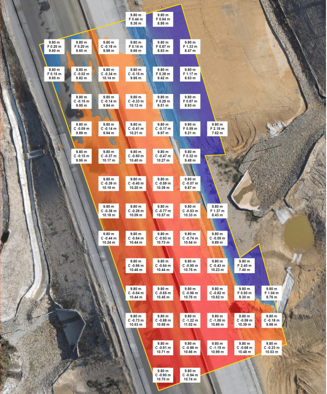
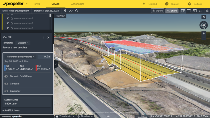
Now let’s say that, rather than working towards a design surface, you need to grade the area off at a particular reference level. To do this, select Reference Level Volume in the left panel and enter the relevant reference level.
In this example, the reference level we’ve entered is somewhere in the middle of our selected area. That means our visualization shows both a red section (cut) and a blue section (fill).
Assuming this is all the same type of material, the Net value shows exactly how much material we’d need to order in (or cart offsite) to complete the job of bringing this area to the specified level.
Once you’ve completed your measurements, it’s time to share that information with your team. You can export data as a PDF or invite others to view your measurements in the cloud via an emailed link. (Note: all Propeller Platform licenses include unlimited view-only users.)
Export your data to generate cut/fill volumes using other applications
While it may be convenient to generate all your cut/fill volumes in Propeller’s earthwork software, we understand that some projects may require you to work within other established software stacks and conform to specific workflows.
That’s why Propeller makes all of your data downloadable in industry-standard file formats (including CSV, JPEG, TIFF, DXF, and LAZ) and in a wide range of coordinate reference systems.
Data downloads are free and unlimited with every Propeller platform license. Just click Downloads under the Layers tab and select the files you want.
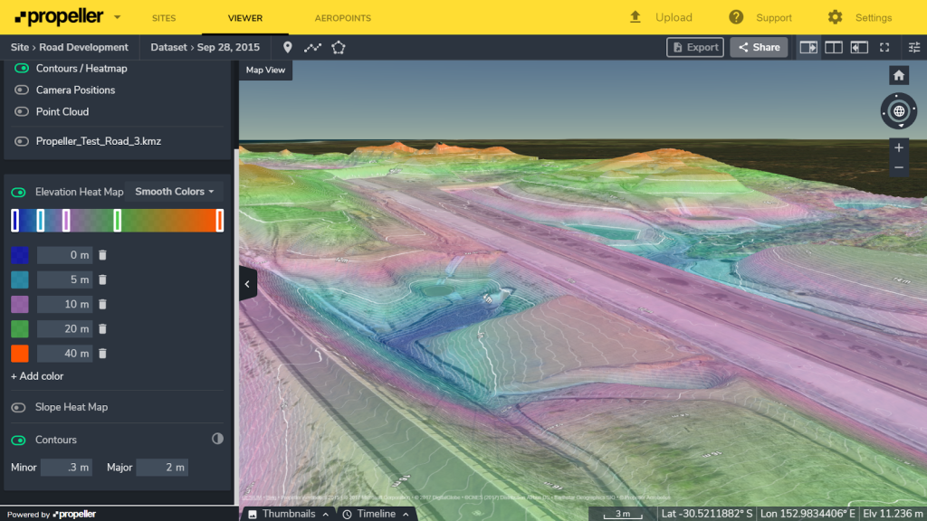
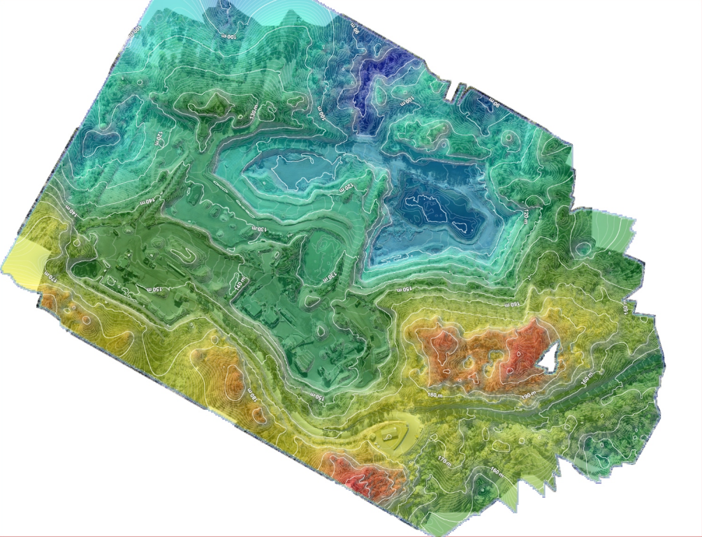
Generate Topographic Contour Maps
Generating customized topos is incredibly easy with earthwork software like Propeller. Simply turn on the Contours/Heat Map function and specify your major and minor intervals. (You can also choose to generate contour maps for a discrete area.)
A range of sharing options makes for effective collaboration. Either invite your team to view contour maps in Propeller or export them as PDF files or (for standard contours) as DXF files.
Generate Instant Cut and Fill Maps
It’s vital that everyone working on an earthwork job is on the same page. Propeller lets you generate accurate takeoff maps so your whole team can understand what needs doing and where.
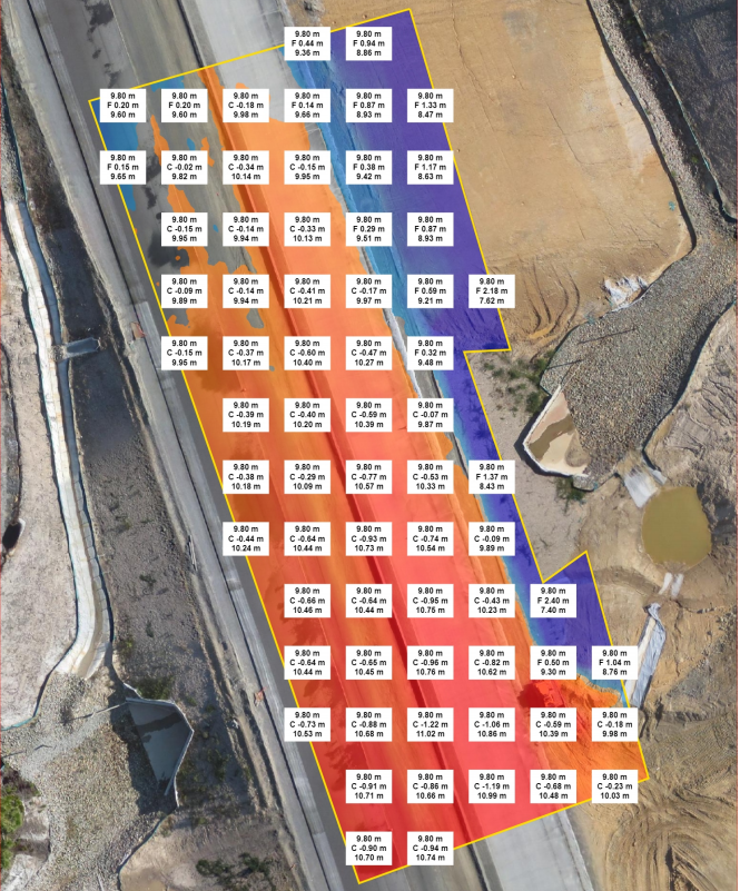
For instance, when you turn on the Dynamic Cut/Fill Map function, you’ll see a customizable elevation heat map over the area you’ve defined.
Hovering your mouse over a point on the map shows the vertical distance remaining to hit your desired reference level or design from that point.
This information is great for people working in the office, but it’s even more important for operators. By exporting this measurement to PDF, you can generate a full takeoff map to print and distribute to onsite workers. Generate a new one each time you send up your drone.
Track Progress and Resolve Disputes with Accurate Reporting
For as long as people having been paying other people to move material for them, there have been disputes on how much material has been moved.
The amount of material moved is how everyone doing earthwork gets paid, so it’s an important number to get right. Unfortunately, calculation methods are often very crude (i.e., number of trucks seen leaving the site multiplied by maximum capacity of the truck).
Underloading of trucks and incorrect truck counts are the two most common causes for error here, and can easily distort actual results by up to 20–30%. As those in the business know, this can mean losses in the hundreds of thousands of dollars.
Propeller lets you track actual progress and resolve disputes using accurate data, collected in cycle with claims.