If just reading the title of this post leaves you scratching your head, don’t worry! You’re not alone. Site calibrations and coordinate reference systems sound a lot more complicated than they are. And the good news is, you don’t need to be an expert to get a drone surveying program off the ground. (Pun intended.)
The goal of this post is to make the whole process easy to understand. So the next time someone asks which coordinate system you’re using in your drone surveying workflow, you’ll be able to give a confident answer—not to mention get the most out of your site data.
What are local grid coordinates?
So let’s start at the very beginning. What are local grid coordinates, and why should contractors care?
Local grid coordinates are a type of coordinate reference system. They measure positions on site relative to an arbitrarily selected point on your worksite instead of measuring points relative to an established national or global system.
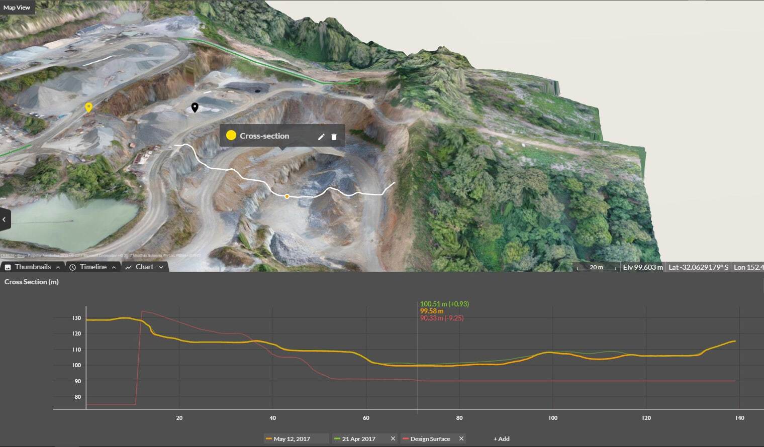
Coordinate reference systems are important because they provide context for everything mapped on your site: road lengths, stockpile volumes, cut/fill quantities, road grades, berm heights, pit depths … you name it. Even the best worksite mapping software in the world won’t produce an accurate survey without knowing which coordinate reference system you’re using, because that’s how everything lines up. It’s kind of like using Google Translate on a page of text—the words are there whether you can read them or not, but the translation provides the meaning.
Coordinate reference systems ensure that your data is accurate and understandable. If you’re ever surprised by a discrepancy between two survey datasets, make sure they’re using the same coordinate reference system.
Here’s how local grid systems are set up:
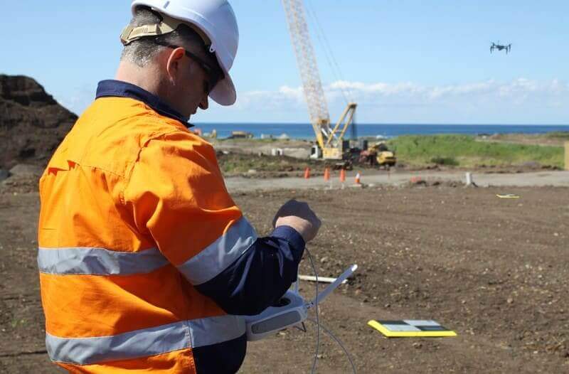
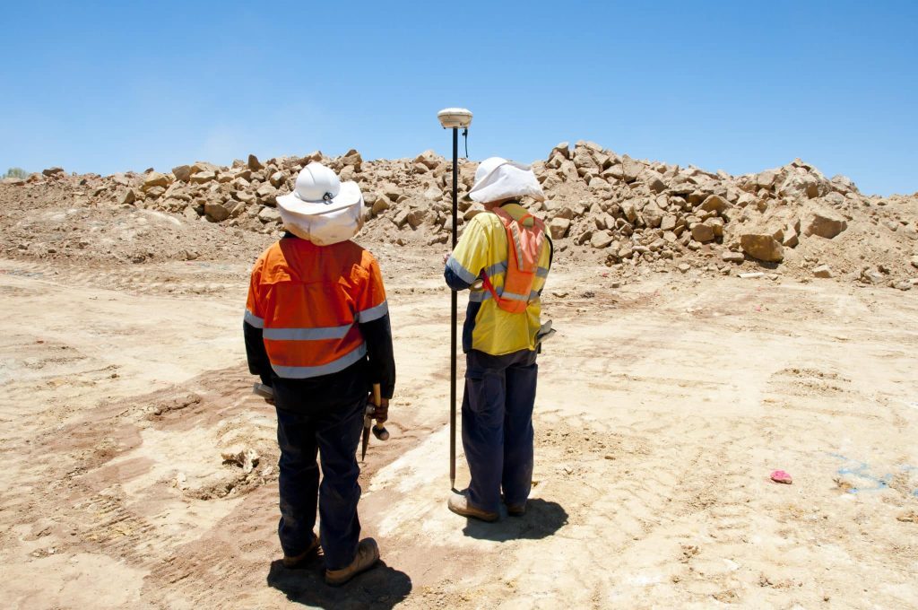
- Measure coordinates: A surveyor uses a base and rover to measure coordinates in a geodetic system (basically a fancy way of saying latitude, longitude, and elevation). Even though these coordinates look like measurements we’re used to seeing anywhere in the world, there’s a margin of error for the absolute global position of the base station, so we call this system a local geodetic system. As long as the base is always on the same point, the rover will return reliable coordinates in the local system. For most sites, this works just fine—you don’t necessarily need global accuracy to know how much material you have on your local worksite.
- Define a grid system: Next, surveyors define a local grid system—a way to translate local geodetic coordinates into even more specific markers relevant to a single site. Surveyors will evenly distribute control points across a site for multipoint verification. (More on this later.)
- Determine the relationship between local geodetic and local grid systems: Finally, the surveyor will input pair points—one set of local geodetic coordinates and one set of local grid coordinates—into the rover. The rover can then “translate” from one system to the other. We call this a calibration file. If your site uses a local grid system, this file allows you to use the Propeller Platform for your drone surveying workflow.
If this overview felt brief, there’s lots more to learn! Check out this post for more detail on how local grid systems are set up.
When to use local grid coordinates vs. published coordinate systems
Why would sites use a local coordinate reference system and measure positions on site relative to each other, rather than a large-scale coordinate system that’s applicable nationwide?
There are a few reasons why you might choose a local grid system:
- Local systems are much smaller in magnitude than national or global coordinate reference systems, which are often in the millions of meters/feet. Smaller scale makes local systems easier to work with.
- For certain types of measurements, it helps to use ground coordinates instead of grid coordinates.
- You can isolate your site’s coordinate system from global geodetic systems (like NAD83), which are revised over time as the continents shift.
- The region or size of your worksite might mean that using a standard system would subject your survey measurements to high distortion.

How to use local site calibrations with drone surveying software
First, it’s necessary to understand whether your site uses a local coordinate system or a published coordinate system.
Most sites use published Cartesian systems to measure ground coordinates. If you’re referencing codes from established authorities like EPSG, ESRI, or FIPS, which describe national or state grids, you’re using a published system. Propeller can process data from most of these systems with no additional information needed—just plug and play.
But if you’re using a local coordinate system, you’ll need to give Propeller the “translation” so our tools understand what your coordinates mean. The file is called a calibration file—the one generated by the rover or surveying software after the surveyor inputs parallel points. Propeller uses multipoint calibration to ensure maximum accuracy.
Once you’ve uploaded your calibration file to Propeller, you’re ready to fly your site normally. You can even automatically download image data in your site’s local coordinates. This is just one thing that makes Propeller PPK unique—there’s no post-processing for you to manage after the fact.
You can even use AeroPoints on a local grid system. Just set up your site with a local grid calibration file, process your AeroPoints with the local site survey benchmark correction method, and upload your flight images. Voila! Your survey data will be available in your site’s local coordinate system.
Please note that Local Coordinate Systems and Local Site Survey Benchmark processing options are only supported when processing data sets using AeroPoints with the Propeller or Stratus platforms. If you would like more information, please contact us.
Whether you use local grid coordinates or a published system, Propeller is here to help. For more information on local grids and coordinate reference systems, check out our Definitive Guide to Coordinate Reference Systems!