How drones are revolutionizing construction surveying at Franz Trippe
About the project
Dies ist eine Anwenderfallstudie von einem deutschen Kunden. Möchten Sie diese Studie auf Deutsch lesen? Klicken Sie hier.
Franz Trippe GmbH, a German construction company based in Schmallenberg, Germany with a workforce exceeding 100 employees, offers a diverse spectrum of services encompassing earthworks, civil engineering, road construction, landscaping, and site development. Embracing a forward-thinking approach, Franz Trippe embarked on the path of digitizing its construction operations early on.
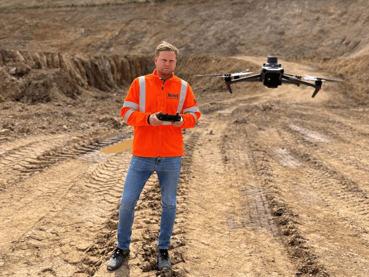
In recent times, the company integrated drone surveying as a pivotal component to enhance the efficiency of construction surveying and data analysis. Seven Trippe employees, following an intensive two-day in-house training program, successfully obtained the EU category A2 remote pilot certificate. This certification process included both theoretical and practical components, wherein participants familiarized themselves with the controls of their Mavic 3 Enterprise drone and executed their first flight.
Aerial surveying pays off not only for large areas
The introduction of drone surveying has proven to be a valuable asset for Franz Trippe GmbH, not solely for large-scale projects but also for more modest endeavors. A notable development in this regard was the incorporation of Propeller, facilitated through Propeller’s partner SITECH Germany. Propeller harnesses aerial imagery from the drone to process terrain data, generate digital terrain models, and monitor construction progress. Accessible to all of the company’s construction managers, the platform empowers them to swiftly and accurately compute areas, volumes, and distances for billing purposes. Additionally, it extends the benefit of granting project stakeholders access to construction project data, a feature acknowledged and utilized by select clients and municipalities for billing verification.
A recent instance of drone surveying success was observed during the measurement of stockpiles and material inventories in a 26-hectare quarry characterized by substantial elevation variations and intricate rock formations. The drone survey, inclusive of ground point measurements with a rover, was completed in just one and a half hours, a stark contrast to the multiple days conventional surveying would have required. The flight generated over 2,800 images, subsequently processed into a high-quality point cloud via Trimble Stratus, making the data accessible within hours and sparing the team extensive analysis hours.
Drone surveying is worthwhile even for small projects
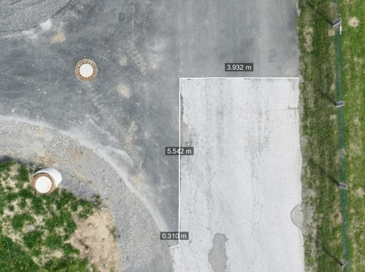
Drone surveying, with its inherent advantages, shines particularly bright in the challenging topography of the Sauerland region. Conventional surveying in such inaccessible areas with steep slopes or within quarries not only consumes significant time but also exposes workers to elevated accident risks. Furthermore, the agility of aerial surveying is equally advantageous for smaller projects. An illustrative case was the development of a local shopping center, where drones efficiently scanned and photographed windrows of earth material, producing distortion-free and to-scale orthophotos. These assets were readily utilized by the construction manager for billing, as well as for formulating project quotations and planning new construction initiatives.
A mere four months post-acquisition, Franz Trippe GmbH has completed over 40 drone flights, with overwhelmingly positive feedback. The sentiment among employees echoes a desire for further exploration of this innovative tool. Surveyor and site manager Benedikt Schauerte reflects, “It motivates us to do more! With the drone, we are advancing our commitment to digital innovation. It’s truly remarkable how the drone autonomously navigates its routes via GPS coordinates and delivers exceptionally precise data. By employing drones, we are streamlining our on-site operations, saving an invaluable amount of time.”
Want to know how Propeller can help you?
Learn more about Propeller’s products, pricing, and how to get started on your site.
You might also like

Cross Section Survey in a Matter of Minutes Using Drone Data

How to Use Drone Data to Improve Landfill Performance
