How LIFA leveled up their clients’ workflows with easy-to-access survey data

About the project
LIFA Surveyors is one of the leading surveying companies in Denmark. With more than 30 years of surveying experience, LIFA uses only the best equipment on the market and is constantly looking for newer, better ways to complete and share their surveys with clients.
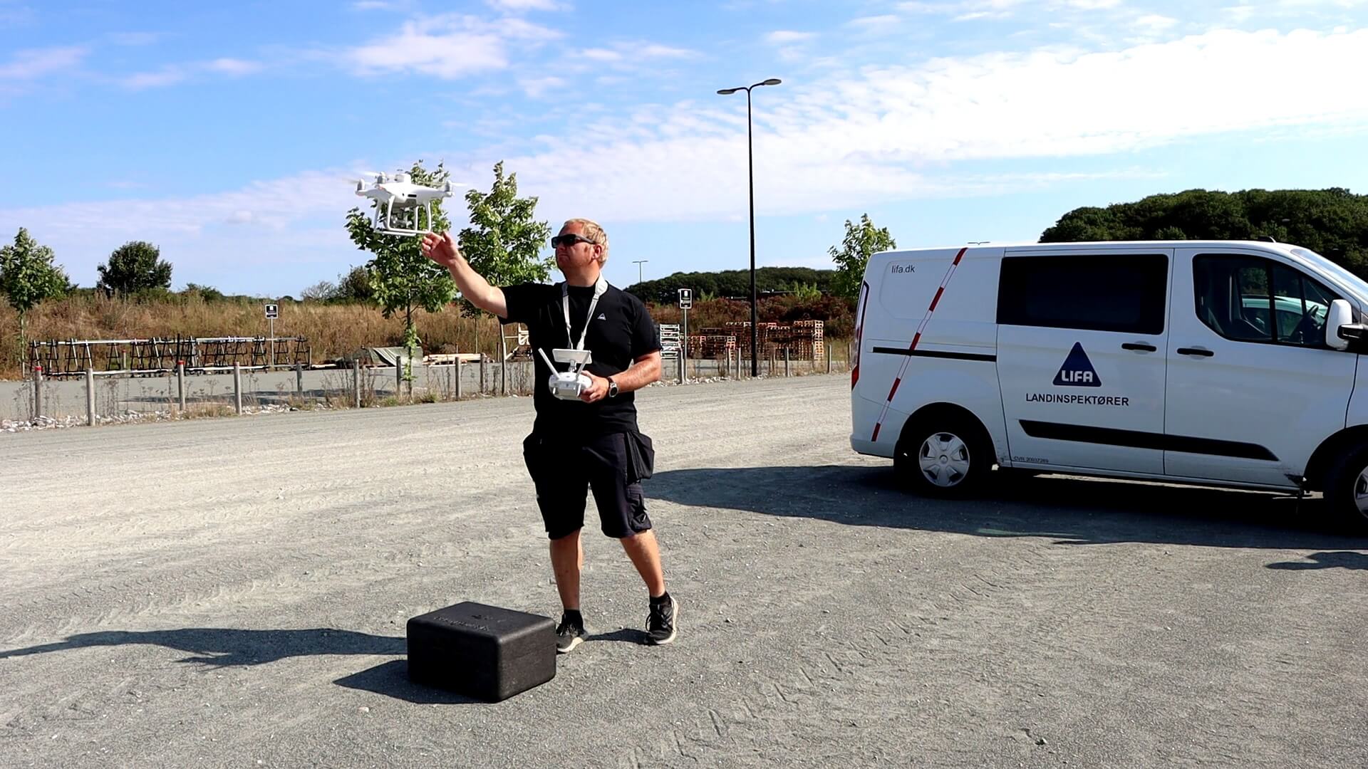
Land surveyor Anders Westh Matthesen joined LIFA when one of their core services—processing survey data and providing measurements to clients—was still done in-house. The process was unwieldy, requiring expensive hardware, technical knowledge, and multiple time-consuming steps.
Today, LIFA grants their customers direct access to visual survey outputs in Propeller. Clients with zero technical expertise can now access their surveys and make measurements directly—no burdensome data download or “translation” required.
Large, hard-to-read datasets with long processing timelines
Before Propeller, LIFA lacked an elegant way to give their clients direct visibility into their survey data. Without the right software and technical skill set, clients essentially received a large data packet, useful only to the engineering firm or other third-party vendor they passed it along to. If they needed to calculate volumes or make measurements, they had to tap LIFA to dig into the data for them.
For Anders and his colleagues, the process was entirely manual. They did their own processing on a powerful desktop computer—and even that wasn’t always enough. For the largest data sets, they’d have to rent processing space on an Amazon cloud-based machine, install the necessary software, and then upload and download the data several times before they could share it with customers.
The whole process took a lot of time and energy, requiring patience from stakeholders on all sides. “We’re glad we don’t have to do that anymore,” said Anders with a smile.
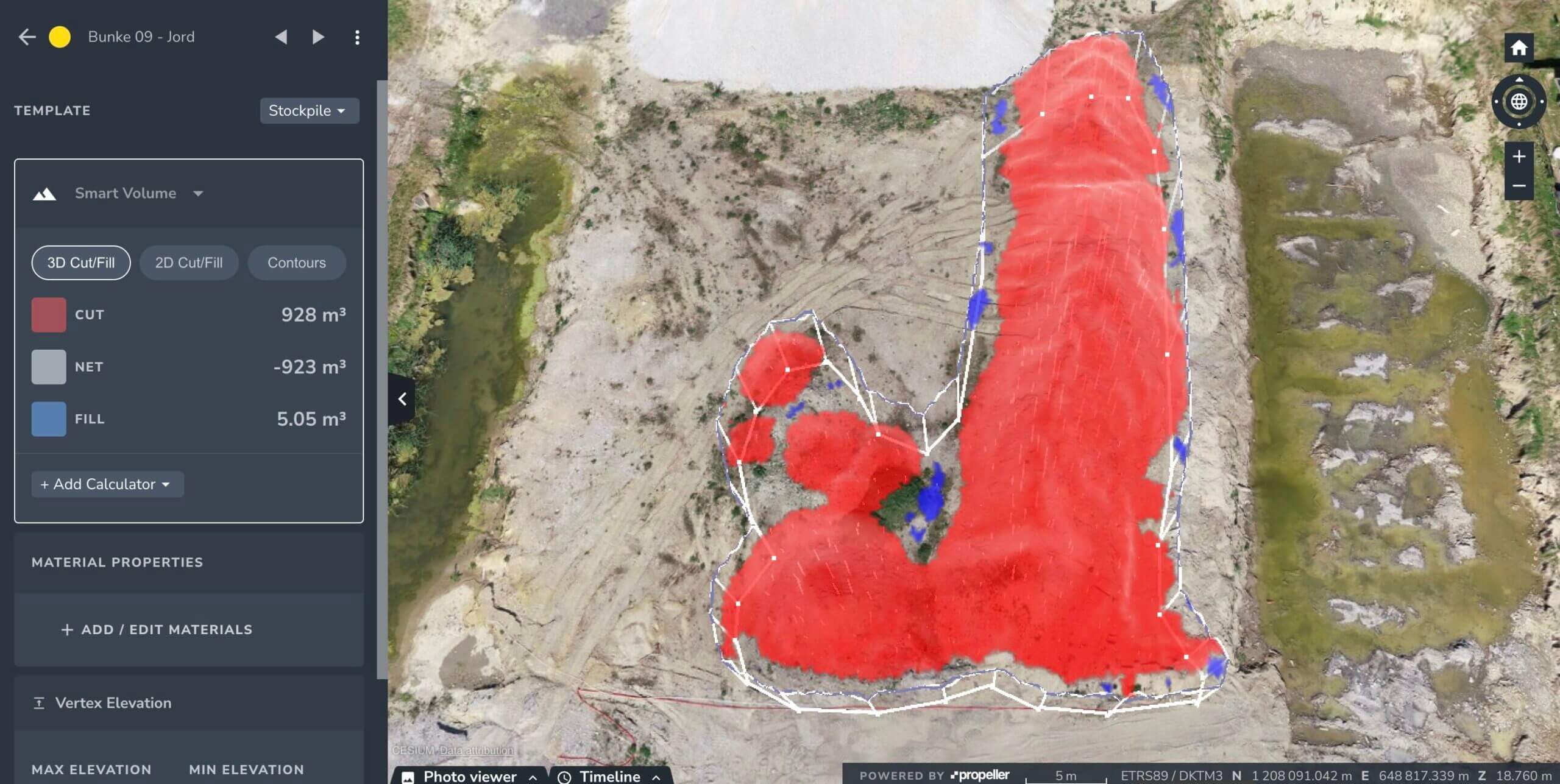
Direct customer access to user-friendly 3D maps
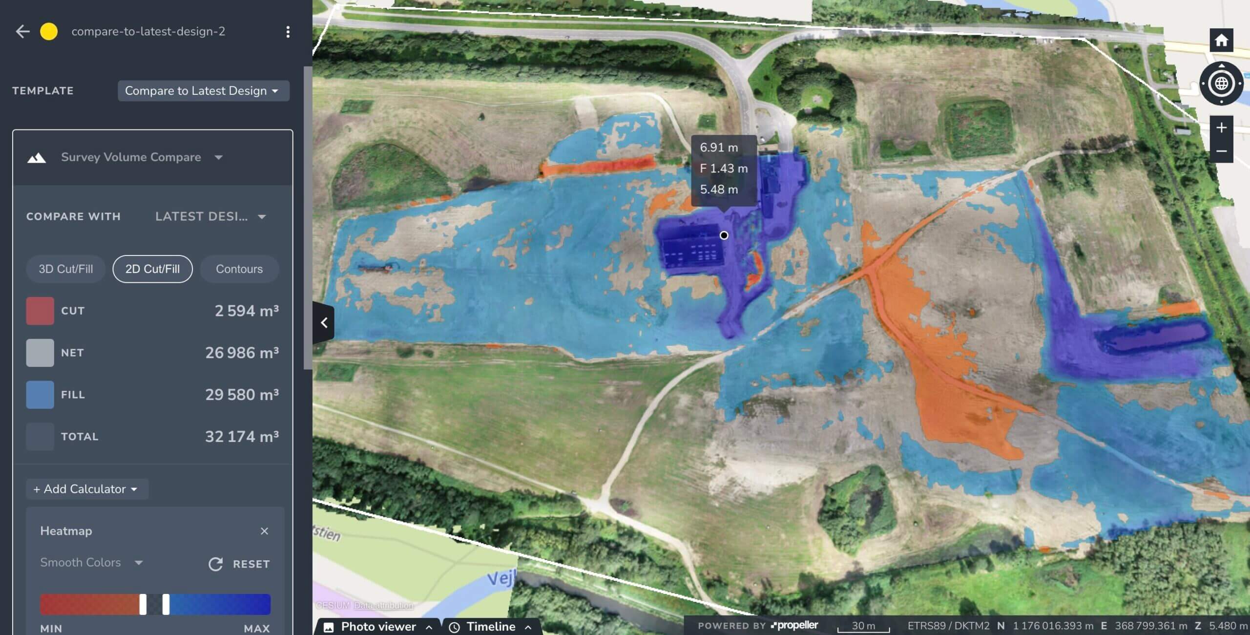
LIFA searched far and wide for solutions that would improve the workflow for their customers. They considered developing custom software for data viewing and sharing—but the moment they discovered Propeller, they knew they could do a lot more. In addition to streamlining their data processing, they could put the ability to make measurements and calculate volumes directly into their clients’ hands.
Now, instead of a massive and highly technical data packet, LIFA’s customers receive their survey data in an easily accessible 3D map. They can visualize and understand the data they’ve paid for and make calculations themselves without having to ask Anders and his team to do it.
One client in Odense was so enthusiastic about the ability to visualize their data that they used each biweekly survey’s orthophoto to make a tablecloth for their meeting room. This enabled them to keep the most up-to-date maps front and center, facilitating better decision-making and efficient material movement.
In another instance, at a remote mining site in Greenland, the LIFA team finished a laser scan of onsite buildings a day early. With time to spare before they could return to Denmark, the client asked for a scan of their mining site as well. LIFA recommended drone photogrammetry instead, and the client was so pleased with the results that they’ve since requested a second drone survey of the mine. “The response from the client has been very positive,” said Anders. “They really like the software.”
Streamlined processing, without compromising accuracy
Propeller’s survey processing has saved LIFA hours each week. “Even our powerful desktop computer was slow to process large datasets, so everything took more time. When we do a survey, customers expect the data back the next day. With Propeller, we can deliver accurate data faster, and we don’t have to spend hours of time to do it ourselves,” Anders told us.
With Propeller handling the processing and QA, surveyors no longer have to manually check each photo for GCP placement or worry about data accuracy. Anders admitted some initial skepticism related to giving up some control over the data output. “I’m a bit of a geek, so I like to tinker with the data, and I was a bit skeptical about having other people doing it,” he said. “But that has been far outweighed by the ease of the workflow. One person (the drone pilot) can do everything without having to involve a second person. We can avoid delays and deliver data to our customers quickly, and the data quality has stayed extremely high.”
So easy anyone can use it
Although LIFA’s customers have direct access to Propeller, the intuitive platform means they don’t need any training to use it. “We just send them a few instructions via email and they can start using it right away,” said Anders.
Internally, the process is nearly as easy. When new drone pilots need to learn to use the workflow, they receive remote training via screenshare. “Even my boss could do it, without any knowledge of drones or photogrammetry,” Anders told us. “It was quite simple to tell him how to use it over the phone. The workflow is so easy to use that even inexperienced people can get the results that they want.”
Want to know how Propeller can help you?
Learn more about Propeller’s products, pricing, and how to get started on your site.
You might also like

Cross Section Survey in a Matter of Minutes Using Drone Data

How to Use Drone Data to Improve Landfill Performance
