Technical FAQs
From expert analysis and advice to efficient data processing, the most productive teams are powered by Propeller. We’re committed to making your worksite map the hub for every decision you make—a place where LiDAR, photogrammetry, and design come together, creating actionable synergy.
Here are the answers to some of the more technical questions you may be asking yourself about Propeller’s LiDAR workflow.
Does Propeller support local coordinate reference systems (CRS)?
Yes, local CRSs are supported.
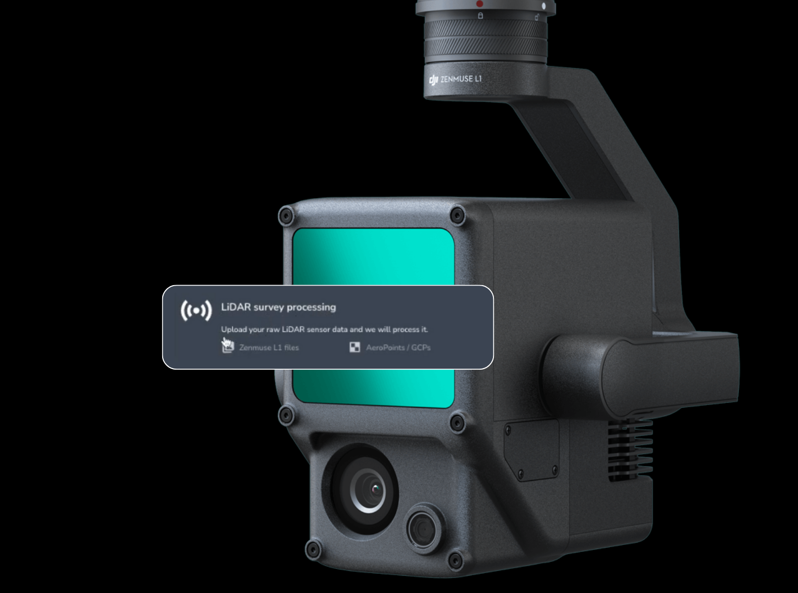
What kind of hardware is needed for Propeller’s LiDAR workflow?
DJI’s M350 drone and Zenmuse L2 sensor. AeroPoints should also be used for a complete PPK workflow.
What files are required for the LiDAR upload?
Zenmuse L2 files for LiDAR – .CLC, .CLI, .IMU, .JPG, .LDR, .RTK, .RTL, .RTS
For Photogrammetry PPK – JPGs (images), Timestamp.MRK, .RTK
Minimum of one GCP for published sites, two for local sites
How much does LiDAR processing cost?
LiDAR pricing is credit-based. LiDAR credits must be purchased separately from processing packs.
What exports are available?
Static Download
- Rough orthophoto in the site CRS (GeoTIFF)
- Digital Terrain Model (DTM) in site CRS (GeoTIFF)
- Elevation Contours in 1 and 2 unit values (DXF)
- Point cloud in the site CRS (LAS)
- PDF Processing Report
Dynamic Download
- Rough orthophoto (GeoTIFF, JPEG, KML, JP2, PNG)
- Outline (DXF or KML)
- Surface (DXF or TTM (usually for Stratus only))
- Point cloud (LAS, LAZ, or CSV)
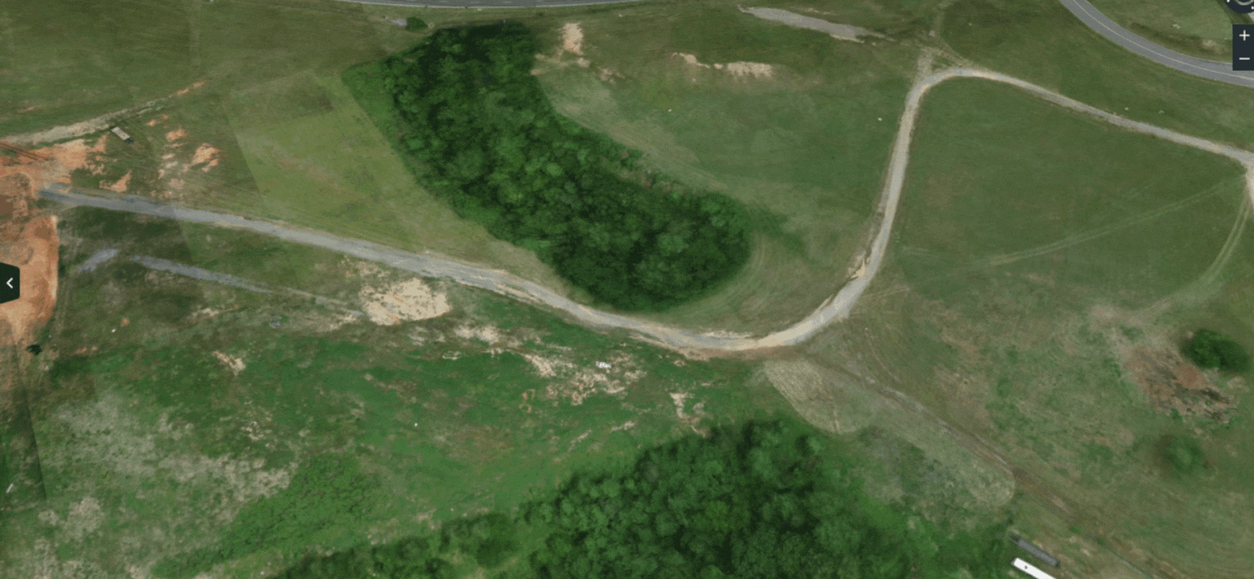
How are the terrains generated?
From the LiDAR point cloud “ground” classification.
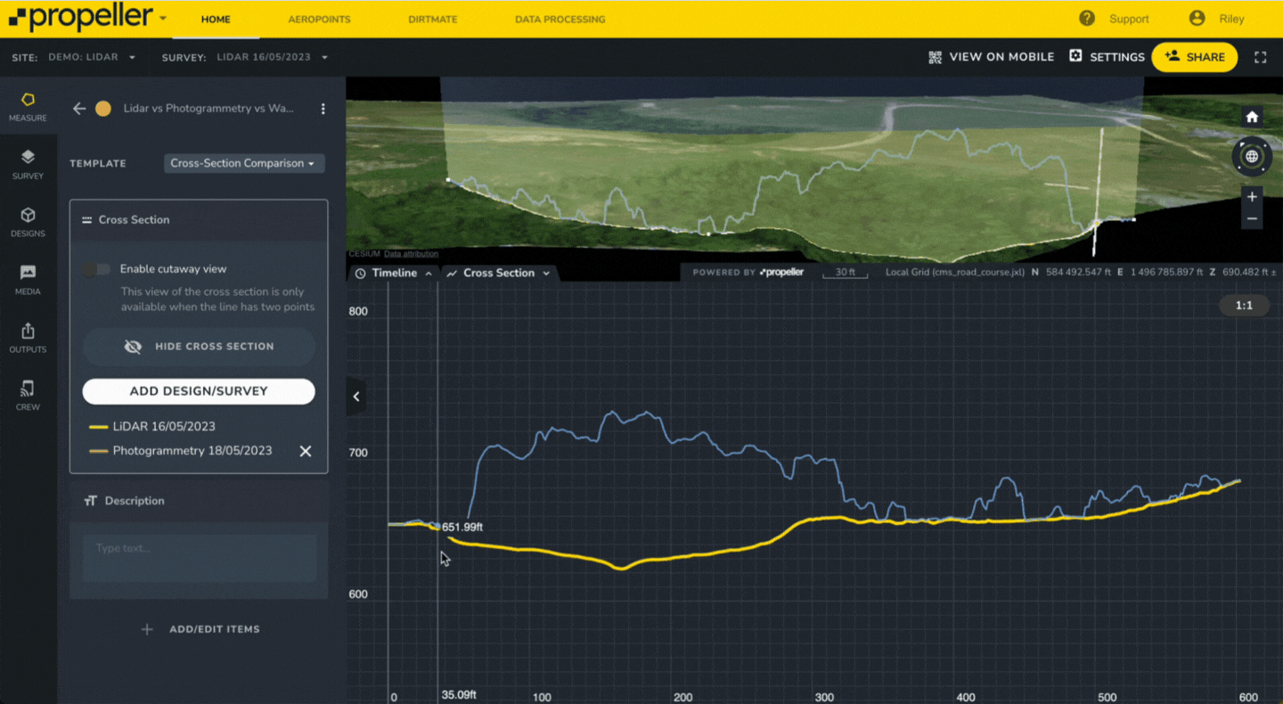
Can I use LiDAR datasets to create composite surveys?
Yes, composite terrain models and/or orthophotos can include any dataset—LiDAR, photogrammetry, or preprocessed. However, we do not support point cloud composites.
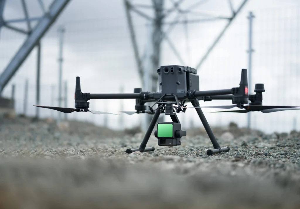
What drones does Propeller support with the L2 sensor for LiDAR and photogrammetry?
We support the L2 paired with DJI’s M300/M350 drone for LiDAR and photogrammetry.
To use the M300 with the L2, you must upgrade the Remote Controller to RC+ (the M350 controller), which does not come with the M300 by default.
Do you have a hard limit for LiDAR point cloud uploads?
Yes, 1 billion points.
Do we perform trajectory alignment during LiDAR processing?
Yes, this is performed to ensure the most accurate point cloud and terrain data is produced.
Do LiDAR datasets have a processing report?
Yes, a PDF can be downloaded from the files modal.
If I turn off “unclassified points” will that be reflected in the point cloud file when downloaded?
No, it will not. All points will be included with their appropriate classes
How do terrain edits work with LiDAR data?
They are applied to the terrain, not the point cloud, and will work the same as other surveys
Why does my contour map extend so far beyond the survey?
Sparse points around the edge of the survey lead to this.
Still have questions? Ready to elevate your pre-construction processes? Contact us today.
 If you’re hungry for more details, here are the highlights (and if you want to get more technical, visit the FAQs below):


