Survey-Grade Land Surveying Software for Earthworks

Stop letting slow data cycles and disconnected tools stall your progress.

Propeller is the land surveying software built to close the gap between your design and reality. By combining high-precision drone captures with a simple, cloud-based platform, we give your entire team from the field to the office the power to measure, track, and manage every cubic yard with confidence.

1K
Worksites powered by Propeller
1K
Users collaborating on the map
1K
People powered by Propeller

Land Surveying Software Built for the Way You Work

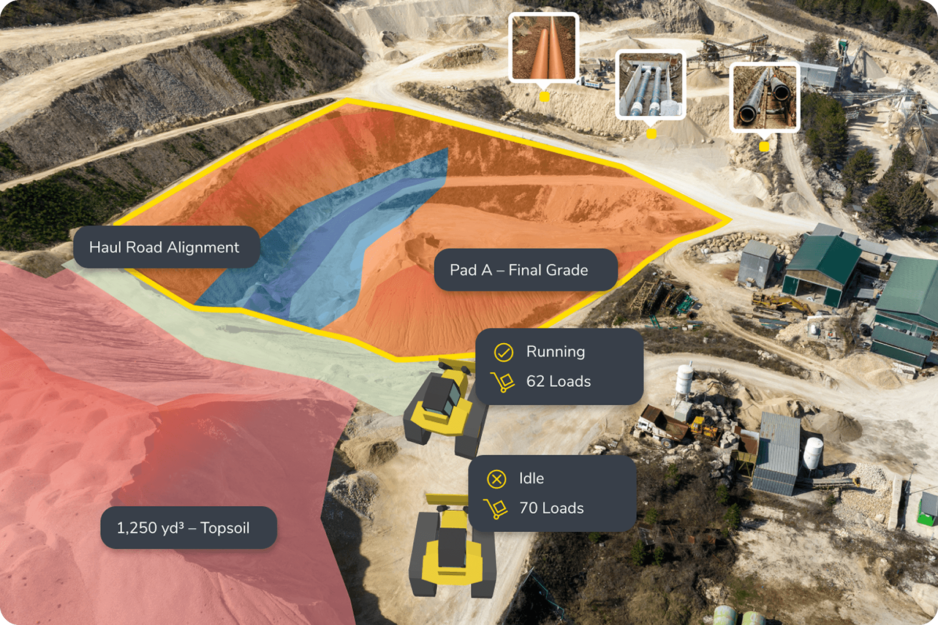
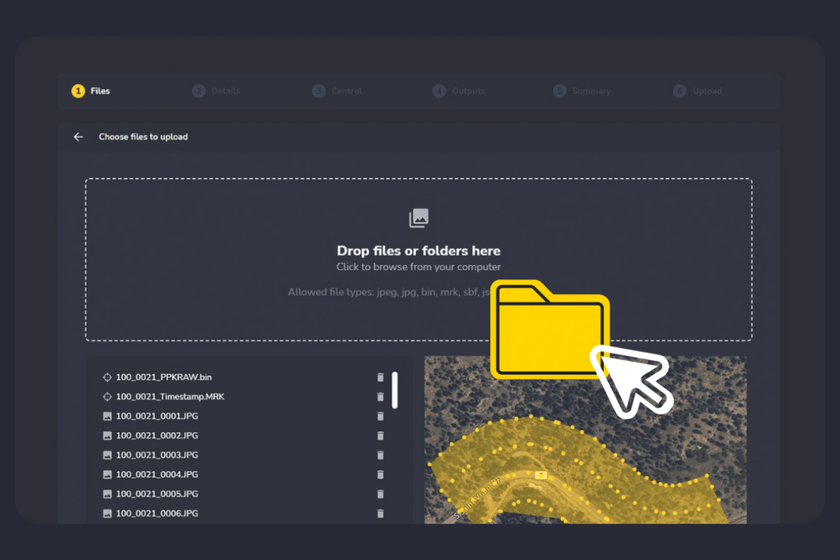
One Source of Truth: Bring your drone, GPS, and LiDAR data into a single platform. Stop jumping between disconnected tools and start analyzing your site in one place.

Survey-Grade Accuracy in 24 Hours: Skip the manual calculations. Get precise stockpile volumes and cut/fill measurements back in hours, not days, so you can reconcile inventory faster.

Catch Errors Before They Cost You: Overlay CAD designs on your survey data to spot deviations early. We help you ensure grade compliance and stop expensive rework in its tracks.

Site-Wide Transparency: Track progress through visual timelines and share interactive 3D maps with the whole team—from the field to the office—so we’re all working off the same data.

Machine trails and surface comparisons visualized in Propeller

Why the Best Teams Choose Propeller

Accelerated Workflows

We know you’re busy. Our cloud-based processing handles the data crunching for you, so you can spend less time behind a screen and more time making decisions in the field.

Unrivaled Site Visibility

Get a “drone’s eye view” of your entire operation. Toggle between 2D and 3D maps to spot inefficiencies that are invisible from the ground.

Your Unified Data Hub

No more searching through folders for the latest design file. Store your surveys, designs, and reports in one secure, accessible location.

Fits Seamlessly Into Your Existing Workflow

We don’t want to change how you survey; we want to make it faster. Propeller supports all standard geospatial formats, ensuring a smooth handshake with your CAD and GIS platforms:

Design Surfaces & Linework: Upload DXF and LandXML files to compare your “as-builts” against the theoretical design in seconds.

Point Clouds & Orthomosaics: Export high-density LAS/LAZ point clouds and survey-grade GeoTIFFs for deep-dive engineering work.

Easy Sharing: Use KML/KMZ files to provide quick site overlays for stakeholders who just need a “bird’s eye view” in Google Earth.

Propeller PPK processing upload resized
three construction workers inspecting site

High-Performance Solutions Across Industries

Propeller is the “boots on the ground” partner for leaders in:

Civil Construction: Hit grade and stop rework.

Mining & Aggregates: Accurate inventory and reconciliation.

Waste Management: Maximize airspace and site life.

Earthmoving Operations: Keep the “iron” moving efficiently.

Simplified workflows for busy teams

You don’t need to be a GIS expert or a photogrammetrist to get survey-grade results. Our platform is designed to fit into your existing workflow, not disrupt it. From flight to finish, we’ve automated the technical hurdles so you can focus on moving dirt, not managing files.

Hardware agnostic: We work with the drones you already own, including DJI and Autel.

Seamless exports: Move your data directly into CAD, Civil 3D, or Trimble Business Center without the need for manual file conversion.

subcontractor management

Join thousands of pros mapping the way and try Propeller now

REQUEST A DEMO