“Propeller is going to save us a lot of time and money on this project. Now, our in-house GIS/grade control coordinator doesn’t have to sit for three hours processing surveys.”

Patrick Schultz
Assistant Project Manager for Grade and Quality Control
“Propeller is going to save us a lot of time and money on this project. Now, our in-house GIS/grade control coordinator doesn’t have to sit for three hours processing surveys.”

“When I’m going on a job walk, it’s pretty hard to say that you’ve walked every piece. With Propeller, it eliminates that risk. It gives you that knowledge without stepping foot on site.”

“We believe that investing in cutting-edge technology is key to staying ahead of the curve, and our partnership with Propeller is a testament to that.”
Customer examples; results vary by project and workflow.
Stop chasing spreadsheets and paper plans. Bring your designs, drone surveys, and machine data into one cloud-based map that everyone can access.
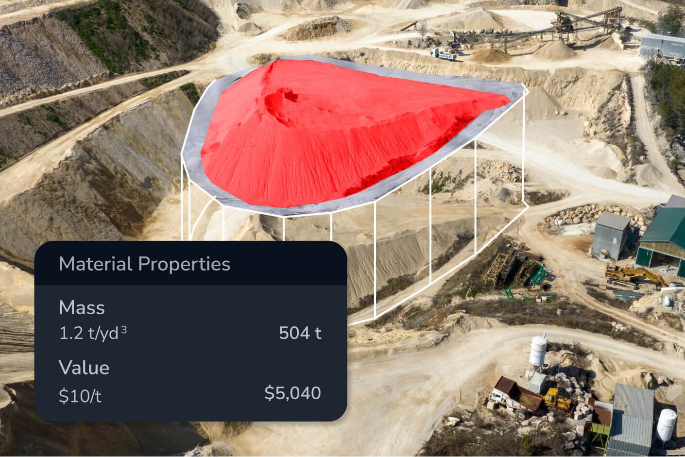
From simple stockpile volumes to complex design-to-grade comparisons, get survey-grade accuracy in clicks, not days, without specialized survey training.

Empower your superintendents and project managers with visual data. Resolve disputes instantly with a transparent, timestamped record of every site change.
Whether you need a high-level monthly survey or a granular daily update, Propeller scales to fit your project’s reporting requirements.
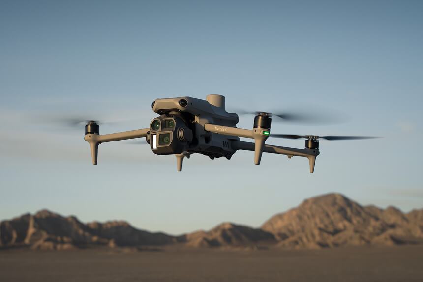
Fly your site weekly or monthly to capture a comprehensive snapshot. Process through Propeller’s world-class photogrammetry engine for 1/10ft (3cm) accuracy.
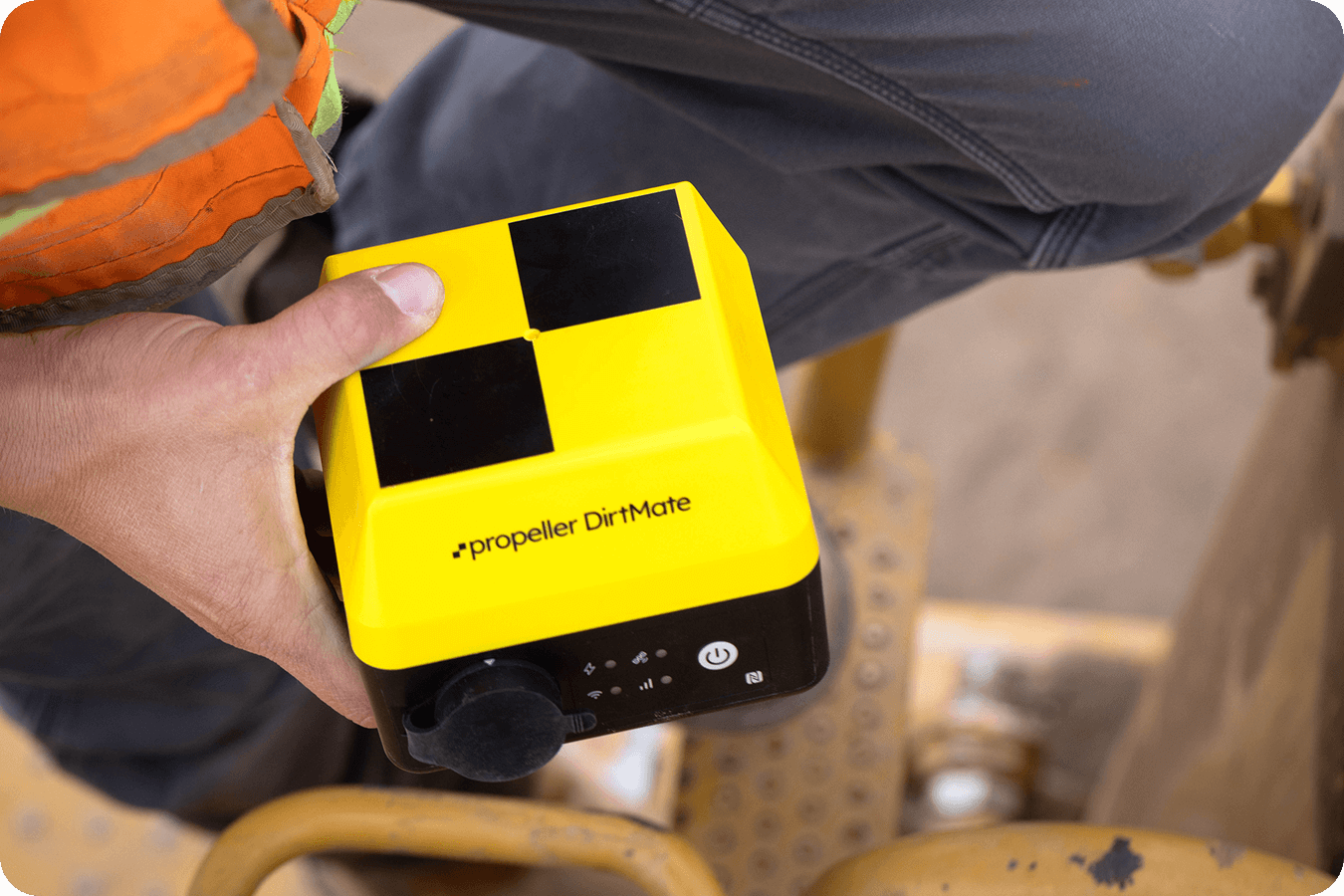
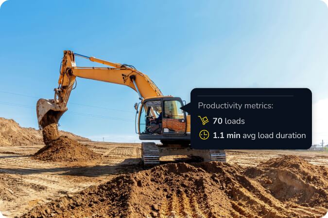
Add DirtMate to your fleet to turn every machine into a surveyor. Get surface updates every 30 minutes and track productivity as it happens.
Once you upload your imagery, our team processes it in under 24 hours, so you can start measuring the very next day.
No. We designed the platform for project managers, engineers, and superintendents. If you can use a web browser, you can use Propeller.
We support all industry standards, including DXF, TTM, LandXML, and GeoTIFF for designs, and LAS/LAZ for point clouds.
Yes. We use AWS for hosting and maintain SOC 2 Type 2 compliance to ensure your project data remains private and protected.