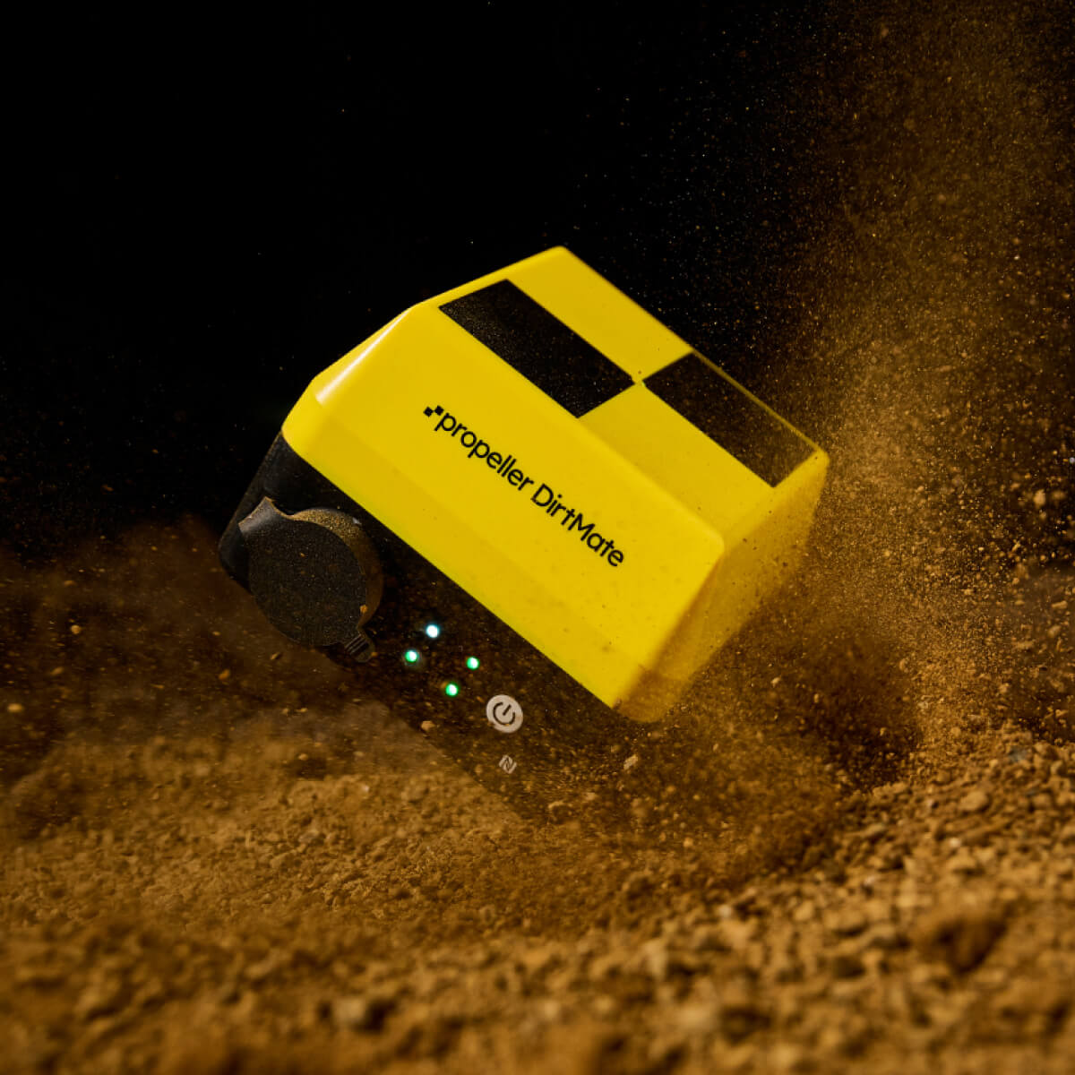
DirtMate:
The advanced GNSS receiver designed for project teams
DirtMate is the only GNSS receiver that delivers real-time production, progress and productivity insights, integrated with your drone maps. See your surface data, machine telematics and real-time site positioning wherever you need it with everything connected between the field and the office in real time.
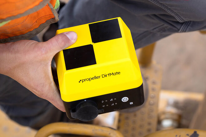
How to use DirtMate GNSS receivers
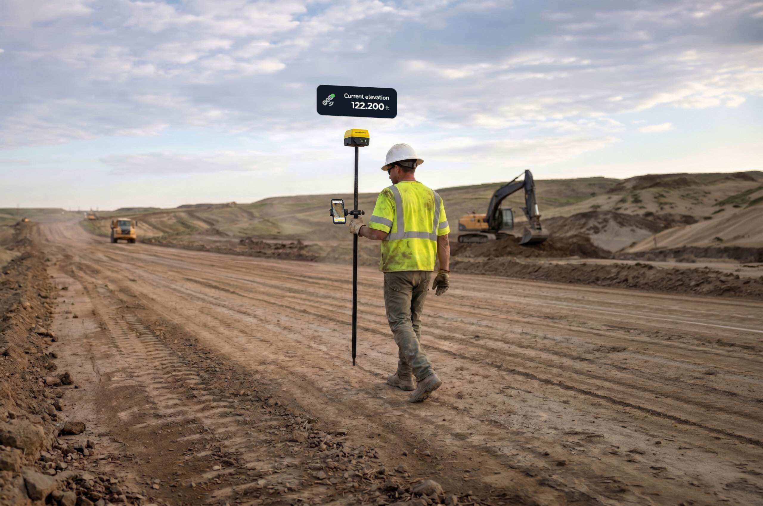
Built for the changing worksite, DirtMate GNSS Receivers swap roles on demand. Mount it on a machine, run it as a base, or put it on a pole for RTK workflows. Whatever the task, DirtMate delivers high-precision results in real time and syncs everything back to Propeller so the office and the field stay aligned.
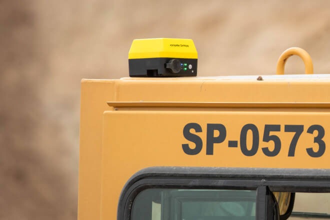
Machine telematics
Attach a DirtMate unit to active machines to capture PPK-corrected location, elevation, and machine utilization data
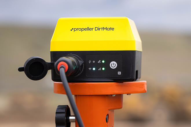
Base station
Use a static DirtMate unit as a reference base station to enhance GPS accuracy for drone surveys, machine surfaces and RTK tools
Position monitor
Monitor elevation changes of structures or fixed objects with centimeter-level accuracy, maintaining a historical record
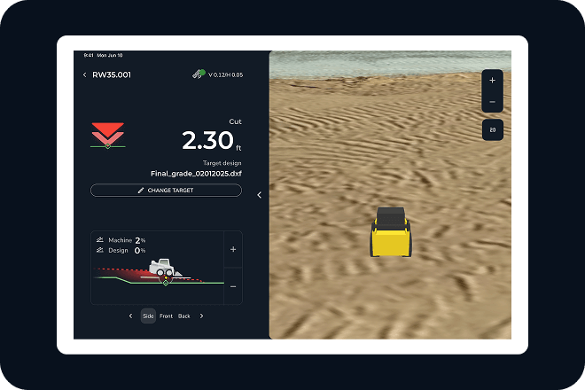
In-cab guidance (New)
Give operators in-cab visibility of designs and live position so they can rough grade flat surfaces and stay oriented on the map while they work.
Real-time site positioning (New)
Accurate positions for checking grade, staking out and collecting points. Synced instantly back to your Propeller platform
DirtMate GNSS receiver tech specs
Packing dual-frequency GNSS and an onboard IMU into one compact sensor, DirtMate turns active machines into its own survey crew. Stream live insights straight to a shared map. No extra surveyor, no extra steps. Here are the specs that make it possible.
Real-time solutions to the toughest challenges on site
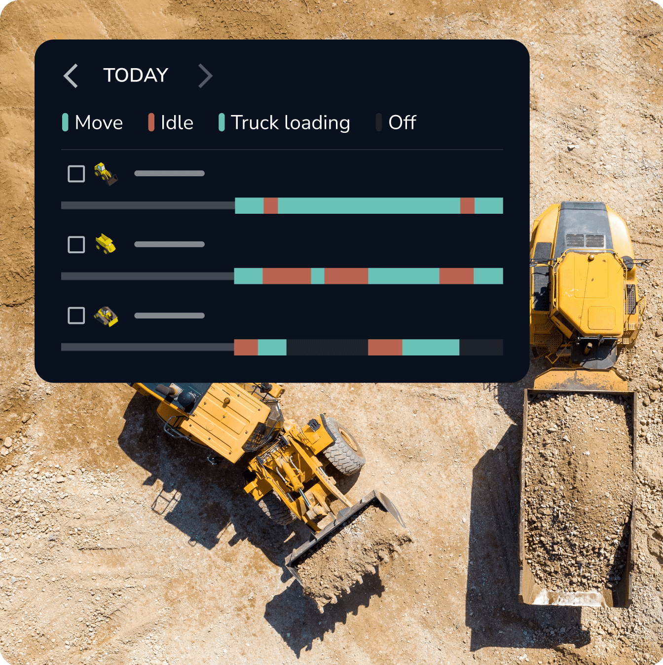
Cut idle time with real-time machine oversight
Automatic load/dump counters
Track and report on cycle times, load count, and dumps automatically
Daily reports
Receive automated daily reports summarizing key productivity metrics
Run/idle time
Monitor daily run and idle times on active machines
Live machine location
Visualize machine activity on the map to optimize haul routes
Utilization history
Benchmark efficiency metrics against your company’s average
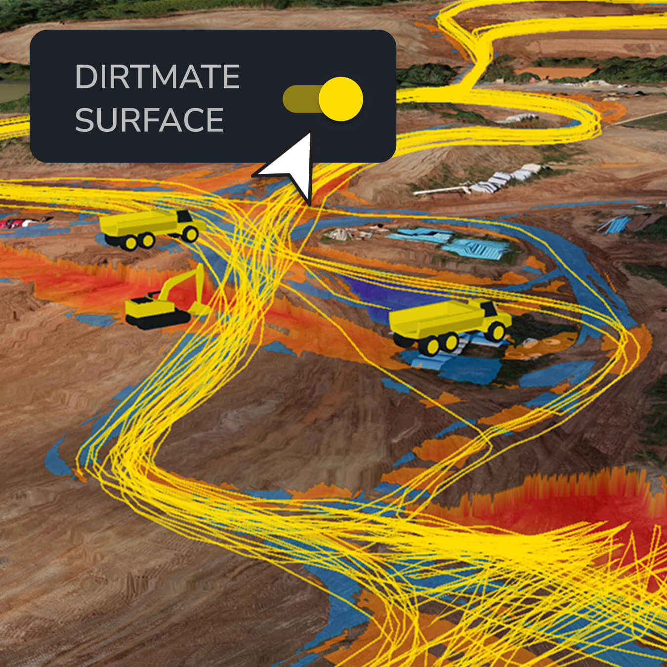
Verify your daily production with continuous capture
Generate new surfaces every 30 minutes
Create new surfaces wherever your machines are actively working
Track and report on daily cut/fill volume
Automatically create end-of-day surfaces that enable daily progress reports without the need for surveyors or drones
Daily automatic earthwork takeoff
Pick a region of the project and finish or sub-grade design for daily take-off reports from DirtMate surfaces
Keep surface elevation on record
Track changes in elevation at specific points across multiple surveys for historical comparison
Monitor the elevation of any machine, object, or terrain
Achieve 1/10ft (3 cm) accuracy
Track elevation changes with centimeter-level precision
Monitor structural movement
Stay informed about the position of walls and other structures, even in challenging environments
Dynamic position tracking
Monitor the real-time location and movement of structures to identify potential risks or inefficiencies
Historical positioning data
Record and analyze position data over time to improve maintenance, planning, and site management
Real-time answers when you need them
Compare to design surfaces
Spot cut/fill differences on the ground while work is happening
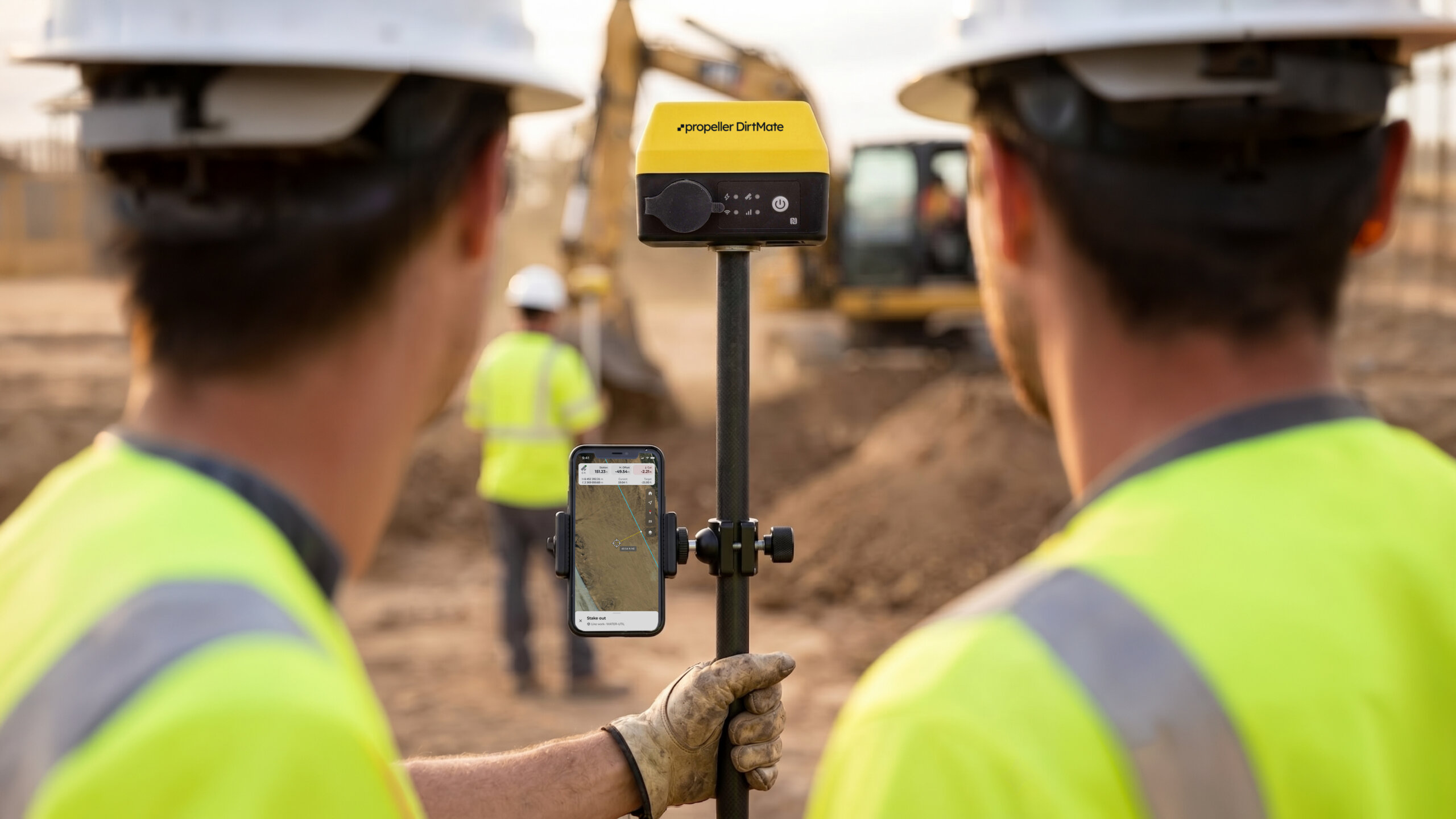
Stake out points and lines
Put layouts where they need to be, faster and with fewer back-and-forths
Capture points
Record installed locations and sync them to Propeller as a timestamped record
Measure lines and areas
Get accurate distance, slope, and area measurements on demand
Live fleet visibility
See your machines elevation and keep up to date with what’s happening across the site in real time
Lhoist boosted operational efficiency by 22% with DirtMate GNSS receivers
Martin Dillon, P.E., Lhoist’s Senior Business and Operations Manager, was tasked with finding a way to track productivity, reduce idle time, and increase efficiency. That’s when he found DirtMate.

“Before DirtMate, we had a basic spreadsheet where we took load counts and assumed a fixed volume. We could never get these values to reconcile and didn’t have our true cost structure as developed as we do for other areas of our operation. In retrospect, it was a very haphazard way to run the mine compared to how we operate today.”
– Martin Dillon, Senior Business & Operations Manager at Lhoist
Ready for real-time insights on your site?
DirtMate FAQs
The 2.4 GHz WiFi range is approximately 800 meters, limited by legal transmission power. The 900 MHz WiFi HaLow range is expected to be upwards of 2000 meters.
The receiver is IP66/IP68 weather-resistant.
Receiver: -40°C to +85°C
Battery charging: 0°C to 55°C
Battery discharging: -20°C to 60°C
The receiver has an integrated 5/8” thread for standard surveying tripods and poles. A 420 stainless steel bracket with adhesive strips is included. An optional rail-mounting kit is available for pipes or handrails.
DirtMate uses the u-blox LARA-L6004D Global Cat 4 LTE modem, compatible with 4G, LTE, and 3G.
The modem is certified by global standards and carriers, including AT&T and Verizon. Full certifications at launch include AT&T and PTCRB.
The internal battery can last up to 24 hours on a single charge. If set to sleep overnight, the battery life can extend significantly—up to two days for the receiver and four days for the PowerPack without any charge or solar input.
The DirtMate receiver (48.6 Wh) charges in ~3 hours with a >25 W power supply.
Yes, DirtMates can be configured to only collect data during certain hours of the day, and then sleep for the remainder.
If the temperature is outside the recommended range (0°C–55°C for charging), the system pauses charging but continues to supply power. The battery will completely cease to discharge outside the range of -20C to 60C. Extended exposure to extreme temperatures can shorten battery lifespan.