Know your inventory. Trust your numbers. Protect your margins.
Turn every pile into a data point. Propeller gives quarry and aggregates teams survey-grade stockpile measurements, real-time production tracking, and the financial transparency to run a tighter operation from virtually anywhere.
Use Propeller for stockpile volume calculations, aggregate inventory tracking, quarry production monitoring, and machine activity from one shared site platform.










The data your operation runs on

Inventory you can act on
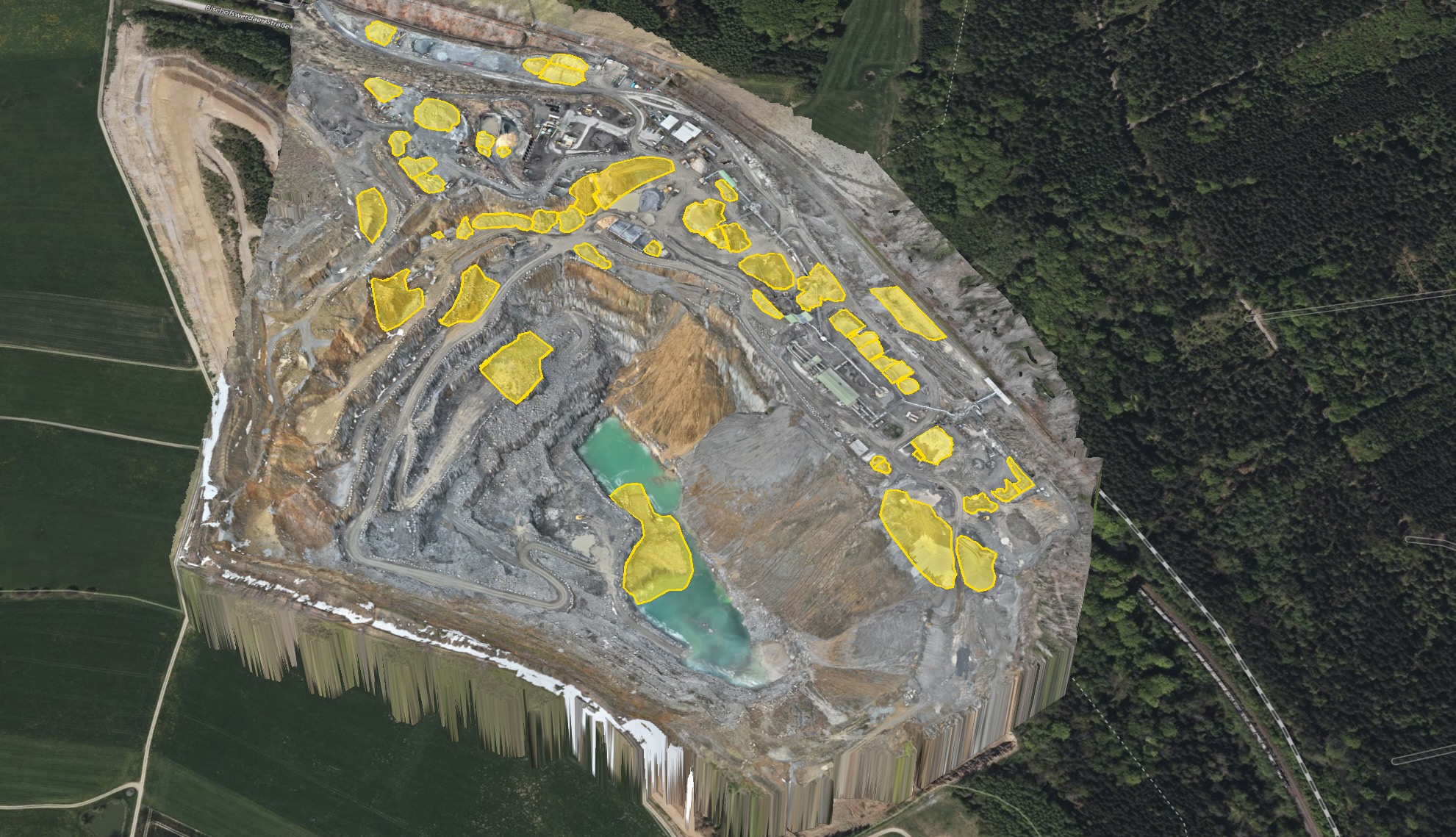
Survey-grade stockpile volumes available whenever you need them — not just when a survey crew can make it out. Give your sales and finance teams numbers that reflect what’s actually on the ground. Propeller’s stockpile measurement tools calculate pile volumes from current survey surfaces and let teams compare inventory between captures.

Production visibility across your fleet
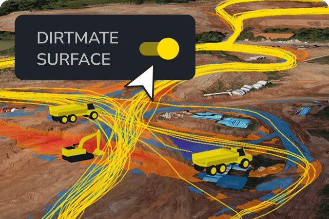
Track extraction rates, monitor machine cycles, and verify subcontractor output against schedule with data that updates as often as your operation demands. Pair survey data with real-time machine telematics to monitor machine locations, utilization, cycle activity, and daily production between formal surveys.

A record that closes every billing cycle with confidence
Timestamped, georeferenced site data means your billing, reconciliation, and compliance conversations are always backed by ground truth.
“Implementing Propeller has effectively created a digital replica of our plant, enabling us to conduct volume calculations, plant state comparisons, and measurements — all without leaving our office chairs.”
– Friedrich Bayer, Division Manager at Cemex
The tools that run your site
From pit opening to final reconciliation, Propeller gives quarry and aggregates teams the data infrastructure to measure accurately, produce efficiently, and report with confidence.
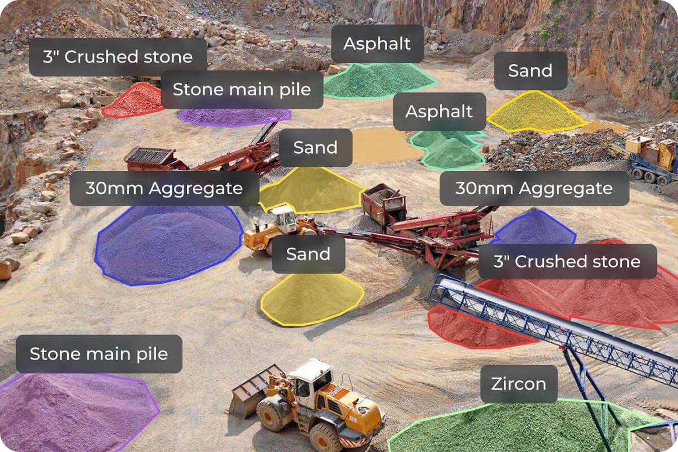
Measure stockpiles and track inventory
Get survey-grade volume data without waiting on a survey crew. Measure stockpile volumes in seconds from your desktop, track exactly how much material has moved between captures, and generate CSV or PDF inventory reports for any time period. Give your sales and finance teams a number they can act on. Use surface comparisons to measure how stockpile and material volumes change between surveys.
Track production and machine activity
Verify quality and plan adherence
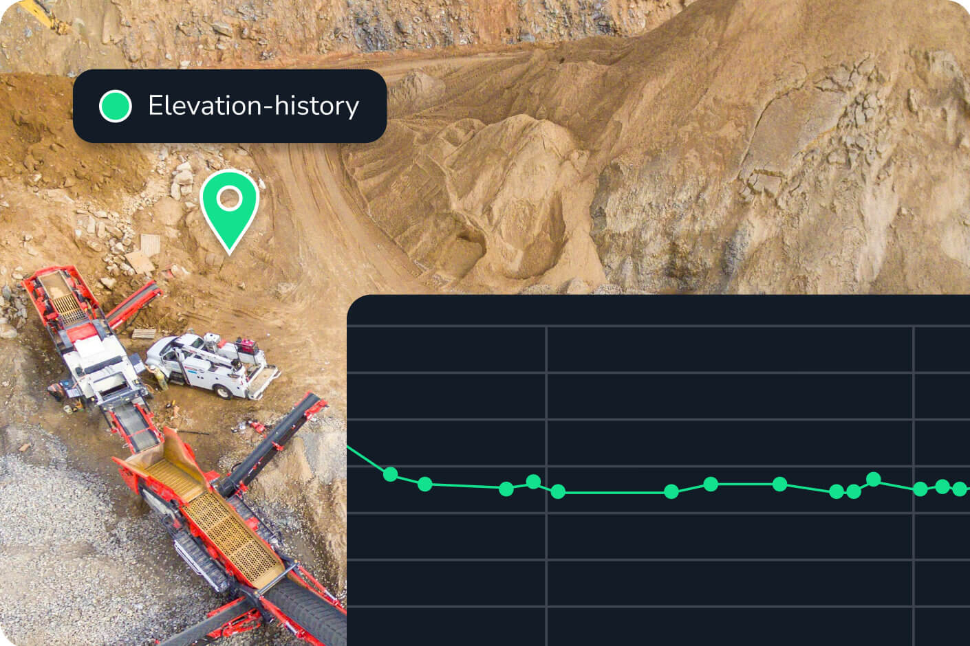
Make sure extraction is tracking to design before small deviations become expensive corrections. Compare any survey surface to your mine plan or design surface, visualize your pit design directly on your 3D map, and generate cross-section charts for quality and compliance checks. Use surface-to-design comparisons to review elevation and material differences between current quarry conditions and approved pit or extraction plans.
Document, report, and share with confidence
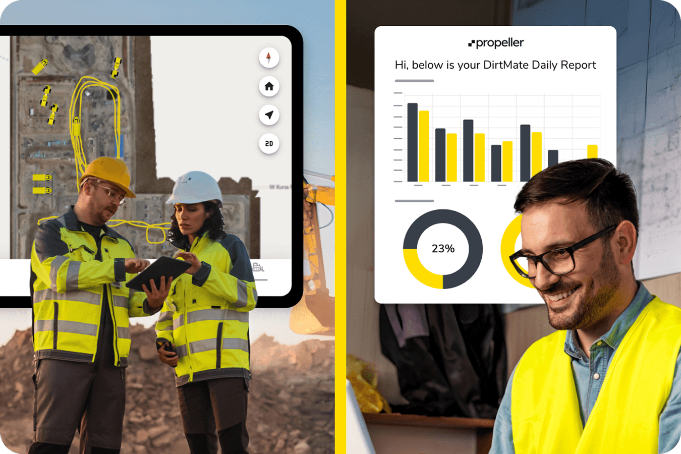
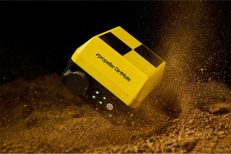
Real-time machine data that justifies every asset in your fleet
DirtMate gives owners and VPs direct visibility into how every machine is performing. Think load counts, cycle times, utilization, and real-time position across your entire fleet. See which sites are running efficiently and which aren’t, and have what you need to make fast resource and equipment decisions without relying on a chain of phone calls to find out. Learn more about DirtMate and how it connects machine telematics with survey and production data.
Frequently asked questions
Propeller delivers survey-grade stockpile volumes processed with PPK correction. When flown with AeroPoints, horizontal accuracy is typically within a few centimeters, giving you data you can confidently use for billing, reconciliation, and financial reporting.
As often as you need. Some teams fly daily, others weekly. Unlike traditional survey crews on a fixed schedule, Propeller gives you the flexibility to capture data whenever a business decision requires it. Think end of month, ahead of a client meeting, or right after a significant extraction event.
No. Propeller is designed to be used by the people already on your team. Quarry managers, engineers, and operations staff typically get up to speed within a few days. Propeller handles all PPK processing and quality assurance on the back end so your team can focus on flying and making decisions from the data.
Yes. Propeller supports imports and exports in a wide range of formats and includes a read-only public API for pulling terrain data directly into CAD and GIS platforms. It also supports WMTS for streaming orthophotos into your GIS software.
Propeller creates a timestamped, survey-grade record of every volume change on your site. When a contractor’s load count doesn’t match your ground truth, you have the data to work through it accurately rather than relying on tickets and estimates.
Propeller is hardware-agnostic and works with most commercial drones. AeroPoints ground control targets are used to achieve survey-grade accuracy. For machine telematics, DirtMate installs on any heavy equipment in your fleet. Your Propeller team will walk you through the right setup for your site.
Stockpile measurement software calculates the volume of material stored in a pile using survey or terrain data. Quarry and aggregates teams use it to track inventory, compare material changes between surveys, support reconciliation, and report quantities. Propeller’s stockpile volume tools allow users to measure individual piles and compare volumes over time.
Drone stockpile measurement uses aerial survey imagery and ground control to create a measurable 3D surface of the site. Teams outline a stockpile and calculate its volume against an appropriate base surface. Repeat surveys can then be compared to track how inventory changes over time.