Construction CAD software, built for the field
Describe an earthwork design in plain language and Propeller CAD generates it on your site’s real survey terrain (access and haul roads, building pads, utility trenching, retention ponds) for early-stage concepting, then export to DXF and TTM for your engineering team’s final deliverables.
Real designs, generated on real terrain
Every design starts on your actual survey surface. No blank canvas, no terrain import.
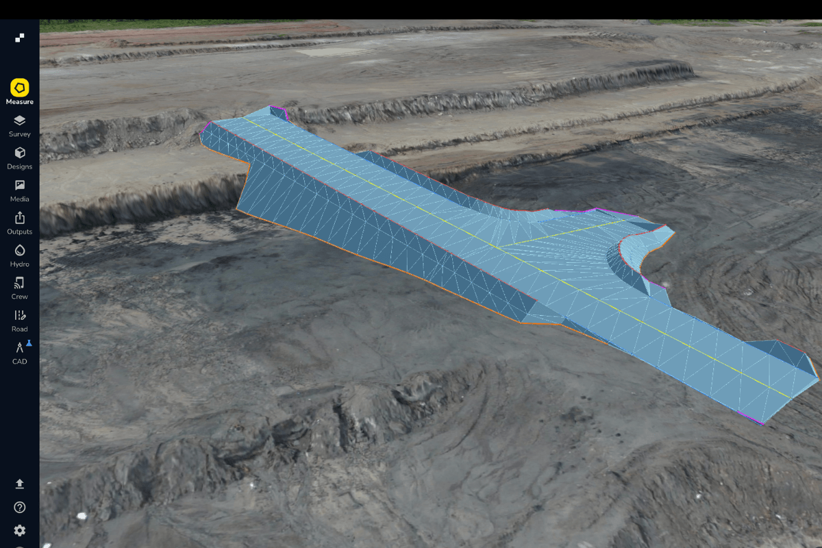
Haul roads & ramps
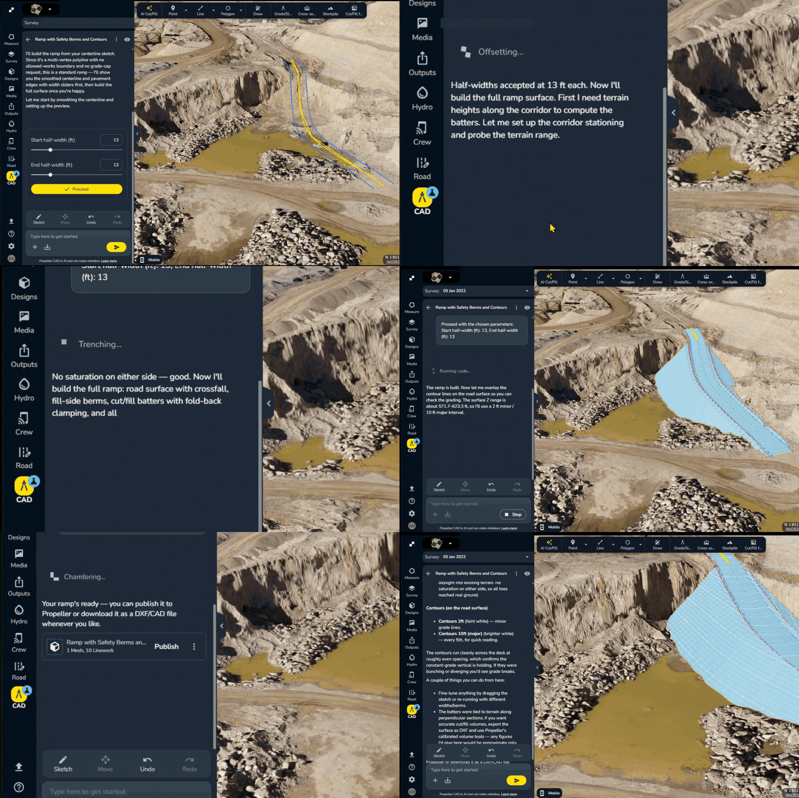
Generate a graded route from a centerline in seconds.
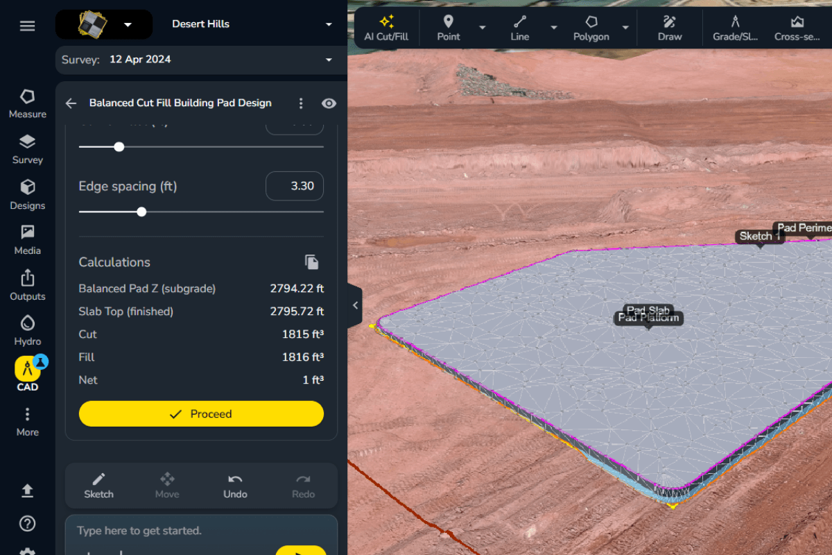
Balanced pads
Create a cut-fill-aware pad design from a sketched outline.
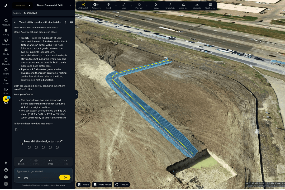
Ponds and trenches
Size a catchment pond for a rainfall event, or cut a trench from a line.
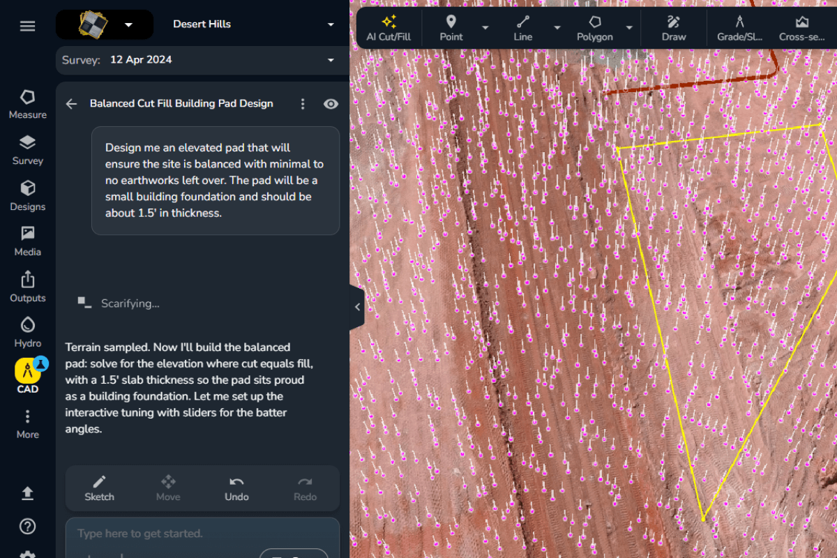
Plain-language prompts
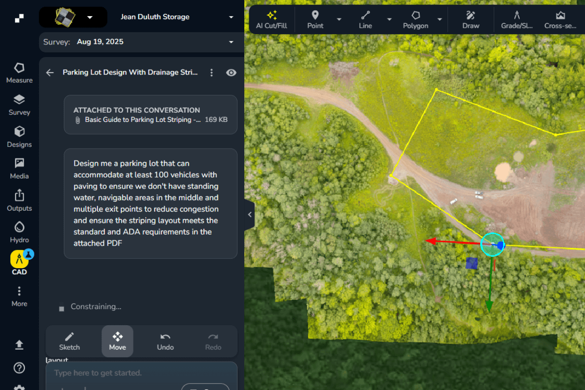
Describe the design, and the AI reasons over your elevation data.
Fast iteration
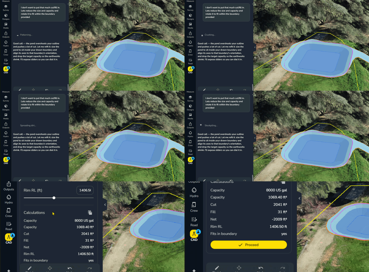
Tune parameters and rebuild in minutes.
DXF and TTM export
Take designs into your downstream workflow.
What Propeller CAD software can do when it understands your site
Generate designs from plain language
Type what you need, like “a haul road from here to the pit at 8% grade” or “a balanced pad inside this boundary,” and Propeller CAD builds it on your terrain. Roads, ramps, pads, trenches, and ponds, all from a prompt.
Behind the plain language is an AI that reasons over your site’s elevation data, so what it generates fits the ground you actually have.
Not sure where to start? Use the built-in prompt suggestions to jump straight into a guided workflow: balanced pad, ramp from a centerline, access track, catchment pond, and more.
Design on your real survey terrain
Propeller CAD works directly on your drone survey surface. There’s no exporting terrain out and importing it back just to get context. You’re designing against real coordinates and real elevations from the first prompt.
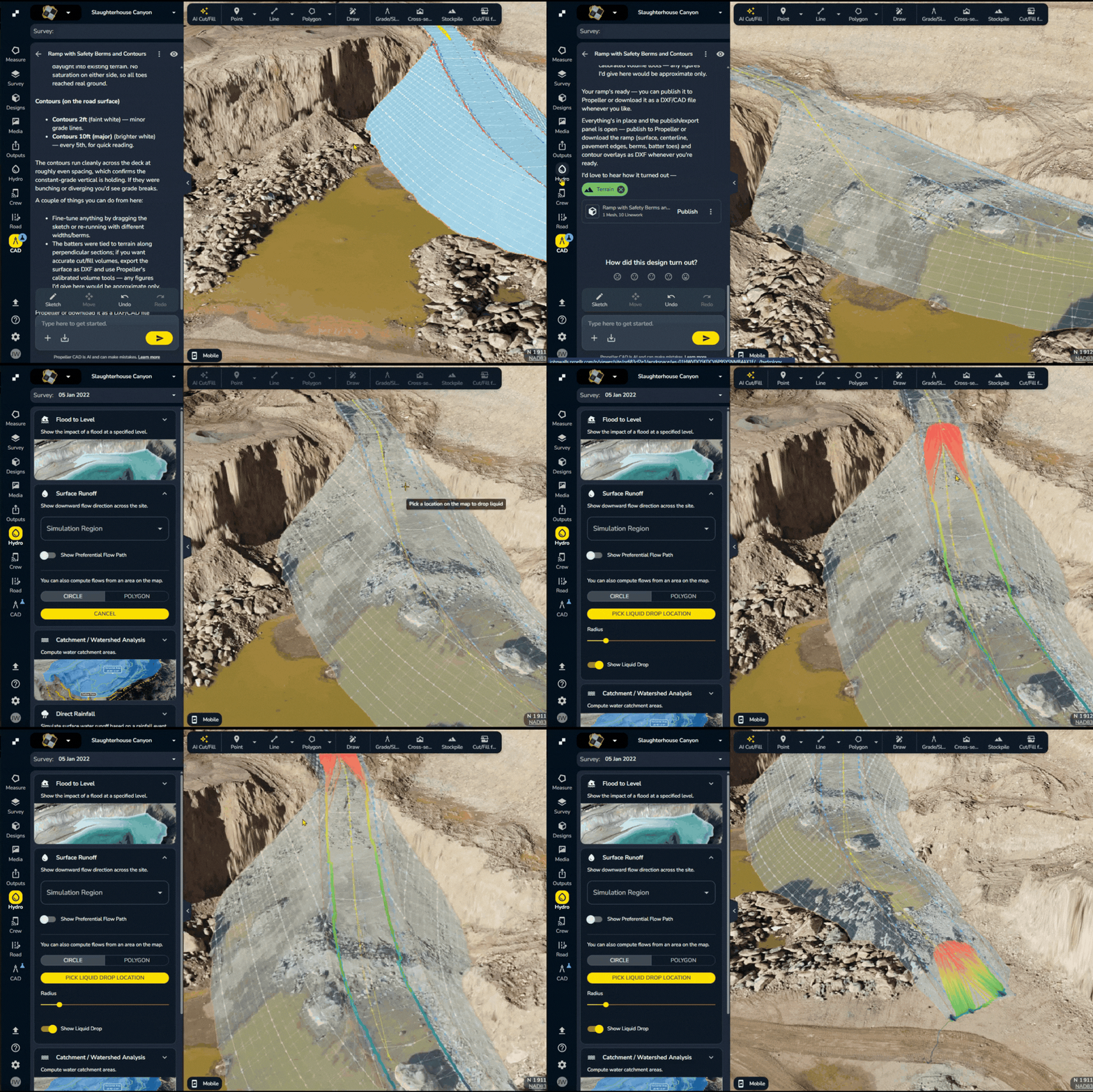
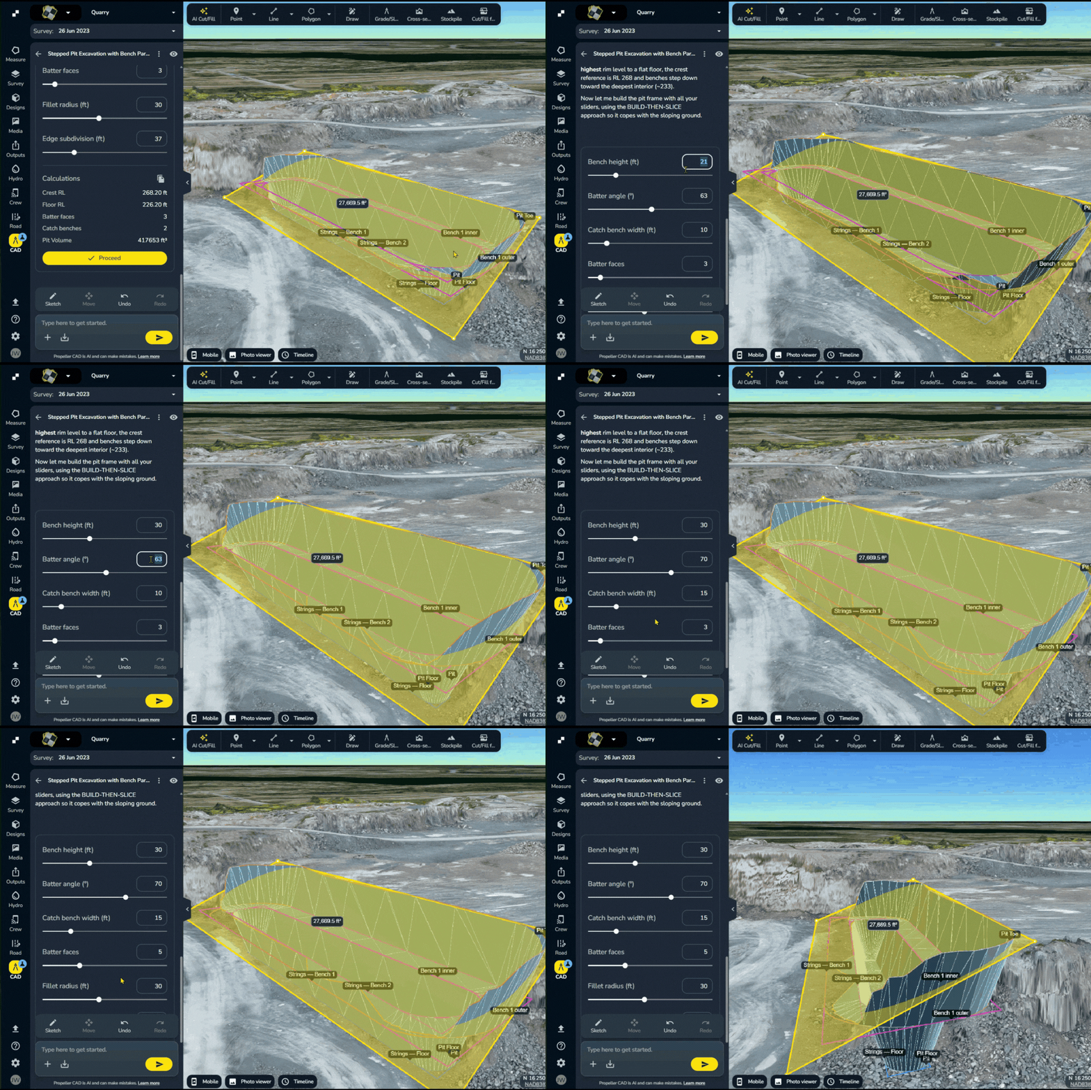
Adjust and iterate quickly
Change a grade, shift a boundary, or resize a pad: describe the adjustment and regenerate. Import your existing line work and turn it into 3D pipe networks. Comparing design options becomes a quick back-and-forth, so you can explore more ideas before committing.
Export to Design, DXF, and TTM
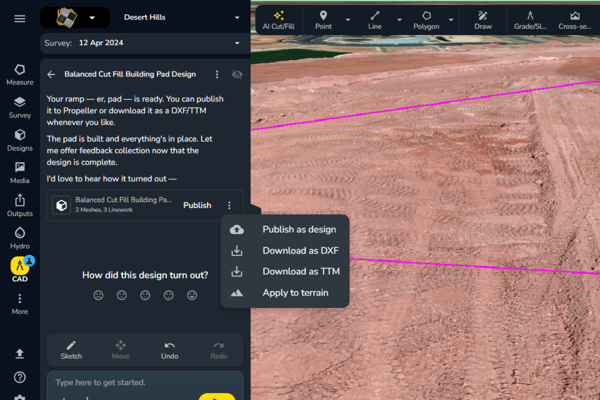
When a concept is ready to move downstream, push it directly to Propeller’s Design folder, export DXF for your engineering team, or export TTM for machine control and GPS data collectors. Propeller CAD is where the design starts, and your existing tools take it from there.
Bring your own design standards
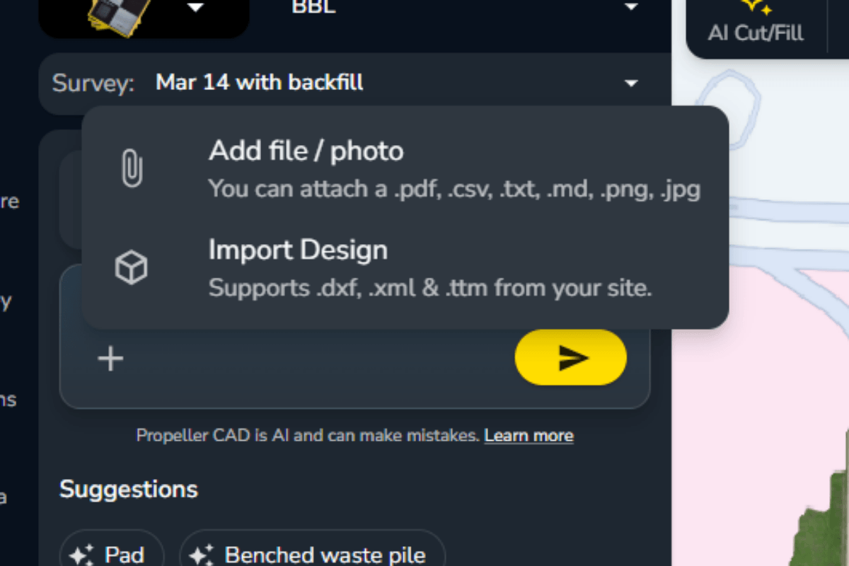
Attach your standards and specs with the + button, and Propeller CAD will use them as context while it designs, so outputs match your standards from the start.
Supported file types: PDF, CSV, TXT, MD, PNG, and JPG. You can also reference geometry on your site directly in the workflow: draw and label something like a “new haul road centerline,” then tell Propeller CAD what to build along it (e.g., width and max grade). If you need to, you can also bring geometry in via DXF, XML, or TTM.
2.5 days → 10 minutes
One earthworks contractor cut a design task that used to take two and a half days down to about ten minutes with Propeller CAD.
Based on a beta customer’s own account.
The first place to shape a design, right on your survey data
Propeller CAD is the natural language interface for modern site engineering and development teams. Concept a design in plain language, iterate it against real site conditions, then export it to the tools your engineers already use. It complements your existing CAD workflow rather than replacing it. It’s a fast way to go from an idea to something you can move forward with.
From idea to export, on real survey data

Starts on your terrain
No blank screen and no import step. Every design generates on your real survey surface.

Iterate in minutes
Describe a change, regenerate, compare. Design cycles that took hours can take minutes.

No CAD training needed
Plain language in, design out. Anyone on the team can design without CAD expertise.

Exports to your workflow
DXF and TTM out. Hand off to engineering, machine control, and data collectors.
What Propeller CAD is for
Use it for
- ✓Early-stage design concepts on real site conditions
- ✓Fast iteration and comparing options
- ✓Communicating a design idea across the team
- ✓On-site guidance and field decisions
- ✓Producing DXF / TTM to hand off downstream
What it doesn't do
- •Certify or sign off a design. That stays with a qualified engineer.
- •Replace an engineer's review. Export to DXF and have them finalize.
- •Deliver volume accuracy beyond site scale. It's built for site-scale concepting.
- •Re-edit a design once it's exported. Bring it back in via DXF and rework it in your engineering tools.
Propeller CAD doesn't certify designs. People do. If you need an engineer-certified or approved deliverable, use Propeller CAD to generate the concept, then export (e.g., DXF) for an engineer to finalize and sign off.
From survey to downstream, without leaving your data
Propeller CAD sits between your survey and the tools your teams already run.
Confirmed downstream flows: DXF into third-party earthworks tools; TTM into machine control and GPS data collectors; and applying a design back to terrain in-session for native cut-fill and conformance analysis.
See Propeller CAD on your own site
Propeller CAD turns a plain-language prompt into a design on your real survey terrain. It’s currently in beta, so book a demo and we’ll walk you through it on your own site.
Frequently asked questions
Propeller CAD is construction CAD software built into the Propeller Platform. Instead of drafting a design manually, you describe what you want in plain language and the AI generates it on your site’s real survey terrain (roads, ramps, pads, trenches, and ponds), which you can then export to DXF and TTM.
Propeller CAD complements your existing CAD workflow rather than replacing it. It’s built for concepting and iteration directly on survey data, and the software doesn’t produce certified or engineer-approved designs on its own. When a concept is ready, export it to DXF so your engineering team can take it into their tools for final, approved deliverables.
Earthwork designs on your survey terrain: haul roads and ramps, balanced pads, trenches, catchment ponds, and access tracks. You describe the design in plain language and adjust it by describing changes.
Yes. Propeller CAD is used by civil and earthworks teams to concept site designs on real survey data. It’s a fast way to explore and communicate a site plan concept. The software doesn’t produce a certified plan on its own, so use the DXF export to move your concept into your engineering software for final documentation.
Yes. Export designs as DXF for engineering handoff or TTM for machine control and GPS data collectors. These formats let Propeller CAD feed the downstream tools your teams already use.
Outputs are built for concept design, design input, and on-site guidance. The software doesn’t certify a design or produce a stamped deliverable; a qualified engineer does that. Volume accuracy is reliable at site scale, so for anything requiring sign-off, export to DXF and have your engineering team finalize it.
Yes. Attach a site-specific standards document using the + button in the chat and Propeller CAD will use it as context while designing. Supported file types are PDF, CSV, TXT, MD, PNG, and JPG. You can also import existing site geometry as DXF, XML, or TTM.
Propeller CAD is currently in beta. The best way to get started is to book a demo, and we’ll walk you through it on your own site and get you set up.