Construction Progress Monitoring Software for Real-Time Site Visibility
Construction progress monitoring software tracks earthwork production in real time against 3D design, giving you daily visibility instead of weekly reports. Propeller integrates drone mapping with machine telematics to catch deviations before they cost you time and margin.










Turn data blackouts into daily visibility
Most earthwork projects run in a data blackout. By the time the weekly report lands, the over-excavation has happened, the machines have sat idle, and the schedule has slipped. You find out you’re behind when it’s too late to avoid the weekend shift.
Propeller closes that gap. By comparing as-built data against your 3D design every day, your whole team works from a single source of truth, catching deviations before they become change orders.
The tools that keep your project on track
We’ve built the capabilities to give every team member a daily pulse on production.
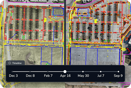
Timeline
Compare as-built progress against your master 3D design between captures to spot deviations before they affect the schedule.
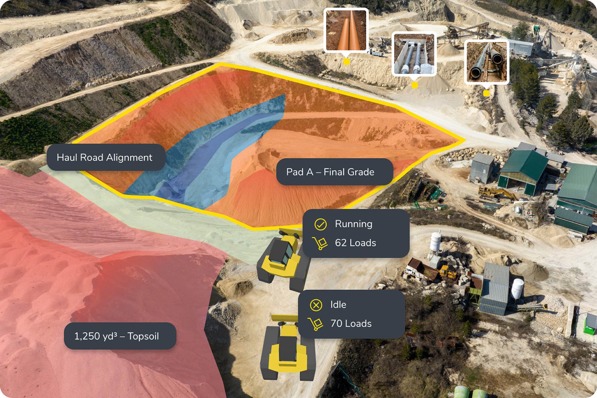
Machine telematics
Track fleet location, cycle data, and machine activity in real time to make sure dirt is moving as planned.
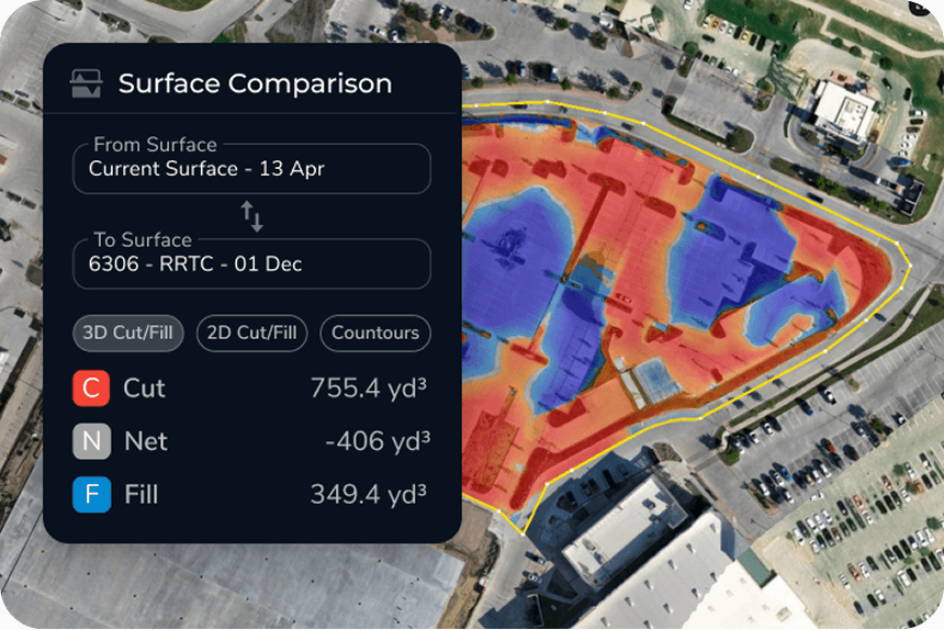
Cut/fill tracking
Measure actual volumes against your 3D design to calculate remaining work and projected completion dates with high-precision accuracy.
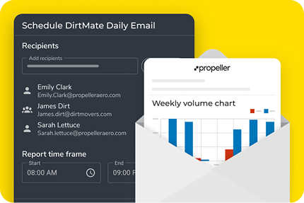
Automated reporting
Move from weekly snapshots to daily production data that delivers actionable insights to the office without the manual lag.
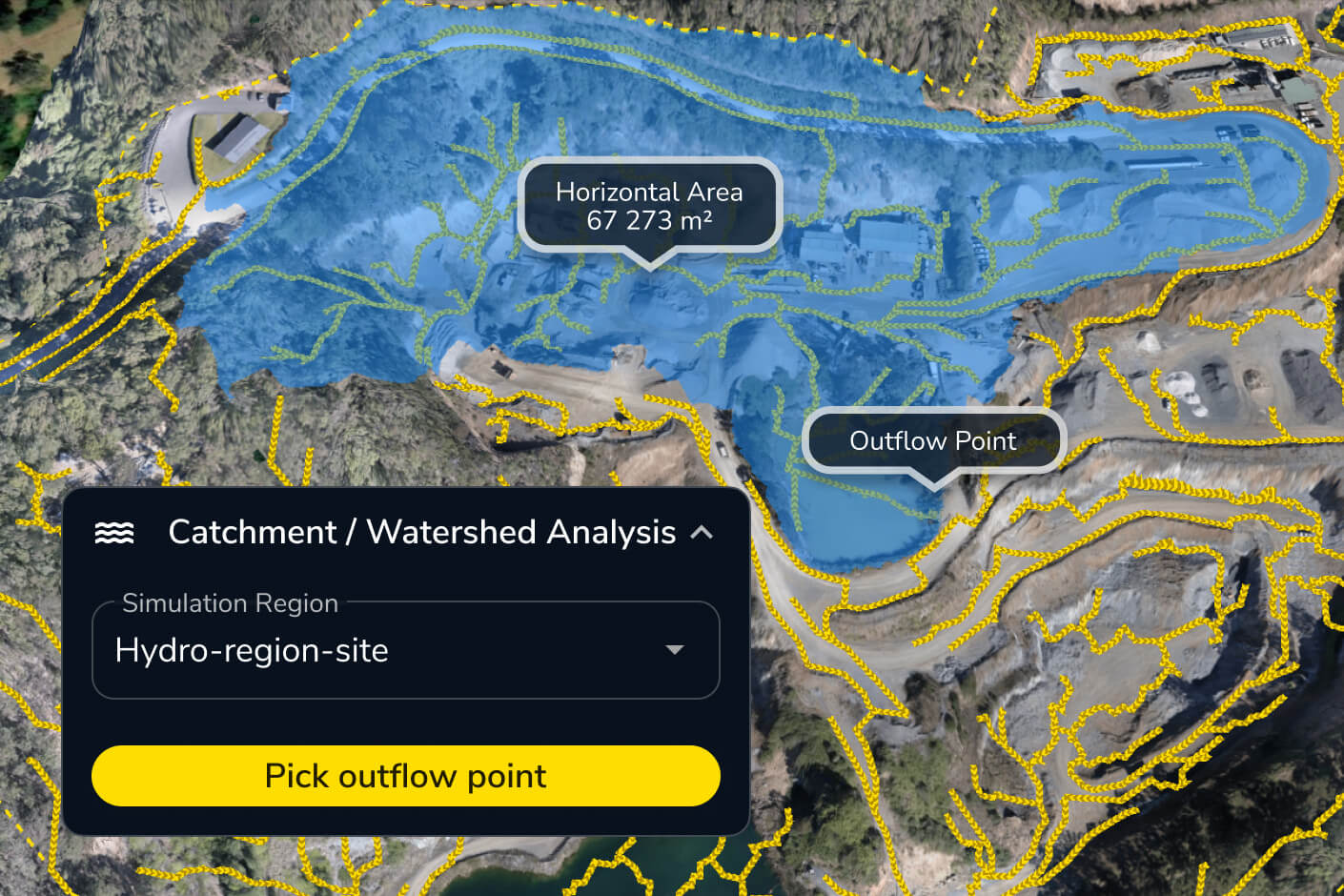
Hydrology overlays
Monitor how site changes affect drainage and water management throughout the build, before a surprise becomes a problem.
Tailored value for every stakeholder
Different roles need different answers. Here’s how survey-grade measurement translates into clearer costs, tighter schedules, and more defensible reporting across the team.

Project managers
Protect your margins. Automated cost and schedule tracking gives you defensible data for change order support and keeps you off the back foot.

Foremen and superintendents
Run a tighter day. Use accurate daily production records to plan the next shift and back up your tailgate talks with real data.

VPs and owners
See the full picture. High-level production tracking and shareable visual reports keep stakeholders informed without the manual prep.

Inventory managers
Know your numbers. Track earthwork volumes against pit plans and manage selling inventory with real-time accuracy.

Site engineers
Stay on design. Check daily progress against the 3D model with design overlays to verify quality and conformance before rework becomes a line item.
The tech behind the truth
Our hardware and software work in harmony to provide a survey-grade foundation for every project.
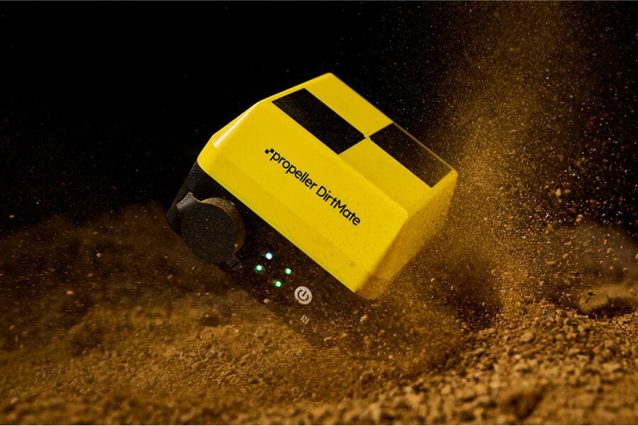
DirtMate
DirtMate streams live machine telematics and surface data directly to the map, giving the office real-time visibility into fleet activity and earthwork production as it happens.

Propeller Platform
A single, browser-based home for all your site data. From here, the whole team can visualize site changes, overlay 3D designs, and generate automated production reports.
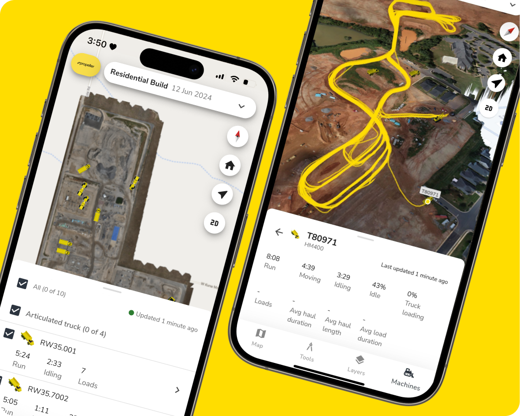
Propeller mobile app
Field teams can capture 360 media, run site checks, and share real-time updates directly from their mobile device, without heading back to the office.

Drone and hardware integrations
Propeller is hardware-agnostic, combining aerial drone mapping with terrestrial captures to give your team a complete 3D picture, regardless of site complexity.
Pre-construction drone survey applications by industry
Construction
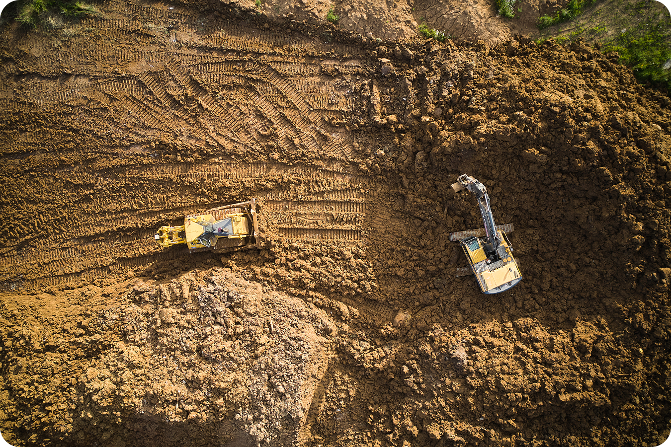
Keep the schedule. Track earthwork production against design daily and get the defensible data you need for subcontractor billing and change order support.
- Compare daily as-built surfaces against design to catch deviations before they cost you
- Generate defensible cut/fill data for subcontractor billing and change order support
- Track remaining earthwork volume to project completion dates accurately
- Keep office and field aligned on the same map without extra meetings
Mining
Hit your targets. Monitor stripping, overburden removal, and blast schedules with daily data tied to real volumes, not estimates.
- Verify stripping and overburden volumes against pit plans
- Monitor haul road activity and fleet movement across the site
- Track production against blast schedules with daily survey data
- Reconcile actual volumes with subcontractor load counts

Aggregates and quarries
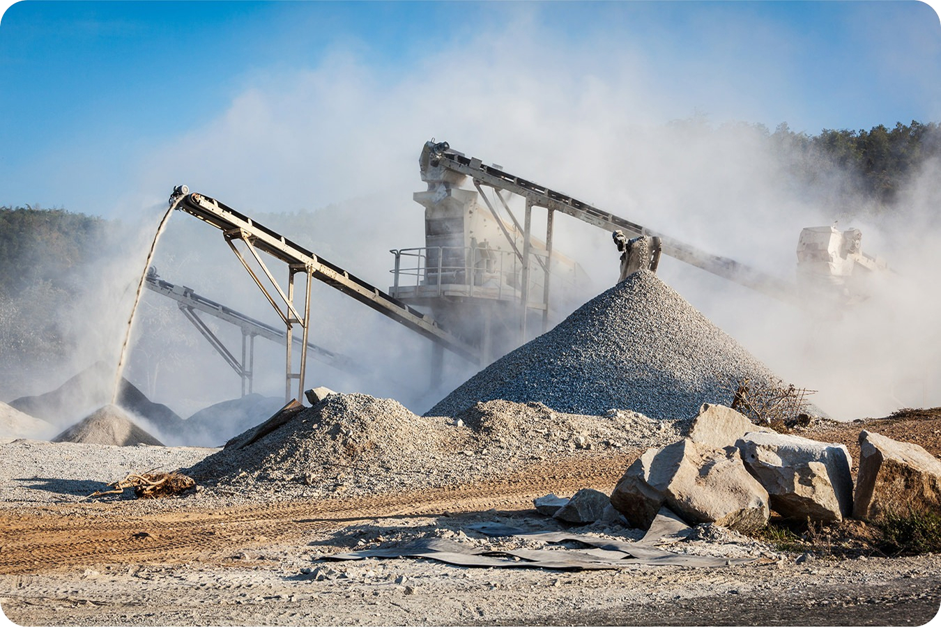
Know your pit. Reconcile production volumes and keep stockpile inventory tied to real, daily numbers.
- Reconcile pit extraction volumes against production targets daily
- Monitor stockpile inventory to keep sales tickets accurate
- Track bench heights and haul road changes across active faces
- Combine drone captures with machine telematics for complete site visibility
Waste management
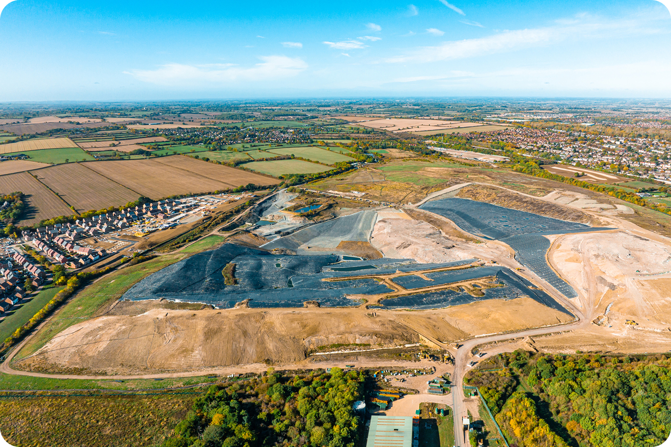
Protect your airspace. Track remaining capacity, compaction density, and slope conformance to maximize site life and keep regulators satisfied.
- Track remaining airspace and daily waste volumes against cell design
- Monitor compaction density to avoid under-compacted areas
- Generate regulatory-ready reports that document slope conformance
- Catch cover soil inefficiencies before they cut into your airspace budget
Transportation
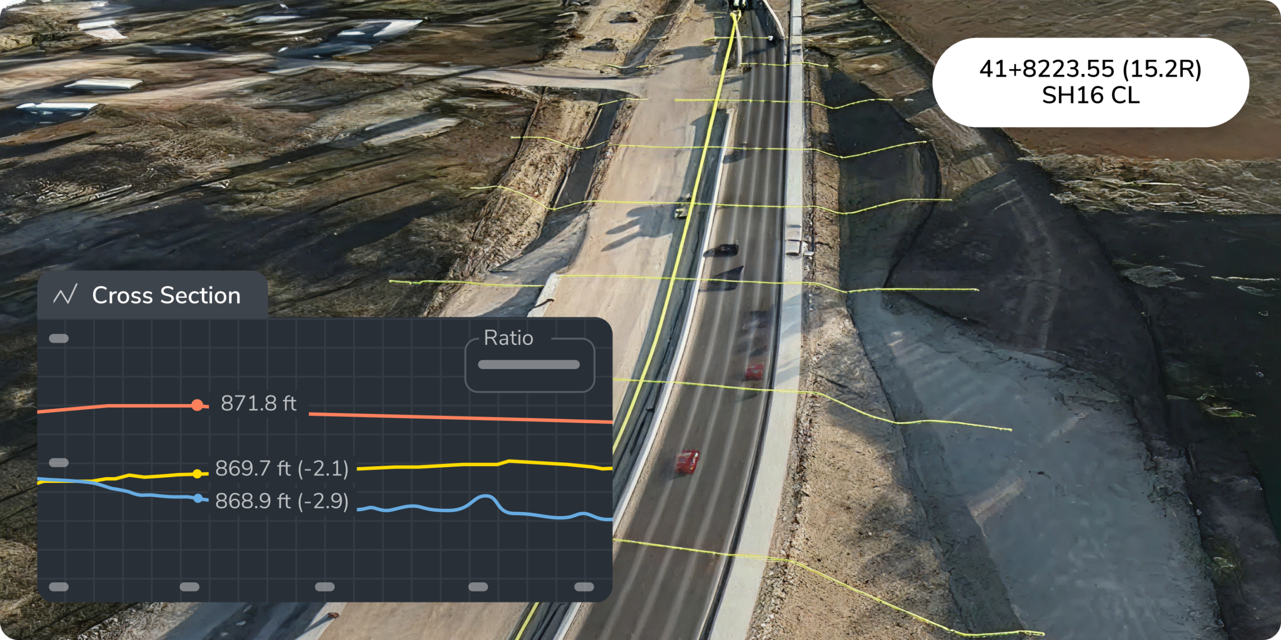
Track linear progress. Monitor corridor development across miles of right-of-way with a single shared map your entire team can access.
- Visualize earthwork progress along alignments against design grades
- Monitor fill placement and subgrade conformance across long stretches
- Track multiple active work fronts from one map
- Share progress reports with owners and stakeholders without the manual prep
Stop reacting. Start managing.
Your team shouldn’t have to wait until Friday’s report to know where the project stands. Get daily production visibility from the first dig to final grade.
Frequently asked questions
Progress tracking is about measuring work completed against a plan. Progress monitoring is about watching it happen in real time and catching deviations before they cost you. Propeller does both—you track daily volumes against your 3D design, and you monitor machine activity and site changes as they happen through live telematics and automated drone captures. The difference matters: tracking tells you what happened; monitoring lets you respond while it’s still happening.
For general oversight, weekly drone flights are the industry standard. But high-stakes projects with tight schedules or subcontractor billing milestones benefit from daily updates. With DirtMate, your team gets live machine telematics and surface data throughout the workday, so you catch deviations before they turn into costly delays. You don’t need a pilot every day—machine-mounted sensors handle the automation. The cadence depends on your risk tolerance and budget, not on pilot availability.
Yes. Propeller is hardware-agnostic and integrates with data from any drone, GNSS rover, terrestrial scanner, or total station. If you’re already capturing survey data with another tool, you can upload that data directly into Propeller and overlay it against your 3D design to compare progress. Your existing workflows don’t have to change—Propeller just gives you a single map where all your site data lives and talks to each other.
It eliminates the data blackout between traditional survey visits. By comparing as-built data against your 3D design daily, your team can identify over-excavation, machine downtime, or schedule drift immediately—before expensive rework, weekend shifts, or liquidated damages kick in. One day of early detection can save tens of thousands in corrective costs. The ROI comes from catching problems while they’re still cheap to fix.
For general oversight, weekly drone flights are the current industry standard. But high-stakes earthwork projects with tight schedules or subcontractor billing milestones benefit from daily updates. With DirtMate, your team gets live machine telematics and surface data throughout the workday, so you can catch deviations before they turn into costly delays.
When paired with high-precision ground control like AeroPoints, drone mapping achieves 1–3cm (approximately 1 inch) global accuracy. That level of precision lets teams calculate cut/fill quantities and stockpile volumes with high confidence, giving you a defensible single source of truth for subcontractor payments and change order verification.
No. Propeller is hardware-agnostic. While we recommend RTK/PPK-enabled drones like the DJI Mavic 3 Enterprise for professional results, our platform processes data from any drone. For high-frequency tracking that doesn’t require a daily pilot, DirtMate integrates directly with machine-mounted sensors to provide automated surface updates throughout the workday.
Automated tracking eliminates the data blackout between traditional survey visits. By comparing as-built data against your 3D design daily, your team can identify over-excavation or fleet inefficiencies immediately, preventing expensive rework, weekend shifts, and the downstream costs of liquidated damages.
Yes. Propeller supports seamless export of high-resolution orthomosaics, point clouds, and 3D surfaces in industry-standard formats including .DXF, .TTM, and .CSV, so your teams stay aligned within the tools they already use, including Agtek, Civil 3D, and other BIM platforms.
Propeller generates automated daily production data in professional PDF or CSV formats—cut/fill takeoffs, volume reconciliation, progress timelines, and machine activity summaries. You can tailor reports by role (project manager sees cost exposure; foreman sees hourly production; VP sees portfolio-level progress) or by audience (internal team, owner, subcontractor). Reports are defensible for change order verification and regulatory compliance because they’re tied to survey-grade measurement data, not estimates.
Yes. Propeller lets you visualize and track multiple active work areas simultaneously on a single shared map. You can overlay individual designs, set custom boundaries for each work front, and compare progress across the site without creating separate dashboards. Machine telematics show fleet movement across all areas, so you can see if machines are bottlenecking in one zone or if productivity is uneven across fronts.