Design conformance & as-built verification: Catch issues early, close with confidence
Experience seamless project phase closeout with Propeller. Compare high-precision survey data against approved designs so your team can spot grade, volume, and alignment issues early, and close every phase with proof.











Turn late-stage surprises into daily design confidence
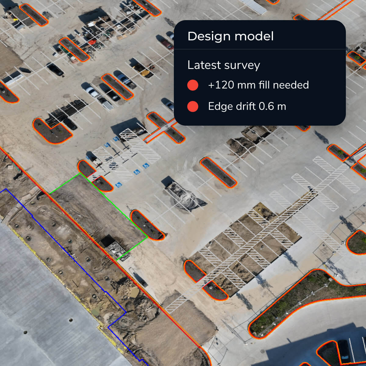
Design variance can emerge at any point in the project, from excavation and fill to grading and final inspection. Regular design comparisons give teams a clearer view of where current conditions match the plan and where additional review may be useful.
Propeller brings current site conditions and approved design surfaces together in one view, making it easier to identify variance earlier, coordinate next steps, and maintain a clear record through closeout.
The tools that keep your site built to plan
Propeller brings the design, the latest site data, and defensible closeout documentation into one workflow.
Design overlays
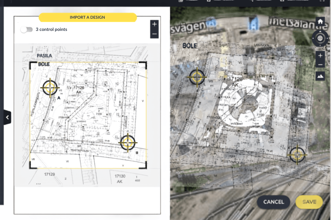
Compare approved design surfaces, CAD files, and 3D models against the latest survey data so teams can see design intent and actual conditions in the same view.
Surface comparison
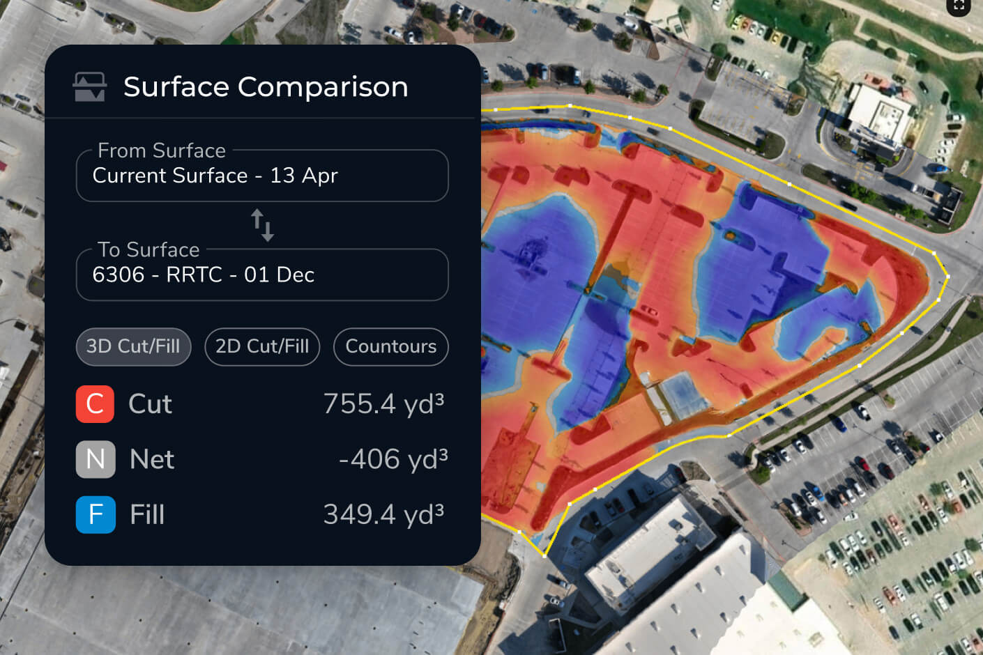
Generate cut/fill heatmaps, elevation difference surfaces, and variance views to identify exactly where work is above, below, or aligned to design.

Grade checks
Check elevations, slopes, pads, roads, drainage areas, and other tolerance-critical locations in seconds from the office or field.
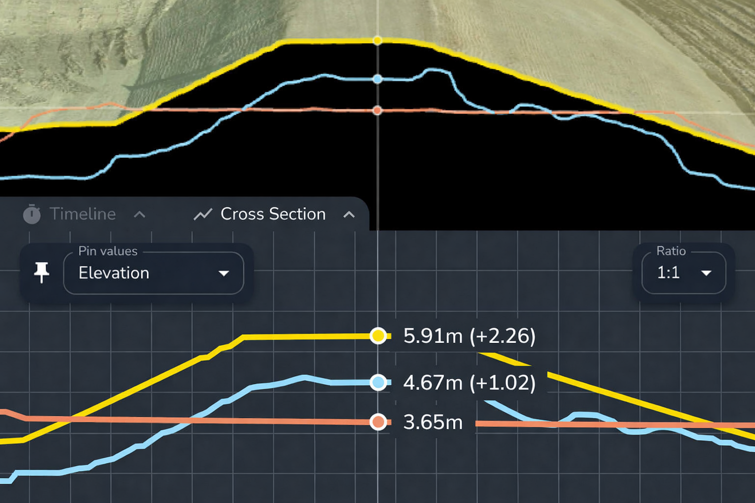
Cross-sections
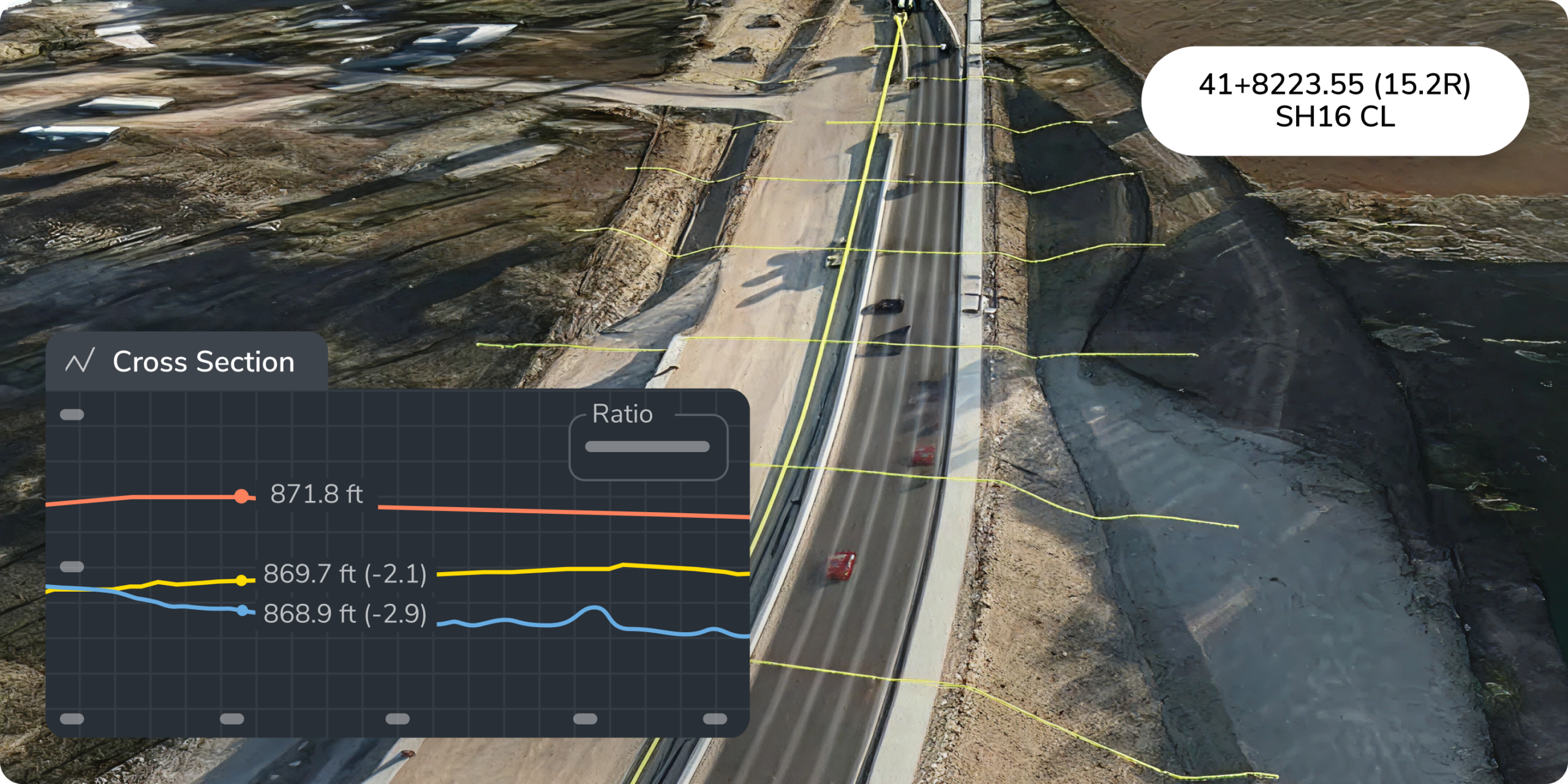
Review design conformance across roads, benches, trenches, embankments, and other linear features with clear section views that are easy to share.
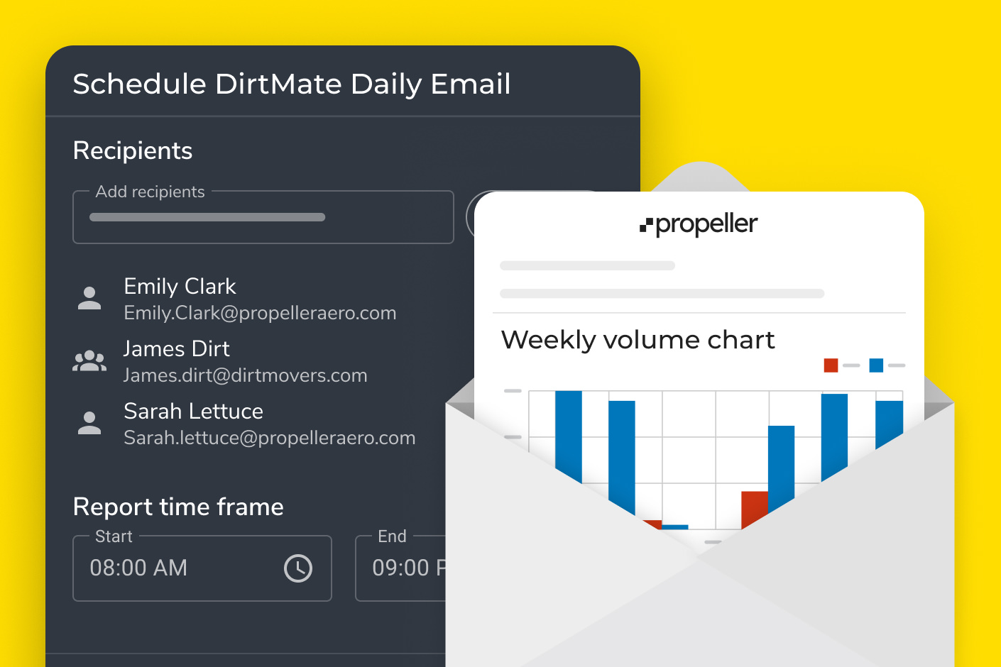
Automated reporting
Export timestamped variance reports, PDF maps, CSV takeoff data, and scheduled updates to support closeout, claims, sign-offs, and stakeholder conversations.
Tailored value for every stakeholder
Different roles need different answers. Propeller translates high-precision design conformance data into clearer decisions for the office, the field, and leadership.

Project managers
Catch deviations before they become change orders. Track conformance against plan, support pay apps with defensible proof, and keep phase closeout moving without last-minute surprises.

Foremen and superintendents
Give crews a clear visual answer on what needs attention next. Use heatmaps, grade checks, and mobile site context to redirect work before the next crew or inspection.

VPs and owners
See the full picture across risk, schedule, cash flow, and handover. Use timestamped documentation to support sign-offs, regulatory closeout, and confidence that work is tracking to contract requirements.

Surveyor and GIS leads
Keep design alignment, coordinate systems, and data quality under control. Propeller supports local site grids and calibration formats so design overlays line up with real site conditions.

Site engineers
Validate grades, slopes, volumes, and design intent throughout the project lifecycle. Share the same visual evidence with field teams, office teams, subs, and stakeholders.
The tech behind defensible closeout proof
Propeller’s hardware and software work together to turn survey data, design files, and field progress into a shared source of truth.
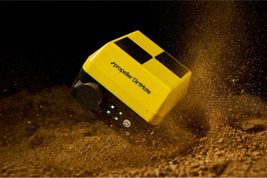
DirtMate
DirtMate streams live machine telematics and surface data into Propeller during active operations, giving teams more current insight into what changed between surveys.
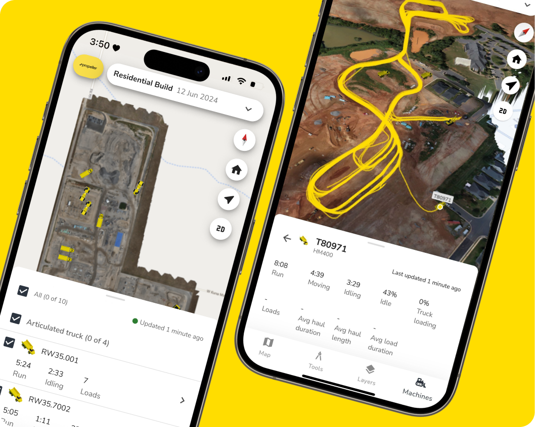
Propeller Mobile app
Field teams can view site context, check grades, review measurements, and share updates from the mobile app without waiting for the office to translate survey outputs.

Propeller Platform
A single browser-based workspace for survey data, design surfaces, measurements, timelines, reports, and collaboration. Compare planned work against actual conditions without jumping between desktop tools, cloud viewers, and static reports.

Drone and hardware integrations
Propeller works with the drone and hardware setup that fits your site, combining aerial mapping, ground control, PPK processing, LiDAR, and terrestrial capture workflows into high-precision site data.
Design conformance workflows by industry
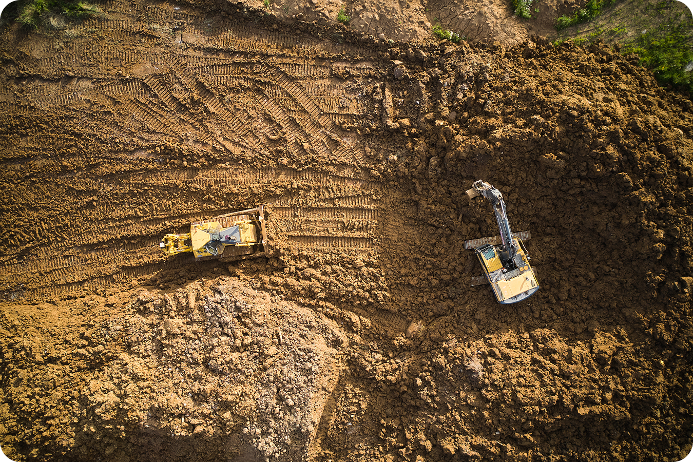
Construction and civil infrastructure
Verify cut/fill conformance on roads, pads, embankments, drainage, and structures before handover. Catch over-excavation, under-fill, and grade drift before the asphalt crew, concrete team, or inspector is waiting.
- Compare as-built surfaces against design to catch deviations before they cost you
- Generate defensible cut/fill data for subcontractor billing and change order support
- Track remaining earthwork volume against project completion targets
- Keep office and field aligned on the same map without extra meetings
Mining
Track stripping, bench progression, pit walls, haul roads, overburden removal, and rehabilitation work against the mine plan. Small deviations from plan can compound into safety risk, lost extraction efficiency, and harder rehabilitation.
Use case: Rehabilitation conformance
Verify that regraded areas, final landforms, slopes, drainage, and cover material placement match rehabilitation designs before sign-off.
- Verify stripping and overburden volumes against pit plans
- Monitor haul road activity and fleet movement across the site
- Track production against blast schedules with regular survey data
- Compare rehabilitation surfaces against approved final landform designs
- Export defensible proof for rehabilitation milestones and closeout records


Aggregates and quarries
Keep production, pit progression, and inventory tied to real site data. Propeller helps quarry teams reconcile volumes, monitor active faces, and keep stockpile reporting accurate.
- Reconcile pit extraction volumes against production targets
- Monitor stockpile inventory to keep sales tickets accurate
- Track bench heights and haul road changes across active faces
- Combine drone captures with machine telematics for complete site visibility
Waste management
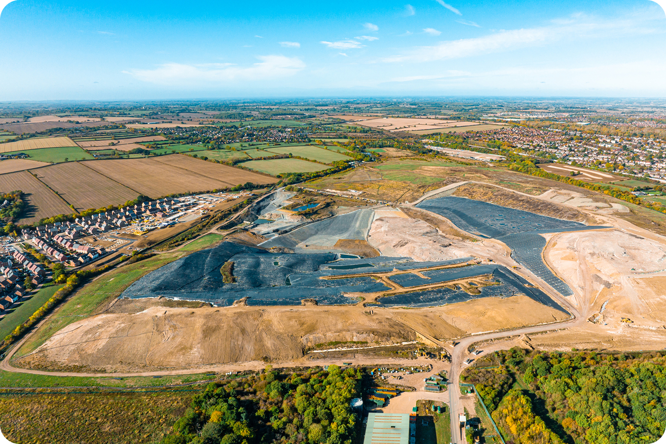
Validate cell construction, liner base grades, side slopes, closure surfaces, and remaining airspace against design and permit requirements.
Use case: Landfill closure
Compare final cover grades, cap surfaces, drainage features, and side slopes against closure designs so teams can document conformance for regulators and owners.
- Track remaining airspace and daily waste volumes against cell design
- Monitor compaction density to avoid under-compacted areas
- Generate regulatory-ready reports that document slope conformance
- Verify closure surfaces, cover soil placement, and drainage against permitted designs
- Catch cover soil inefficiencies before they cut into your airspace budget
Transportation
Verify roadway and subgrade grades across linear miles of right-of-way. Keep corridor alignment, cross-slope, and closeout documentation consistent across multiple crews and stakeholders.
Use case: DOT submittal
Package roadway conformance, cross-section evidence, and timestamped progress documentation into defensible submittals for DOT and agency stakeholders.
- Visualize earthwork progress along alignments against design grades
- Monitor fill placement and subgrade conformance across long stretches
- Track multiple active work fronts from one shared map
- Export consistent closeout documentation for DOT review and agency submittals
- Share progress reports with owners and agencies without manual prep
Start managing design conformance in real time.
Compare high-precision survey data against approved designs to track grade, volume, and alignment from active work through final sign-off.
Frequently asked questions
A design conformance and as-built verification workflow is the repeatable process of comparing actual site conditions against approved design plans, identifying deviations, documenting progress, and exporting proof for sign-offs or closeout. In Propeller, that workflow combines survey data, CAD overlays, design surface comparison, grade checks, timeline tracking, and reporting.
Start with your latest survey data. Upload the approved design surface, align it to your site coordinate system, and run a surface comparison or grade conformance check. You’ll see where the site matches the plan, where it’s drifting, and what to fix before phase closeout.
Propeller supports common civil design and site data formats, including DXF, LandXML, TTM, IFC, PDF, KML/KMZ, and supported Trimble design surfaces. Upload, overlay on your survey data, and start measuring the differences.
Upload your design surface and your latest survey or point cloud. Propeller’s surface comparison highlights cut/fill differences between the actual site and the design. Cross-sections show elevation, slope, and conformance at key points.
Yes. Propeller’s timeline tools compare your site across multiple survey dates, so you can see how conformance has moved over time, not just whether it conforms today.
Propeller supports local site grids and common calibration formats, including JXL, DC, CAL, and GC3. Design surfaces align correctly with survey data, even on complex sites with local coordinates.
Yes. Export timestamped cut/fill variance data, volume measurements, and visual reports to support pay app verification, progress claims, change order conversations, and dispute resolution.
Match the cadence to the risk. Weekly checks cover general oversight. For final grading, slope work, subgrade verification, or regulatory closeout, run daily or more often. DirtMate adds machine movement context between surveys.