Every workflow.
One platform.
From the first stake in the ground to final closeout, Propeller connects your field data to the decisions that matter.
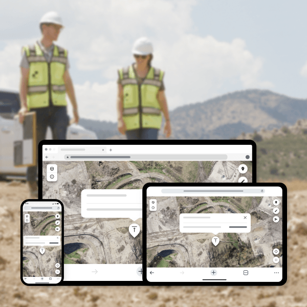
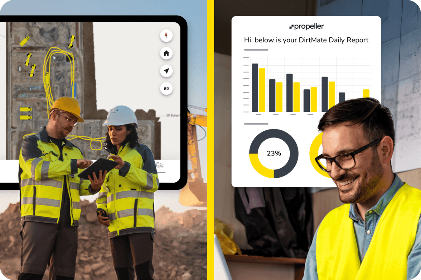
Propeller is built around the way worksites actually operate. We aren’t just a data viewer; we’re the real-time command center that connects your field crews, office teams, and stakeholders. Six critical workflows. One shared source of truth.
Powering critical workflows on worksites worldwide
Why workflow visibility changes everything
Replace guesswork with ground truth
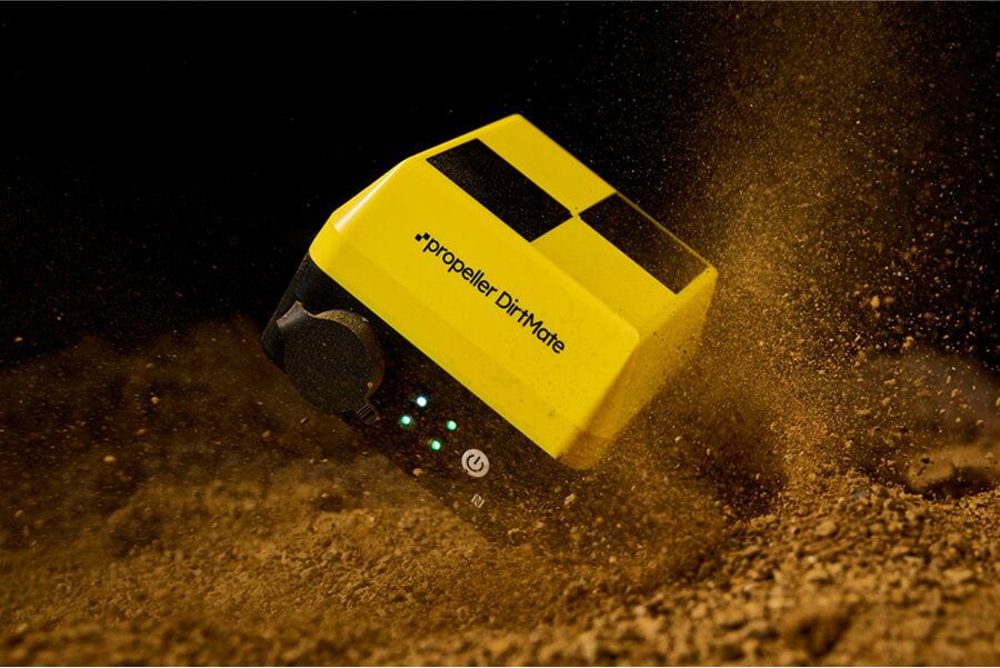
High-precision data that every team can act on in hours, not days.
Close the feedback loop
Connect the field and office with a shared 3D map everyone can see, mark up, and act on.
Protect your margins from day one
Catch errors early, verify quantities, and eliminate rework before it compounds.
Build a defensible record
Timestamped, visual documentation for compliance, audits, and contract disputes.
Our workflows
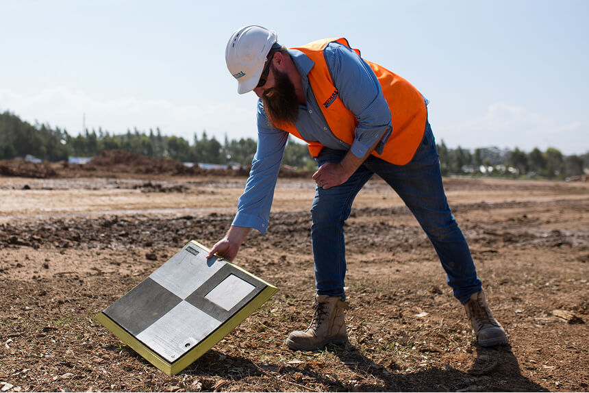
Existing ground
The problem
Without an accurate topographic record from day zero, your bid quantities are a guess and your profit is at risk before a single machine moves.
What Propeller does
Use drone surveys and LiDAR to capture a precise, permanent record of original ground. We handle the complex processing so you can focus on building accurate bids.
The payoff
Turn bids that keep the lights on into wins that make the year.
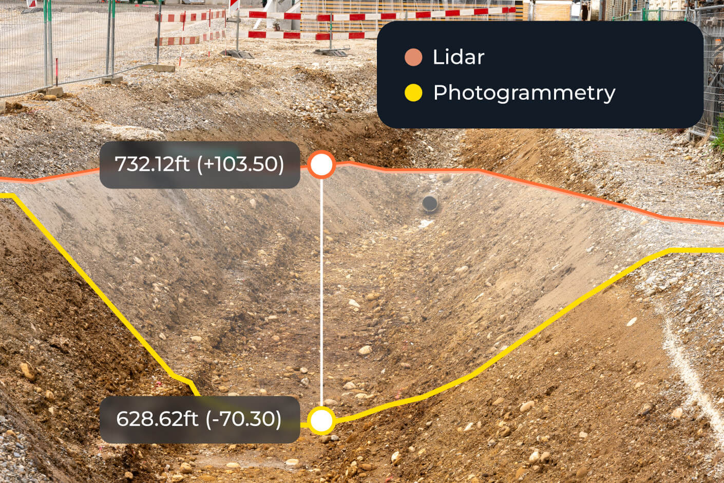
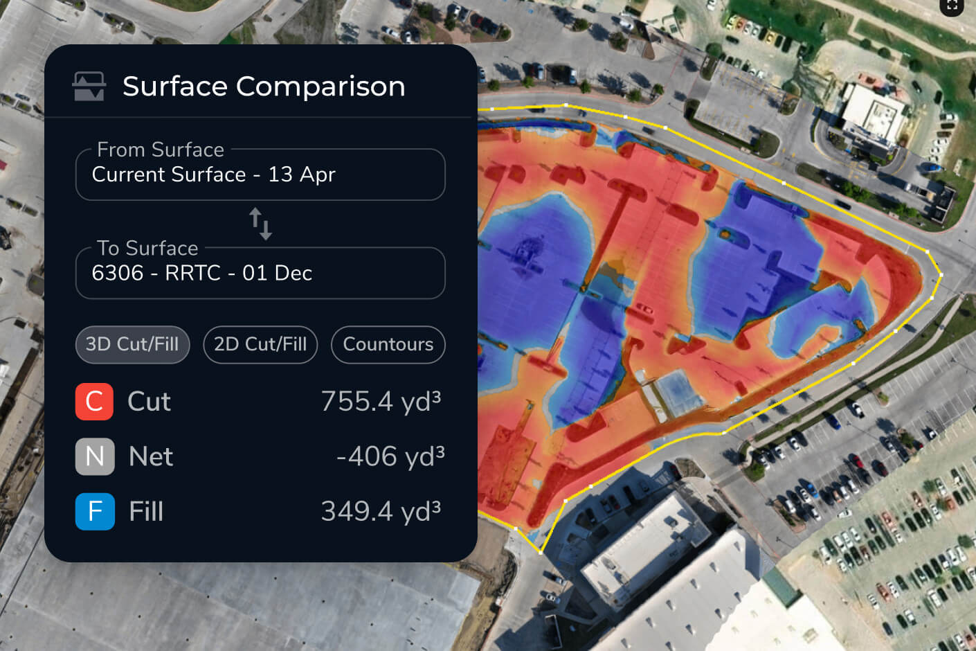
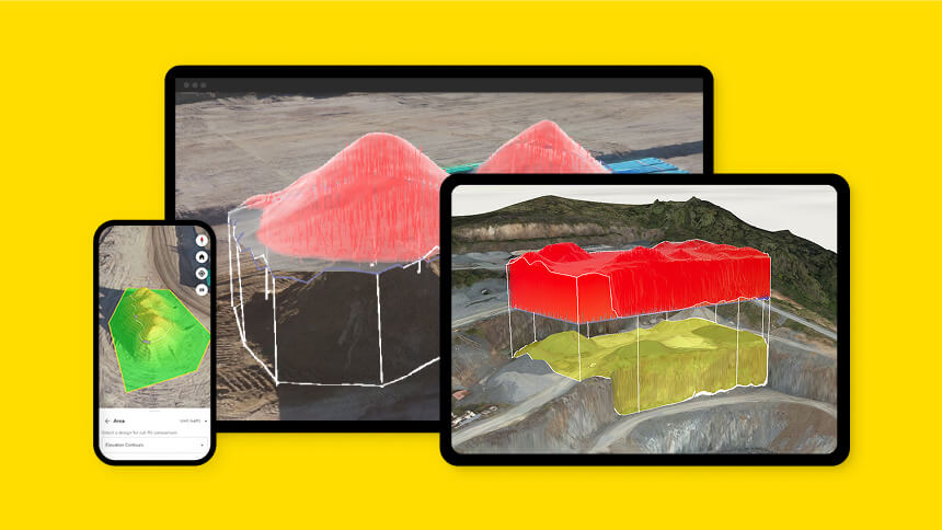
Design conformance and as-built verification
The problem
Grading errors discovered late mean expensive rework and blown schedules.
What Propeller does
Overlay design files onto high-precision 3D maps. Use heatmaps and cross-section tools to see exactly where you’re on-grade throughout every phase, not just at closeout.
The payoff
Stop rework before it starts. Every yard of dirt moved according to plan.
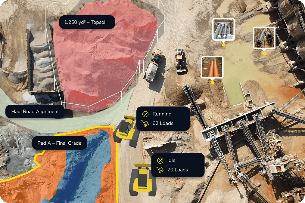
Progress and productivity tracking
The problem
Without high-frequency data, you’re flying blind. By the time a problem surfaces, it’s already a delay.
What Propeller does
Use frequent surveys and machine telematics to track production against your schedule. Monitor cycles and operator efficiency to give your team the visibility they need to manage the project confidently.
The payoff
Eliminate schedule opacity. Hit your delivery targets.
Inventory and volume measurements
The problem
Manual stockpile measurements are slow, dangerous, and often leave money on the table.
What Propeller does
Measure stockpiles in seconds with high-precision 3D modeling. Generate inventory reports and track historical volumes to manage your cash on hand with total transparency.
The payoff
Precision in every measurement. Confidence in every invoice.

Field to office, office to field
The problem
Information gets distorted at every handoff. Foremen work from outdated plans, and project managers make calls without seeing the site.
What Propeller does
Give every stakeholder access to the same map. Real-time location tracking, 360 photos, and mobile syncs eliminate the gap between the site and the office.
The payoff
Stop playing telephone. Everyone sees the same thing.
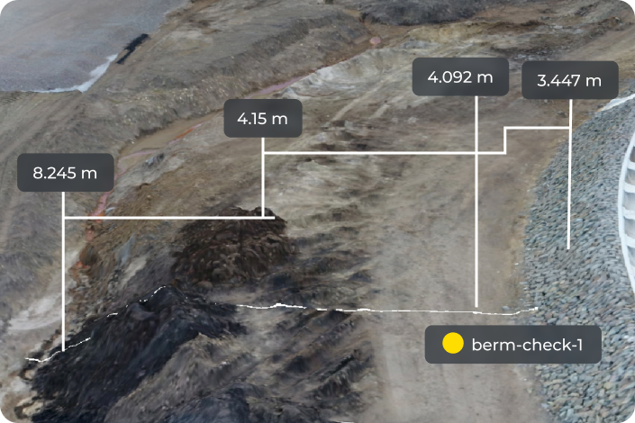
Safety and agency compliance
The problem
Compliance incidents and safety near-misses are costly. Without a continuous record, it’s your word against the regulator’s.
What Propeller does
Use high-precision data to prove compliance and protect your license to operate. Monitor runoff, check berm heights, and verify liner thickness — all without putting people in harm’s way.
The payoff
Stay compliant and audit-ready, on your terms.
Unlock the full workflow
Frequently asked questions
It depends on how fast dirt is moving. Most sites fly weekly for progress and operator efficiency tracking, monthly for inventory audits. Existing ground is a one-time capture before work begins. The short answer: the more activity on site, the more often you should be flying.
Yes, and it’s one of our strongest use cases. Every survey is timestamped and permanently stored, giving you an auditable visual record you can hand to a regulator with confidence. It works across landfill environmental audits, MSHA safety checks, and civil runoff documentation.
By catching errors when they’re cheap to fix. Overlay your design file onto a high-precision 3D map and see exactly where you’re off-grade in hours, not days. Grading errors get corrected during the phase they occur, not at closeout when fixing them means moving dirt twice.
Progress tracking is about time (are you on schedule?) while inventory management is about quantity (how much material do you have and what is it worth?).
Most sites run both: progress tracking drives schedule decisions, inventory management drives financial ones.
Through the Propeller mobile app. The same 3D map, markups, and measurements available on desktop are accessible on any phone or tablet. Crew links let you share a view with anyone, no log in required.
There’s no separate setup. One drone flight can feed your existing ground baseline, update your cut/fill comparison, refresh your stockpile inventory, and generate safety documentation at the same time. They’re different lenses on the same data — not separate modules.