Position monitoring data in real time
From slope stability to material levels, DirtMate delivers constant position monitoring to keep your worksite safe.

Save time and labor
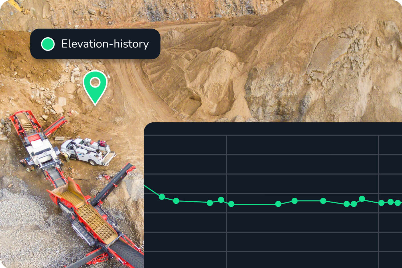
Track small position changes over time without sending out a surveyor. DirtMate provides automated position monitoring data so you can keep tabs on slope stability and structure elevations without setting foot on site.

Enhance site safety
Even small slope movements can signal bigger trouble. DirtMate delivers live positional data sensitive enough to catch minor changes, giving you early warning before failures happen.

Plug and play
Get on-site survey technology that’s easy for anyone to use. No specialized training or complex GNSS receivers required. Just set it up, power it on, then analyze real-time location data in your reporting tool of choice.
Power your progress
Drive automated workflows in the office and the field with Propeller and DirtMate.
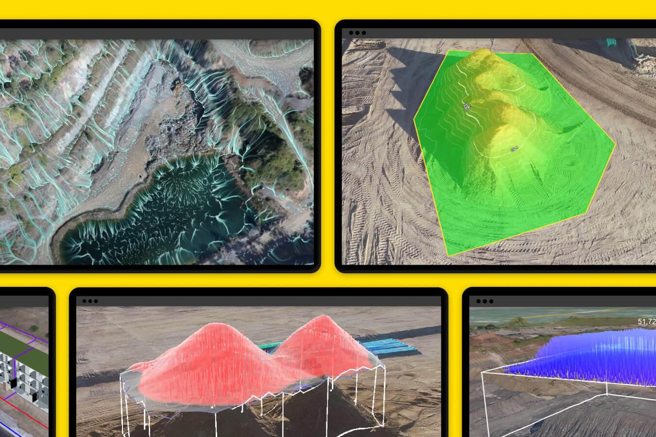
Map, measure, and manage site activity with Propeller
Your cloud-based geospatial data hub, where project and production teams work together from a central 3D map.

Unlock real-time machine locations and activity with DirtMate
Your all-in-one GNSS receiver for tracking machine location, routing, and operator efficiency in real time on any worksite.
Effortless elevation tracking
- Track elevation changes or water levels with centimeter-level precision
- Monitor X,Y,Z coordinates for structures and slopes
- Track changes over time so you can act early
- Set alerts to notify your team of significant changes
- Achieve 1/10ft (3cm) accuracy
- Historical position tracking
Slope stability monitoring
- Monitor the real-time location and movement of structures and slopes to identify potential risks
- Keep a constant watch on slopes, berms, and high walls
- Track small movements to spot risks before they escalate
- Protect surveyor safety by keeping them out of harm’s way
- Monitor structural movement
- Dynamic position tracking

Ready to simplify your position monitoring?
See how DirtMate’s real-time position reporting can make your site safer and more efficient.
Position monitoring FAQs
DirtMate senses and reports real-time X,Y,Z coordinates using high-precision GNSS and an onboard IMU.
Real-time position data gives you immediate insights into the stability of critical structures and surfaces on-site. By tracking precise coordinates and elevation changes over time, teams can detect subtle shifts that might escalate into larger issues, like falling high walls or overflowing dams. Automated alerts keep you ahead of problems, minimizing the need for manual surveys.
Certain spots on-site are time-consuming and even hazardous for a surveyor to measure on foot. With always-on position monitoring sending constant elevation data, there’s no need to send a surveyor to re-shoot key points on-site. DirtMate can deliver position data at the frequency you select (as often as once per second) for data that arrives the moment you need it.