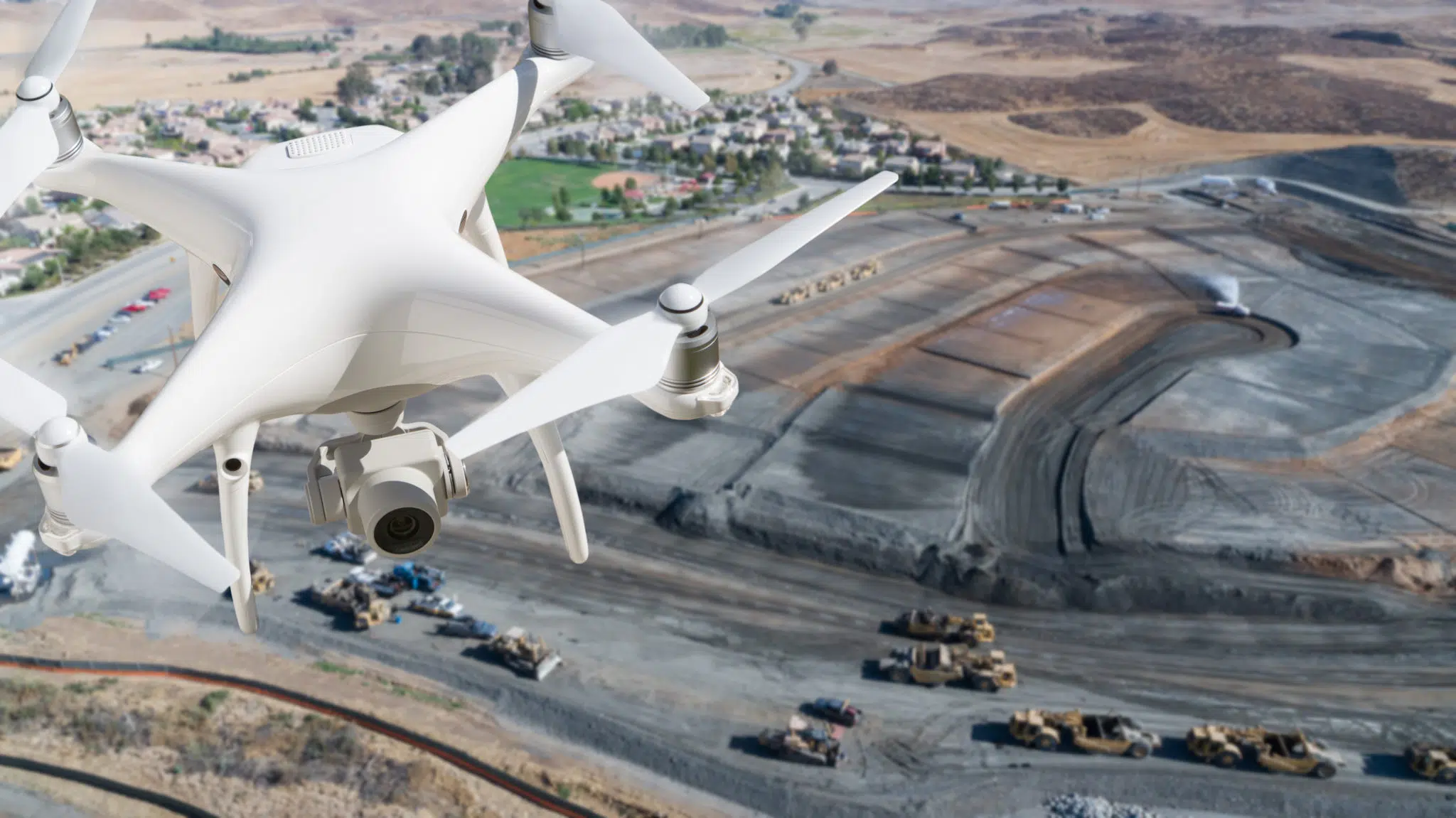
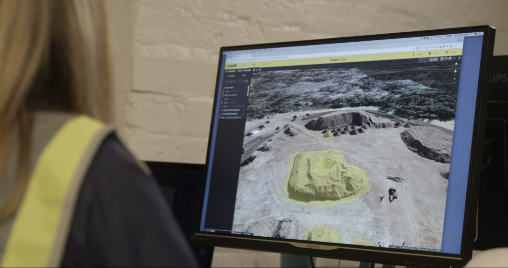
Drones have quickly become one of the most valuable tools on any worksite, from mines to construction sites to quarries and landfills.
With the combined forces of drone data quickly accessible in the cloud and powerful, easy-to-use earthwork software like the Propeller Platform, the job of estimating, planning, and conducting civil earthwork at any scale is made much easier.
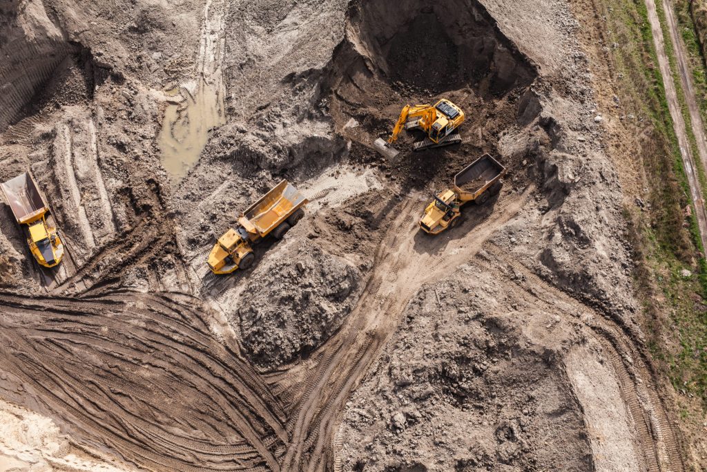 Aerial view of the working earth mover in Poland
Let’s explore the top 10 most impactful ways drone survey data and earthwork takeoff software can be used to make your next earthwork project a success.
1. Estimate earthwork volumes more accurately
Inaccurate estimation of an earthmoving job can be the difference between winning and losing the tender. It can also mean the difference between a profitable and unprofitable job.
Whether you overestimate or underestimate, mistakes can be costly. For example:
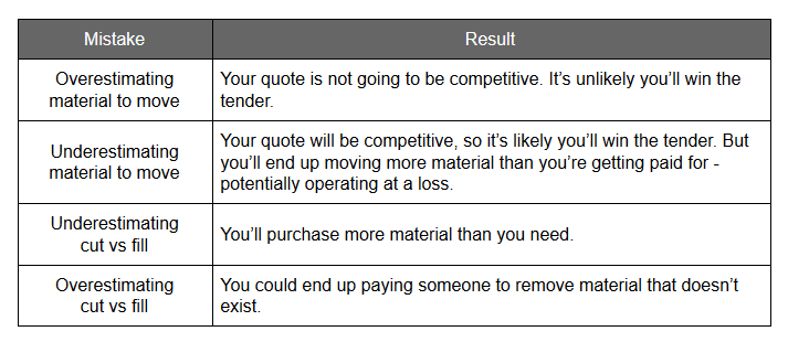
All of these scenarios will shrink your profit margin and, depending on the size of the job, could end up costing you hundreds of thousands of dollars.
Propeller’s earthwork takeoff software ensures these mistakes are avoided. Powerful, built in earthwork estimation tools result in accurate estimates every time with instant cut/fill volume calculations, cut/fill maps, topographic contour maps, and progress tracking.
2. Optimize earthwork planning and reporting with instant cut/fill maps
Accurate earthwork analysis and reporting is central to success in civil contracting, no matter how large or small the project. Getting the accurate data you need can be limited by access to site, surveying resources, safety restrictions or changes on site between the survey and the job starting.
The Polygon measurement tool now has a dynamic cut/fill map. In just a few clicks, mark out the area you are analyzing, select the comparison (e.g., Design File, previous survey, or Reference Level), then click on the heat map icon. This will generate a map displaying each area above as cut and below as fill.
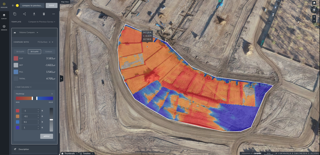
Aside from the obvious benefits of generating more accurate and timely invoices and getting paid more quickly, combining the cut/fill map with regular survey flights is a great way to track progress against schedules and ensure you’re paying only for what has been moved or removed.
With drone data and Propeller earthwork software, you can now capture data on a typical site in under an hour, putting accurate cut/fill (takeoff) maps and topo surveys directly into the hands of anyone who needs it. This is a game changer for civil contractors.
3. Easily settle disputes with a log of earthwork movement on site
In the past, it was difficult to prove how much dirt had been moved and who was responsible for it. Without a detailed log of changes in stockpile volume, having to move someone else’s dirt was all too common.
By conducting frequent drone surveys, you get a visual, detailed account of whose dirt went where and when. Propeller’s timeline tool allows you to slide between survey dates from one flyover to the next or see a progression of changes in a cross-section view.
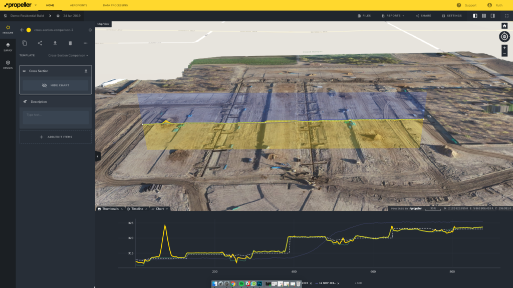
Having a paper trail and easy-to-understand visuals enable you to settle disputes as they arise and avoid legal complications or fines from the start. Accurate stockpile volumetrics allow you to pin down tonnage measurements and get a number you can trust.
For example, a civil contractor in California was spending upwards of $2M every year on unforeseen earthwork projects, simply because they couldn’t accurately track progress to prove the dirt wasn’t in their scope of work.
Unlocking insights with Propeller on earthwork movement on site, they identified discrepancies as the project progressed and submitted data-driven change orders, ultimately increasing net profits by $2.5M, a 50% increase.
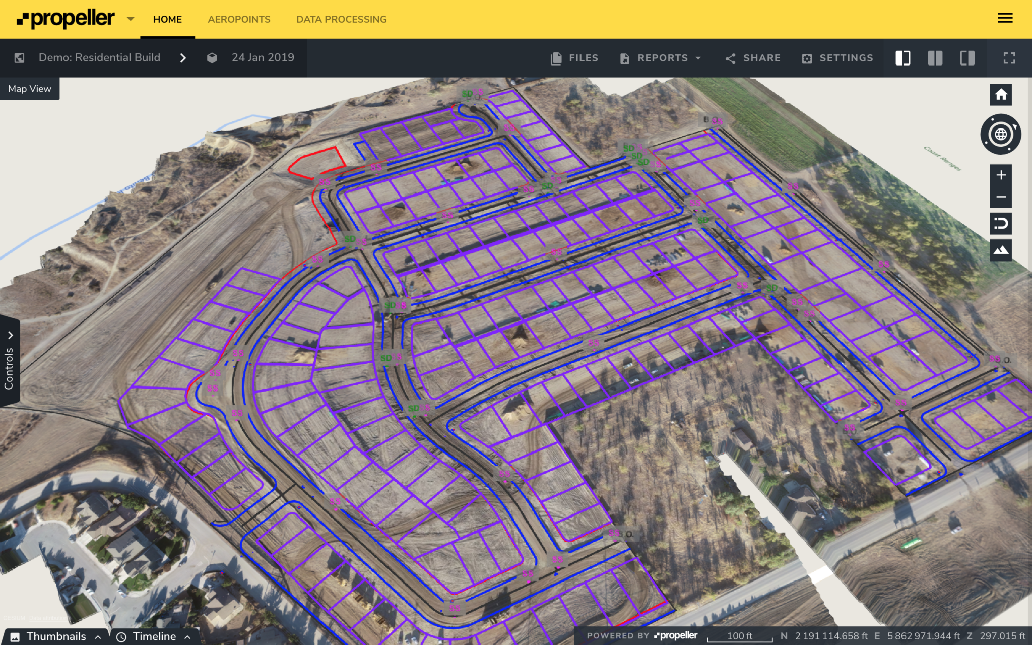
4. Track your progress against designs more frequently
Regularly checking your construction site against design goes a long way, but it’s difficult to generate those comparisons quickly with traditional surveying methods. Spotting a problem before it becomes expensive is ideal, but is not typically a part of the status quo.
Drone survey data has changed that. The ability to easily, quickly, and inexpensively get accurate progress reports is a key reason why so many earthwork companies are choosing Propeller.
With earthwork software, uploaded design surfaces can be viewed at any time against any survey captured for that site. This removes the conversation barriers that arise when using drawings or visual inspections to gauge progress against designs.
A trained engineer may have no problem visualizing the plan in their mind, but when briefing your team—or your boss—it’s easier to take abstraction out of the conversation.
5. Avoid environmental fines
Depending on where you’re building, you might have more than just the regular restrictions to contend with. To avoid any fines associated with failed inspections or violations, you need to keep tabs on your site boundaries and no-go zones.
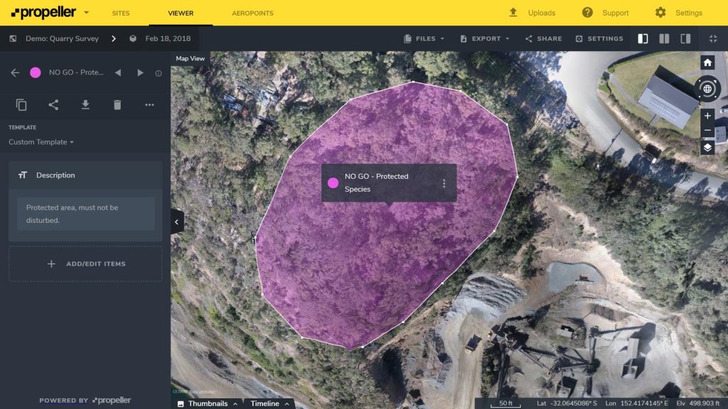
In addition to the benefits delivered with more frequent surveys and a visual 3D interface, you can mark off protected areas on your site and share them with your team. This gets everyone on the same page and highlights exactly where precautions need to be taken.
6. Improve the safety of your site
Safety is always going to be a top priority. From day-to-day safety plans to traffic management, you spend time and resources to get them right.
Drone data and platforms like Propeller allow you to trim time off safety-related tasks. Since the surveys are accurate and up-to-date, the need for in-person inspections are decreased, or sometimes eliminated.
With the line tool, you can quickly measure haul roads to ensure they meet safety standards. Short- and long-term traffic management can be streamlined with accurate, bird’s-eye visuals of assets, past vehicle movement, and existing roads.
Never underestimate the value of up-to-date site maps. Both the orthophoto and individual shots are downloadable. Tack up the site photo in the office or use it to map out that day’s route with your team or visitors.
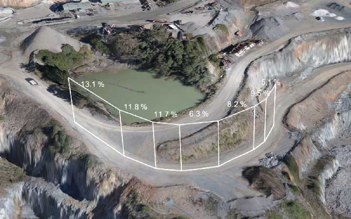
7. Troubleshoot mobile plant operations quickly
Even small modifications of haul road design can mean an increase in cycle times and fuel burn. Not to mention falling outside of proper safety guidelines. The time, legwork, and safety risks associated with monitoring and fixing those issues add up.
With drone surveying and Propeller earthwork software, you no longer need to leave the office to troubleshoot operational issues. You can measure grades and cross-slopes directly in your web browser.
With road widths and windrow heights in hand, you can quickly compare against design and standard safety requirements. Simple, accurate visuals make any conversation about the physical site easier to understand.
It’s hard not to overstate the value of being able to survey accurately more often. With frequent data capture, you can take the pulse of your site and do inspections remotely. Monitor and stop problems before they become expensive or require reworking.
8. Improve site survey accuracy with terrain filtering
Earthworks software lets you filter obstructions out of your data to create clearer, more readable surveys. Scrubbing objects like vehicles and vegetation from the point cloud helps with asset monitoring and tracking job progress. It’s also critical for accurate volume calculations.
Whether it’s a hedge stopping a bare-earth calculation or a vehicle parked on an active surface you need to get a grade on, Propeller’s terrain filtering algorithm helps minimize these annoying obstructions.
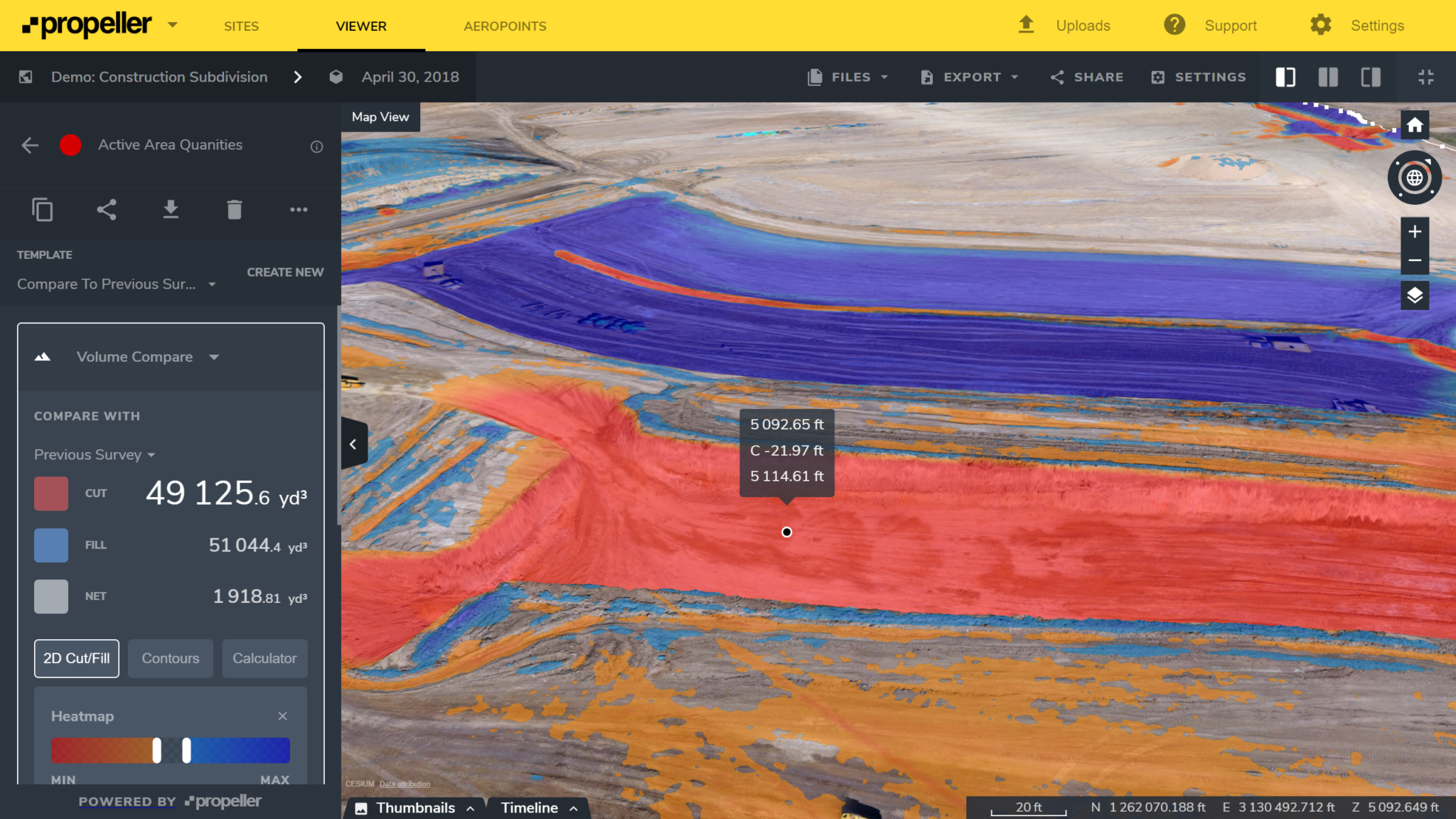
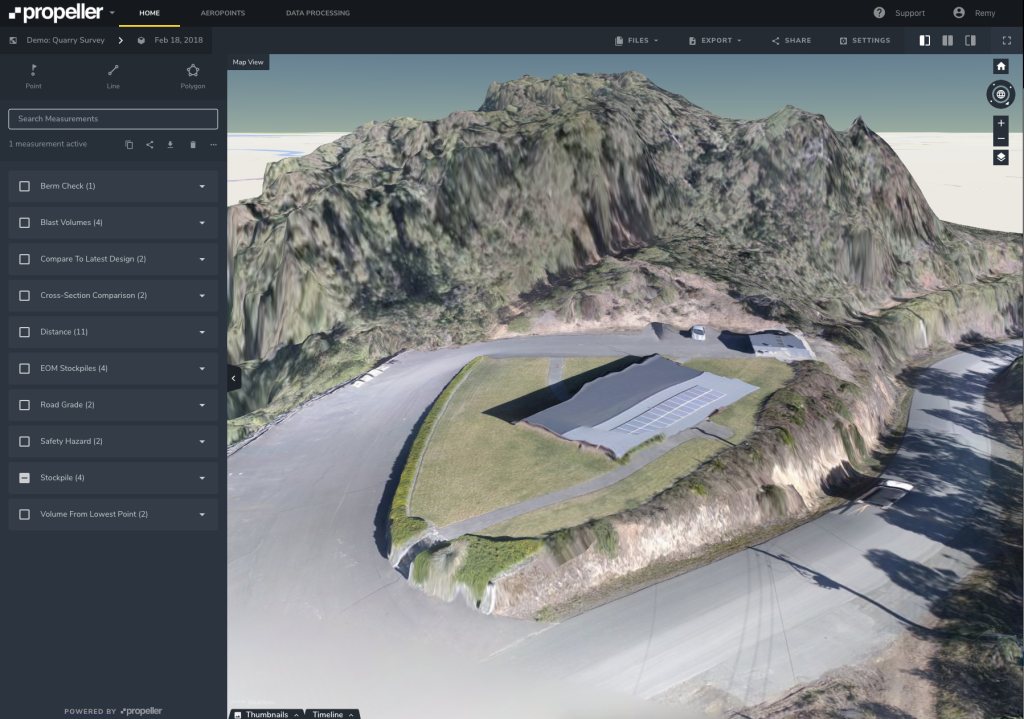
9. Accurately measure stockpile volumes using earthwork takeoff software
Performing complex volume comparisons against other surveys and design files is incredibly quick and easy with Propeller. All volume measurements are instantly visualized in 3D, so that anyone can understand what’s been measured and visually track volume changes.
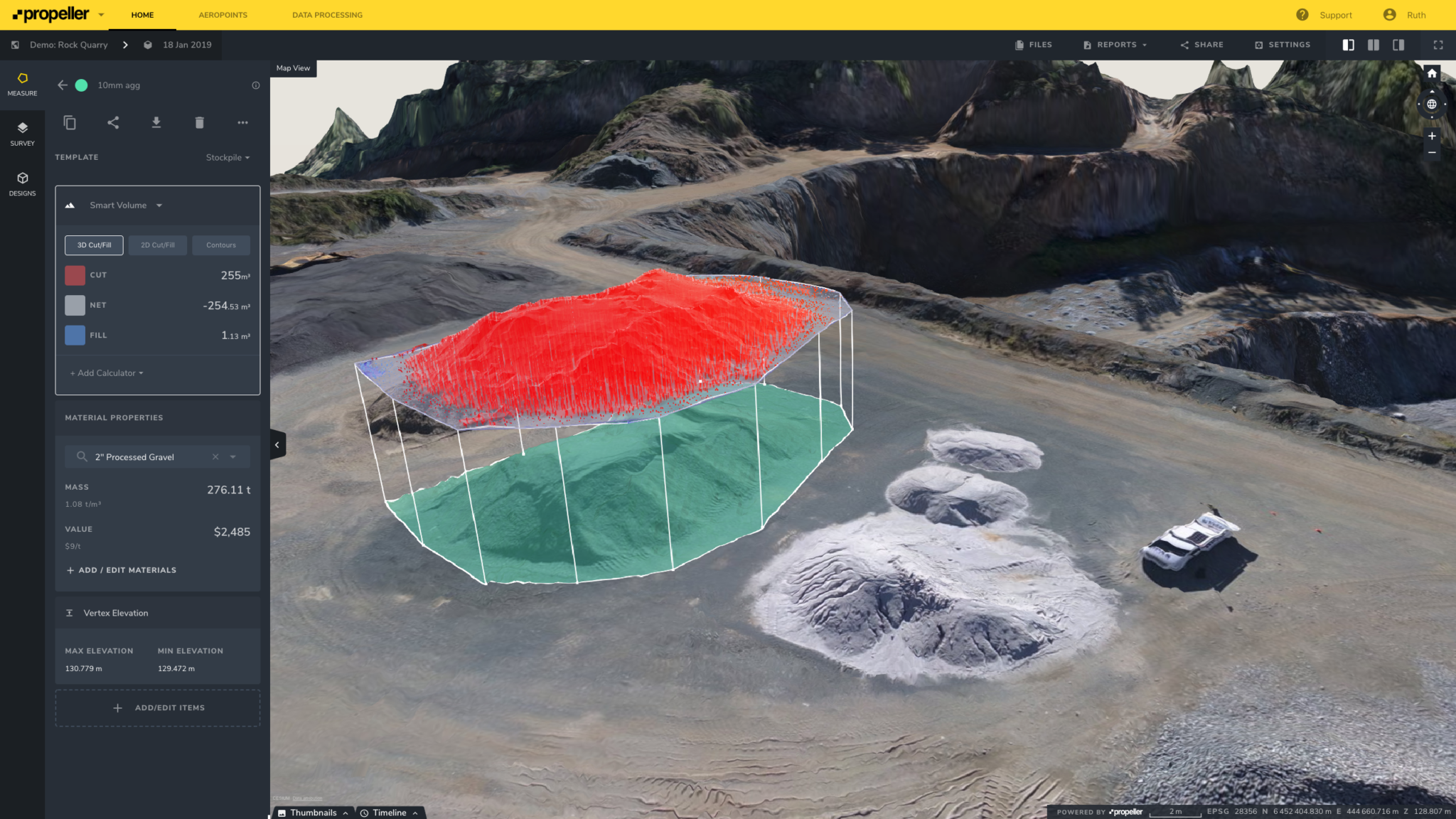
Propeller provides a clear picture of where dirt is coming from and going to, and sums it all up in the left panel, ready to export for reporting (complete with gridded cut/fill maps).
Earthworks software shows you exactly how much dirt you and your contractor has moved and exchange money accordingly. No more miscounting or underfilling trucks!
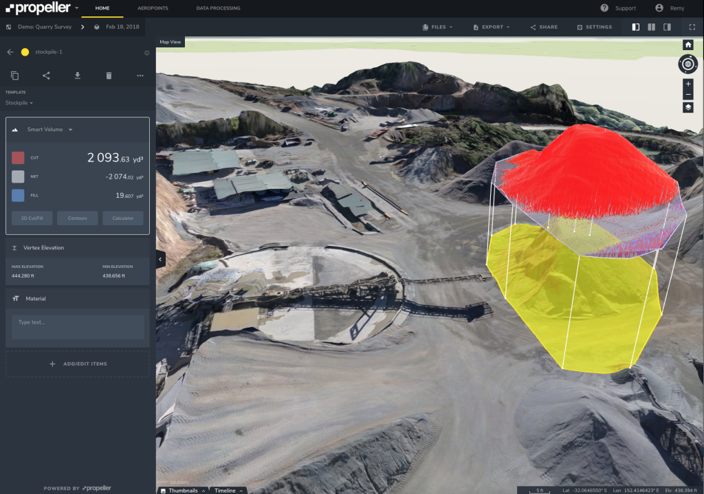
10. Track changes in stock over time
Did you know you can easily track changes in stock, measure erosion, compare against your design, and calculate density, all using Propeller’s set of volumetric tools?
If you have highly active stockpiles that are getting filled and cut simultaneously, our Volume Compare tool lets you visualize and measure this change over time. Using Propeller, we can see where each was occurring and see exactly how much at a glance.
Use Cases: Propeller in Action
Now that you know about the many ways drone data and Propeller earthwork software can improve your operations, let’s take a look at some specific how-tos.
How to calculate cut/fill volumes using Propeller
Fly a drone over your site, then have us do the photogrammetry grunt work for you. Once your data is processed (within 24 hours) a few clicks is all it takes to calculate cut and fill volumes for the current terrain against reference levels and design surfaces.
Take this construction job, for instance:
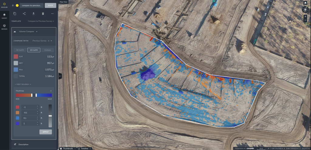
First, upload your design surface. Then select the polygon tool and simply click around the area you’re interested in. Choose Volume Comparison (to compare the selected area against the design surface) and voilà! Your cut and fill volumes are calculated instantly (displayed in the left hand panel).
In Propeller, every calculation is also displayed visually (in high-res and 3D) so there’s no confusion about what the numbers represent.
Now let’s say that, rather than working towards a design surface, you need to grade the area off at a particular reference level (RL). To do this, simply select Reference Level Volume in the left-hand panel and enter the relevant RL. Again, you’ll get instant, accurate results.
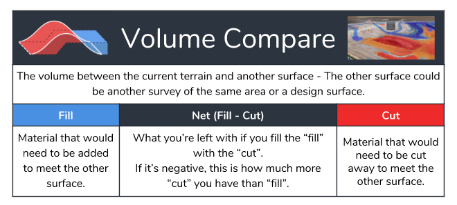
In this example, the RL we’ve entered is somewhere in the middle of our selected area. That means our visualization shows both a red section (signifying material that needs to be cut away) and a blue section (signifying space that needs to be filled).
Assuming this is all the same type of material, the “net” value shows exactly how much material we’d need to order in (or cart offsite) to complete the job of bringing this area to the specified level.
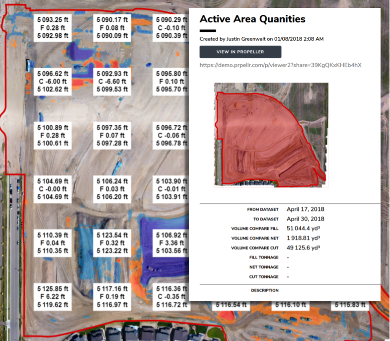
How to generate instant cut and fill maps
It’s vital that everyone working on an earthwork job is on the same page. Propeller lets you generate accurate earthwork takeoff maps so your whole team can understand what needs doing and where.
Once you’ve completed your measurements, it’s time to share that information with your team. Simply export your data as a PDF (good for paper-based workflows, especially out on site) or invite others to view your measurements in the cloud (all Propeller Platform licenses include unlimited view-only users).
You can also export data to generate cut/fill volumes using other applications. While it may be convenient to generate all your cut/fill volumes within Propeller, we understand that some projects may require you to work within established software stacks and conform to specific workflows.
That’s why Propeller makes all of your data downloadable in all of the industry standard file formats (including CSV, JPEG, TIFF, DXF, and LAZ) and in a wide range of coordinate reference systems.
Data downloads are free and unlimited with every Propeller Platform license. Just click Downloads under the Layers tab and select the files you want.
How to generate topographic contour maps
Generating customized topos is incredibly easy with Propeller. Simply turn on the Contours/Heat Map function and specify your major and minor intervals. You can also choose to generate Contour Maps for a discrete area.

Again, a range of sharing options makes for effective collaboration. Either invite your team to view Contour Maps within Propeller, or export them as PDF files or (for standard contours) as DXF files.
How to track progress and resolve disputes with reporting features
For as long as people having been paying other people to move material for them, there have been disputes on how much material has been moved.
This is how everyone doing earthwork gets paid, so it’s an important number to get right. Unfortunately, calculation methods are often very crude (i.e., number of trucks seen leaving the site multiplied by maximum capacity of the truck).
Underloading of trucks and incorrect truck counts are the two most common causes for error here, and can easily distort actual results by up to 20–30%. As those in the business know, this can mean losses in the hundreds of thousands of dollars.
Propeller lets you track actual progress and resolve disputes using accurate data, collected in cycle with claims.
After processing thousands of surveys, we’ve found that drone survey obstructions fall into four categories and built the programming behind the scenes to filter them without complicating things for you.
Think they’ve been underloading or miscounting? Prove it with Propeller.
How to filter out vegetation
The first terrain filter is vegetation. Whether you’re running a large quarry or constructing a housing development, it’s possible to have plants and trees obstructing parts of your site survey.
 Right, unfiltered image. Left, vegetation has been filtered from the survey.
Filtering for flora means that we’ll take out all the plants, so you can see the bare earth under trees, shrubs, and other greenery.
How to flatten trucks and site equipment
The second is vehicles and equipment. Every industry, from waste management to mining, uses trucks and other heavy equipment in their day-to-day work. These machines can be big or small, and usually touch every part of your site on some occasion.
 See the terrain filter at work on this conveyor belt. It’s flattened it completely on this quarry.
Filtering these out means taking cars, trucks, earthmovers, and conveyor belts out of the 3D survey. This is usually the best choice for measuring stockpiles or accurately comparing to design.
How to remove obstructing buildings
The third is buildings. This could be actual buildings or the fixed plant itself. Either way, it’s a more strict terrain filter than vehicles and equipment.
How to filter to bare earth for flat sites
The fourth and last terrain filter removes all distinct objects with a raised gradient against the base, including equipment and piles. Of course, this is the most strict drone survey terrain filter. Use it wisely, and only on flat sites.
Regardless of which terrain filter is best for your site’s needs, being able to remove obstructions from your drone surveys means cleaner data and faster analysis, both of which enable better site monitoring, progress tracking, and volumetric calculations.


