At every landfill, cells are lined to protect the surrounding environment from contaminants. Built on a slope so rainwater drains easily, the liquid is captured and processed or recirculated before it’s released back into the environment.
Recently, a landfill based in the US had an excavator on site that might have damaged the liner in one of their cells.
Previous drone flights captured surveys with the liner exposed
The landfill’s surveyor had flown the site with a drone when the liner was exposed a couple of months earlier. As such, they had aerials showing the exact spot where the machine had been when this possible breach had occurred.

Accurate as-builts loaded into RTK rover instantly confirmed the breach
Once notified about this issue, the surveyor took a shot at the suspected location with their rover. With the as-built surface from the earlier survey loaded into the rover, this surveyor was able to tell instantly if a breach had occurred.
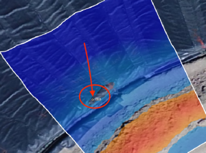
From there, they created a KML point from that shot and loaded into the Propeller Platform to visually see where that point sat (pictured above). After this confirmation, the site was again surveyed by drone.
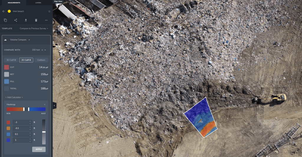
Now the landfill had an accurate as-built surface and a recent surface of the site after the excavator had moved material. Taking these two flights, you can simply draw a polygon around the area of interest and see the recent flight relative to the flights a couple months ago.
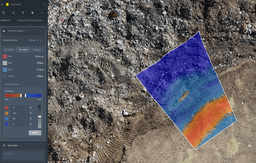
Comparing as-built to new drone surface in Propeller caught a 1/10ft difference
The difference at the point in question? 1/10ft (3cm). Meaning they detected that the excavator did breach the liner, even by such a small amount.
“Comparing the first and second flights, where the excavator’s teeth went was about a 1/10th into the first flight. So they just barely touched it,” said the surveyor. “But we could still see it.”
“We could see that they hit really close to the anchor trench. Knowing this gave us a good understanding of the magnitude of the repair effort required,” said the landfill’s surveyor who confirmed the breach.
As far as corrective measures go, the landfill was able to call the contractor back in to repair the liner they’d installed. “They understood exactly where the break was, as it was fully visible with the drone data and imagery, so when they called the contractors to fix it, they could show them precisely where it was,” said the landfill’s surveyor. “They could see how deep it was, how much material was needed—it made the repair process extremely straightforward.”
On the grand scale of things, this is no environmental disaster. But regulations require that you have a liner and if it gets broken, you need to fix it. “The visibility and accuracy of the two flights let them see this,” summarized the surveyor.
Propeller showed “this is exactly where it happened and how deep we went”
While a small case, this kind of situation really highlights the power of having accurate as-built data on hand. The surveyor used his rover to measure and confirm it with Propeller—which took a 20-minute drone flight and the data processing turnaround to get the visuals above.
Simply put, this shows how accurate these drone surveys can be. It’s the certainty to “say this is exactly where it happened and how deep we went,” said the surveys.