Propeller Aero & Trimble
Ledcor is a diversified construction company, consisting of several teams working together to design and build projects across North America. Their areas of focus include civil construction, mining, and oil and gas.
A surveyor and civil engineering technician by trade, Luiz Araujo recently joined Ledcor as a machine control foreman. He currently manages all of the survey layouts, land surveying, and topographic surveying for Ledcor’s role in the Trans Mountain Pipeline Expansion project. Ledcor is building 200 kilometers of 42” and 36” pipeline from Mt. Robson to Clearwater, British Columbia that parallels the existing pipeline and other infrastructure such as highways, railroads, and powerlines. This section of the pipeline is difficult to build as it traverses rocky and mountainous terrain, steep slopes, and numerous areas with access limitations.
Bringing Trimble Stratus powered by Propeller and Wingtra Onboard
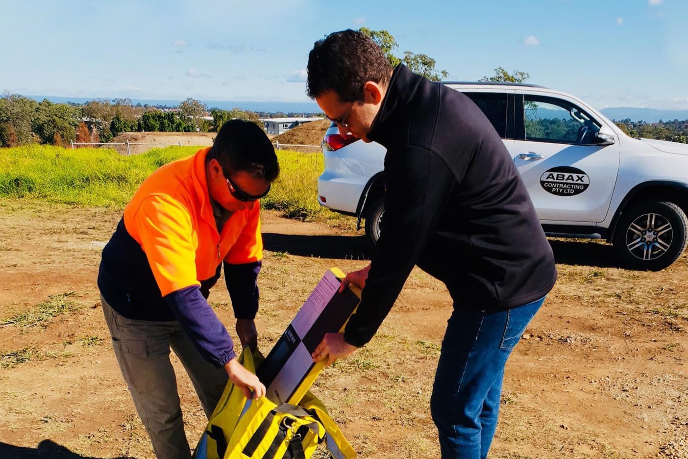
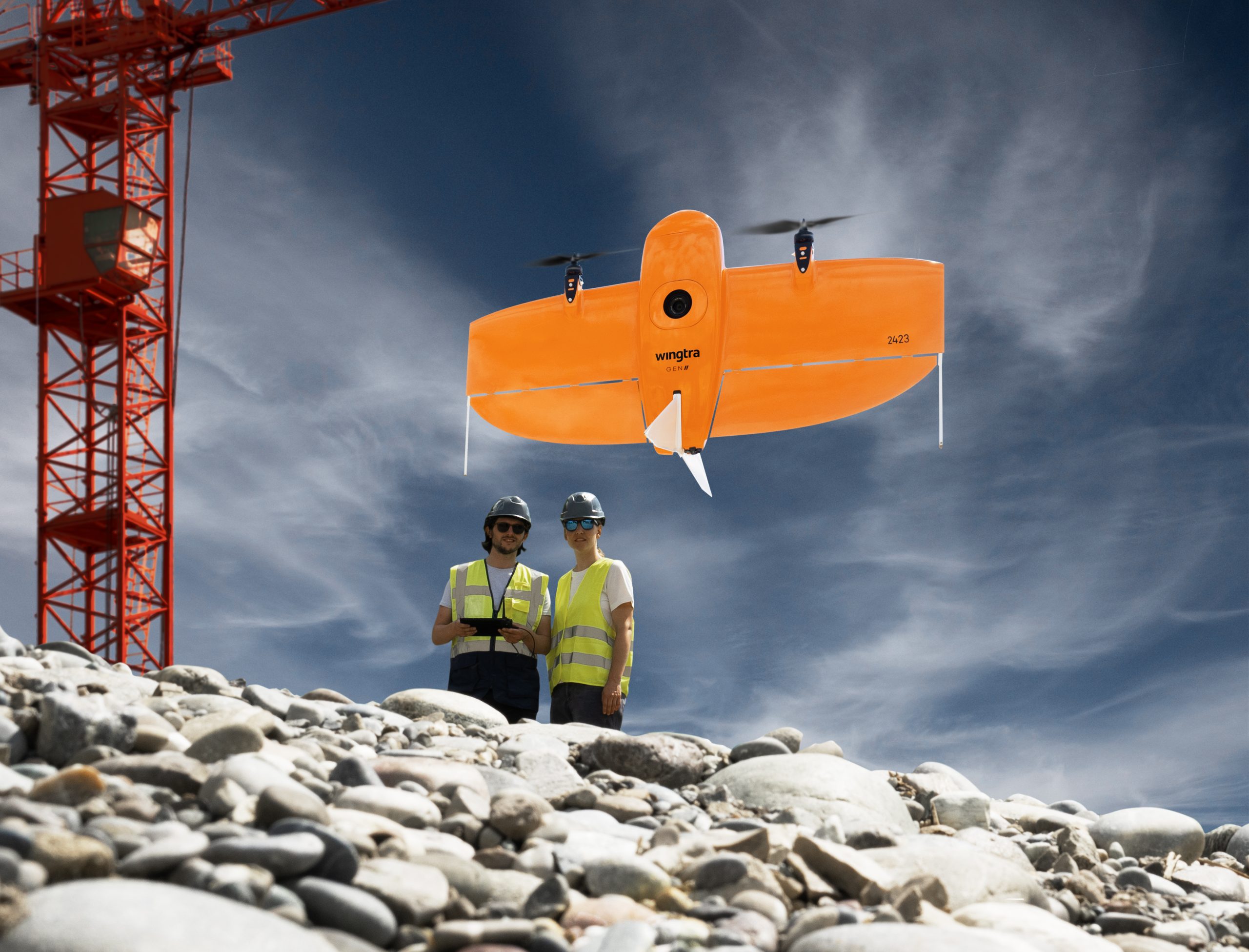
For this challenging project, Luiz explained how valuable adopting Trimble Stratus powered by Propeller and the WingtraOne Gen II drone was for their site surveying. “We implemented this specific set up and service because of the amount of land we have to cover for topographic surveys and progress tracking,” Luiz shared. “Using the drone surveying solution I had previously worked with would definitely have been a lot more work and would have taken more people to capture and process the data. We also would have needed more powerful computers. In general, Trimble Stratus definitely saves us a lot of time, personnel, and effort. And with Wingtra, I can cover more ground and still get great results. We fly big corridors with a straight line data capture and without many curves. It’s perfect for what we do here, honestly.”
Building a pipeline varies somewhat from other types of construction projects…Ledcor designs the pipe as they go. At the beginning of a routine workflow, engineers request a topographic survey and drone imagery to design how they will build the pipe.
“Our data gets processed in about 24 hours, sometimes sooner,” Luiz explained. “Our engineers receive a notification that the data is available, and they can interact with it directly on the Propeller Platform. Other times they download the information they need, the digital surface or ortho image, and they design the pipeline based on that. After the pipeline is designed and installed, we do take one final topographic survey of the land as a quality check.”
A Cloud Based Solution
Trimble Stratus powered by Propeller is very user friendly. Luiz says that sharing data across the team is very streamlined now and is easy to use, even for more inexperienced platform users. “With past solutions, we would have to process the data, export it to a tiff file, which is typically a lot smaller than what we can do with Propeller,” Luiz explained. “We would have to print out maps and CAD files, which would be cumbersome. Now with this online system, it’s a lot easier to share data with people who are not very experienced with AutoCad or other software platforms. Most of our departments use Trimble Stratus powered by Propeller, including Environmental and Engineering, and Project Coordination. They’re able to upload their own designs and compare them against the actual image in the 3D terrain model.
“We’re definitely able to do more with Trimble and Wingtra than we would with any other system. It’s been a valuable asset for all of the departments on the project. We’re able to do more surveying and other things. If I had to process my own data, I’d have to either use a lot of my own time or hire someone else to process that. So, there’s a savings there.”

Working with the Propeller team
Luiz has enjoyed working with Propeller. The support team trained him and his crew very quickly and is very responsive, helping him if he runs into a problem or has a question. He states that other divisions within Ledcor could also find Trimble Stratus’ volume and progress tracking very useful and encourages anyone considering surveying with a drone to take a closer look.
“For someone who has never used a drone, they may be scared of accuracy. But I can tell you the accuracy from Trimble Stratus is great,” Luiz shared. “With a drone you can capture way more detail than field surveyors can using GPS or base stations. It definitely will be a lot faster for you, and it’s not only for surveying and engineering, but also for project coordinating and planning the worksite. Having that wide, ortho image of the construction site really helps with planning logistics, where to place equipment, and where to put stockpiles. It’s user friendly, and you don’t need decades of experience to operate the platform. I am happy with the system and would definitely implement it into future projects I work on.”