Based in Longmont, Colorado, an hour north of Denver, Zak Dirt was founded in 1976 and focuses on highway and heavy construction projects. They recently started construction on the Boulder Canyon project, a 14-mile-long road cutting through complex terrain.
For many highway construction companies like Zak Dirt, getting quick and accurate topos has always been challenging, and, depending on the terrain, sometimes impossible.
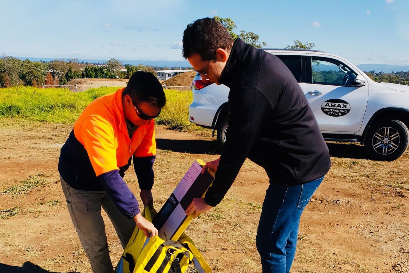
In search of a tool that would take their people out of harm’s way and speed up the process, they looked into drones and visualization platforms. They found Trimble Stratus powered by Propeller.
Trimble, the global leader in positioning technologies, was an early partner of Propeller. Our teams work closely together to deliver Trimble Stratus survey-grade drone data solutions for the heavy civil industries.
We spoke with Angelo Mancina, Zak Dirt’s corporate treasurer who also handles GPS surveying, about how getting quick topos with Propeller has changed the way the Boulder project operates for the better.
Getting topos for roadwork jobs was next to impossible
Boulder Canyon’s terrain is simply too difficult to survey by hand. “It would be too dangerous, taking shots up and down a slope,” Mancina said.
“There’s absolutely no way that would be done. By the time we did a topo of the canyon and got it back, we would be two months past when we needed it.”
—Angelo Mancina, Zak Dirt
And that’s only for the fieldwork side of taking shots. When you get back to the office, there’s hours of data processing work to be done. If you add up all the man hours, manual topos turn into a full-time job.
“There’s lots of valuable information to be had with these topos, but you almost have to hire someone full time to do that,” Mancina said, but Zak Dirt didn’t have the personnel to spare.
That’s why they turned to Propeller. Now they can fly a drone as often as they want to update their surveys. They send in the data to Propeller and get back to work while it’s processing.
“With Propeller, for the most part, within 12 hours we have our files, which is awesome,” noted Mancina.
Beyond topos—what’s in Zak Dirt’s toolbox?
All the hours and manpower Zak Dirt used to spend creating topos left little time beyond the bare minimum to dive into complex measurements, analysis, or to create new insights.
Now that they’re getting reliable accurate topos quickly and spending less time processing, they have answers about material movement, right when they need them. This foundation has started a chain reaction of new or more in-depth ways of using worksite data to track progress, quantities, logistics, and more.
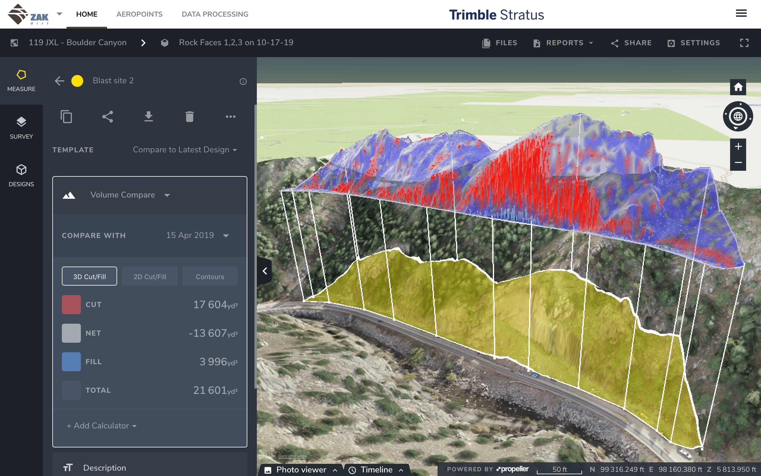
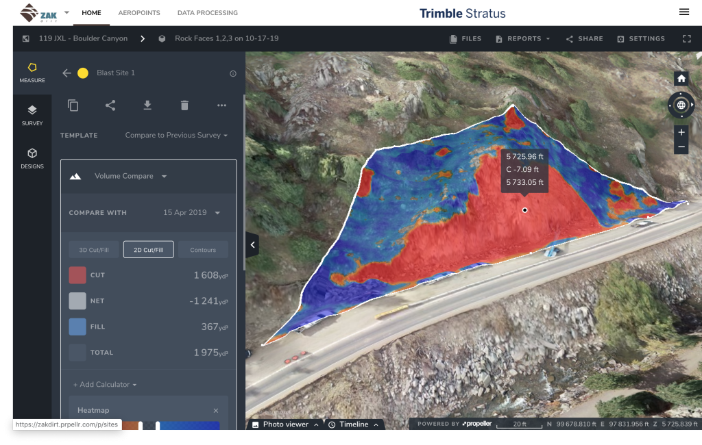
Comparing against design
The Boulder Canyon job involves a lot of blasting. Zak Dirt uses Propeller to visualize road designs and make changes when needed.
Specifically, Mancina shares the platform with an engineer who works on blasting. They go in to measure and change the slopes on blasts, no middlemen required.
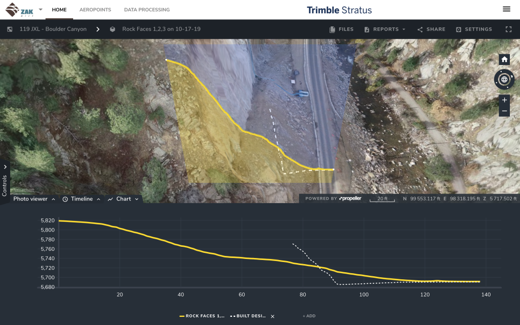
“We’re able to fly it and do cross-section comparisons to where we are at now with the design, and [the engineer] can actually see the cross-section as it is with the design, and they can make the changes that they need to make,” said Mancina.
Sharing data
Data sharing like the above is the norm for Zak Dirt. “I can’t speak for other contractors, but we’ve always tried to be open, and we try to share everything because we want the project to be a success,” Mancina said.
Propeller is shared among project managers, surveyors, superintendents, engineers, and more. Altogether, Zak Dirt has about 10 people using the platform regularly.
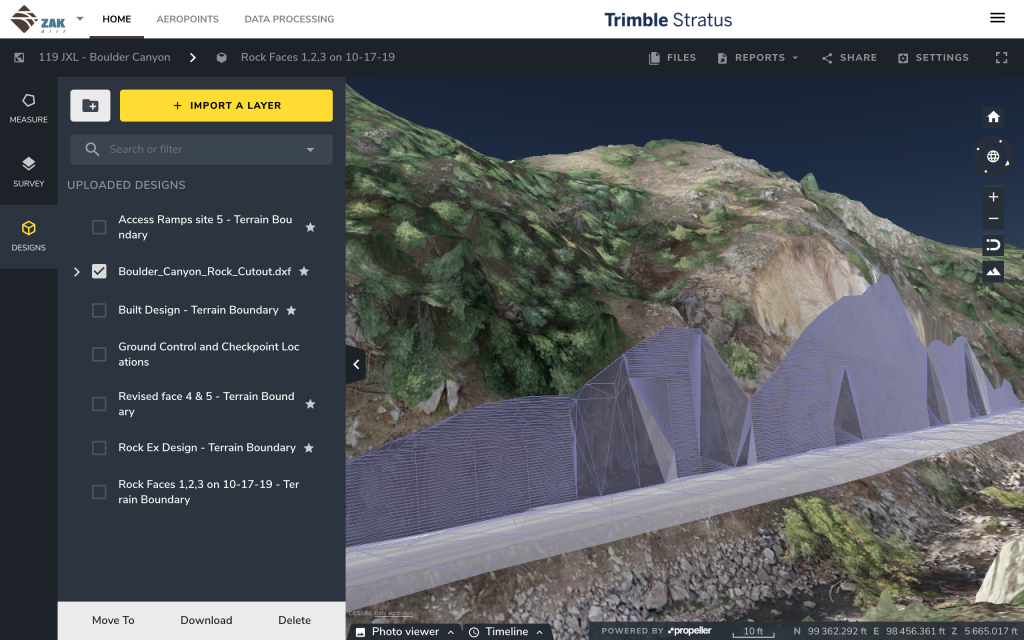
Beyond that, they use Propeller to show project updates and relay progress reports to owners. “We’ll pull it up with them in the room and show them cross-sections, or we’ll print the reports,” Mancina explained.
From there, “we will print them the DXF CAD files,” handing it over to the customer to maintain transparency about where they’re at on the project timeline.
Measuring stockpiles
It’s critically important to measure the volumes coming out of the blasts. Dirt moves around nonstop, a continuous cycle of displacing and replacing. Without Propeller, they would have had to measure by truck counts and coordinate with the Colorado Department of Transportation.
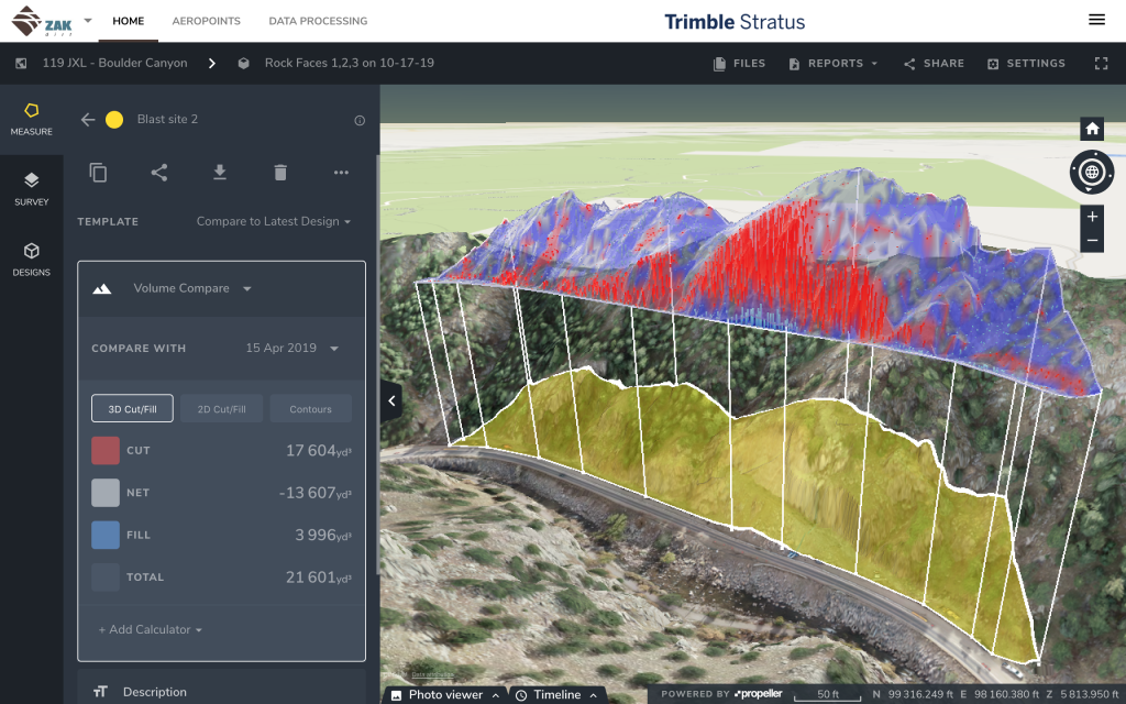
“[Now] we can just fly it, do a comparison, and say, ‘Here’s how much rock was taken off the mountain.’ Very simple,” explained Mancina. To keep track of quantities, they fly the site twice a month while blasting occurs.
Logistics
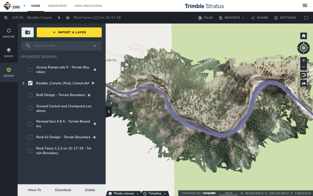
Last comes logistics. The roadwork job spread out over 14mi, consisting of five subsites. That’s a lot of moving pieces. Having all the data in one place allows Zak Dirt to plan out vehicle movements, earth moving, and more.
“We’ve used it to make some designs for access; we’ve built some files so we could access down into the river to do some of the work,” explained Mancina. “We’ve flown the site, and then did a volume comparison to see if we have all of the dirt [we need] right there,” instead of trucking it in from some other part of the worksite.
“We know what we’ve done and what we have left to do.”
—Angelo Mancina, Zak Dirt
At a macro-level, Zak Dirt is using drone surveying and Propeller for three main things: collecting data, processing, and getting answers about their site. Making this three-step process seamless and fast is the difference between getting a project done on time or going over.
Mancina summarizes it best: “The most useful is getting the topo done quickly and having accurate information to compare, to get our volumes, or to know how much is left to do.”