Keith Taylor is the survey manager at D.H. Griffin Infrastructure, a division of D.H. Griffin that provides site grading and development, specialty concrete, and underground utility services in and around North Carolina. Keith manages everything from GPS machine control equipment, site positioning, manual survey instrumentation—and, now, drone surveying, which he does using the Propeller PPK workflow.
Since implementing a drone program with Propeller, Keith has been able to survey DHGI’s sites faster and with greater accuracy than with traditional surveying alone, helping him deliver more reliable, actionable data into the hands of the decision makers who rely on it.
Recently, Keith sat down with Propeller CEO and co-founder, Rory San Miguel, to discuss his drone program journey, how drones fit into his day-to-day operations, and the different ways accessible data has helped DHGI do better work.
Watch the video now, or check out a quick summary of what they covered below.

Why D.H. Griffin chose to invest in Propeller
Keith took on the survey manager role at a time when DHGI’s estimation department was pushing for the adoption of a drone program. In addition to the time consumption of relying on traditional surveying alone, they were experiencing issues approximating the scope of new jobs.
“We had run into some problems where we bid a project and found out there was more or less dirt than we anticipated,” said Keith. “We really wanted to have a better handle on our operations as we move through a project.”
Due to an unfortunate experience with photogrammetry in a previous job, Keith was initially convinced that LIDAR was the only way to go—until he saw what Propeller was capable of. His choice to move forward with Propeller came down to a few things:
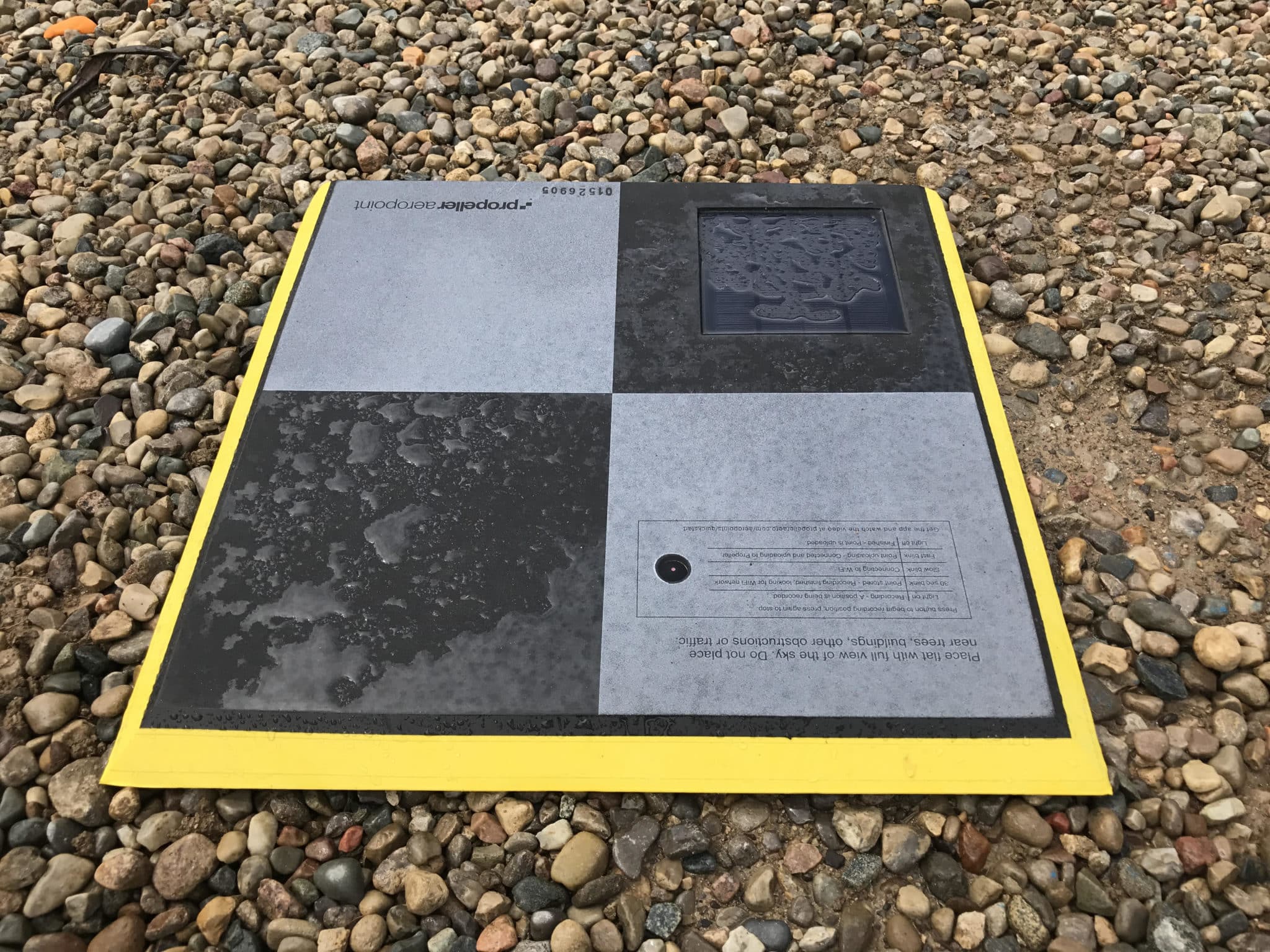
- Propeller’s unmatched accuracy—made possible by our AeroPoints and PPK workflow
- The ease of use of the Propeller Platform
- Our 24-hour turnaround processing drone data
How Propeller makes life easier for survey managers
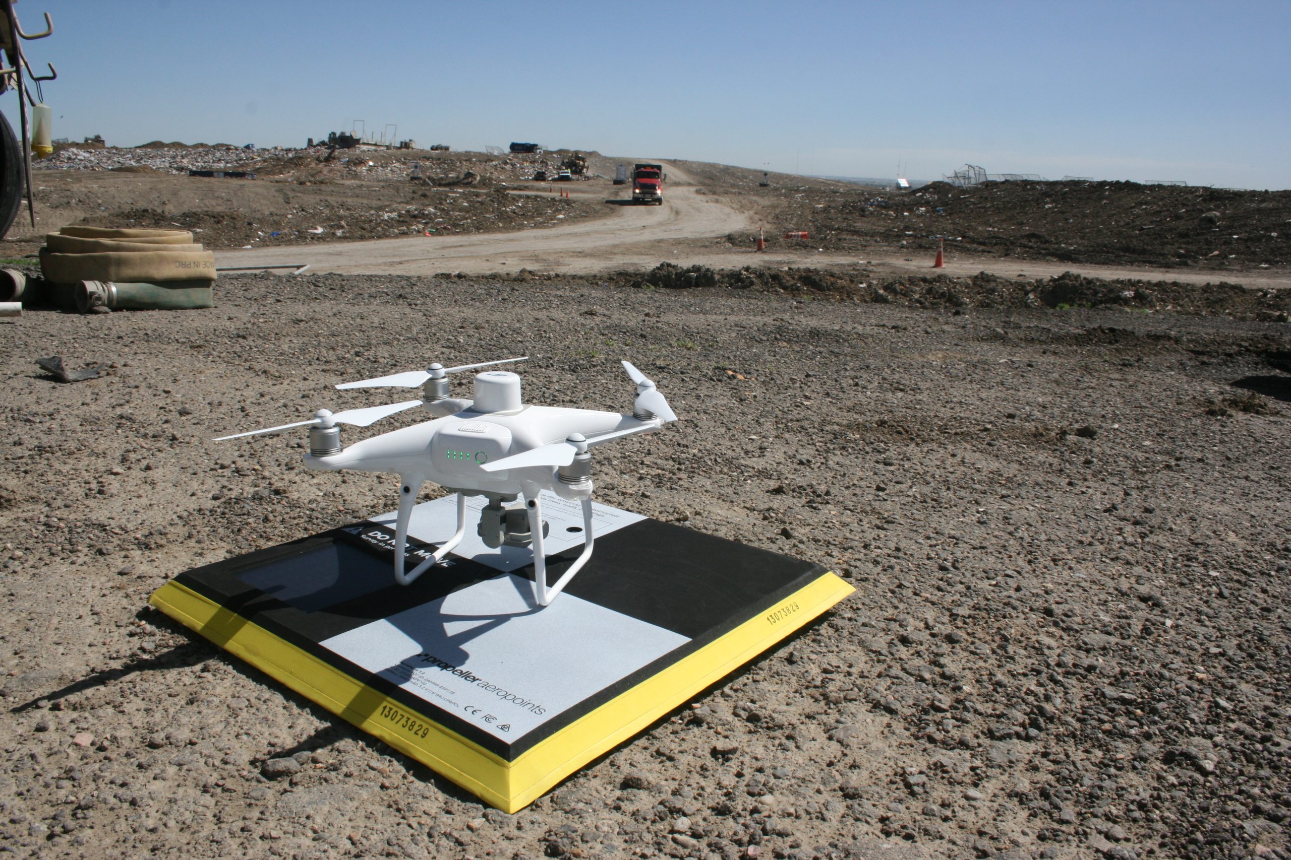
In his conversation with Rory, Keith takes us through the day he just had surveying two landfills, one larger site he visits every two weeks and one brand new site about a third the size.
Keith explains each step, from distributing his AeroPoints through launching his drone and uploading the data for processing—and as he explains, it’s exactly as simple as it sounds.
“I don’t do anything. I hit go and watch for air traffic,” says Keith.
For the new site, which he had never flown before, Keith was able to take 299 images in only 11 minutes. Between the two sites, uploading his data to the Propeller Platform for processing took less than 30 minutes.
And while other surveyors he knows are skeptical of the “black box” that is third-party processing, Keith doesn’t have the same concerns when it comes to Propeller.
“I don’t think it’s a valid argument once you add in AeroPoints,” says Keith. “If you just have ground control, if you didn’t use PPK, then maybe. But with the way you have your whole workflow set up…I’m pretty confident in the data I’m getting.”
The ROI—and unexpected advantages—of accurate drone data
Again using the example of a landfill, Keith explains how collecting more reliable survey data at a faster rate has empowered his teams to more consistently plan future work.
“Early on in this project, they were doing truck counts,” says Keith. “After I flew my first drone flight, they found out their measurements were wrong. There was too much fluff in there, they hadn’t accounted for it. They were off by 15% in each truck.”
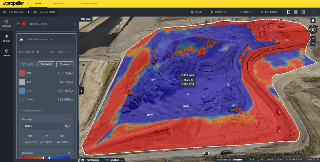
By getting a better handle on how much earth they were actually moving, project managers were able to more more accurately schedule subcontractors for the next phase of the project. And using the Propeller Platform’s stockpile tool, Keith was able to verify that they had the right quantities for each phase of the cell build.
Keith also discusses how having more accurate data has given them a competitive advantage when bidding on new projects, especially when it comes to negotiating change orders.
“We had a project where there was a discrepancy between what our drone was seeing in the existing topo versus what was in the survey that was done for the design. We were able to use that information to negotiate additional work.”