Drone technology is becoming a common tool in any surveyor or site manager’s toolkit. It’s ushering in a new era for topographic surveying by enabling the capture of detailed site maps, including contours and terrain, for a fraction of the time and cost of traditional methods.
Calculating the return on investment
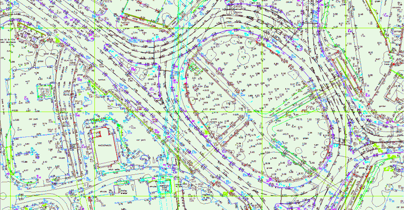
With conventional GPS and Total Stations it can still take a lot of time to cover even a small site. And that’s not including the office time it takes to process data into final linework and surfaces.
When you add this to conventional surveying costs (around $125/hr), traditional methods can be unfeasible to cover large sites regularly.
Using drones with a platform like Propeller is empowering site personnel to make accurate estimations, track progress, and data-driven decisions. This can save a major civil construction project literally millions of dollars.
Easy and legal: drone surveying is now within everyone’s reach
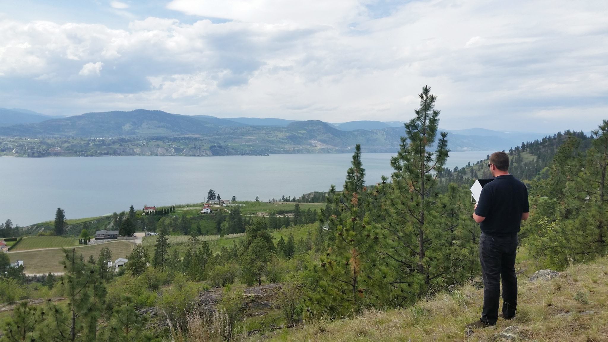
Government regulators are making it easier to get certified to fly a drone for commercial use. And drones’ increasing affordability means complete a survey in less than an hour can be the norm. Data turnaround happens in 24 hours.
Drone data is already being used in many land development projects. From the early stages of planning and designing land subdivisions, through to preconstruction assessments, it’s also helping with progress tracking and final as-builts.
Civil contractors are among the earliest adopters of drones. They say that drone-captured data, when used with ground control systems like AeroPoints and processing software like Propeller, provides a quicker, easier, and safer way to produce digital terrain models and aerial site maps than previous methods.

Better insights from rich, visual datasets
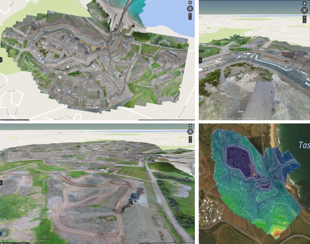
Unlike traditional topographic survey data—which is basically a set of linework—drone surveys include an orthophoto, contour map, digital terrain model, and dense point cloud. The result is a highly accurate, visual dataset. All ready for analysis.
Simple tools give everyone the power to map, measure, and analyze
With easy-to-use tools to measure and annotate datasets, stockpile volumes can be accurately measured in under a minute and haul road grades can be measured in seconds.
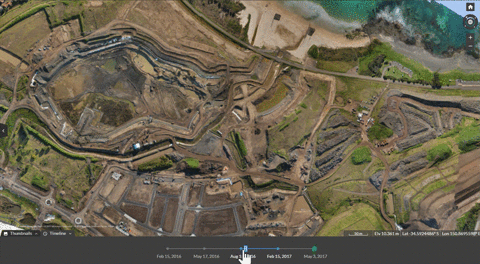
Using a surface-to-surface comparison, site terrain can be viewed against design to see where material should to be added or removed. Timeline sliders makes it easy to visually track changes in specific areas, or across the entire site, to make sure everything’s on track for successful completion.
Overlaying boundary linework over an orthophoto allows to check that the construction works stay within the defined area and avoid legal issues.