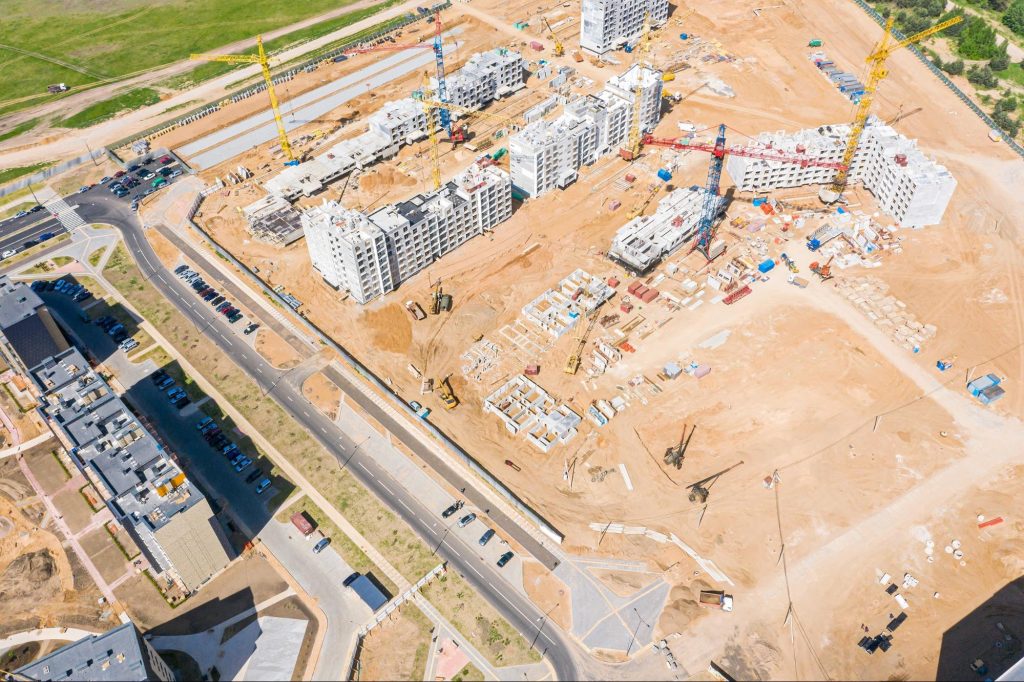
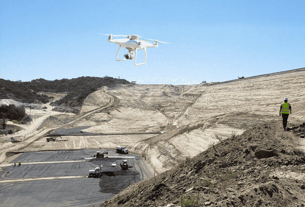
In the US alone, there are 770,000 registered drone users, and many of them are being used to create 3D models of worksites. These site models capture every angle, feature, and safety hazard with an objective lens, eliminating human bias.
By using 3D drone models, you’re making your sites more accessible and gaining the ability to measure site attributes accurately. You’ll have the ability to pinpoint safety hazards, compare completed work against design documents, and measure stockpiles from a fresh vantage point—things you would have never been able to do from the ground.
Here’s five things to know if you want to start using drones to create 3D maps of your site.
1. Get a reliable drone
Yes, you guessed it. You can’t render 3D models from drone-collected data without a drone.
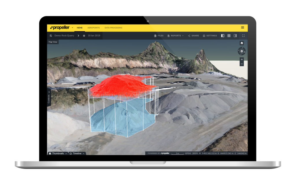
Right now, most drone chatter is centered on post-processing kinematic (PPK) workflows and real-time kinematic (RTK) drones.
The most effective drone surveying process combines the two in a fully integrated solution. This is precisely what we’re doing with Propeller PPK, seamlessly uniting hardware, workflow, and software.
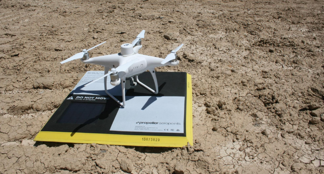
With Propeller PPK, your DJI’s Phantom 4 RTK drone flies overhead while your AeroPoints collect ground-level feedback. After you land, all that data is funneled into the Propeller Platform to process your data accurately.
It’s is an easy-to-use, one-stop option that doesn’t require outside assistance. There’s no worrying about compatibility issues or wondering who to go to for assistance if something goes awry.
2. Take control of ground control
Ground control is a vital element in all drone surveying, and, therefore, in all 3D model creation.
Ground control points (GCPs) are the static tethers you need to “ground” aerial images and serve as a common frame of reference across multiple datasets. They enable cross-dataset comparison by snapping aerial imagery to a shared coordinate system and locating each image’s true position on the earth. Using GCPs reduces the margin of error from a few meters to a couple centimeters.
Without GCPs, you’ll have an unreferenced 3D model that you’ll be able to use for basic calculations using arbitrary measurements. However, won’t be able to generate time-lapse comparisons and calculations that hold their meaning outside of their native model.
For more literature on ground control, visit this previous post.
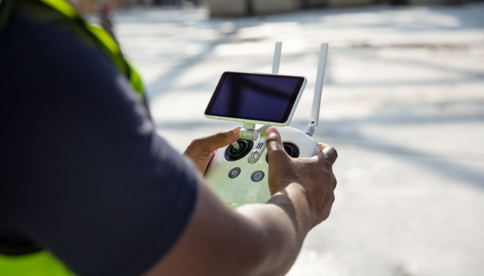
3. Prep your drone camera and other hardware
Check everything, and we mean everything. There’s nothing worse than setting up all your equipment and finding out your remote has a dead battery or your memory card is at capacity. Doing a little preliminary QA will minimize unanticipated roadblocks.
Proactive camera calibration is key here—your camera is your all-seeing eye, and micro changes to the shutter speed, gimbal angle, and aperture have macro-level impact.
It’s important to find a balance between shutter speed and drone speed to prevent motion blur. Because 3D drone models are a mosaic of thousands of individual photos, the finished quilt is only ever as detailed as the pieces it’s comprised of.
Do a few test runs. Similar to riding a bike, there’s some trial and error involved with drone surveying.
Propeller recommends a ~75% overlap during flyovers, which allows the computer to stitch images together properly. When you have low visibility or lack of distinguishing features on the surface below, you want to increase the overlap rate.
4. Check the weather
Unfortunately, drones are subject to the weather. The general rule of thumb: if it’s excessively cloudy, raining, blizzarding, or windy, don’t fly. One of our previous posts covers ideal flight conditions more comprehensively.
Don’t fly your drone in bad weather. You’re not only compromising data integrity and putting your equipment at risk, but you can also violate FAA regulations. Clear skies will help you remain in accordance with line-of-sight laws.
So, if there’s a drone flyover in your near future, get online and check out the weather forecast.
5. Get the right 3D drone modeling software
It’s easy to get caught up in actual drone-flying aspect, but the processing of your data is just as important to creating the best possible 3D map of your site.
If you decide to go the self-processing route, prices can be steep; not only will you need a powerful, dedicated computer, you’ll need your resident surveyor/GIS expert to spend time manually working through the imagery.
Propeller processes your drone and ground control data together for you, typically with a 24-hour turnaround. Not only that, but we also have a team of GIS specialists and photogrammetrists on hand to troubleshoot any issues that might come up during processing.
In addition to choosing how you want to process your data, you’ll also want to consider the actual tools available to you in your 3D drone modeling software.
When you’re vetting platforms, prioritize industry relevance. Some platforms are built to serve a diverse group of users, which can lead to an inadequate toolbox. The good news: industry-focused photogrammetry platforms exist.
The Propeller Platform, for example, was engineered to serve four primary industries—mining, construction, aggregates, and landfills—and its features are designed for the specific needs of those industries.
For individuals with a more general set of goals, a “come one, come all” platform will work just fine. Regardless, making a list of your must-have features will help you hone in on the right one.


