Using drones to measure stockpiles: the basics
First, fly your drone to capture site data
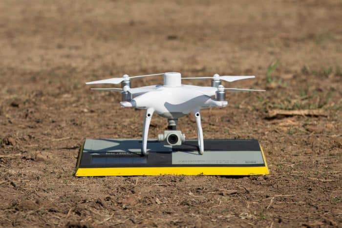
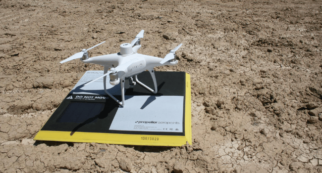
Before you can take a single volume measurement, you need to capture site data with a drone flight. There are a few ways to do this. “Drone surveying” means using a drone to take aerial photos of your site, combined with GPS data and ground control to provide geographical context.
There are two major drone surveying workflows: GCP-based drone surveying and PPK drone surveying. Flying a drone to survey your site is significantly faster, up to 10x faster by some estimates, than traditional ground-based methods. It’s also safer for a drone pilot to stand by and let the drone capture the data instead of walking the site themselves.
Next, let the photogrammetry software do the work
Once you’ve got imagery and ground control data, it needs to be processed into your 3D model. For all but the largest operations, keeping a photogrammetrist on staff is cost-prohibitive. Processing the data in-house is also a lengthy manual process that requires specialized software and often a dedicated computer.
Propeller processes drone data for you with a 24-hour turnaround, so you can focus on other work. And you don’t just get the final model. You get easy access to data outputs: point clouds, digital elevation models, and more, all exportable for use in other GIS and CAD programs.
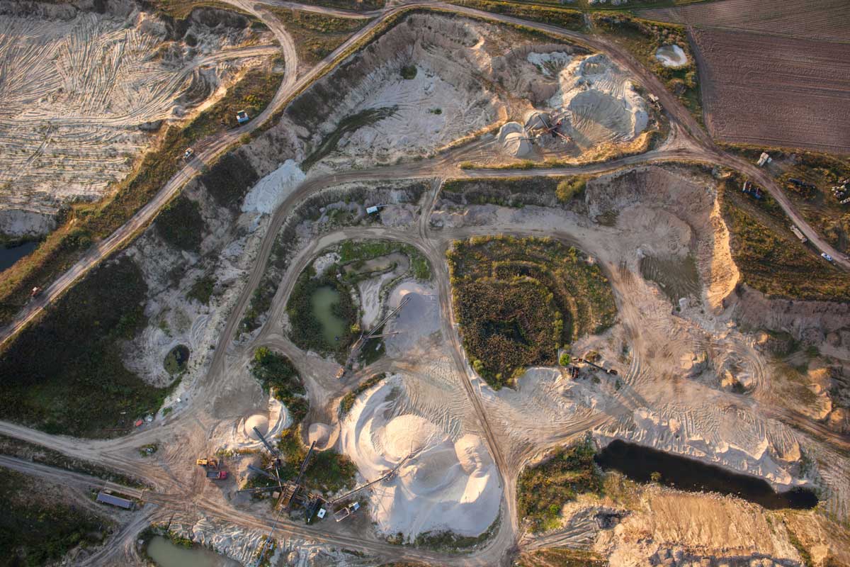
How to measure stockpile volumes for quarries or mines
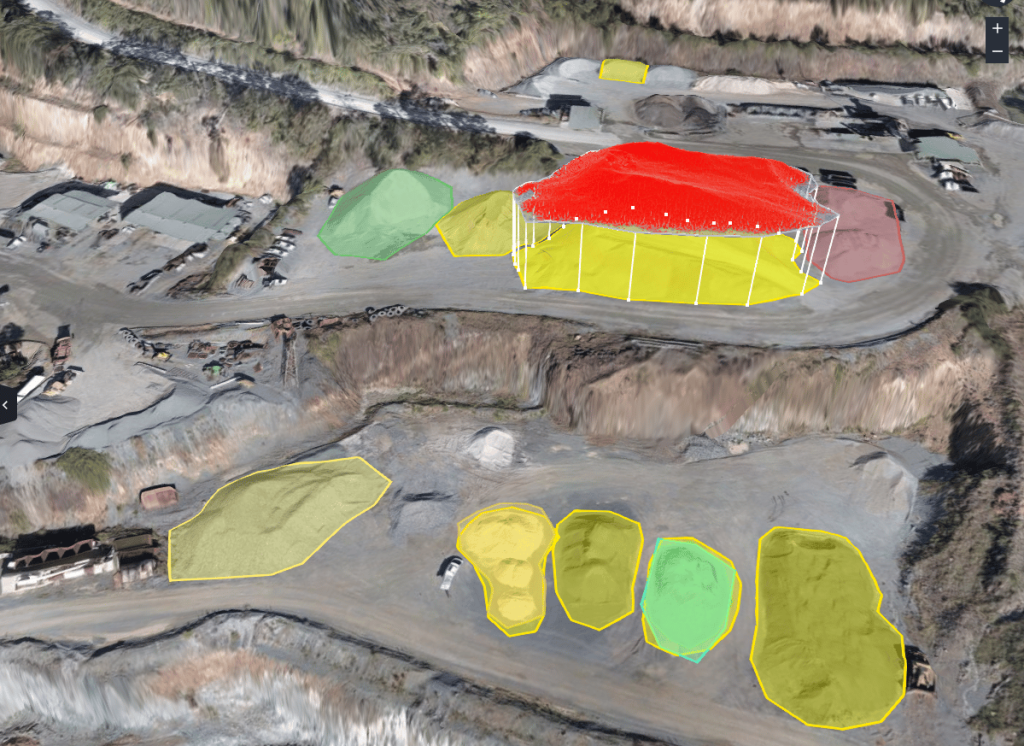
Once you’ve generated your model, you can analyze your site using the Propeller Platform. Measuring the volume of a stockpile in Propeller is as simple as drawing a boundary around it with a few clicks.
You can quickly make the types of comparisons site managers use to measure progress and keep track of material inventory. The measurement method you use will depend on the information you need.
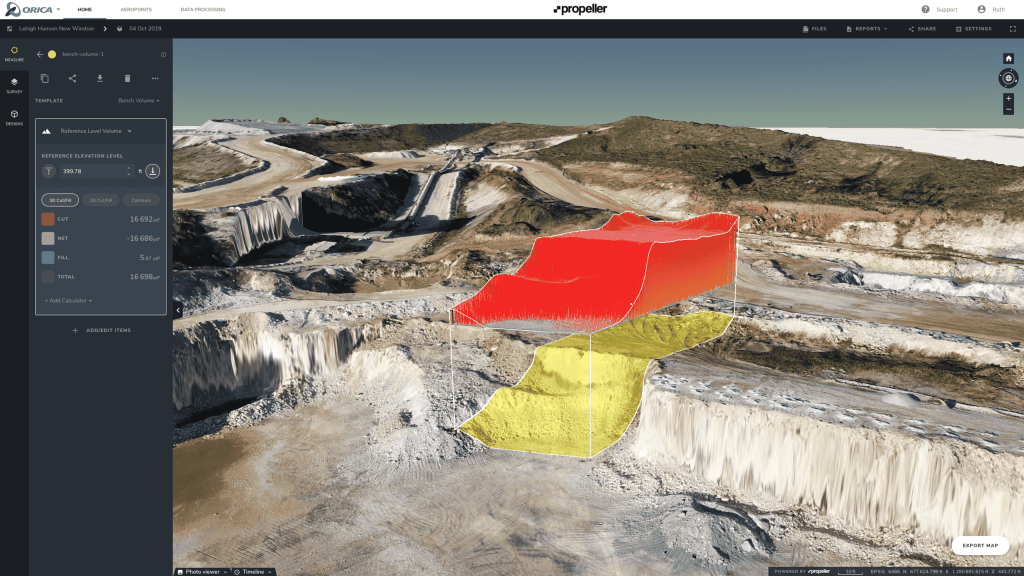
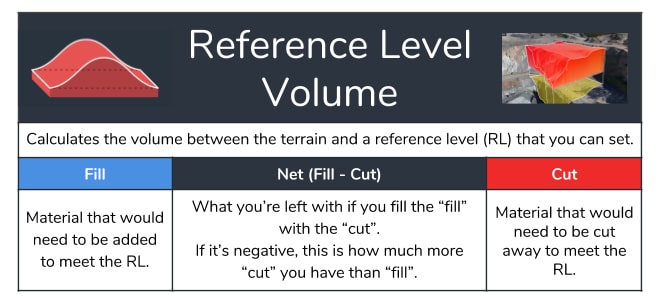
Option 1: Measure volume from a reference level. Set the baseline to the desired figure and calculate stockpile volume from that level up.
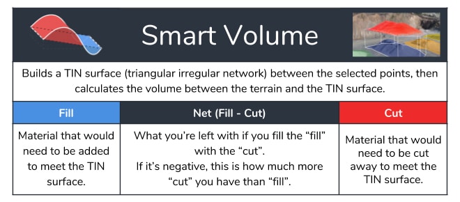
Option 2: Measure using a smart volume, and let the platform do the work. For a smart volume, the platform extrapolates where the base of your pile is and calculates a total volume from there.
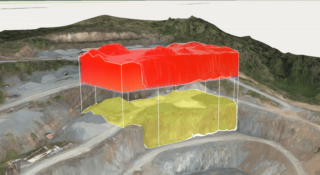
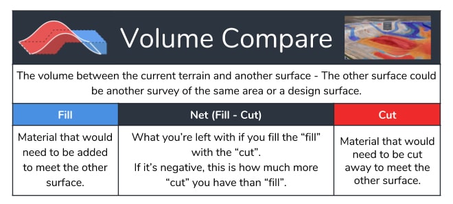
Option 3: Compare volumes between two surfaces. Compare survey to survey to see progress over time. Or compare the current surface to a final grade design you’ve uploaded to Propeller.
Using the stockpile volume calculator
Once you have a stockpile volume, you can enter its known material density into our stockpile volume calculator. This tool helps you determine the tonnage and cost of any stockpile using a simple volume calculation.
For example, let’s say you want to find how much material has been added to or removed from a stockpile since your last drone survey.
Simply select the Polygon tool and draw a line around the base of the stockpile. In an instant, Propeller takes the thousands of recorded height samples within your digital elevation model and runs the calculation within the boundary of that polygon.
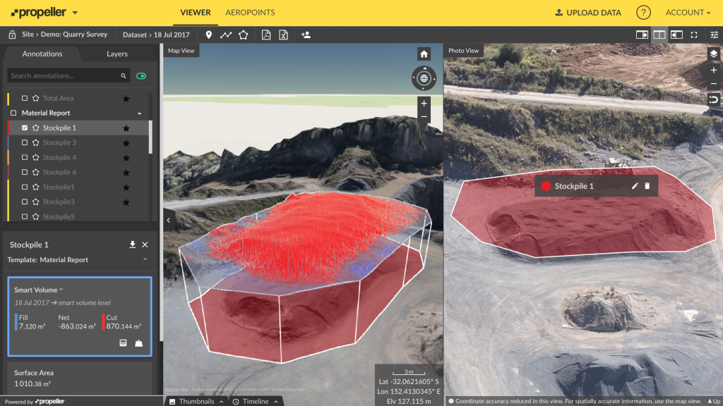
Next, Propeller compares these height readings to those from your previous survey. Volume changes are expressed as Fills where material has been added, or Cuts where material has been removed.
The Net value is the difference between the Cut and Fill. When measuring stockpile volumes, the Net figure will be more or less synonymous with the Cut, since you are measuring one mound of land above the base elevation.
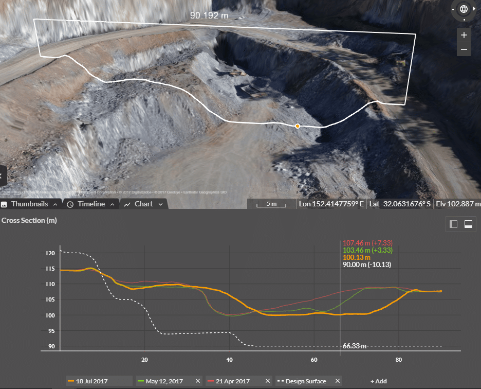
It’s also possible to visualize stockpile changes as a cross-section. Just use Propeller’s Line tool to generate a graph depicting the elevation change for each point on that line.
The measurement process for pit and stockyard volumes is similar to that of quarries and mines. Having the correct grade blends is essential to success.
Insufficient input grades are often discovered after the fact, when the final material doesn’t add up to pre-processing records. Use Propeller to monitor stockpiles before something goes wrong, not after.
We know landfill surveys can be difficult, too. Drone surveying can capture the data you need in hours, not days, without sending anyone to walk over dangerous piles.