
Filtering obstructions out of your data means clearer, more readable surveys. Scrubbing things like vehicles and vegetation from the point cloud helps with asset monitoring and tracking job progress. It’s also critical for accurate volume calculations. But how does terrain filtering work and how can you make sure you’re filtering out the right things on your site?
A point cloud is a set of points in a 3D system, each representing a place in space and the object or terrain sitting there. When drone-captured imagery is processed, each pixel within the picture has its own coordinates—those X, Y, and Z values.
Once your images are stitched together using photogrammetry and ground control data, those pixels are reconstructed into 3D point clouds modeling your survey area in the real world.
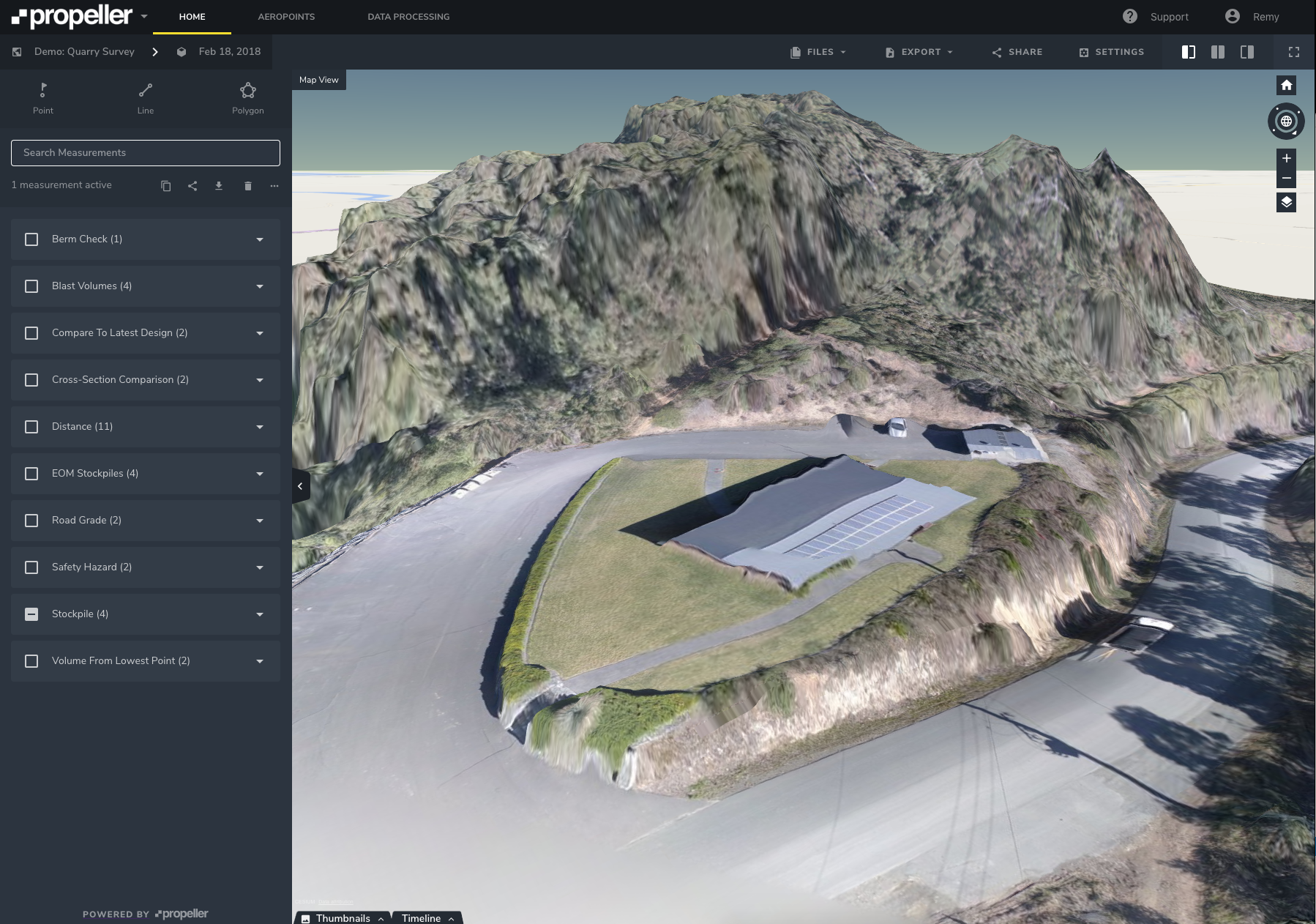
The Propeller Platform uses our smart filtering program to remove unwanted objects. It groups points into separate classes by characteristic. This allows us to bundle them together and remove a selected class from the final 3D survey. Whether it’s a hedge stopping a bare-earth calculation or a vehicle parked on an active surface you need to get a grade on, Propeller’s terrain filtering algorithm helps minimize these annoying obstructions.
The basics of how terrain filtering works
There are three basic terrain filter parameters to keep in mind:
- Point distance, measured in meters or feet, sets limits on how far a point can be from ground level. The greater the distance, the more likely that the point is part of a raised obstruction.
- Hold size, measured in meters or feet, defines an area inside of which points should be left alone. Think large stockpiles or buildings.
- int anPogle, measured in degrees, defines a line between the ground and a raised feature. The bigger the angle, the more likely that point belongs to a vertical feature you might want to filter out.
These all work together. For a point to be labeled as something besides “the ground,” it has to meet all three of these criteria.
How to select the best terrain filter for your drone imagery
Instead of wading through the complicated technical classifications, you can identify which things on site you’re most concerned about interfering with your drone survey, we take it from there. Propeller uses the most appropriate terrain filter and removes the obstructions in question in your final 3D site survey.
After processing thousands of surveys, we’ve found that drone survey obstructions fall into four categories and built the programming behind the scenes to filter them without complicating things for you.
Filter out vegetation
The first terrain filter is vegetation. Whether you’re running a large quarry or constructing a housing development, it’s possible to have plants and trees obstructing parts of your site survey.

Filtering for flora means that we’ll take out all the plants, so you can see the bare earth under trees, shrubs, and other greenery.
Flatten trucks and site equipment
The second is vehicles and equipment. Every industry from waste managment to mining uses trucks and other heavy equipment in their day-to-day work. These machines can be big or small, and usually touch every part of your site on some occasion.
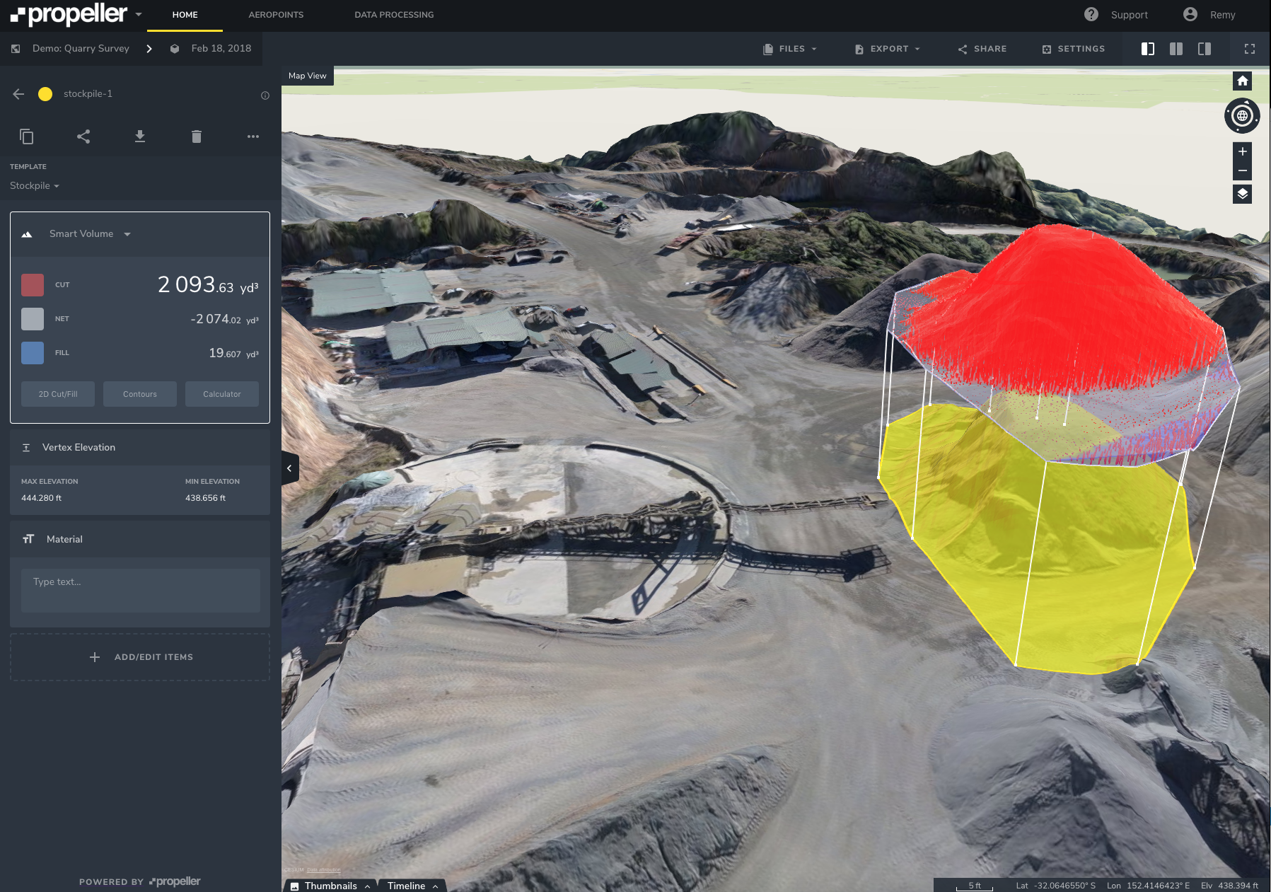
Filtering these out means taking cars, trucks, earthmovers, and conveyor belts out of the 3D survey. This is usually the best choice for measuring stockpiles or accurately comparing to design.
Remove obstructing buildings
The third is buildings. By that, we mean large objects with vertical surfaces. This could be actual buildings or the fixed plant itself, either way it’s a more strict terrain filter than vehicles and equipment.
Terrain filter to bare earth for flat sites
The fourth and last terrain filter removes all distinct objects with a raised gradient against the base, including equipment and piles. Of course, this is the most strict drone survey terrain filter. Use it wisely, and only on flat sites.
Regardless of which terrain filter is best for your site’s needs, being able to remove obstructions from your drone surveys means cleaner data and faster analysis, both of which enable better site monitoring, progress tracking, and volumetric calculations.
Finish off with manual terrain cleanups
Our smart filters do the heavy lifting, however we also offer a manual Terrain Cleanup tool to give you more control over your survey. Terrain Cleanups let you remove additional objects not edited out by your smart filter, as well as any other inaccuracies or disruptions to the survey. Removing a feature in your survey is as simple as drawing a boundary around it.
Using our Terrain Cleanup workflow, you can easily add back filtered objects. This is especially useful for users who want to remove stockpiles to calculate the bare-earth elevation and then add them back to measure their volume.
Want to see our terrain filtering in action? Check out a video demo for your industry.


