Over the past few months, Propeller has been fine-tuning our PPK workflow for drone surveying, which uses a DJI Phantom 4 RTK drone and one of our AeroPoints. This fully integrated solution was just released and provides a streamlined workflow for getting survey accuracy of 1/10ft (3cm) or under with less hassle and in less time.
With all the talk of new RTK- and PPK-enabled drones on the market, we wanted to do a deeper dive into how we made this workflow happen and how we made it accurate.
Before we even started thinking about PPK, we had seen that for some customers placing sufficient ground control on their sites was either not possible due to terrain restrictions or too time-consuming depending on site size.
We knew we needed to make drone surveying even simpler without compromising accuracy. And for that, we chose post-processing kinematic (PPK) technology.
Why use PPK?
“Overall, we want to make it as easy as possible to get data into our platform,” said Fred Greer, AeroPoints lead product engineer at Propeller. “PPK is a fundamentally easier way of capturing and collecting data because it takes much less time to set ground control.”
With better and better onboard GPS correctional tech becoming more affordable, we knew that the time for reliable accuracy with a simple workflow had come.
“Our mission at Propeller has always been accuracy,” said Rory San Miguel, Propeller co-founder and CEO. “First it was making ground control easy with AeroPoints, and now the next big accuracy push is PPK.” So, we started testing.
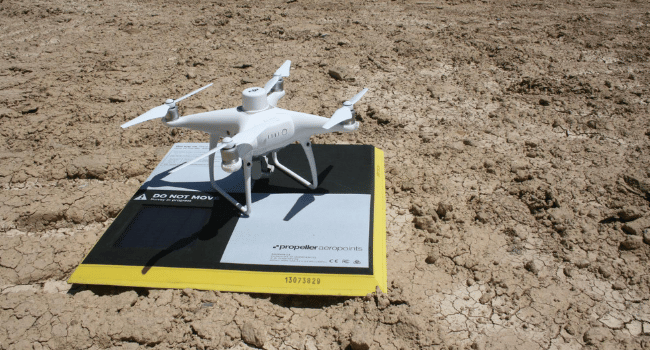
We chose DJI’s new Phantom 4 RTK drone to collect our aerial imagery and data. DJI drones are the workhorses of the industry. They’re reliable and sell for a reasonable price point. Our tried-and-tested AeroPoints are the industry-standard smart GCPs.
The importance of on-the-ground data validation
Despite the attractiveness of “real-time” processing, surveyors all over the world recommend having some form of ground control even with RTK-enabled drones. RTK craft alone don’t get the reliable, repeatable accuracy needed for industry standards.
The myth that’s been perpetuated is that you don’t need any at all. “In reality, you need one point on the ground to reconcile the drone’s errors. Having that one point on the ground allows you to dial the accuracy way in—from many centimeters to 1/10ft or better,” said San Miguel.
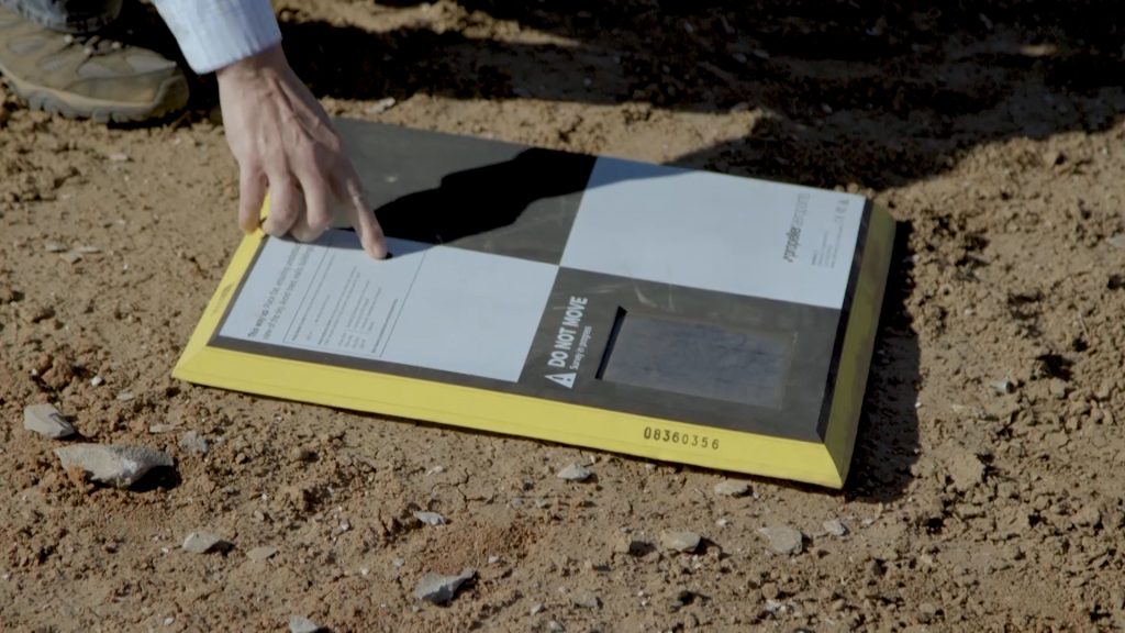
AeroPoints serve as this on-the-ground validation for such a workflow. But because there are on-board GPS capabilities on the drone, you only need one AeroPoint on the ground—drastically reducing the time-sink for traditional ground control setup.
Integrating local coordinate systems into your data capture and export
Another issue that had to be addressed was local coordinate systems. These grids are ultra-specific, sometimes covering small regions or individual sites. Because all the work that’s done on those sites are in this custom “language,” any drone data needs to be in that language too.
Local coordinate systems are very common in the US. When using a traditional network base station, it’s more difficult to get your drone data in a local system. AeroPoints are already equipped to work on a local grid, so we were able to use our existing infrastructure for processing local coordinates to simplify the workflow.
“The best way to get a survey in locals is to have your base in locals, too,” said Greer. “We already have the infrastructure in place to deliver that data in local coordinates because our AeroPoints already do that and we’re able to extend that to PPK data.” All that is needed is to place an AeroPoint on a known point on the local coordinates on site, Propeller takes care of the rest.
Getting accuracy down to 1/10ft was a process of continuous improvement, as most development projects are when it comes to hardware and software.
Please note that Local Coordinate Systems and Local Site Survey Benchmark processing options are only supported when processing data sets using AeroPoints with the Propeller or Stratus platforms. If you would like more information, please contact us.
Testing the Propeller PPK drone solution on site
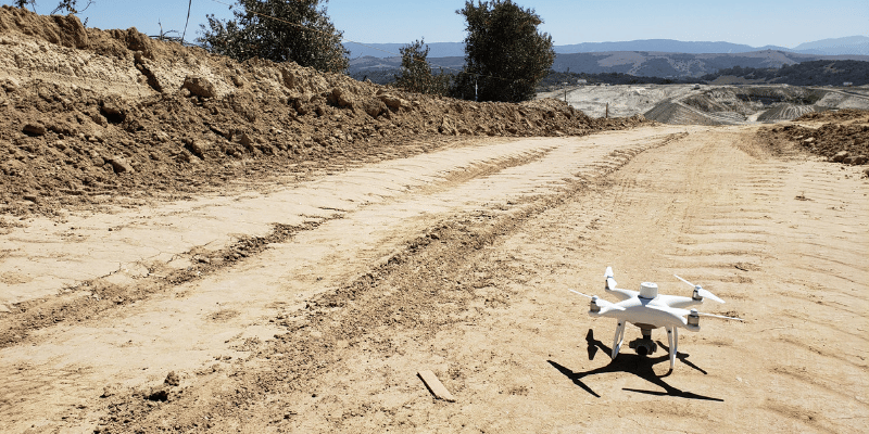
After troubleshooting the various use cases and ensuring we had the backend processes down pat, we needed to test this workflow in the field. Starting in March 2018, we took the drone and an AeroPoint out to numerous sites in the US and Australia. Each time, we crunched the numbers and refined the workflow.
Following success in many, many unpublished flights on real-world sites, we took the drone out to Front Range Landfill in Denver and did an official accuracy test.
“The thing we were trying to test is how well the data agrees with conventional methods of surveying,” said Greer.
A team of Propeller engineers and drone surveying experts went out on site and tested the accuracy of the Propeller PPK workflow against checkpoints on site and against a site survey rendered with lots of ground control and a traditional drone.
Real-world testing and 1/10ft accuracy
“The first thing we did was set lots and lots of control points, both using the AeroPoints but also using Trimble’s survey equipment,” said Greer. “From that, we had a big list of known points that we knew very accurately on site. So, we flew the drone and we processed all of the test data using our conventional workflow, ignoring any PPK or RTK data—just using the images and the ground control data—and making what we’re confident is a good drone survey.”
That first test flight had accuracy of 1/10ft (3cm) or under.
“We flew the site a week later and processed the data using the exact same method. This was to ensure and prove repeatability and reliability of this accuracy,” said Greer. “When the team did the same survey a second time, we incorporated the RTK/PPK data using only one of those control points and comparing it to the first drone survey and all the checkpoints around the site.”
The results of the second flight were, again, accuracy of 1/10ft (3cm) or under.
These tests proved that the Propeller PPK workflow reliably gives survey-grade accuracy. Further, testing in the real world allowed Propeller to refine the steps of the workflow itself.
It takes just three steps: place your AeroPoint, fly your drone, upload and view your data in Propeller to get accurate, 3D site surveys to help you better track progress and productivity and manage quality and cost on any site.