Drone surveying is quickly becoming an integral part of many construction and civil engineering projects. Drones are well-suited to a wide variety of applications on the job site, especially during construction pre-planning phases. In an era where how we build matters as much as what we build, drones have found their niche. Not only do they offer productive insights into job progression, drones are key in promoting sustainability. From preliminary site inspection to monitoring progress, they present an incredibly efficient, safe, and sustainable alternative to traditional surveying methods.
Sustainability starts with site preparation
Accurate surveying is an extremely important part of the site preparation and planning process. Starting the job off right is crucial for everything from orchestrating the site to determining where materials should live during the buildout and even pinpointing locations where existing utilities and infrastructure already exist. More and more, engineers in the field are choosing to survey by drone—it’s a much safer, more accurate, and more efficient process.
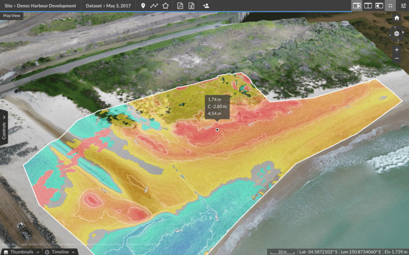
The simplicity and versatility of drones has led to their broad adoption on construction sites. Downward-facing sensors on aerial drones take pictures of the land from many different angles—more than what’s possible through traditional surveying means. Moreover, each image is tagged with the appropriate coordinates to expedite the surveying process. Drones capture and collect all relevant topographical survey points, which can number in the hundreds and thousands depending on the size of the area.
Site prep demands efficiency. Data collected by drones can be shared quickly and efficiently with everyone involved in site planning, ensuring easy access to accurate site information that enables them to perform out in the field.

Sustainable benefits stem from drone surveys
Efficiency is the undercurrent that drives sustainability–less waste isn’t just beneficial for budgets and timelines, it’s great for the environment, too. Drone surveying unlocks efficiencies during the construction pre-planning phases that result in more sustainable approaches when the project gets off the ground.
- No impact on an unspoiled environment: Traditional surveying methods require cutting sight lines, as well as making room for a crew of surveyors. Drones can launch from almost anywhere, typically requiring no intervention on unspoiled sites.
- Reducing rework: Job progress is routinely checked to ensure a project stays on-schedule and on-budget. This traditionally involved constant facetime with subcontractors, manual walks around the site, and measuring work against plans. Field engineers using drones can verify completion of work, including accurate measurements that juxtapose with intended design. As a result, drone surveying helps engineers catch problems early, to reduce rework and save time, money, and needless waste of materials.
- Reducing fuel burn: Drones can accurately quantify and measure different zones for a project, enhancing efficiency in site prep. Drone data provides clear directions that allocate earthmoving equipment in the field, keeping heavy machinery from needlessly driving across the job site or sitting idle for a long period of time, reducing unnecessary fuel burn in the process.
- Identifying potential hazards: Worksite safety is greatly improved with drone surveying. Surveyors can spot potential safety risks before workers even step foot on the site, so they arrive fully prepared to address any challenges. This includes everything from planning around underground utilities to material storage in safe zones.
Drones are true drivers of environmental sustainability when utilized in engineering and construction applications. When a worksite functions as efficiently as possible, there’s less waste, a speedier timeline and–most important—fewer mistakes. It all equates to a more environmentally friendly construction process, and one that provides benefits not only for stakeholders and construction teams, but for the planet as a whole.