Nobody wants to waste a survey crew’s day on a job that they’re only bidding on. After all, if you spend that time doing a pre-bid topo and don’t get the contract, what was it for? But if you could get up-to-date as-found topo, you’d have an edge over competitors.
In the past, it was a matter of choosing whether or not to do that precon in the first place. Having that accurate precon is ideal. Not having one can potentially lead to problems down the line with quantities.
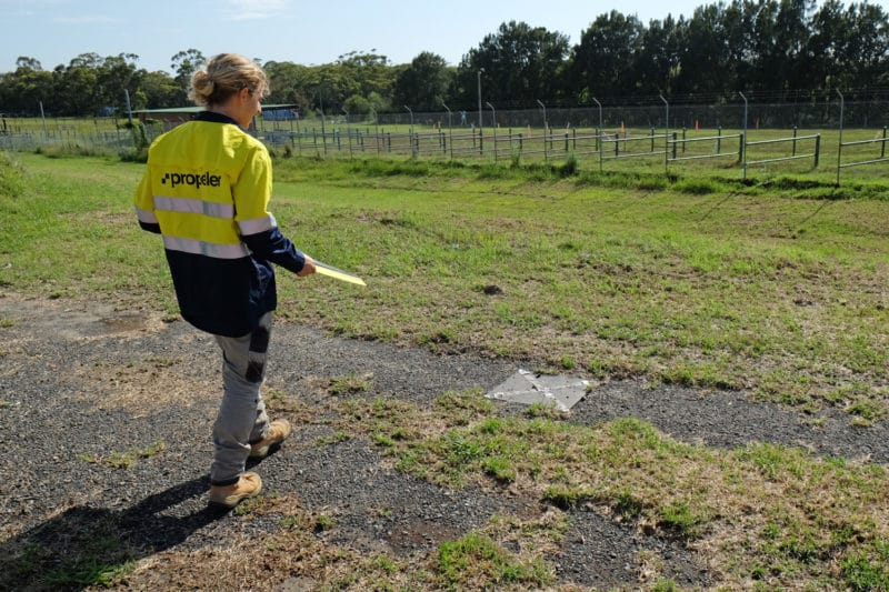
But with drone surveying and processing platforms like Propeller you can get an accurate preconstruction topo without sinking more time than you want into the task. It’s simpler than you think. You can fly a site once, pre-bid, and have all the information you need.
Get the pre-bid topo in less time
As those in the industry know, commercial drones have become a great tool for worksite surveying. It lets you get eyes on hard-to-reach places without putting your people in hazardous areas on site—and it’s affordable.
This is just what Buesing Corp., based in Phoenix, Arizona, found to be the most effective when it came to doing prebid topos for their business.
“With a drone flight, we can go into a site before a bid or during precon and say with confidence how much dirt is there,” said Buesing Corp.’s GPS Manager Rio Byman, who frequently oversees bidding and site topos. The surveying process only takes an hour or two.
Ensure your pre-bid topos are complete and finished in less time
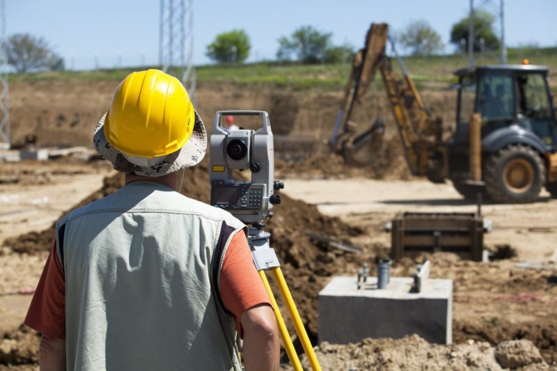
Before using drone surveying, Buesing would typically pay for grid spacing using traditional surveying methods. Depending on the site itself and the terrain, it might be 25- to 100-foot grids to survey the site.
“For a flat site, about 100 acres, say, it could take us two hours to do a precon bid topo. Maybe $1,800 for the survey,” said Byman. But these numbers depend on the site’s accessibility. “If the terrain is rough and if the site hasn’t been grubbed yet, it could take us two to three days and around $5–6k to hit the same size area.”
While those time and cost variances are an issue, when it comes to work on a job you haven’t been awarded yet, the grid itself can also introduce problems. Depending on the spacing, it’s sometimes possible to miss important breaklines and features. Missing what’s under the vegetation is possible or if an area is inaccessible, you could also miss a lot of dirt.
In cases like this, using a drone to survey might be a better option for getting that topo. A ground topo captured with a drone surveying workflow is extremely dense, as millions of points are gathered in photogrammetric drone surveying.
Without detail like that, it “can lead to time-consuming disputes over how much dirt was on site, and from there it’s word against word,” cautions Byman.
“Now that we have Propeller, we fly every job before we even touch it.”
Using drones to capture precon topos and the Propeller Platform to process that data, allows Buesing Corp. to save money on prebid planning—and cut time after they win, too.
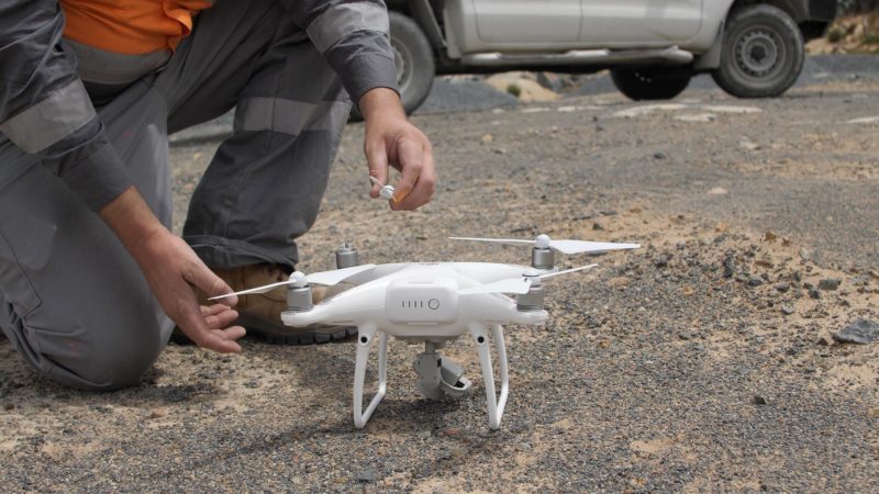
Before they started using drone surveying, Buesing Corp. would have to move a base and rover off a different job to do a precon topo for a bid. That could then lead to not having a base and rover on the initial job, which might be vital to that site’s operations. “With the AeroPoints,” said Byman, “we eliminate the need to have guys shooting in targets or points, so it’s a huge convenience.”
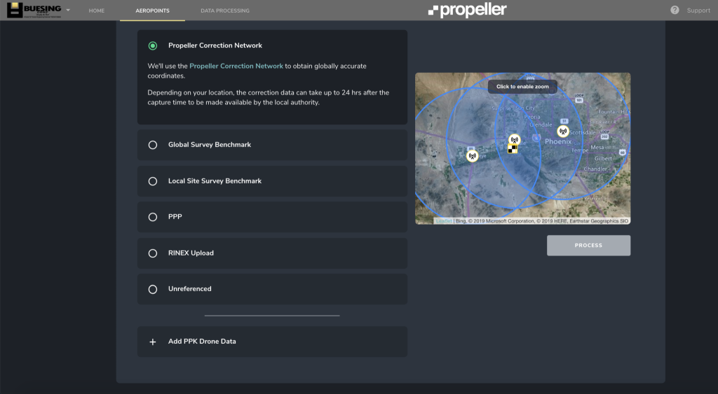
AeroPoints are smart ground control points and they have the additional advantage of allowing you to process surveys in both local site calibrations or some other coordinate system without flying twice.
Traditionally, when you’re bidding on a job you know that while you can get an updated original, you’ll then have to re-topo the site when after you win the job to get usable data matching the CRS of their design surface and site plans. But with AeroPoints, you don’t have to.
How to get your precon bid topo
Find a location on the edge of the site that won’t be covered up or removed between your precon topo and the start of the job. Place a pin or easily identifiable marker in the ground here.
When you fly that site, center one AeroPoint over this pin or marker. (Using an AeroStencil is recommended.) Then fly as normal, ensuring that the AeroPoint is on for at least 45 minutes while your drone is up in the air.
If you’re surveying with a traditional drone, you need to have at least 10 APs spread optimally across your site. (In that case, at least one of those 10 is placed on your marker.) If you’re surveying with the Propeller PPK workflow, you don’t have to spend time setting up ground control points across your site—all you need is one AeroPoint, which would sit on that marker.
Once you’re done flying your site, you can then process data in the Propeller Platform using a published coordinate system before you win the job.
This will allow you to design your bid with up-to-date and more accurate takeoff quantities to say:
- How much dirt needs to be moved to meet design,
- Where it needs to be moved, and
- How you will move it.
Getting an updated site topo after you win the bid
After you win the bid, you can go back to that marked point and set up your local site calibration using your rover. Simply survey the exact center of the top of that pin with your rover in the site’s local grid.
This establishes a known point for use with subsequent drone topos that’s out of the way of any earthworks.
Using the newly shot-in coordinates of your survey pin or marker, you can now reprocess your original AeroPoint survey using the known point method for local site calibrations.
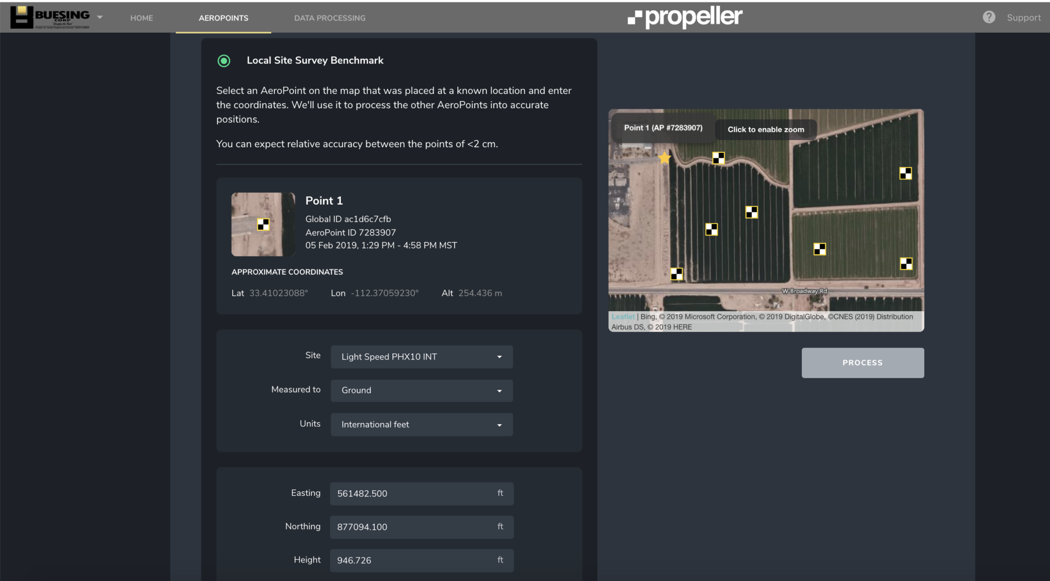
This means you don’t have to topo the site from the start because you already have an original surface to track job progress from. And that survey is accurate down to 1/10ft with Propeller PPK, so you can run, or verify, your billing quantities from subsequent progress topos.


