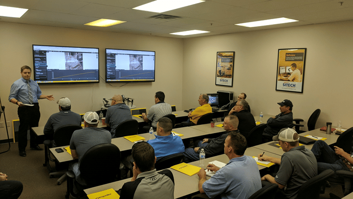
Full customer support is now available through Propeller for DJI’s Matrice 300 RTK (M300) drone. As a recommended drone, the M300 has specifically been selected for optimization with Propeller PPK, and will provide the best user experience. Need help? Visit our Knowledge Base now with expanded content supporting the M300.
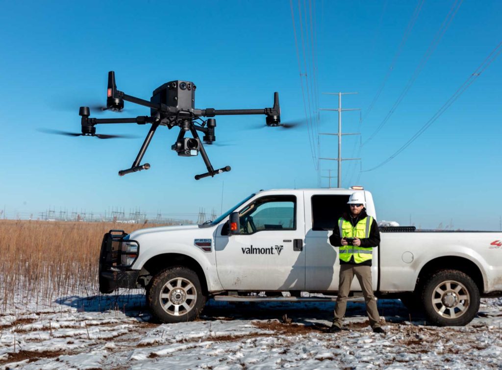
When you’re faced with a complex project, it’s critical that you have the right tools and solutions to get the job done right. For many earthworks contractors, this includes choosing the right drone and drone data processing software. For large, complex worksites, that right combination may well be the DJI Matrice 300 RTK drone with Zenmuse P1 sensor and Propeller PPK.
With the M300 and P1 bundle on our list of supported drones, we’re able to deliver a powerful turnkey PPK drone surveying solution for large worksites with complex terrain (like mines or highways with bridges). With this heavy-duty commercial drone and Propeller’s PPK workflow, site managers can confidently survey challenging sites with reliability, process their data quickly, and measure with precision … in virtually any weather condition.
Get to know the DJI M300
The M300 is a heavy-duty drone, built for tough conditions and large, complex worksites. When you need a drone that’s tough enough to handle up to 55 minutes in flight time and up to three payloads simultaneously, the M300 may be the right option.
Here’s some of the reasons we love the M300:
- Extended transmission distance: Transmits up to 9.3 miles (~15 km) away and supports triple-channel 1080p video with a long battery life.
- Refined airframe and propulsion system: Flies 23 meters/second (51.5 mph) for up to 55 minutes per flight.
- Multiple payload configurations: Can be configured to fit various mission needs by mounting up to three payloads of up to six pounds simultaneously.
- Advanced Intelligence: Is equipped with a collision avoidance beacon and obstacle detection sensor for safe, reliable flying.
- All weather capable: Operates in temperatures from -4° to 122° Fahrenheit with a self-heating battery and is wind resistant up to 49 feet/second. Includes a weather sealant, making it rain and dust proof.
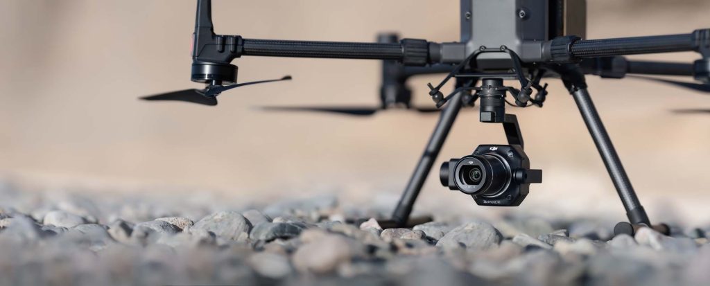
Zenmuse P1 Sensor
Fully compatible with the M300, the P1 is a compact, 45 MP full-frame sensor camera with an integrated gimbal made for aerial surveying. Designed for photogrammetry flight missions like earthworks site surveying, the P1 can take a photo of your worksite every 0.7 seconds during the flight, delivering reliable and accurate images so you can closely track progress data for your site.
The P1 supports 25/35/50mm lenses with DJI DL Mounts and is accurate without ground control points 3 cm horizontally and 5 cm vertically. Its global mechanical shutter functions at 1/2000 per second.
Putting it together with Propeller PPK
Because of the faster drone flight speed, the rapid shutter speed, and the higher MP camera, the M300 and P1 bundle can capture 250 acres in a single flight and deliver the same pinpoint survey accuracy. So, how do the M300 and Propeller PPK integrate? Here’s a quick review.
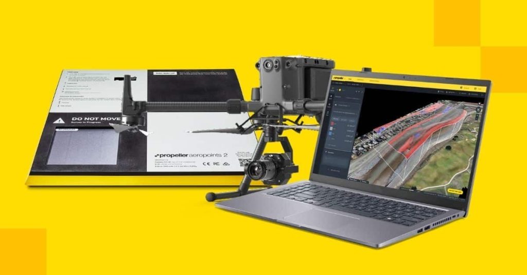
Propeller PPK combines your choice of drone hardware (now including the M300) with AeroPoints, our “smart,” high-precision ground control points, and the Propeller Platform. Our software is a cloud-based application for processing, mapping, measuring, and sharing aerial survey data.
Together, these three components (drone, AeroPoints, and the Propeller Platform) unite to form a solution that easily fits with how you already work. You’ll get more accurate data (even surveying rough terrain or in inclement weather) in less time and with fewer man hours, allowing you to build a better strategy, assess any risks, and collaborate with your team more effectively.
The Propeller PPK solution you dig—now with a new choice!
We’ve made it possible for you to pair Propeller PPK with the supported drone that best suits your on-site needs. With the powerful new combination of the rugged M300 drone and Propeller PPK, you’ll be able to survey complex terrain, like highways, bridges, and mines, with exceptional reliability in almost any kind of weather. Simply drag and drop your M300 flight data into Propeller, and our team of GIS experts will review your surveys to validate your data and ensure top-notch accuracy you can rely on.
Get complete automation of PPK geotagging and photogrammetry for high-accuracy results, every time you fly.
Join the earthworks industry transformation and work more efficiently, accurately, and safer.