
GeoTIFFs files are raster image file types that are commonly used to store satellite and aerial imagery data, along with geographic metadata that describes the location in space of the image. GeoTIFFs are compatible with nearly all CAD and GIS applications and maintain their quality when compressed, edited, and transferred. In drone mapping workflows, GeoTIFFs can contain both orthophotos and digital elevation models (DEMs).
When it comes to georeferenced imagery used in digital mapping—like drone-collected survey data, for instance—there’s no greater vessel than the GeoTIFF. This trusted, widely-used file format is used to store, transfer, and display large image files that also contain contextual geographic information.
But what exactly is a GeoTIFF file? And why has it become the go-to standard for, among other things, aerial imagery used in GIS and surveying workflows?
For anyone in need of a bit more context on the GeoTIFF, check out this handy summary:
Discover What GeoTIFF Files Are and How They Are Used
A Tagged Image File Format (.TIFF or .TIF) is the most commonly used raster graphic file type. You’ve seen a raster graphic image if you’ve ever looked at a photograph or a scanned document online. Or a piece of graphic art, or a logo, or a thousand other examples of images.
Basically, rasters are grids (or “bitmaps”) of pixels that when combined depict an image. The more pixels used to recreate a single image, the more defined that image will appear.
The other primary image file category, vector images, use mathematical commands to define and place objects (lines and shapes) in a 2D or 3D space. Vectors are great for displaying large images, as they do not lose definition when scaled. However, they can’t capture subtle shifts in color and texture necessary to display a photo-realistic image, making them useless in aerial mapping.
.TIFFs are the preferred raster graphic file type when it comes to professional photography, as well as aerial and satellite imagery. The primary reason for this is that .TIFFs come in a “lossless” format.
Unlike “lossy” file types, .TIFF files maintain their full quality when they are compressed for transfer and then reconstructed in an application. For things like aerial surveys with geospatial data that need to remain intact no matter how many times they’ve been compressed, copied, edited, and uploaded to different applications, .TIFFs make the perfect container. Unfortunately, this also means .TIFFs make for extremely large files, making them less than ideal for displaying on a webpage or for sharing via email.
Other advantages of the .TIFF include their interoperability—you can upload them to any GIS, CAD, or photo editing software—as well as their capacity to include metadata.
What is the difference between TIFFs and GeoTIFFs?
As we’ve discussed, .TIFF is a format for storing images. .TIFFs are widely supported by publishing, page layout applications, and 3-D imaging applications, to name a few. They are a bit-mapped image format and support various resolutions. A GeoTIFF is basically a metadata .TIFF format with the ability to embed geo-referencing information with the data of an image. Geo-referencing means to define a feature in physical space, thereby establishing a relation between the image and a set of coordinates. Alternatively, GeoTIFFs may also determine the location of other geographical features on a site.
GeoTIFF metadata tags
The contained metadata tags in GeoTiffs help describe the actual location that each and every pixel represents. When uploaded to a GIS application, like ArcGIS or QGIS, they make it possible to position the image in context of the real world.
Information included in these metadata tags include:
Coordinate systems: The grid of X and Y units (and Z if three-dimensional) used to describe the location of each point on a map.
Ellipsoids and geoids: Ellipsoids are estimated models of the Earth’s shape (not accounting for changes in elevation) that are used in determining horizontal coordinates. Geoids are more dynamic models of the earth that do consider the undulations of the planet’s surface and are used to determine elevation. (Check out our complete explainer on ellipsoids and geoids.)
Datums: Horizontal datums pin an ellipsoid to a specific location in space. Vertical datums take the surface of a geoid (or the Mean Sea Level) and establish it as a zero-point for elevation. (And here’s where we break down datums in full detail.) Projection: Mathematical rules for taking data for a three-dimensional space and transforming it into a two-dimensional display (aka a map).
Essentially, GeoTIFF files contain information about your data’s coordinate reference system (CRS). Think of CRSs as languages that help geospatial datasets speak together. If you try to use multiple datasets that have been referenced through different CRSs together in a GIS package, their coordinates will not line up, making measurements between them useless.
GeoTIFFs can either be referenced through a published CRS (with coordinates that put it in context with the rest of the world) or a local CRS (with coordinates that are specific to that location).
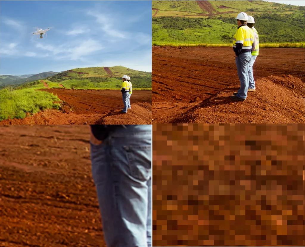
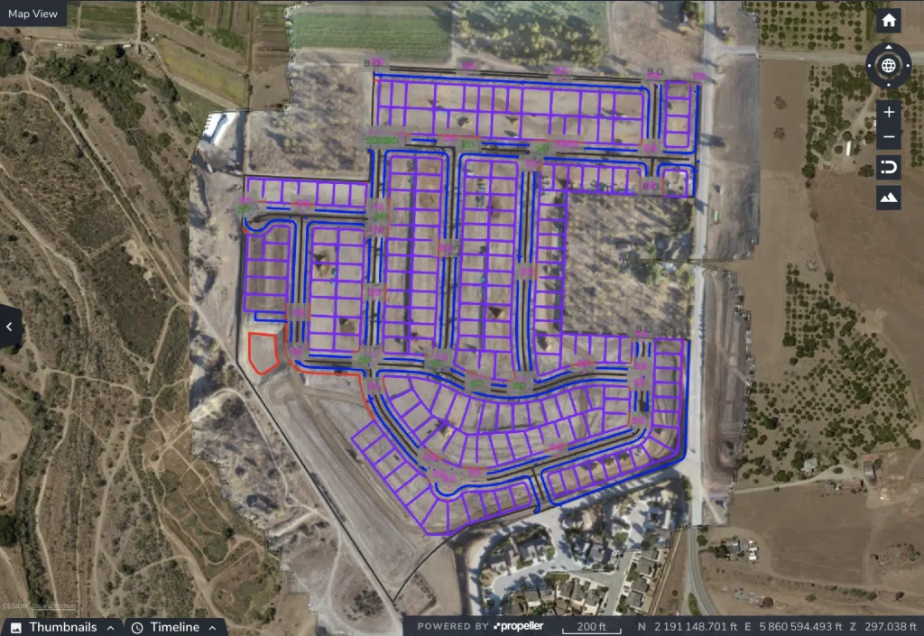
How are GeoTIFFs used in GIS and drone surveying?
After flying a drone over their worksites, surveyors can use a photogrammetry software platform like Propeller to process their data and calculate cut and fill volumes for the current terrain against previous levels and also the project’s design surfaces. Data is then downloadable in a wide range of coordinate reference systems as a GeoTIFF or other file format. In drone mapping workflows, GeoTIFFs can contain both orthophotos and digital elevation models (DEMs). Once the measurements are complete, the information can be shared across the team and other relevant stakeholders. GeoTIFF files with embedded GIS data can also be used for analyzing potential new development projects, visualizing open space areas, or even creating maps for the internet.
See how Propeller makes it easy to reference survey data with a local grid on your site.
What data types can a GeoTIFF contain?
In drone surveying, there are two primary visual outputs that can be saved as GeoTIFFs:
Digital elevation models
DEMs are visual depictions of the topography for a surveyed area. They do not contain color or texture data, differentiating them from more actionable 3D site models. DEM GeoTIFFs list the vertical point (z) recorded for every horizontal coordinate (x,y), in addition to all the CRS information necessary to place them in greater spatial context.
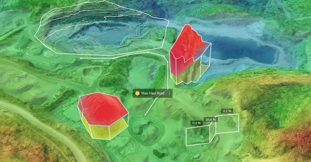
DEMs are one of the building blocks (along with point clouds) used to create 3D site models. On their own, DEMs can be used to analyze water flow, establish the viewshed (or line-of-sight) of a given point, check foundational soundness, and more.
Check out how Propeller uses our smart ground control points to produce highly accurate elevation maps.
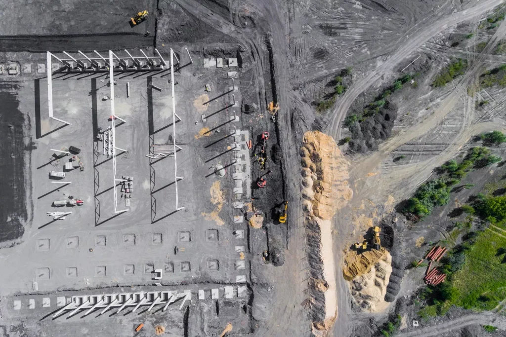
Orthophotos
An orthophoto is a two-dimensional, overhead image of the surveyed area. Orthophotos are different from an unedited drone-captured images as they’ve been corrected for perspective, lens distortion, topographic relief, and camera tilt. Basically, every point on an orthophoto is shown as if the drone that captured it was exactly perpendicular to the surface when the image was captured.
When combined with the georeferenced metadata in a GeoTIFF file, orthophotos can be used the same as a paper map to measure horizontal distances, only with much greater accuracy (assuming the data was originally captured using drone surveying best practices.


