What is Photogrammetry?
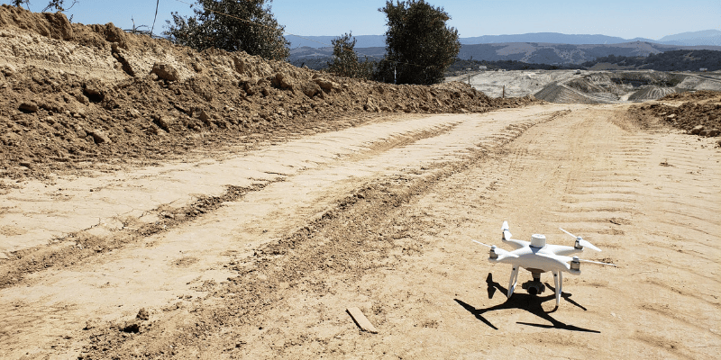
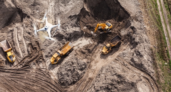
Photogrammetry is the science of collecting physical information from 2D photos, often aerial images captured by drones.
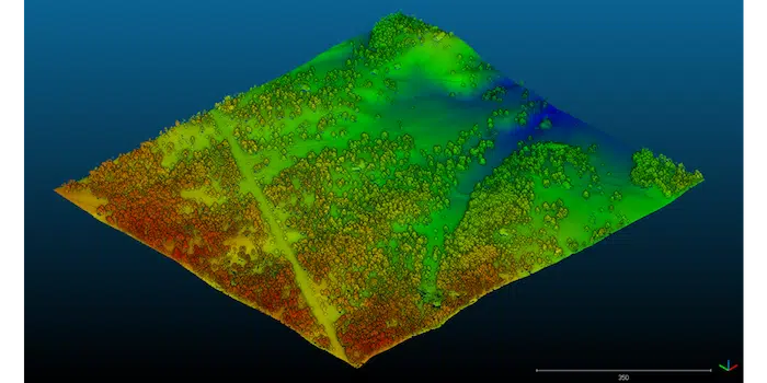
By combining enough overlapping images of the same features, photogrammetry software can be used to generate photorealistic 3D representations of topographic surfaces.
Surveying and GIS professionals use drone photogrammetry, along with accurate GPS data (usually from ground control points), to create 3D maps and models for use in construction, waste management, mining, and aggregates workflows.
How Drone Photogrammetry Works
Drone photogrammetry follows a structured workflow designed to ensure both accuracy and repeatability. Although it may seem like the drone is collecting more images than you actually need during land surveying, the multiple target points of one location on the ground are processed to create a 2D orthophoto and a 3D digital terrain model that’s an exact representation of conditions on a worksite.
This process ensures that each feature on the ground is captured from multiple angles, increasing measurement reliability and improving overall model accuracy.
The process typically includes:
- Flight planning and automated aerial capture
- Overlapping image collection
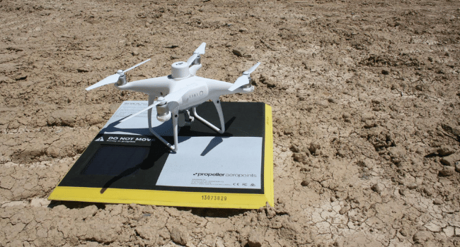
- GPS or ground control point integration
- Image alignment and feature matching
- Surface model and orthophoto generation
These highly accurate 3D models are surprisingly useful for a wide range of industries, including civil construction, mining, aggregates, and waste management.
What is Photogrammetry in Surveying? 4 Applications for Site Surveys
Aerial photogrammetry is a quick, cost-effective method for collecting data at a variety of sites. In fact, there are certain situations where photogrammetry is the best option, namely civil construction/earthworks; mining and aggregates; and waste management. Since these industries rely on incredibly precise points, site managers rely on the realistic mapping results from photogrammetric data.
Some key industry-specific benefits include:
-
-
Civil construction:
Photogrammetry technology is invaluable for infrastructure planning and design. Real-time data helps construction workers manage site progress, keeping costs down and preventing delays.
-
-
-
Earthworks:
Photogrammetry creates topographic maps of earthworks sites. The data is key for identifying precise earthwork quantities. Not only does photogrammetry data provide verification of work, but it also helps keep projects running smoothly and within budget with volume measurements that accurately calculate costs and labor time.
-
-
-
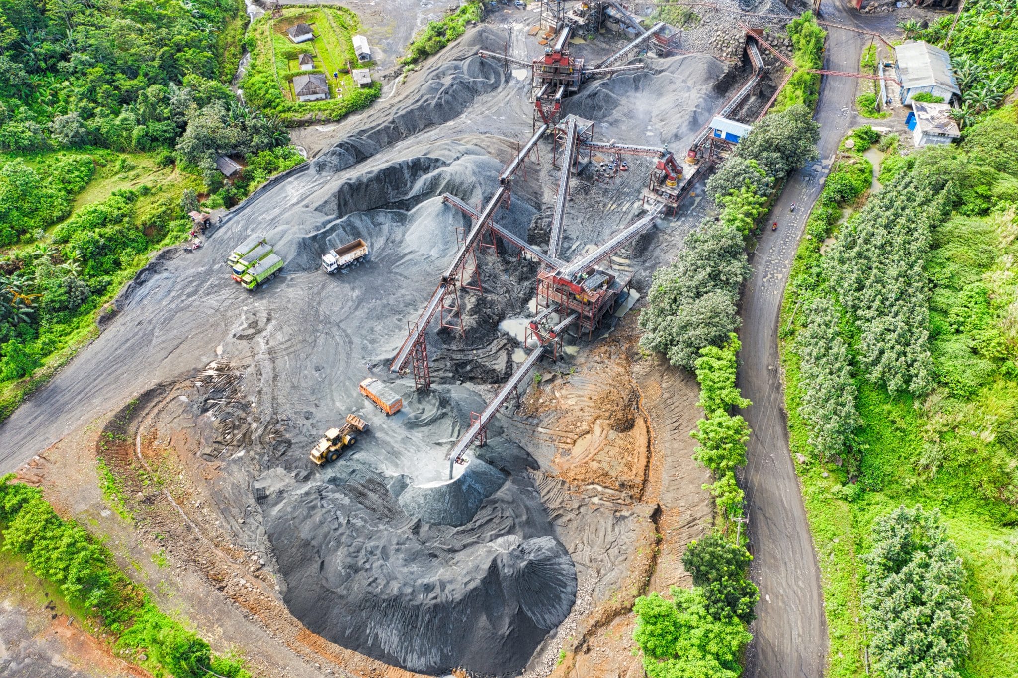
Mining and aggregates:
The digital terrain models created with the help of photogrammetry help mining operators obtain quick information regarding areas to be excavated. Operators have easy access to up-to-date calculation of stockpile volumes, not only improving consistency in inventory reports but also speedy validation of the amount of material moved by subcontractors.
-
-
-
Waste management:
Digital surface models help site managers optimize their landfills by monitoring capacity and providing an accurate density reading for specific cells. Photogrammetry data allows site managers to make strategic decisions about where teams should spend their time, where to build new cells, and many other important choices.
-
Key Benefits of Drone Photogrammetry
Faster Data Collection Across Large Sites
Drone photogrammetry enables teams to capture accurate site data significantly faster than traditional ground-based methods. Large construction sites, quarries, and landfills can be surveyed in a matter of hours, allowing teams to access up-to-date information without disrupting ongoing operations.
Reduced Need for Repeated Ground Surveys
Because photogrammetry captures comprehensive visual and spatial data in a single flight, teams reduce the need for repeated site visits. This improves efficiency while ensuring stakeholders can revisit historical site conditions without sending crews back into the field.
Improved Safety by Minimizing Site Exposure
Drone-based data collection reduces the need for personnel to access hazardous or unstable areas of a worksite. By capturing terrain and surface conditions remotely, teams can maintain visibility while lowering exposure to heavy equipment and active work zones.
High-Resolution Visual Documentation
Photogrammetry produces detailed orthophotos and 3D surface models that provide both measurement accuracy and visual clarity. These outputs improve collaboration between field teams, project managers, and stakeholders who rely on clear site documentation.
Repeatable Measurements Over Time
Because drone photogrammetry follows consistent flight paths and processing workflows, it enables repeatable data collection throughout a project lifecycle. This makes it easier to track progress, verify quantities, and compare changes in terrain conditions over time.
Automating Drone Photogrammetry Workflows
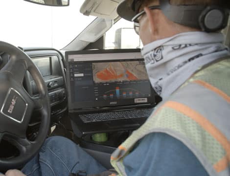
While drone photogrammetry offers clear advantages, traditional processing workflows have historically required significant technical expertise and time. Automated processing tools reduce manual steps, enabling survey teams to focus on analysis rather than data preparation.
Automated workflows with the help of advanced technology solutions like Propeller PPK enable survey teams to bypass manual processing and analysis headaches and take advantage of photogrammetry technology to create accurate and reliable 3D maps of their worksites.
Even on large-scale sites like quarries or major civil construction projects, the mass of photos and data can be processed quickly, delivering high-quality topographic renderings that can be used by all stakeholders to inform project status and future decisions.
Propeller helps teams automate drone photogrammetry processing while maintaining survey-grade accuracy. Even on large-scale sites, thousands of images can be processed efficiently, delivering reliable terrain data to help make project decisions.
Frequently Asked Questions
What is photogrammetry used for?
Photogrammetry is used to create accurate maps, surface models, and measurements from photographs. In construction and mining, it supports earthworks planning, stockpile measurement, and site progress tracking.
What are the three types of photogrammetry?
The three primary types of photogrammetry are aerial photogrammetry, terrestrial photogrammetry, and satellite photogrammetry. Drone photogrammetry falls under aerial photogrammetry and is commonly used for surveying and mapping.
How accurate is drone photogrammetry?
When combined with GPS correction methods or ground control points, drone photogrammetry can achieve survey-grade accuracy. Actual precision depends on flight planning, site conditions, and processing workflows.
Is photogrammetry better than LiDAR?
Photogrammetry and LiDAR serve different purposes. Photogrammetry excels at high-resolution visual surface modeling, while LiDAR can penetrate vegetation and capture bare-earth data more effectively in certain environments.
What software is used for photogrammetry?
Photogrammetry software processes overlapping images to generate orthophotos, point clouds, and 3D surface models. Platforms like Propeller automate this workflow while delivering survey-grade accuracy for construction teams.
See how Propeller simplifies drone photogrammetry workflows and request a demo to experience the platform in action.