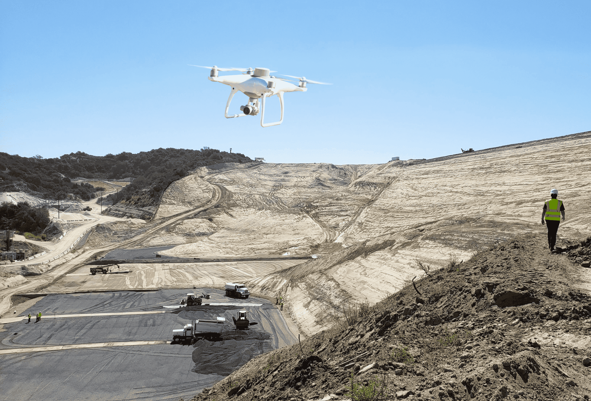
The Phantom 4 RTK drone, DJI’s first survey-focused UAV, has become a workhorse for the civil construction, aggregates, mining and waste management industries. So, what has made the Phantom 4 RTK popular among site work professionals? The answer: a precise imaging system capture ability that tags images with positional data in real time.
The difference RTK makes
With the introduction of the Phantom 4 RTK (P4RTK), DJI has brought surveying workflows closer to real-world accuracy than ever before—unparalleled accuracy within 1/10ft (3cm).
To achieve centimeter-level positioning data, the P4RTK uses a TimeSync system to coordinate its camera and RTK module, ensuring the most accurate geospatial information is tagged to each and every image. In addition, TimeSync centers the positioning data to the optical center of the camera, which helps ensure image data accuracy is maintained during processing.
The real-time geotagging, plus corrections from a base station on the ground, means unprecedented reliable data accuracy for your drone surveys. Now, surveyors can weigh what’s collected in the sky against what’s collected on the ground to form a single source of locational truth.
Benefits of flying the Phantom 4 RTK:
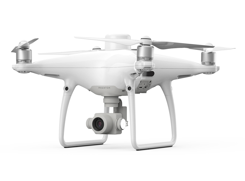
Superior image quality: With its precise imaging system, the P4RTK combines a one-inch, 20-megapixel CMOS sensor; a mechanical shutter that improves the capture of moving objects; and an aerial-optimized wide-angle lens with a 24mm focal length, to deliver you clear, consistent images every time you fly.
Intelligent flight modes: Flight controllers can direct the P4RTK’s flight by simply tapping on a point on the controller screen, drawing a path with their finger, or by instructing it to follow the most direct path “home” to the base station. Alternatively, users can upload a predetermined flightpath beforehand by uploading a KML file or using the ActiveTrack mode to automatically follow designated objects.
A remote controller designed for professionals: The Phantom 4 includes a microSD card slot, high-quality speaker, and hot-swappable batteries, so users don’t lose connection to their drone if they need to change the intelligent flight batteries mid-flight.
1/10ft accuracy, every time you survey
In the past, worksites juggled speed and accuracy; quick data collection meant compromising accuracy. Because traditional surveying was time consuming and costly, worksites weren’t surveying frequently enough to extract as many useful progress-tracking metrics as they wanted.
Surveyors were caught in a stalemate with their data collection methodology. Walking a site, shooting points, and establishing ground control could take days, sometimes weeks depending on the site acreage.
With its high precision mapping capability, the Phantom 4 RTK has helped provide balance between quality and pace, reducing survey time to a matter of hours, without forfeiting accurate metadata.
Today, surveyors can gather accurate data as often as they want to fly a mapping mission with their drone, obtaining accuracy down to 1/10 of foot.
With more available time, surveyors can direct their attention to their core strength—site analysis, leveraging collected data to make observations about efficiency and progress.
Paving the path for PPK
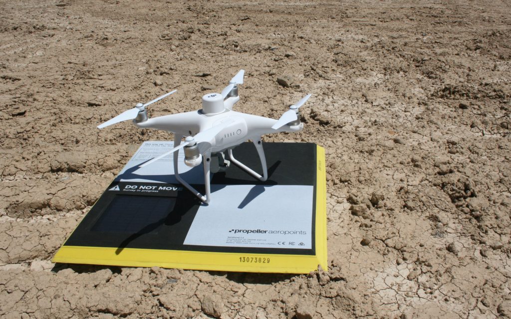
The P4RTK inspired Propeller to develop an accurate surveying solution where hardware and software became fully integrated. DJI and Propeller combined forces in 2018, to bring a seamless flyover-to-processing workflow to market, Propeller PPK.
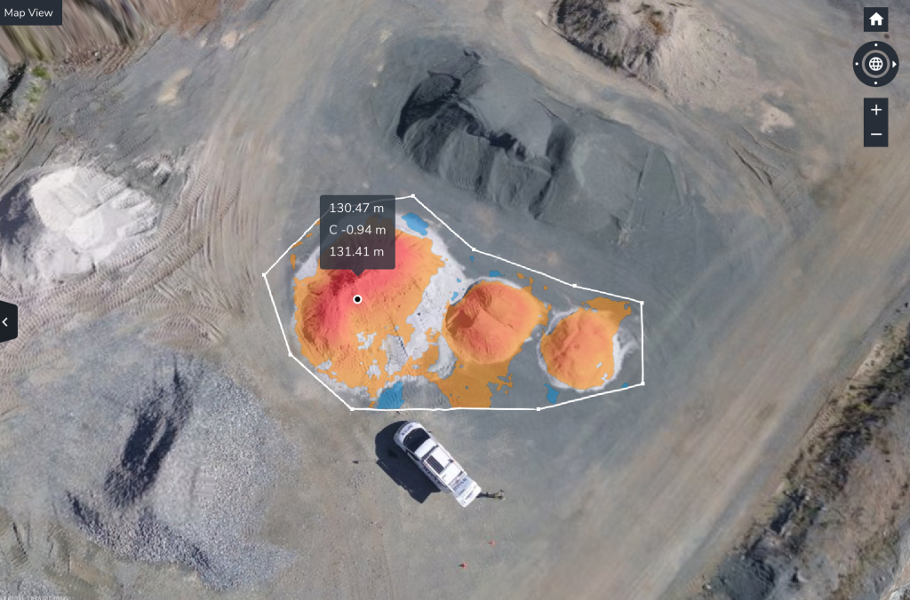
Propeller PPK combines the P4RTK with 1) AeroPoints, our “smart,” high-precision ground control points, and 2) the Propeller Platform, a cloud-based application for processing, mapping, measuring, and sharing aerial data. When we join these elements together, they form a singular worksite management solution that’s easy for new users to integrate into their workflow.
With more consistent ground control comes more accurate data. And with more accurate data site managers have the capacity to better understand their material movement, risk assessment, and cross-team collaboration.
Integrating AeroPoints into surveying workflows also means less time traveling around busy, dangerous worksites, placing ground control points.
With less time on site, those managing drone operations—who typically also have other duties ranging from machine control to modeling—can focus more of their attention on leveraging collected data to improve efficiency and decision making.
Justin Russell, head surveyor at Fiore and Sons, describes how he’s reallocated his time after successfully adopting PPK drone surveying.

Where to go from here?
The surveying professional is only one part of a very complex network of individuals that includes foremen, clients, contractors, and tradesmen. They may have been the initial aerial data gatekeepers, but now, Propeller’s primary users are tying their moving parts together using 3D drone models.
Some of our customers have shared their P4RTK and Propeller PPK success stories with us, painting a picture of where they started and how far they’ve come with Propeller PPK. Here are just a few of their stories:
- Summit Excavation’s Improved Earthmoving Calculations with Propeller and DirtMate
- Digging in with Propeller: Sheckler Excavating’s Improved Landfill Earthmoving
- RIPA & Associates Works Smarter and Finds Better Project Collaboration Using Drone Technology
- California Landfill Calculates Remaining Airspace, Tracks Compaction with Propeller
Propeller and the P4RTK give construction, aggregate, landfill, and mining sites the tools they need to break down informational silos and solve site data collection challenges.


