Try Propeller Today
Propeller’s tools streamline site management with powerful features.
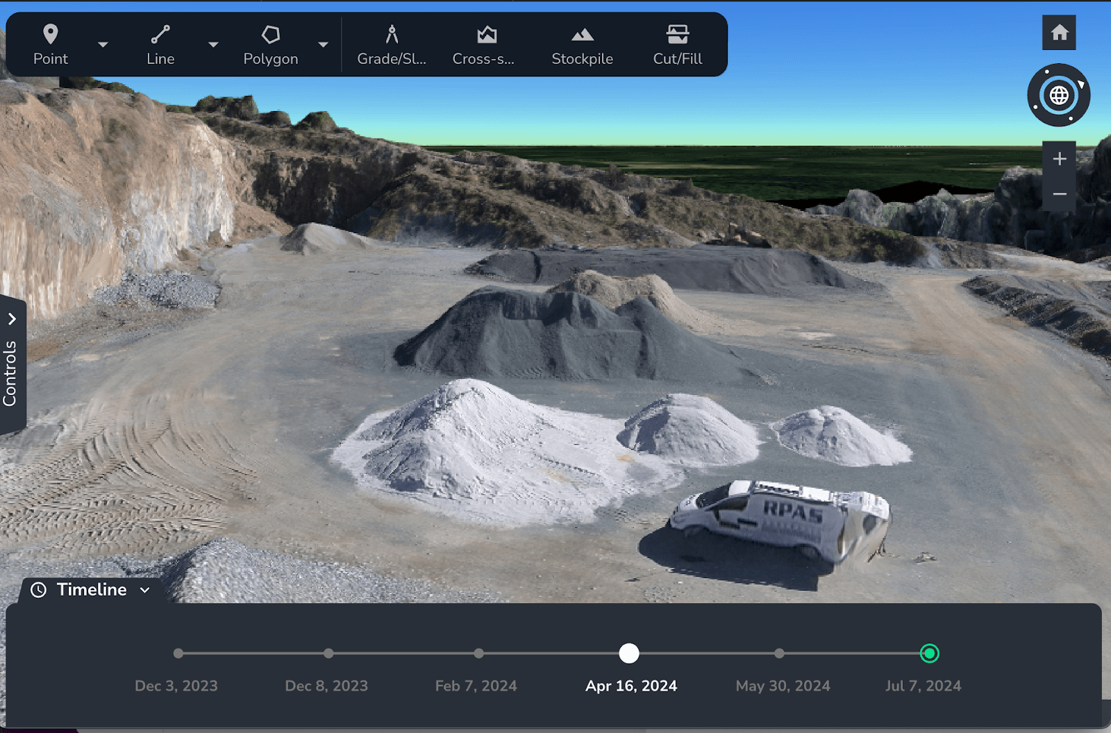
MAP 3D visualization lets you explore your site, monitor progress, identify hazards, and overlay 2D/3D models. The Timeline tool creates time lapses to track milestones, update stakeholders, and ensure transparency. Surface comparison monitors terrain changes and progress against design plans.
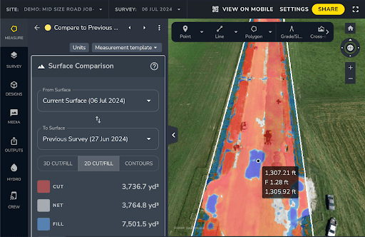
MEASURE tools provide accurate elevation checks, stockpile volume calculations, and cut/fill measurements to track material movement and control costs. Cross-section analysis ensures design accuracy and highlights elevation changes.
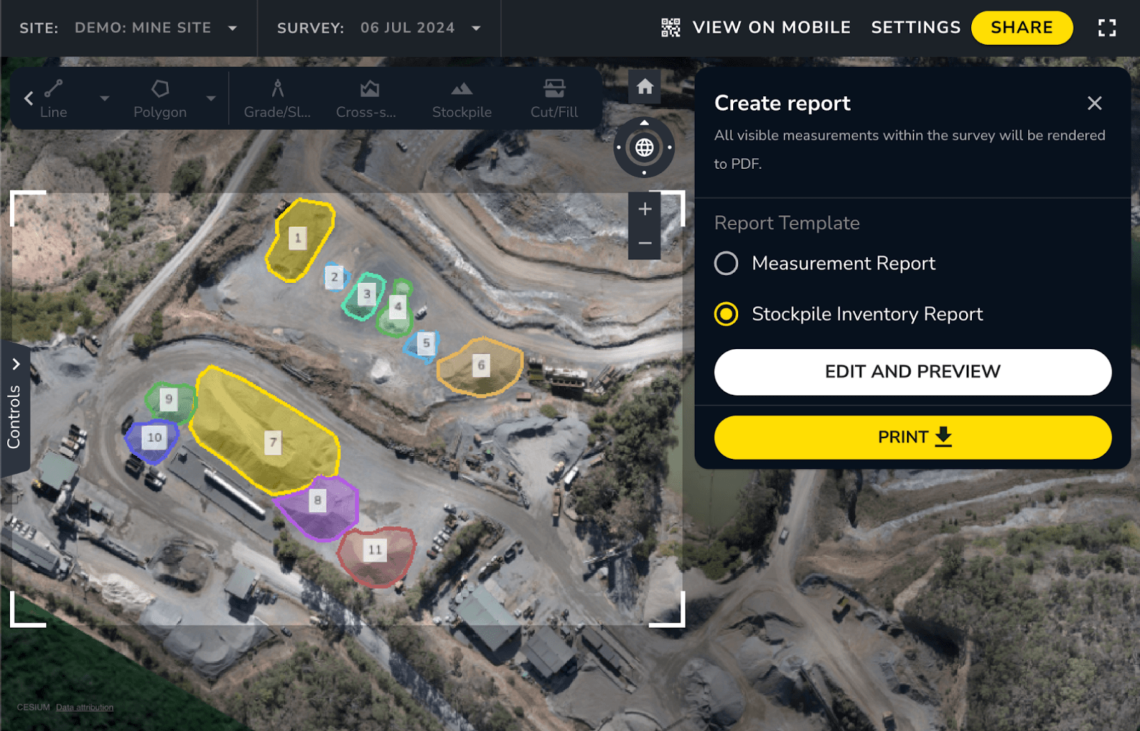
With MANAGE, share data effortlessly through PDFs, detailed maps, and time lapses for clear communication and proof of work. Simplify site management today—try Propeller for free!
Ready to simplify your site management?
Prefer talking to an expert instead? Contact us.
Everything you need to know about Propeller.
Learn how you can map, measure, and manage your worksite with Propeller.
Map
3D visualization
- Explore your site from every angle
- Visualize progress, identify safety hazards, and monitor site activity
- Simplify remote management for a virtual on-site experience
- Overlay 2D linework and 3D models for easy reference
Measure
Understand every level of your site
- Check elevations and compare with design files
- Calculate stockpile volumes and track changes
- Track material movement and calculate volumes
- Visualize site progress and confirm accuracy
Manage
Data sharing
- Create PDF reports in seconds for quick sharing
- Share views easily on mobile or with your crew
- Export detailed maps with designs for clear communication
- Create and share time lapses, measurements, and more as proof of work
Your geospatial data hub.
Make the map a meeting ground where your project teams can access critical insights on their own.
Manage AeroPoints usage, monitor hardware health, and run accuracy diagnostics from a personalized dashboard.
Scale up at your own pace, without adding resources. Just drag and drop your dataset into Propeller, and we’ll send back a high-accuracy 3D map in return.

Production teams use the DirtMate Dashboard to track daily volumes and access productivity insights.
