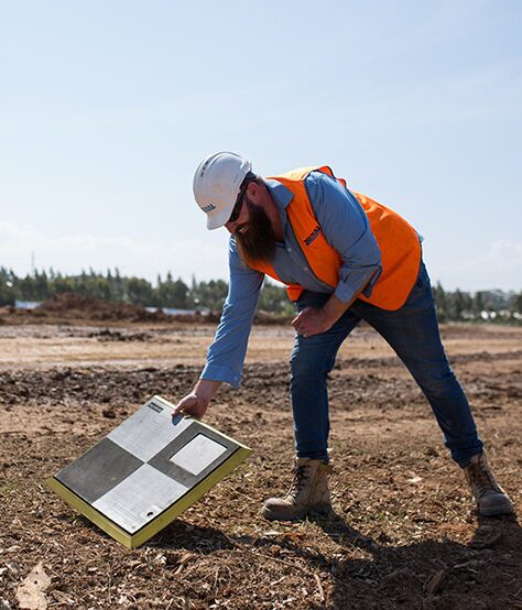
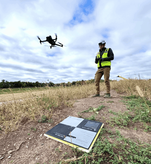
“It’s the accuracy of the AeroPoints that works for us. Some companies rely on RTK, but we want reliable, accurate results. Fixed ground control doesn’t work for construction due to there always being material moved.”
Drone Manager
Helsinki, Finland
DroneDeploy gives imagery.
Pix4D gives photogrammetry.
Propeller gives answers.
While DroneDeploy is great for basic imagery it is limited for decision making. Pix4D proves strong on processing but weak on field alignment. Propeller combines high-precision survey, live machine telematics, and daily field updates into one platform for smarter, faster decisions.
| Capability | DroneDeploy | Pix4D (Mapper / Survey) | Propeller |
|---|---|---|---|
| Primary focus | Visual site capture across multiple industries | Photogrammetry tools for survey work | End-to-end earthworks execution and quantity tracking from pre-construction through closeout |
| Processing | Cloud processing that prioritizes visual outputs | User-configured processing with manual setup | Automated cloud processing with built-in quality checks and expert verification |
| Accuracy | Relative accuracy dependent on GCP workflows | High-precision results when configured by experienced users | High-precision results by default using SmartCheck ground control and Trimble integration |
| Ease of use | Basic workflows for visual site capture | Requires training and technical expertise | Map-first workflows designed for both field and office teams |
| Key features | Flight automation, site imagery, general reporting | Point clouds, advanced modeling, manual editing | Cut and fill maps, volumes, progress tracking, integrated Trimble TTM surfaces |
| Best for | Teams needing site visuals without detailed execution data | Survey specialists requiring full control over technical outputs | Earthmoving teams needing reliable data to guide daily decisions and verify work |
DroneDeploy and Pix4D help teams capture great images and process point clouds. They’re solid tools for imagery and photogrammetry, but they don’t solve daily earthmoving workflows.
Propeller is built for the demands of earthwork. You get survey grade accuracy, daily verification, real time machine telematics, and a unified map that shows what is really happening. When the job is fast moving and high pressure, flight logs and stitched photos are not enough.
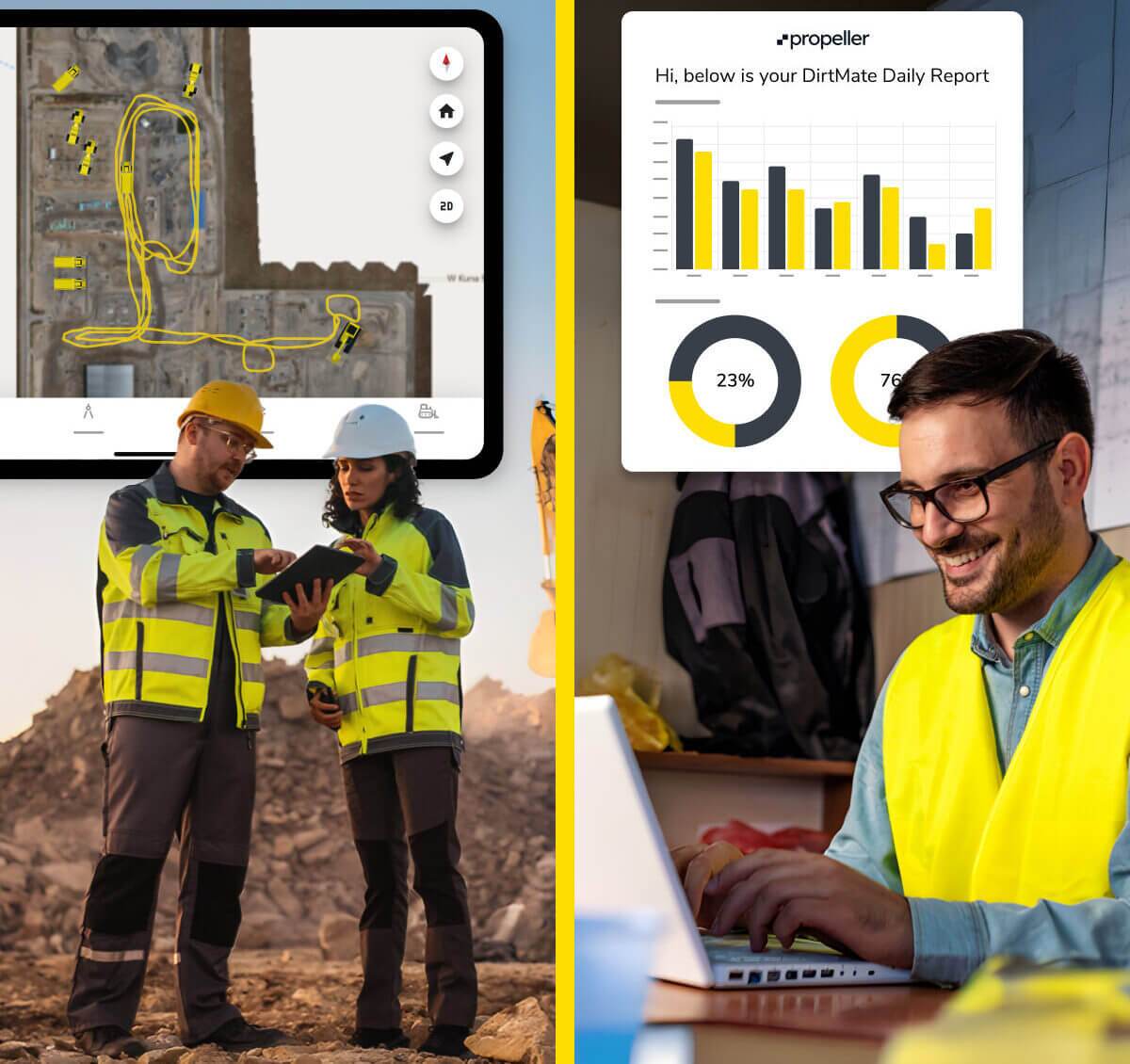
Propeller delivers complete documentation of cost and progress every single day. Operators see where to focus. Foremen confirm work against design before they move to the next task. Project managers know exactly what was accomplished and what still needs attention.
DroneDeploy and Pix4D can show where the drone flew.
Propeller shows daily site status: what’s built, what’s left to move, and how machines are performing.
Most disagreements, delays, and rework begin with unclear information. DroneDeploy and Pix4D were not built to show daily truth on a jobsite. Without integrated telematics and survey grade terrain, teams rely on estimates and assumptions.
Propeller removes the uncertainty that creates avoidable cost.
With Propeller:
“It’s the accuracy of the AeroPoints that works for us. Some companies rely on RTK, but we want reliable, accurate results. Fixed ground control doesn’t work for construction due to there always being material moved.”
“Propeller has changed the way our site department does business, and we have tried multiple platforms and drones. The Propeller PPK workflow changed the game for us.”
“Once you’ve used Propeller, you don’t want to use anything else again. It’s so easy!”
“I don’t know of a platform out there that is as good and as accurate as what Propeller can do.”
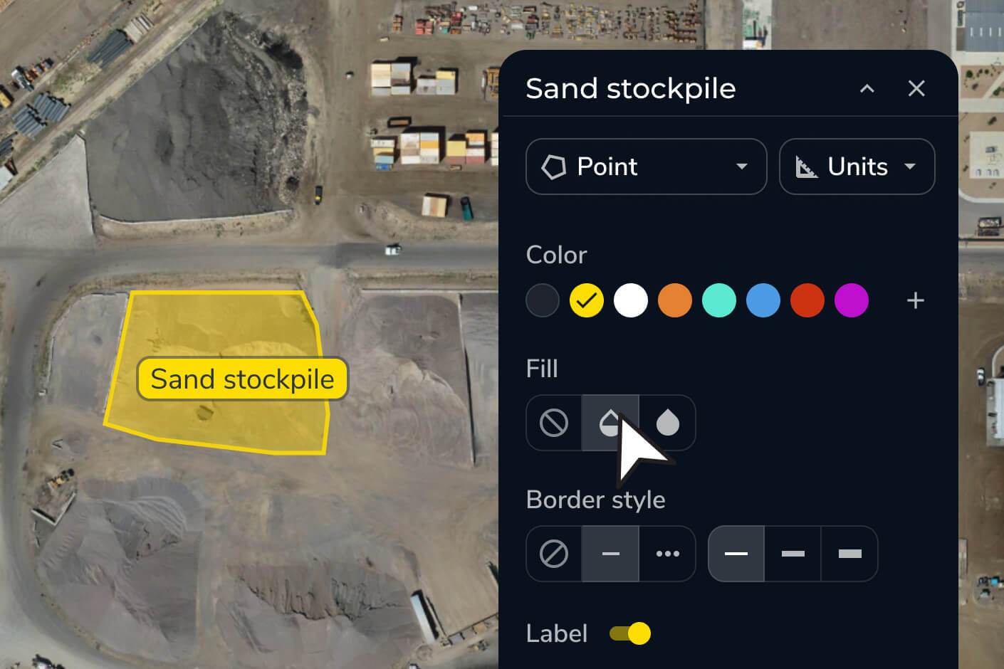
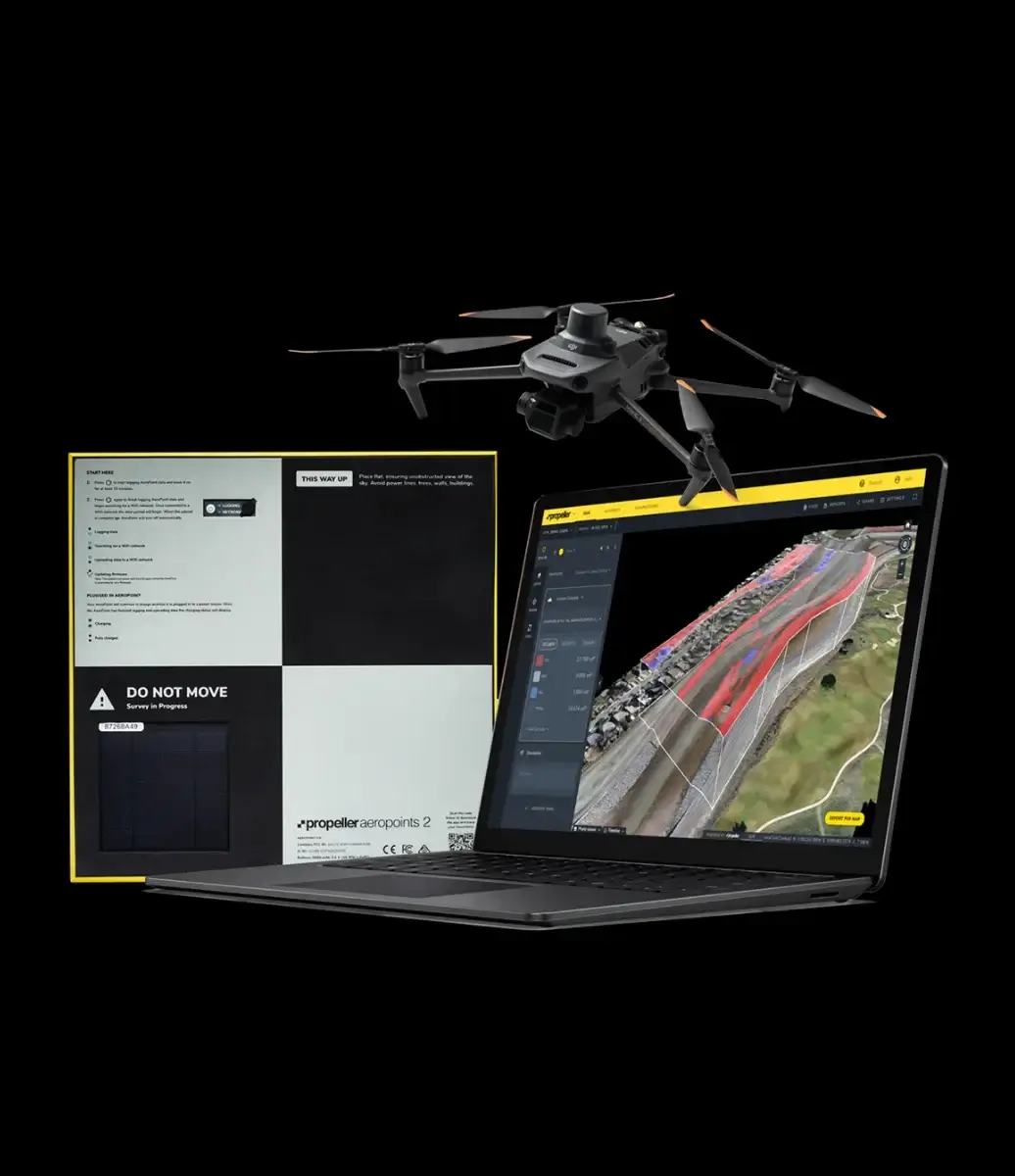
Turn site data into visual insights. Build accurate maps that unify different data sources and document your work from planning to closeout.
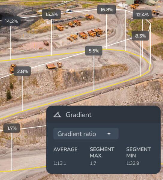
Get precise measurements across your site. From distances and volumes to heights and grades, measure exactly what matters.
Monitor progress and know your position. See trends, identify issues, and ensure your projects stay on track.
Streamline your workflows. Keep projects tidy, permissions secure, and data easy to access when and where you need it.
Stay ahead of site challenges. Analyze flow, elevation, and runoff to predict outcomes and make smarter decisions.
Bring your teams together. Share data, reports, and visuals that connect the field to the office, keeping everyone aligned.
