High-precision drone surveying services for engineering firms
Stop slowing down your field and office teams. Propeller provides the reliable data you need to move faster, from initial site planning to proving progress. Capture, process, and share high-precision survey data with total confidence.

Survey-grade accuracy meets engineering excellence
Engineering decisions are only as good as the data behind them. Propeller provides high-precision drone maps that merge aerial capture, smart ground control, and automated processing into a single, trusted platform with 3 cm accuracy.
Using high-accuracy PPK drone data and survey-grade processing, engineering teams can confidently replace or supplement traditional methods. The result is faster access to trusted data, clearer communication with stakeholders, and fewer surprises downstream.
This is survey-grade drone mapping for engineers, without the friction.
How Propeller transforms surveying workflows
Propeller is designed to support the way engineering firms actually work, from the field to final deliverables. Everything is connected, consistent, and easy to verify.
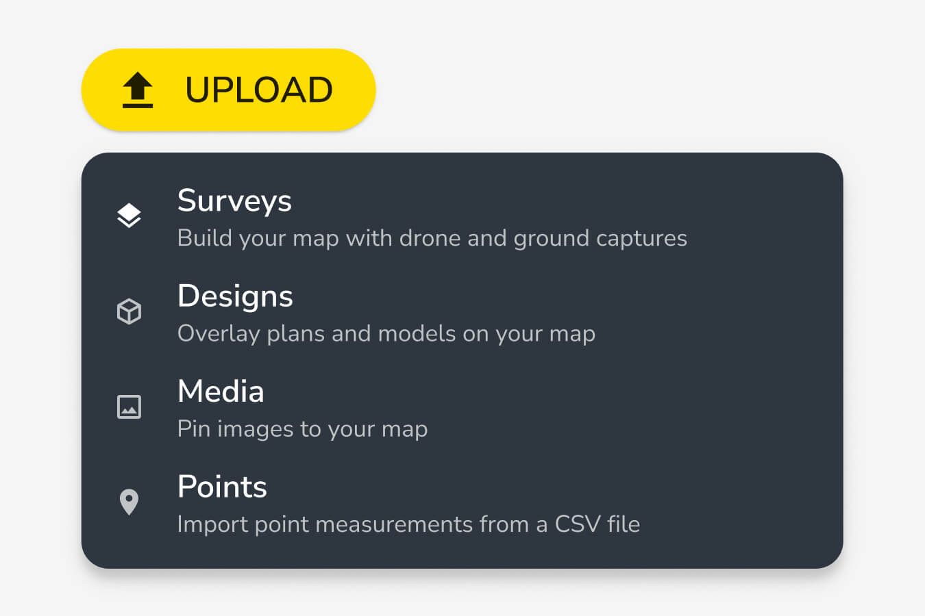
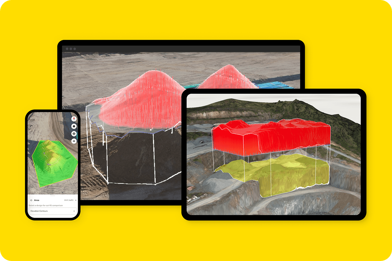
Automated data processing and analysis
Propeller’s photogrammetry services for engineering teams remove manual processing bottlenecks. Upload your drone data and Propeller handles the heavy lifting, producing clean, accurate outputs you can trust.
Engineers and surveyors get fast access to:
- High-precision orthomosaics
- Surface models and contours
- Volumes and measurements
- A clear visual record of site conditions
All processed consistently, so every survey tells the same story.
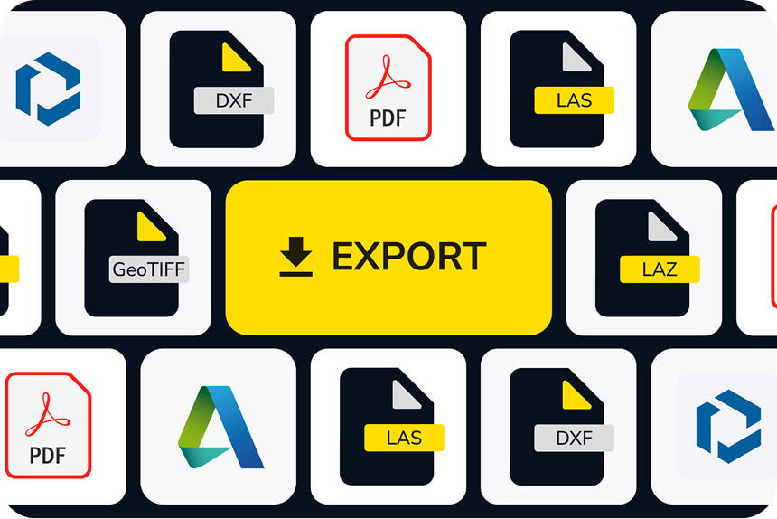
Seamless integration with CAD and BIM software
Drone surveying services should fit into your existing toolchain, not disrupt it. Propeller integrates directly with the software engineering teams already rely on.
Export data into:
- Civil 3D
- AutoCAD
- Revit
- Bentley systems
- Trimble workflows
This makes drone mapping for surveyors and engineers practical, not theoretical. Designs, surfaces, and measurements flow cleanly from field capture into engineering deliverables.
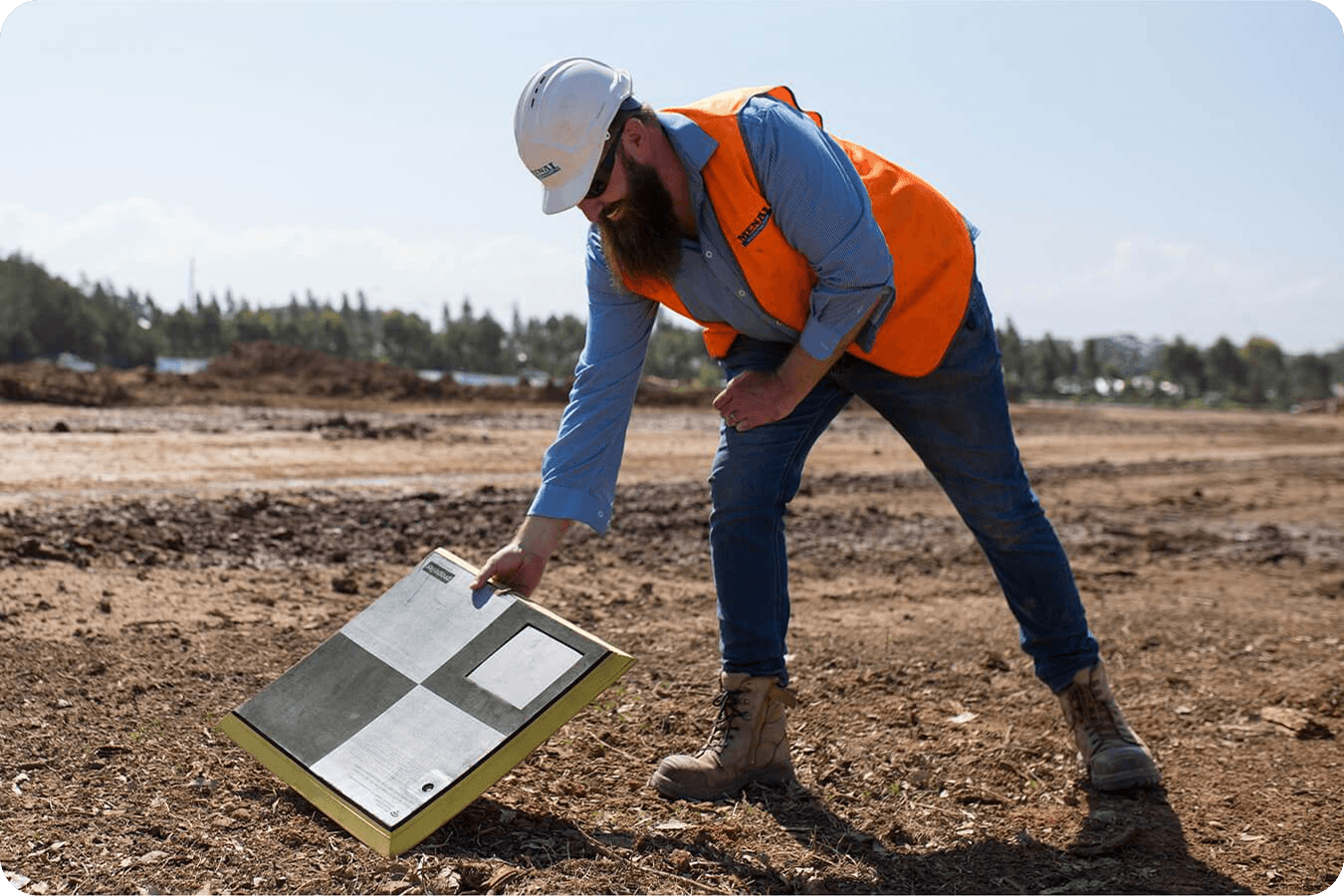
Smart ground control with AeroPoints
Ground control shouldn’t slow your team down. AeroPoints simplify high-precision control without the time and coordination overhead of traditional GCP workflows.
With AeroPoints, engineering drone surveys benefit from:
- Fast, repeatable site setup
- Consistent control across repeat flights
- PPK drone mapping services built for accuracy and scale
It’s a smarter foundation for reliable survey data.
Engineering applications and use cases
Propeller supports a wide range of engineering drone survey applications, helping teams work faster while maintaining confidence in their results.
Topographic surveying and site planning
Capture detailed site conditions quickly and turn them into surfaces and contours ready for design. Propeller enables aerial surveying for engineering firms that need dependable topo data without extended field time.
Use drone data to:
- Validate existing conditions
- Support early-stage planning
- Reduce reliance on repeated ground surveys
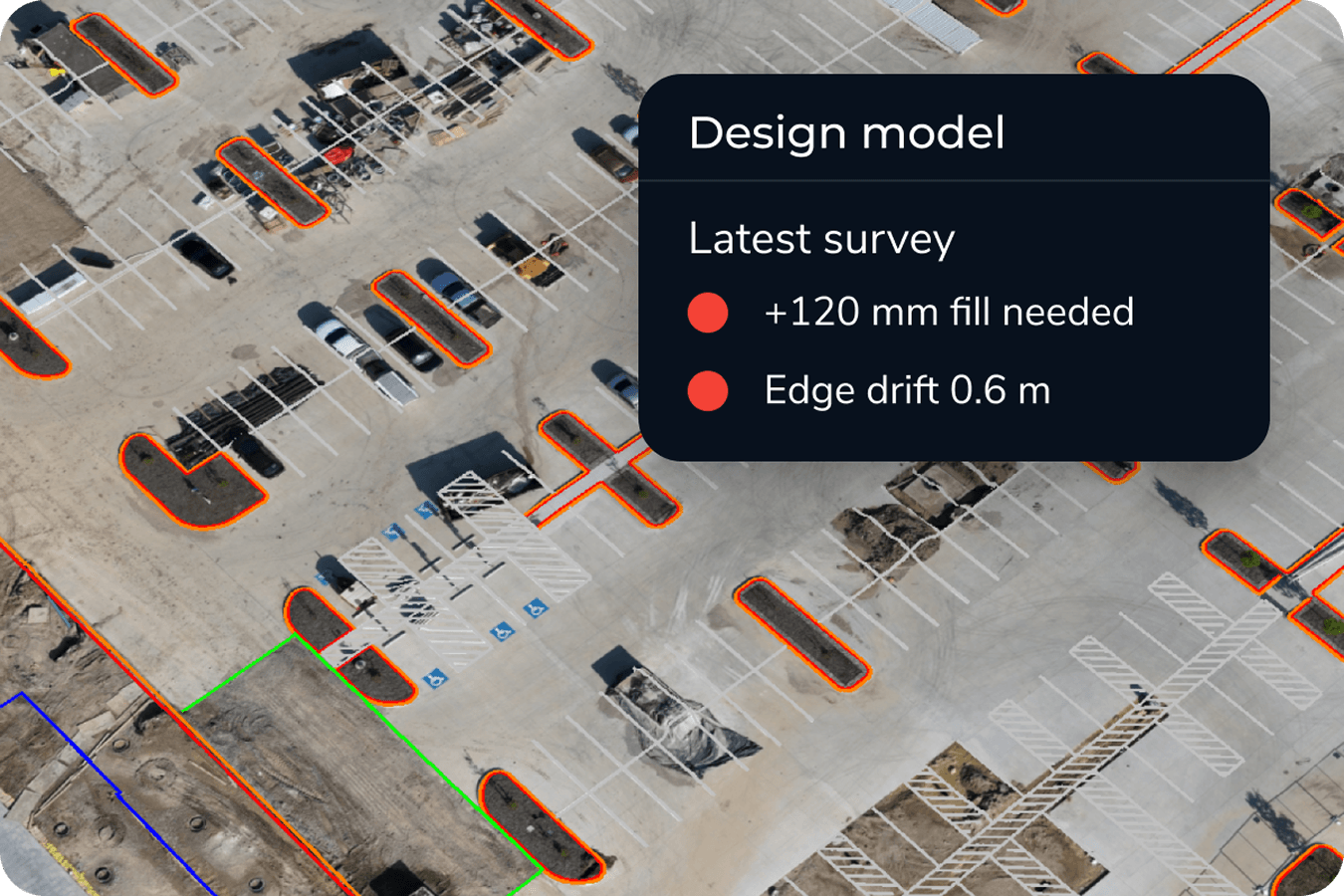
Construction progress monitoring
Engineering teams need clear visibility as sites change. Propeller makes it easy to document progress, verify quantities, and keep a visual record of work completed.
With engineering drone surveys, teams can:
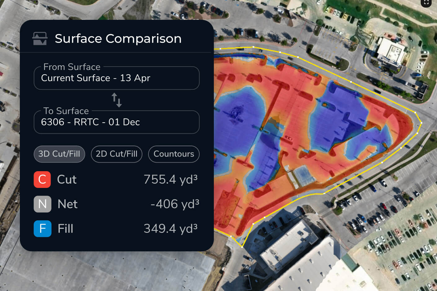
- Track earthworks and grading over time
- Compare surfaces against design
- Share clear updates with clients and contractors
All from a single source of truth.
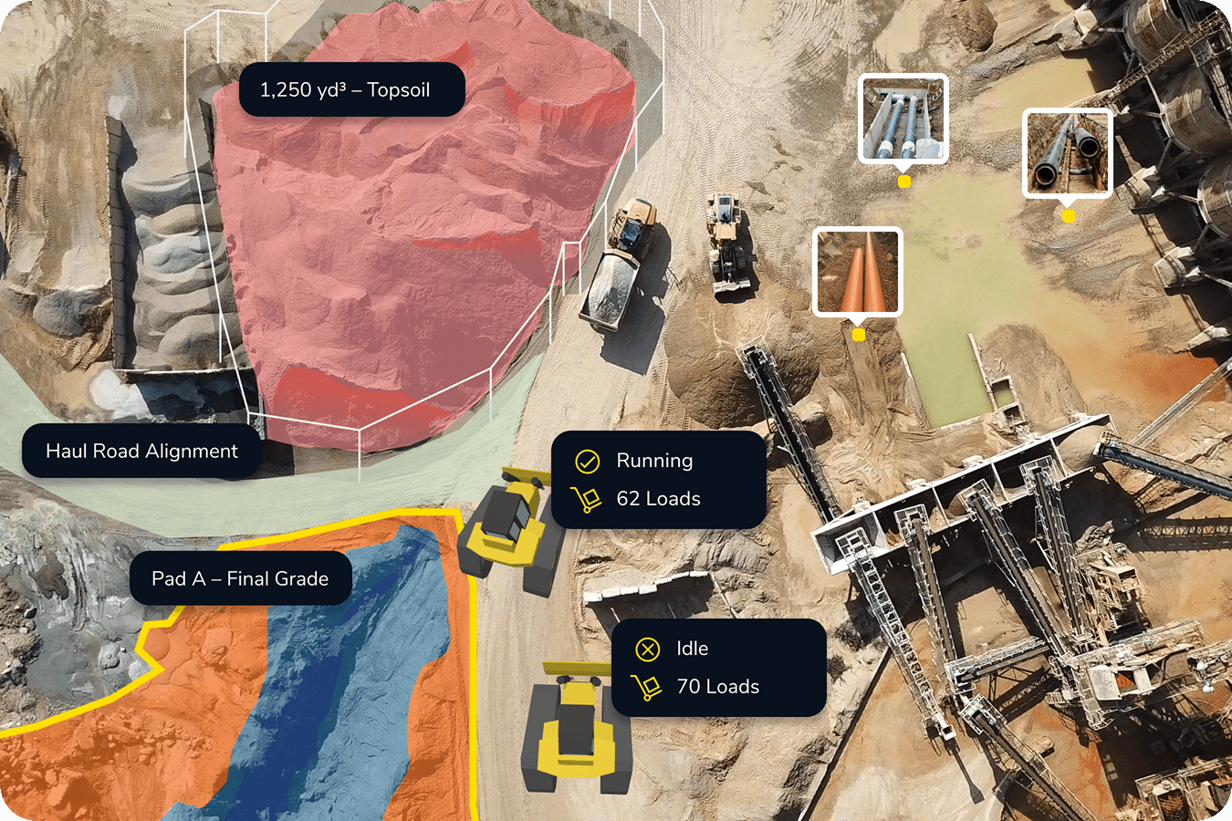
Smart ground infrastructure asset documentation control with AeroPoints
From roads to utilities, Propeller helps engineering firms maintain accurate records of existing assets. Drone mapping creates a comprehensive visual reference for planning, reporting, and managing risk.
This is especially valuable when conditions change or questions arise later.
Why engineering firms choose Propeller
Engineering firms choose Propeller because accuracy alone is not enough. They need clarity, consistency, speed, and confidence at every stage of a project.
With Propeller, teams get:
- High-precision drone surveying services built for engineering standards
- Workflows designed for repeatability and trust
- A single platform for capture, processing, and collaboration
- Data that engineers, surveyors, and clients can all understand
Propeller is professional drone survey solutions for civil engineering teams who want better data and fewer unknowns.
Get started with survey-grade drone data
Whether you are expanding your surveying capabilities or modernizing existing workflows, Propeller makes it easier to deliver accurate, timely results your clients can rely on.
See how Propeller’s drone surveying services for engineering firms can support your next project and beyond.