Construction disputes are not uncommon. Given the sheer number of stakeholders involved in a project—from general contractors and subcontractors to engineers, surveyors, project managers, and others—the chances of a dispute are inherently high. Add the challenges associated with manual data entry and rudimentary communication channels, and the difficulty in resolving those disputes can be extremely frustrating.
What causes disputes in construction
Disputes can plague even the most well-planned project, and they can be costly depending on who is at fault. Here are just a few of the most common causes of construction disputes:
- Differing site conditions. Before boots and wheels ever hit the ground on a construction site, construction teams need an accurate assessment of the site as it stands to make an informed bid for the project. Initial topo (topographic) data from clients is often grossly inaccurate, leading to disputes down the road when discrepancies in soil condition, subsurface conditions, unexpected obstructions, and other challenges arise.
- Timeline delays. Delays are par for the course in the construction industry—there are very few projects that follow an agreed-upon timeline from start to finish. There are several factors that can delay a project, from budget conflicts and labor shortages to change orders and environmental issues.
- Discrepancies in contractual obligations. A thoroughly vetted contract is essential when it comes to avoiding conflicts down the line. Sometimes, a well-worded contract isn’t enough, and if any party involved in a project fails to live up to their obligations, other parties usually seek recourse—even after a project is complete.
How to resolve construction disputes
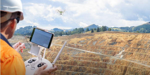
Drone data has proven to be a reliable source of information that contractors look to when addressing worksite disputes. In fact, one in four Propeller customers reported that they have successfully resolved a contractor dispute using drone data.
Drone surveying provides an accurate, bird’s eye view of what’s happening on the ground. By leveraging drone survey data, all stakeholders can access a centralized, unbiased source of truth for progress over time, enabling execution of designs with greater precision, and providing a critical view into the project that allows contractors to catch errors before they become disputes in the first place.
Resolving disputes requires a clear communication and documentation plan. For example, your team should:
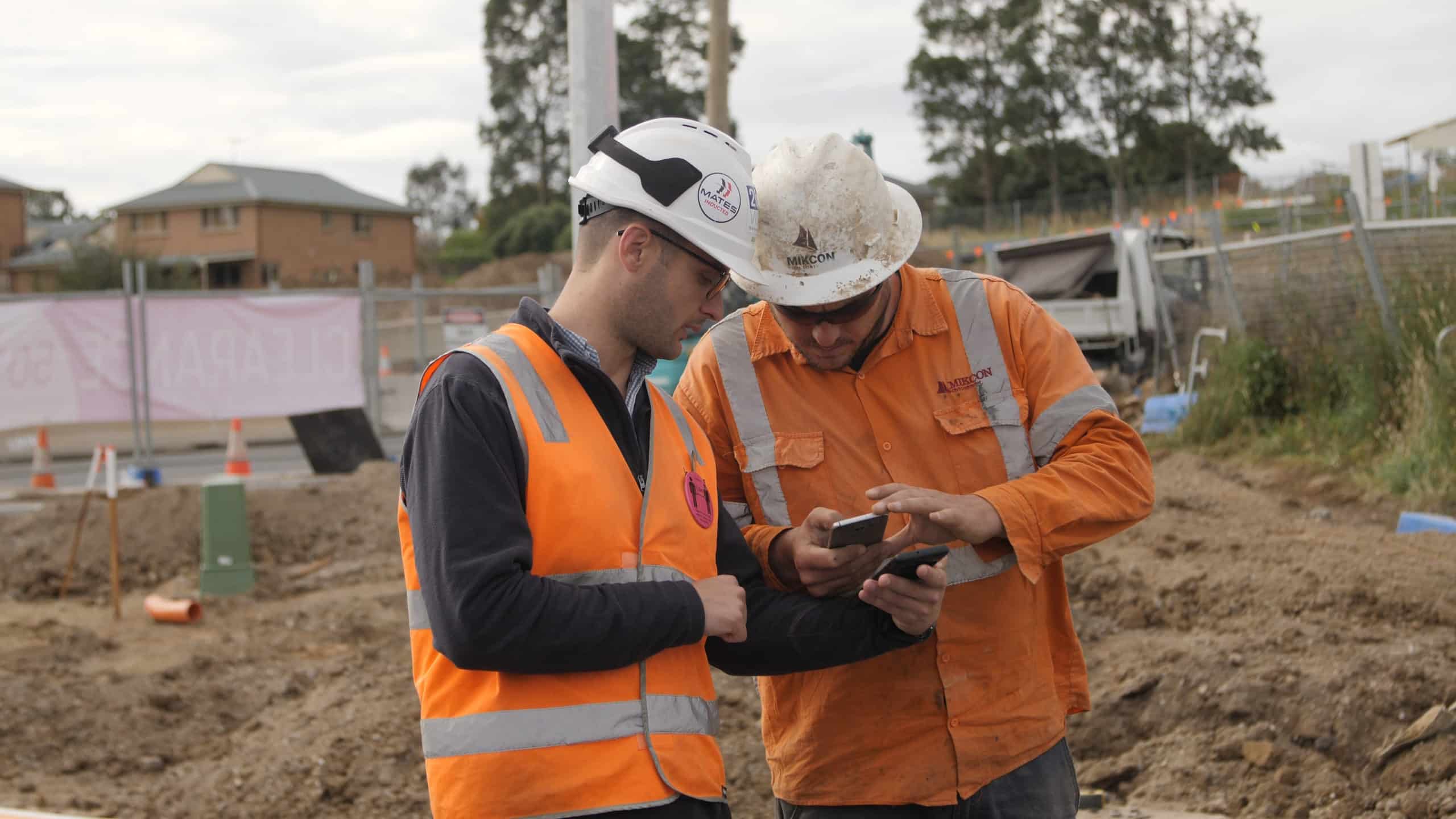
- Prioritize clear communication. All parties involved in a project, from clients to project managers, surveyors to engineers, need to maintain constant communication from start to finish. Clear communication is essential to the success of every project. Set up a transparent communication hierarchy and make sure everyone involved, from the newest laborer to the board of directors, understands who to talk to and how to ask for help when they need it.
- Maintain accurate records. One of the worst mistakes you can make as a contractor is having a normal “gentleman’s agreement.” From notices, letters, emails, photos and more, keep a paper trail to remove any doubts about agreements made between parties. Always get everything in writing—or at least in the cloud. Maintain thorough records of the site as it stands at every point of the project, using clear documentation that can be easily reviewed.
- Follow the contract. Always stick to your end of the bargain, and make sure all involved parties fully understand the contract that’s in place. If changes are made during the project lifecycle, make sure they’re negotiated and understood.
Now, let’s take a closer look at 4 ways we’ve seen clients resolve conflicts with drone data.
#1: Capture initial worksite conditions in pre-bid and takeoff surveys
At Propeller, we’re huge advocates for surveying a site at the earliest opportunity. Conducting your own survey before you move an inch of dirt—or even submit a bid—has several benefits.
Early drone surveying helps project managers create a realistic budget and timeline.
With an accurate assessment of site conditions and the work to be done, project managers can craft an achievable project plan.

Pre-bid and takeoff surveys also help prevent data discrepancies that could become client conflicts down the road.
Conducting your own early-project surveys ensures that your team understands real-time site conditions before work begins, preventing arguments down the line about pre-existing issues. An initial time-stamped survey offers proof of any conditions that existed before your team started work.
Additionally, drone survey data can be used to provide evidence of material movement required to match a requested grade. Complete a simple volume comparison, including photorealistic 3D images, to show clients exactly how much material needs to move (and get paid accordingly).
#2: Establish consistent record of progress
Drone surveys conducted at the start of a project and at regular intervals throughout the course of the work provide a historical record and a consistent (and reliable) record of progress over time. Should a dispute arise, contractors can revisit the relevant site survey to address any concerns.
According to a report released by PwC, using drones throughout a construction project provides a valuable record of all work activities, reduces planning and survey costs, increases efficiency and accuracy, and eliminates disputes over project status.
Material movement is a great example of a common worksite dispute. For example, a contractor gives a customer an estimated volume of earth they’ll need to move for a project. After work starts, they may discover that they’ll need to move more dirt than expected. To get paid for that additional work, they need to be able to prove that it happened.
With historical progress tracking through software features like Propeller’s Timeline, contractors can compare the most recent survey to any survey completed in the past. The Polygon tool allows users to calculate cut/fill on any area of any survey. The Line tool provides an easy way to view the elevation history of any point on site.
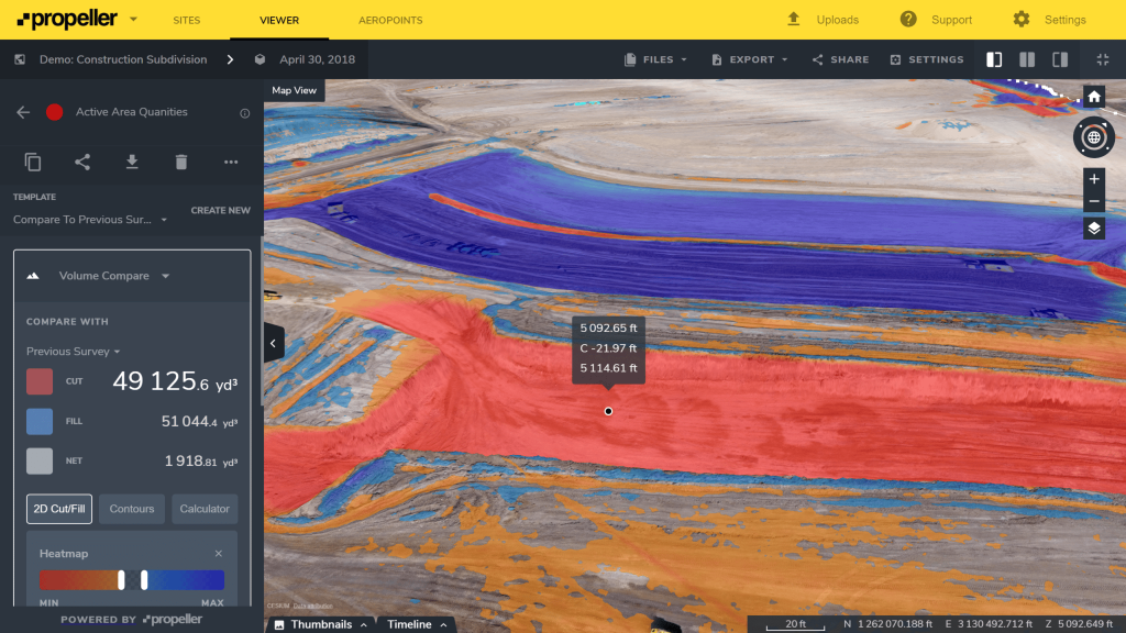
Accurate records take all the ambiguity out of a conflict and rally both sides around a single source of truth. Shared facts (including survey-grade measurements and photographic evidence) are much harder to question or misinterpret than personal anecdotes or hand-written haul records.
According to Propeller customer Mats Nyland, Propeller has made his job easier when it comes to visualizing and conveying progress to both his team and his clients.
“Every 14 days, when I sit down with the clients, I put [Propeller] on the big screen and talk my way through the project. If you have 10 people sitting in a room [imagining what I’m saying], then you probably have 10 different stories afterwards. But if you can visualize it and they can see it, then they can understand it.”
#3: Pinpoint the source of issues
Accurate records established with drone data also enable contractors to quickly identify and address project errors or concerns.
Historically, it’s been difficult (if not impossible) to trace the root cause of worksite errors, especially when several subcontractors participate in a project at different stages. Lots of different firms and a lack of documented evidence creates a significant source of conflict—and without evidence to prove who was at fault, these conflicts often end up in court.
Drone survey data provides clear, accurate, unbiased, and easy-to-understand documentation of every stage in the project. This allows both contractors and clients to review projects and pinpoint the source of an error or concern. Many times, this information can prevent further legal action, enabling parties to settle the worksite dispute out of court (saving a lot of money in the process, too!).
#4: Deliver accurate worksite progress and avoid change orders
The phrase “change order” is enough to make any construction team flinch. Whether it’s an adjustment to the design, budget, or schedule, any midstream change to a project is inconvenient at best and expensive at worst.
If a client’s request is too costly, or entirely outside the agreed scope of work, conflicts can arise and work can grind to a halt. Keeping machines cold and workers idle for too long gets expensive quickly.
Photogrammetric data from drones enables teams to execute work with greater accuracy, making change orders less likely. And if the need does arise, drone data makes it easier to renegotiate potentially problematic changes.
When you’re never more than 24 hours away from accurate survey data, you can execute more effectively and make better decisions at every project stage.


