It’s no secret that collecting accurate, up-to-date project data—and then processing, analyzing, and distributing that data to field teams—has been a headache for earthworks operations for decades (and probably even centuries).
Fortunately, we’ve seen an interesting shift over the past several years: the digitization of worksite surveying techniques.
In our 2018 Earthwork Report, the professionals we surveyed cited lack of technology as one of the biggest obstacles in their path. Fast-forward to 2020, when we conducted the survey again, and 90% of the worksites surveyed planned to increase their technology spending.
We’ve seen digitization in the construction industry increase year over year, with earthworks companies embracing technology like drones to help guide worksites toward greater productivity and efficiency.
A recent Gartner study also stressed the need to innovate and modernize businesses in all industries through technology. Across the board, 76% of CIOs reported increased demand for digital products and services in 2020, and 83% expect that demand to continue rising in 2021.
With construction technology moving up and to the right in both adoption and usage, we thought now would be a good time to retrace our steps from where we’ve been to where we are today.
Here’s how technology has changed surveying over time—and where we think the industry is headed next.
Traditional surveying techniques
For many decades, sending a professional survey to walk a site with a base and rover was the only reliable method for collecting accurate survey data.
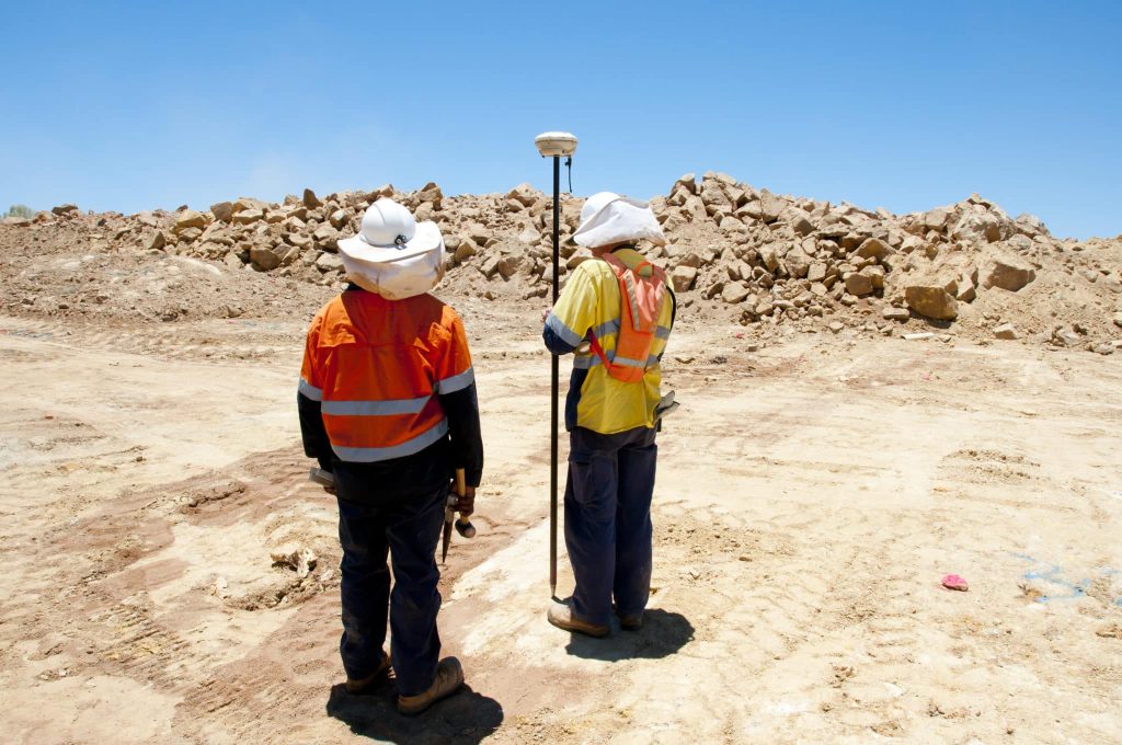
On the plus side, the data was accurate—so long as workers used ground control points (GCPs) correctly.
But the list of cons was long:
- Heavy and expensive equipment
- Sending personnel out onto dangerous terrain
- Painstaking placement (and replacement) of GCPs
- Trained surveyors required to conduct and interpret each survey
- Hard to read data or compare against design, except with specialized CAD software
Surveys were cumbersome and expensive, and couldn’t be conducted very frequently as a result. Surveying even a small site still took a lot of time—and that’s not including the office time involved in processing survey data into final linework and surfaces. It simply wasn’t feasible to cover large sites regularly.
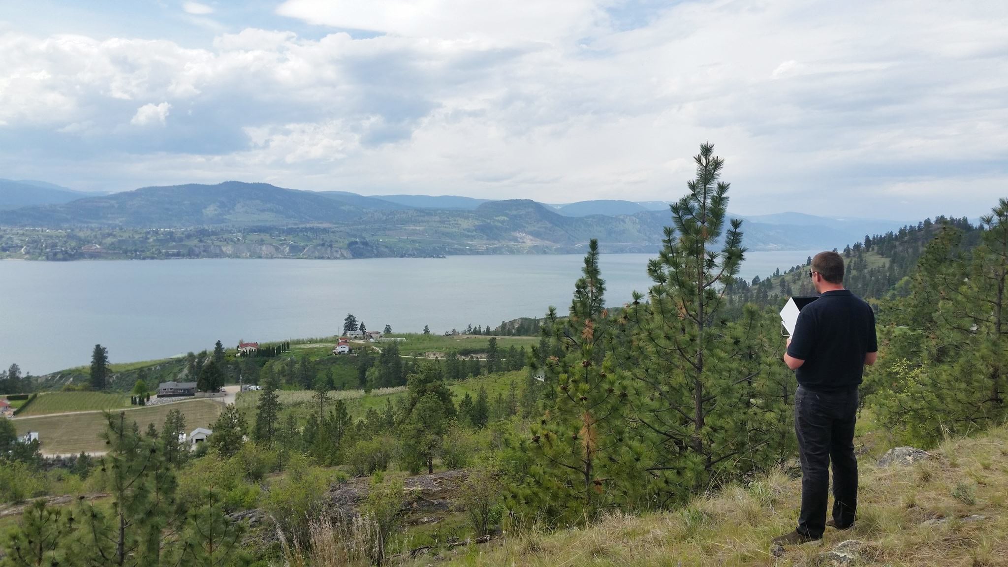
Early drone surveying techniques
When drones first flew into the surveying scene, they were met with skepticism—partly because the construction sector is famously slow to adopt new tech, and partly because drones were expensive. It took a few years for manufacturers to assemble the right combination of affordability and accuracy.
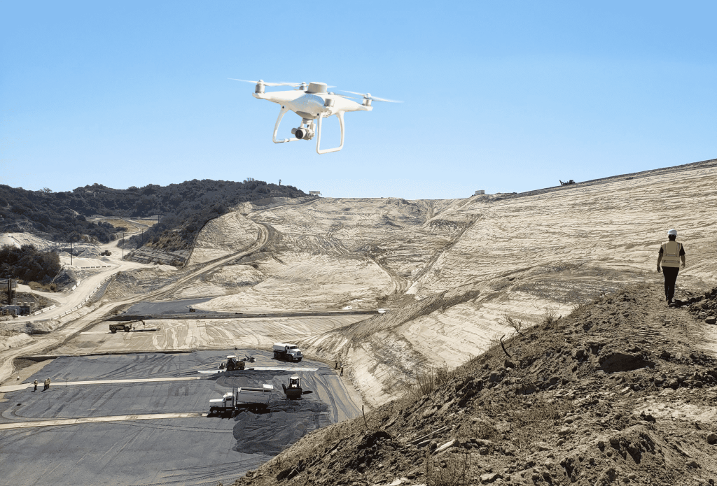
Civil contractors were among the earliest adopters of drones. They saw the potential right away: a visual overview of an entire worksite in just minutes, processed in a digital platform where the data would be easy and quick to distribute to field teams.
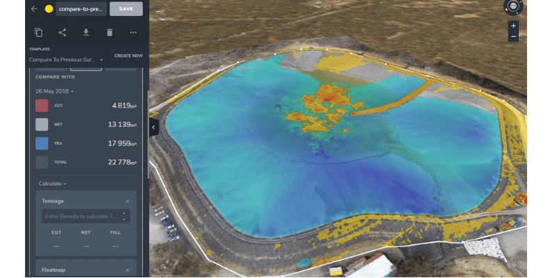
Unlike traditional topographic survey data—which is basically a set of linework—drone surveys provide an orthophoto, contour map, digital terrain model, and dense point cloud. The result is a highly visual dataset that’s ready for analysis.
And while it took a couple of years for drone surveying to achieve survey-grade accuracy, the technology evolved right alongside surveying techniques and other earthworks processes.
Here at Propeller, we’ve relied heavily on customer feedback to continually improve our products. Innovation is an inherent part of what we do—and thankfully, our customers have been willing partners.
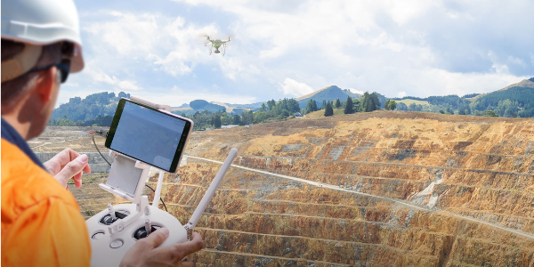
Today, using drones with a platform like Propeller empowers earthwork professionals to create accurate estimates, track progress, and make data-driven decisions in real time. This can save a major civil construction project millions of dollars—and that’s not an exaggeration.
Leveling up with Propeller PPK
If you’re wondering why drones struggled to achieve survey-grade accuracy initially, it all goes back to the base station setup used for years in traditional surveying.
Geolocating a moving target like a rover (or a drone) only works accurately when you can measure the distance between that target and a fixed, known point on the earth’s surface, like a base station or a GCP.
Without the base station technology to accurately position the drone in space, images captured in the early days had less accurate GPS locations attached to them.
Then Propeller PPK entered the scene.
Propeller PPK is a workflow that uses onboard real-time kinematic (RTK) processing on a drone. RTK technology geotags images during flight with an added boost from an active base station on the ground.
Propeller PPK (post-processing kinematic) allows you to skip ground control and use a single smart ground control point as your base station. The drone doesn’t need to maintain an active signal with the base station during flight; just fly the drone for about 10 minutes, and we’ll process your data for you in 24 hours with accuracy up to 1/10 ft.
Read this post for more on how PPK works.
Drone surveying today is just as accurate as traditional methods, but far quicker and more cost-effective. There’s no need to shoot GCPs, and the cloud-based software can be accessed instantly by anyone who needs to see it. No more extensive training or expensive licensing required.
Surveying has never before seen this combination of ease and accuracy—and that’s just the beginning.
What’s next for worksite surveying techniques?
Now that the technology is there, we expect to see it grow much more predictive on earthworks sites.
If you always have the current status of a site at your fingertips, it’s easy to imagine a future where you can proactively identify (and eliminate) risks. Determining whether you need to add a machine, or if someone’s been digging in the wrong place, or how best to balance your cut/fill will all become infinitely easier.