Drone technology has changed the way the heavy civil and earthworks industries survey their worksites. Unmanned aerial vehicles (UAVs) and unmanned aerial surveys enable faster, less costly surveying without sacrificing accuracy. They require minimal special training and education to operate, so you can collect the data as often as you wish—and do it without putting your workers in harm’s way, reducing safety risks. With drones becoming affordable, mainstream worksite tools, getting more frequent and more accurate site data is easier than ever.
Having site data that’s up-to-date also means spotting problems before they become expensive or result in rework. It means tighter planning and budgeting and better contractor management. Drone-captured survey data, processed correctly, can boost team accountability, communication, and collaboration.
Here, we’ll take you in-depth on how drone surveying works and explain concepts like photogrammetry, point clouds, orthophotos, and ground control. We’ll explain how drone data is processed and share examples of how real companies in the civil construction, aggregates, mining, and waste management industries are using drones to increase efficiency, lower survey costs, and reduce safety risks.
Traditional earthworks progress tracking
When asked which metric is most important to them, earthworks professionals have overwhelmingly answered “material moved” – literally how much earth is cut, filled, scraped, hauled, dumped, blasted, or paved. Quantities are surveyed and compared to original designs, and every subsequent survey, to track site progress and get an accurate picture of changes to surfaces on site. The accuracy of those measurements is the difference between a profitable job and money-losing one.
One popular way of capturing accurate measurements is to employ two Global Navigation Satellite Systems (GNSS) receivers that use signals from satellites to determine an exact position on earth. One receiver is known as the “base” (or GPS base station) and is placed over a point with known coordinates. This base does not move and is continuously receiving positioning data from satellites and sending those signals over a network (radio, cellular, or satellite) to a second GNSS receiver called the “rover,” which is manually moved around the site and captures location data. Why do you need a second GNSS receiver? A normal GPS receiver, like the one in your car, will give you a location within about 10 meters of accuracy, which is not considered survey-grade accuracy and cannot be used for civil construction or earthworks.
The rover captures its own satellite signals and communicates with the base to correct inaccuracies in positioning caused by atmospheric, satellite orbit, or timing errors. Combining data from both the base and rover provides positioning accuracy within a few centimeters, which is considered survey-grade accuracy. Drones with GNSS receivers that replace manual rovers, along with unmanned aerial surveys, are becoming a trusted way to scale the speed and frequency that surveys can be produced. Crews can survey a site in minutes as opposed to hours or days, without sacrificing accuracy.
Not only has the need for data accuracy increased, but so has the need to share that data across an organization, from the field to the office. Manual processes, inaccurate measurements, miscommunications, and information silos can result in inaccurate bids, costly rework, and even contractor disputes. Drone surveying software platforms like Propeller enable sites to not only survey more frequently with less cost, but also share that data among project stakeholders.
Why accuracy and collaboration matter?
When you have an open stream of communication between teams on site and back at the head office, everyone is more aware of what’s going on in a particular project.
The simple checks and balances enabled through frequent, accurate survey reporting save time and money on any project. The more people who are paying attention, the faster issues can be spotted and the faster they can be resolved. This preventative mindset can only happen when crews have access to reports that are accurate, easy to understand, and provide insights to help make good decisions. Accurate 3D drone survey data, combined with platforms that make that data shareable across the organization, make visualizing sites very straightforward and as close to the real world as possible.
According to AGC’s 2021 Construction Hiring and Business Outlook Report, nearly 70% of constructors use cloud-based mobile software for easily shareable daily reporting – a considerable increase from just a few years ago. A JLL State of Construction Tech report shows a massive boost in digital collaboration post-pandemic, due largely to cloud-based software.
Here are some of the many measurements now being tracked and shared using drones and survey software:
- Existing/original ground check (initial topo vs engineering or survey topo)
- Progress quantities (survey over survey cut/fill)
- Tonnage measurements and inventory value calculations
- Current conditions vs final/finished grade
- Stockpile quantities
- Trenching quantities
- Slope gradient requests
- Distances (for projects such as pipe laying)
- Square footage for concrete laid
- Verification of truck counts
Conditions change rapidly on construction sites, and making decisions on data that is weeks or months old can lead to errors. Because drone surveying takes significantly less time—both in collecting data and processing it—you can have updated information about your site much more frequently. This improves reporting and collaboration because you’re seeing things much closer to real time.
Using 3D data captured by a drone, you can produce a model that’s visually recognizable and can then be used for easy communication by anyone on- or off-site. You can have a visual conversation with your team with relevant data and reports. Because the model is 3D and uses up-to-date photographs, it’s easy to recognize how the design relates to the current state of your site.
For off-site users, like contractors, designers, or head office personnel, using a 3D site model provides a realistic alternative to costly in-person visits. An accurate and up-to-date model, rich with context provided by notes and shared files, enables off-site users to move around freely, getting a whole site perspective on how things work.
How drone surveying works?
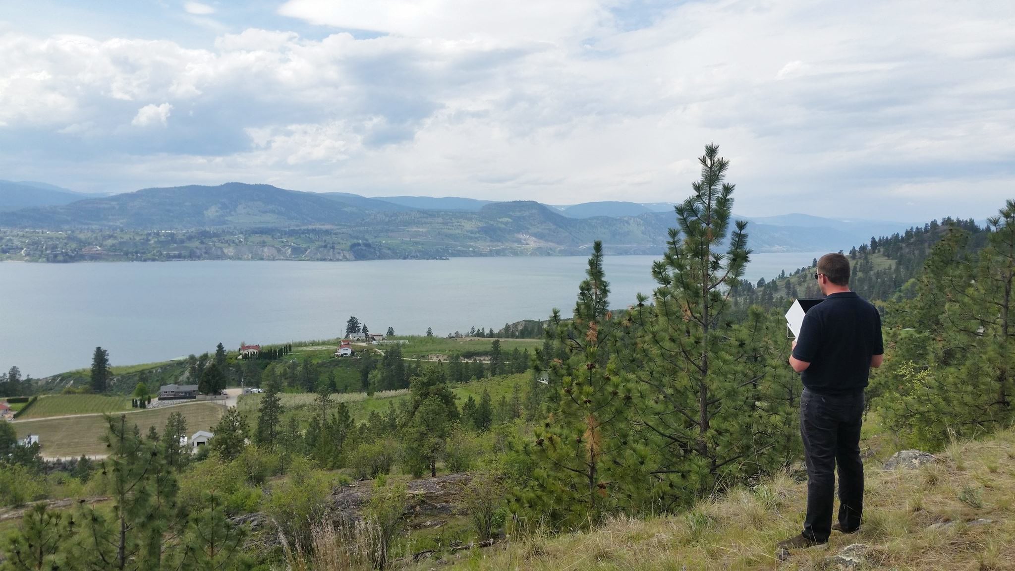
Drones used for surveying are equipped with onboard cameras that take photos of the ground from different points in the air. Images are tagged with geo-coordinates that are captured by a GNSS sensor on the drone, indicating exactly where that image is located in space. The image is “fact-checked” against known points on the ground using RTK or PPK processing (we’ll dive into the difference between RTK and PPK processing later on).
A single drone flight collects hundreds or even thousands of images that are then processed with photogrammetry software that “stitches” the images together to create geo-referenced orthomosaics or 3D models of a work site. Through unmanned aerial surveys, those 3D maps can then be analyzed to get detailed information about project quantities, distances, elevations, and inventory. By collecting this data at regular intervals and comparing those maps to design files and previous surveys, companies can confidently and accurately track changes and progress. Because drones can fly at a much lower altitude than manned aircraft or satellites, they are able to capture highly detailed information much faster and less expensively than a base and rover. Drones are also able to collect aerial images from terrain that could be hazardous and dangerous for a human to survey manually on foot.
The role of ground control in drone surveying
In traditional drone surveying, you need a sufficient number of known points to verify and pin down your drone imagery to the ground. This is because a drone without kinematic processing capabilities is only capturing 2D site imagery.
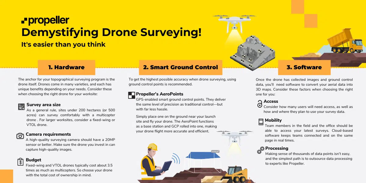
When an image’s position in the sky is not accurately geotagged, you don’t get reliable positional data from the hardware used to collect the imagery alone; that accuracy comes from ground control. The points used to reference positions on the ground are called ground control points (GCPs), which can be known points marked and measured with base and rover or a moveable smart ground control point like Propeller’s AeroPoints. If you’re working with known points, a surveyor typically has to physically walk a site, shoot the points with a rover, and mark them for visibility.
Not only are the mechanics of this process time-consuming, the overall time investment increases dramatically with the site’s physical size. Not to mention that it adds safety risks for personnel who have to walk an active site, traverse hazardous terrain, or access almost unreachable areas of a site. (Think dangerous spots, like a 400-foot cliff that may be unstable in a mine.)
What is smart ground control?
If you’re working with smart GCPs like AeroPoints, you simply place the hardware in an optimal distribution across the entire surveyed area. This is crucial, much more so than the number of GCPs in a particular location. Essentially, you’d need to create a shape bounding your site and distribute GCPs using survey best practices—hitting the lowest and highest elevations.
Once AeroPoints are in place, the process becomes infinitely simpler. The AeroPoint is equipped with a GPS receiver collecting locational data throughout the duration of the flight. Activation is only a single-button operation to start logging the data. When your drone survey is complete, pressing the single button again will submit the data to Propeller via WiFi signal, typically a hotspot on a cell phone.
Photogrammetry: How drone images become a 3D survey?
At its most basic, “photogrammetry” is the science of gathering information about an object or environment by using photos. Photogrammetry is used in drone surveying to measure geography and landscapes by analyzing and processing hundreds or thousands of overlapping aerial photos taken by a drone. When you combine enough overlapping images of the same features, photogrammetry software can be used to generate photorealistic 3D representations of topographic surfaces and features.
As an example, the human eye uses stereoscopic techniques to see in 3D and understand depth. Think of your eyes as two cameras, each taking in a view of your surroundings from slightly differing angles. If you were to focus on an object in front of your face and view from each eye individually, you’d notice the object “moves” location in your vision. When viewing the object with both eyes simultaneously, your brain merges both views into a single, three-dimensional perspective, creating an impression of depth. This is similar to how drone-based photogrammetry works—however, instead of having two cameras on constantly, one camera (on the drone) captures the images as it flies the site, and the photogrammetry software combines those images to create depth/3D information through unmanned aerial surveys.
If you took an average image from a survey, you’d easily be able to pick out many “features” between different photos. The more features you match, the better you can relate images to one another and reconstruct objects pictured in them.
With a lot of these features—think millions—you can create a “cloud” of points. Each point has a matched feature describing your surveyed area in that location. You can then turn your point cloud into any regular outputs used in geospatial software, like a 3D mesh or digital elevation model (DEM).
 RTK and PPK: What are they and how are they different?
All drone images taken in a survey need to be reviewed and corrected for positioning inaccuracies. Real-time kinematic (RTK) processing on a drone and post-processing kinematic (PPK) are both workflows used to ensure survey-grade accuracy but work in different ways.
First, a bit of context. RTK describes onboard drone hardware that allows the drone to communicate with a base station in real time to validate its location in space. RTK processing means the process of correcting positional information in real time during the drone flight through unmanned aerial surveys.
The biggest challenge with RTK processing is that it requires the drone (or rover) to be in constant communication with the base station. Any signal interruption, even momentary, can create significant data loss, which results in inaccurate survey maps. Unfortunately, drones can often lose signal connection for a variety of reasons, which makes data unreliable as a result. Terrain, buildings or other obstructions, a decrease in signal strength, or increased distance from the RTK station can all interfere or decrease the reliability of connection between a UAV and its RTK base stations. Unfortunately, you are likely unaware that disruption has occurred until you begin processing the data.
Because of this, drone surveys are increasingly being processed using post-processing kinematic (PPK), which uses a ground control point and an RTK-enabled drone to correct the positioning data after the flight. After the flight is completed, those two sets of GPS data are matched up using a timestamp, which is recorded when the drone takes a picture. Now that we know the offset after the fact, the initial, less-than-accurate on-board GPS data is then overwritten, giving precise geotags for the imagery. With PPK, there is no need to maintain connection between the RTK base station and the drone during flight. For these reasons, Propeller recommends PPK over RTK for drone surveying on any site, including construction sites, mines, aggregates, and landfills.
Here’s how they stack up side by side:
RTK
- Requires stable radio link to receive base station data, which is processed during flight
- Correction data and initialization loss results in reduced percentage of accurate camera positions, which is necessary for site survey rendering
PPK
- No data or initialization loss by signal link limitations, as with RTK technology
- All captured data processed with similar algorithms to RTK, run back and forth through the data
- Overall, ensures the most reliable results possible survey over survey
To learn more about processing your drone data using PPK workflow, download our ebook The Ultimate Guide To PPK Drone Surveying.
What are the benefits of drone surveying for civil construction companies?
Drone surveying offers a number of benefits for the construction industry including, improved efficiency, better project management, and improved safety standards.
Improved efficiency
Drone surveying allows for highly accurate mapping and measurement of civil construction sites, reducing the need for manual surveying, which is more expensive and time consuming. With drones, contractors can quickly and efficiently collect and analyze data in real-time, enabling them to make informed project decisions.
On a construction site, work is usually being done in several locations and keeping track of what’s changed can be difficult. Larger construction sites require multiple work days to manually survey, and in that time the site can significantly change, making the data inaccurate. The up-to-date data that drone surveying quickly provides helps to ensure construction companies can deliver their projects on time and within budget.
Better project management with accurate site surveys
In a single drone surveying flight, the data collected and then processed with a surveying solution like Propeller can produce a 3D site map with accurate measurements for distances, surfaces, elevations, and volumes.
Drone surveying can also be done as often as necessary. All project stakeholders from subcontractors to office teams then have access to the most current data in an easy-to-understand format to ensure the entire project is progressing according to design.
Improved safety standards
Construction work can be dangerous. Traditional surveying often requires workers to enter difficult-to-reach positions on worksites with a great deal of heavy machinery. However, conducting a drone survey flight can be done from a safe position on the site without exposing workers to hazardous areas. Not only is drone surveying helpful for keeping workers safer, but the accurate data gathered can be used to identify potential hazards on the site before they cause problems.
What are the benefits of drone surveying for the mining industry?
Drone surveying offers a range of benefits for the mining and aggregates industries including improved efficiency, mine exploration and inspection use, and improved safety standards.
Improved efficiency
Drone surveying provides mine operators with highly accurate maps and measurements of their mine sites through unmanned aerial surveys. This reduces the need for manual surveying, which takes more time and money and requires workers with a particular skill set. In mining, drone surveying is most often used to measure and record stockpile volumes, which are important assets. These stockpiles often change daily, meaning frequent surveys are needed to ensure the most up-to-date data is being collected and analyzed. By flying a drone to measure stockpile volumes instead of sending surveyors to traverse a dangerous site, project managers can track their inventories and site progress in a faster and more efficient manner.
Mine exploration and inspection use
Before a mining operation begins, a drone can survey the site to explore how much mineral potential exists. This process is very complex, but the data a drone can quickly and easily collect can prove to be very valuable to the mining company.
Once a mine operation has completely extracted the ore, the large underground space remaining, called a stope, can be incredibly unstable, with rock falling from the ceiling or breaking off from the walls. Stopes are very dangerous and most governing bodies prohibit workers from entering them.
But stope information is important to a mining operation. Any remaining ore could be reclaimed for additional revenue. Using a drone to inspect and gather data on a stope that would otherwise be impossible to collect, provides a great benefit to the mine without exposing workers to these underground hazards.
Improved mine safety standards
Surveying a mine often requires accessing difficult-to-reach locations that can easily put workers into unsafe conditions. With all of the moving machinery and blasting activity on a mining site, it’s easy for a surveyor to end up in a potentially dangerous situation. However, with drone surveying, the data can be safely collected without having to physically climb stockpiles or traverse busy haul roads.
Regular drone surveys also help teams better anticipate and detect worksite hazards, improving overall site safety. Operators can examine windrow heights, berms and tailings dams, pit slopes, and assess slope angles to remain compliant with safety requirements.
Advantages of Drone Surveying: How companies are using the data?
Being able to capture precise and accurate visual representations of a worksite quickly and efficiently is a major benefit of using drones for surveying. But there are other advantages as well.
Take the guesswork out of pre-bids and progress tracking
Bills of quantities in construction allow for quick and easy comparison of contractor proposals. Since all bidders are quoting the same amount of work, it’s easy to identify differences in price. Bills of quantities are also used to clearly define the scope of work on a project. Since quantities and amounts are provided, there’s no room for misinterpretation and less chance of mathematical errors. Using a drone to survey materials on a prospective jobsite helps ensure that the contractor pricing you submit is accurate, and you’ll be compensated for the work you complete. Comparing your initial site survey to the original ground file provided allows you to request a change-order upfront to secure more money for the project if you spot an unfavorable variance between the two.
Case Study: Located in Bloomsdale, Missouri, R&K Excavation is a heavy civil contractor offering excavation and grading, utilities and site work, drilling and blasting, and civil services. To ensure projects are profitable, R&K uses drone surveying to meticulously track progress and costs compared to the original bid. One current project is a four-mile stretch of road that covers 550 acres and they fly it multiple times a week with a DJI Phantom 4 RTK drone. They fly sections of the site weekly on Thursday and Friday and have processed data back by Monday. Read Full Case Study.
“You don’t need to have a degree in grade control or 15 years of surveying experience to be able to turn out a product that looks like you are a professional surveyor. Drone surveying allows us to gather data and do our calculations and get our run time, without having to tie up our grade control guys.”
Patrick S., assistant project manager for grade and quality control, R&K Excavation
Avoid rework
According to the Construction Industry Institute, rework is estimated to represent 2%-20% of total costs. It impacts project timelines, costs, schedules, machine resources, and person hours. All of which erode profitability. A major cause for rework is a lack of information or using outdated information in decision making. Technology, like the Propeller Platform, makes solving this problem easier with more accurate and timely data. Drone surveying enables site supervisors and superintendents to receive up-to-date maps with accurate specs approximately one day after requesting them, which contributes to better decision making and ultimately less rework.
Case Study: Haskell provides engineering, design, and building solutions for industrial, commercial, government, and civil infrastructure sectors. They use a variety of subcontractors to help with their projects. Managing the quality and progress of individual subcontractors’ work, and verifying it meets design specifications, is critical to staying on schedule and avoiding conflicts. Base-and-rover surveying wasn’t feasible here due to speed of construction and the whole site needed to be surveyed once or twice a week. By using drone-captured data and Propeller, Haskell could visualize twice-weekly surveys and track contractors’ progress quickly and easily. Read Full Case Study.
“Propeller makes it easy for us to monitor the work happening on the worksite and make sure everything is being done as designed and modeled. The level of visibility drone surveys provide allows us to identify issues quickly and before they become expensive problems.”
Hamzah S., technology and innovation manager, Haskell
Improve site-to-office communications
Survey data captured by drones and processed by software platforms like Propeller help centralize project documentation and increase collaboration with surveyors, engineers, foremen, and site managers. Collaboration challenges span the entire life of any project and it’s important that all stakeholders at each stage have the data they need to understand if a project is on track, on budget, and on schedule. Platforms like Propeller centralize all your information in one place including present and past surveys, designs and iterations, and all your notes, reports and files.
Case Study: RIPA & Associates is a civil and utility construction services company located in Central Florida and consistently ranked in the Top 100 Private Companies in the Tampa Bay area. They focus on commercial, residential, industrial, and public sector construction projects of all sizes. Don Campbell manages RIPA’s purchasing, IT and field technology departments while also managing projects. A few years ago, Don noticed that drone technology was coming to the forefront as an alternative to aerial photography. While new to drones, he learned more about drone surveying and now shares project details with estimators, field superintendents, and inspectors and has fully embraced drones as a way to get more accurate information about their projects to key stakeholders on a more real-time basis. Read Full Case Study.
“We now have a whole spectrum of users from superintendents to lead foremen to less tech-savvy users. Our project managers have become power users and use it on a regular basis to track flight-by-flight comparisons for monitoring production. Our time can be better spent looking at the drone footage and then coordinating with our team members who need to act on it.”
Don C., senior manager, RIPA & Associates
Minimize change orders
According to the Independent Project Analysis Group, an average of 35% of all construction projects will incur a major change. One study indicated that change orders led to project cost overruns of 11-15% on average and delayed projects as much as 20% beyond scheduled completion dates.
The photogrammetric data you get from surveying your site with a drone enables you to execute work with greater accuracy, making change orders less likely. But when the need for change orders does arise, accurate drone data about your site makes it easier to renegotiate potentially problematic changes. When you’re never more than a day or two away from your latest survey data, you can execute more effectively and make better decisions at every project stage to ensure you’re paid accurately. Visual data, such as orthophotos (overhead photos of your site) can make change orders easier, because it’s difficult to argue with a photo! Check out 3 Tips or Manage Change Orders to learn more.
Case Study: D.H. Griffin Infrastructure provides site grading and development, specialty concrete, and underground utility services in and around North Carolina, USA. Keith Taylor manages their GPS machine control equipment, site positioning, manual survey instrumentation—and drone surveying, which he does by using the Propeller PPK workflow. Keith shared how having more accurate data has given his company a competitive advantage when the need for a change order arises. Watch Case Study video interview and read the summary.
“We had a project where there was a discrepancy between what our drone was seeing in the existing topo versus what was in the survey that was done for the design. We were able to use that information to negotiate additional work.”
Keith T., GPS Control, D.H. Griffin
Avoid disputes
A 2022 study found that 87% of more than 500 respondents from architecture, engineering, and construction firms had dealt with disputes in the past 12 months, a substantial increase from 63% in 2021. In their annual Global Construction Disputes Report (2022), Arcadis found that the leading cause of disputes in North America was poor record keeping and documentation.
Resolving disputes requires a clear communication and documentation plan. Drone surveys conducted at the start of a project and at regular intervals throughout the course of the work provide a historical record and a consistent (and reliable) record of progress over time. Should a dispute arise, contractors can revisit the relevant site survey to address any concerns.
Accurate records established with drone data also enable contractors to quickly identify and address project errors or concerns and provide clear, accurate, unbiased, and easy-to-understand documentation of every stage in the project.
Case Study: Based in Olso, Norway, NCC is a leader in North European construction. NCC works on everything from property development to infrastructure, including a subsidiary dedicated to civil framework projects like new highway and railway builds. When NCC started on a nine-kilometer railway project that included four large bridges and moving a million cubic meters of earth, they looked for an efficient way to share site data between surveyors, survey managers, foremen, site managers, and the customer. Having a proven timeline of data has made it difficult, if not impossible, for disputes to arise. NCC has seen a huge reduction in disputes across the company. Read Full Case Study.
“The reason why there hasn’t been a dispute is because we have these site photos. There was no discussion because there was nothing to discuss. You can’t say it didn’t happen when we have photos every 14 days and can see what happened in between.”
Mats N., Planning Manager, NCC
Save time and money
Measuring quantities and progress manually takes time, resources, and often a full-time dedicated person. And in remote areas, a large chunk of time is spent just accessing a site. When survey data can be captured and processed in hours, not days or weeks, projects go smoother with less rework, added expense, and overhead. Using cloud-based processing also eliminates the need for server and computer costs and is much more scalable.
Case Study: Rickabaugh Construction focuses on large-scale projects across Oregon with humble origins 20 years ago in the owner’s barn. Travess Graham started as a field foreman and quickly felt drawn to the GPS side of the business and was excited about the impact that using drones for surveying could have on his business. It wasn’t unusual for Travess to drive hundreds of miles each day between worksites to help calculate stockpile volumes and confirm elevations. Once, Travess was working with a subcontractor who challenged whether compaction testing had taken place and asked Travess to tear out weeks worth of already-laid asphalt. Rickabaugh was able to show the contractor flight data and photos that confirmed compaction testing had taken place and saved the company $100,000 in one day. Read Full Case Study.
“It’s cutting edge. It gives you an advantage over everybody else and sets you apart. I’ve even had city engineers tell me “I wish I had a drone.”
Travess G., GPS manager, Rickabaugh
Site balancing
One of the major costs in earthworks is importing or exporting dirt from the site. A way to save money for this operation is determining if the project can be done by only using the dirt that’s currently on site, known as site balancing. When developing a grade design for a civil construction or earthworks project, a key goal is to ensure the dirt on the job site balances as much as possible. This means that the cuts and fills are relatively equal, so that contractors don’t have to import or export dirt in trucks to finish a job, which can be costly. Moving the existing earth around on site with excavation machinery is more cost effective. When you survey your worksite with a drone, the data you obtain allows you to track your dirt quantities more accurately and balance your site.
Case Study: Located in eastern Ohio, family-owned Sheckler Excavating provides a wide variety of services including earth-moving, utility work, reclamation, cement stabilization, and site work to customers in Ohio, Pennsylvania, West Virginia, and New Jersey. Sheckler does everything possible to balance their sites with the existing material on-site to minimize the amount of import or export material required. Using Propeller allows them to understand each month how much more dirt they need to move around the landfill cell. Read Full Case Study.
“We’re now building our fourth landfill cell. We fly it every month, compare the surveys and report the data back to our customers. They ask to see our topos when they’re planning new cells, and Propeller has really helped with our yardages. We can accurately measure the stockpiles and inform our customers how much dirt is in each one.”
Nicole S., project manager and head of surveying
Reduce safety risks
Flying a drone enables surveyors to stay on stable ground while safely navigating dangerous terrains and slopes or avoid close contact with busy highways. Drone surveying keeps crews onsite for less time than traditional survey methods, reducing the risk for an injury to occur. Mapping a site becomes as simple as programming a flight path and piloting the drone, and it yields just as accurate results.
Case Study: Zak Dirt was founded in 1976 and focuses on highway and heavy construction projects. They recently started construction on the Boulder Canyon project, a 14-mile long road cutting through mountainous and hazardous Colorado terrain. Getting quick and accurate topos was challenging, and sometimes impossible. They now use drones to frequently and safely capture survey data and obtain their reports within 24 hours. Read Full Case Study.
“Boulder Canyon’s terrain is simply too difficult to survey by hand. It would be too dangerous, taking shots up and down a slope. There’s absolutely no way that would be done. By the time we did a topo of the canyon and got it back, we would be two months past when we needed it.”
Angelo M., corporate treasurer and head of GPS surveying
How to start your own drone survey program?
Drone surveying sets your team up to make better, data-driven decisions. The efficiency of drones allows you to shave days or weeks off typical surveying workflows. Drones are cheaper and simpler to use than traditional surveying equipment, so you don’t need to spend tens of thousands of dollars on hardware and you don’t need to have special training or education to capture site data. You can do it yourself! Update your data as often as you want to fly.
And since the drone is doing most of the work, you don’t need to send personnel out to walk a site or access dangerous areas. This alone reduces safety risks and speeds up data gathering.
When it comes to actually walking on site to launch your drone and capture data, the flight itself is mostly automated. Free apps like GS Pro or DJI Pilot 2 take the complexity out of flying: set up a flight path on a touchscreen, then hit Go. There’s no manual control involved. Automated flying is recommended because steady, consistent flight is crucial to image quality. If you have poor-quality images, you’ll get poor quality surveys.
Drone surveying uses for different industries
Surveying with a drone is very versatile. Here are just a few of the ways companies across various earthworks industries use their drone data to better manage their sites:
- Aggregates: Use browser-based 3D maps to inspect and measure quarry pit angles, calculate blast volumes, and manage material movement and inventory management
- Civil Construction: Capture pre-bid topos more cost effectively for more effective project bidding, measure stockpile volumes, and generate cut/fills
- Mining: Ensure the record of material excavated, processed, and moved reconciles with the accounting each month
- Waste Management: Perform accurate calculations of landfill compaction densities and remaining airspace and use drone surveys to monitor compliance
Drone surveying workflow
When it’s time to head out on site to capture your data, everyone’s exact workflow will look a little different simply because no two sites are identical. But here are the basics of what you can expect when you put boots on the ground to do the surveying with AeroPoints as ground control.
- Preplanning
- Map out your driving route and ground control placement
- Assess safety and traffic management
- Ground control placement
- Drive your site and lay out AeroPoints; turn each on as you go
- Launching your drone
- Set your route with a mission-planning app, and save mission
- Remove your drone from its case, set up the drone according to the make and model instructions, insert a full battery, place in open space for launch
- Launch drone and monitor flight through handheld controller
- Landing and wrap up
- After your drone automatically returns home, place it back in its case
- Drive and pick up your AeroPoints in reverse order to ensure they’ve had enough data-capture time. Press the button before picking them up off the ground.
- After the button has been pressed again, they’ll look for a WiFi signal to automatically upload data
- Return to the office, upload your imagery to a cloud-based processing platform like Propeller.
Airspace and pilot certification
A drone is a type of aircraft, albeit tiny. All unmanned aerial vehicles (UAVs) are regulated by a country’s aviation authority. The rules differ depending on where you are, but you can expect to have weight restrictions for your craft and some kind of certification or licensing for the pilots when it comes to flying commercially, as opposed to recreationally.
Where your site is located can also influence how, when, and if you fly, depending on the airspace it inhabits. We’ll go over airspace and restrictions for the United States here, but if you want more information about a different region, check out your country’s aviation department website.
Some websites catalog regulations by country, like Global Drone Regulations Database, or there are apps, like the B4YouFly app or DJI FlySafe, for the US that give you information based on your location.
Restricted airspace
Airspace is some portion of the sky that’s controlled by a country above its territory. Airspace is divided into six classes. These classes indicate its use and restrictions. For example, the airspace up at 2,500 feet is Class D, and it’s controlled. You couldn’t just fly something in this area without authorization.
While there are many nuances and allowances in controlled airspace, keep in mind the following:
- If your site is near an airport or helipad
- If your site is near a military base
- If your site is in an urban environment
Should the airspace you’re in be controlled, you’ll need to gain additional permission to fly it. This authorization would usually come from the airport or military. If you’re near one of 500 participating airports, you can get authorization via the LAANC (Low Altitude Authorization and Notification Capability) program. You can obtain LAANC authorization through a number of FAA-partnered companies and apps, like Aloft.
United States pilot certification
Drones are regulated by the Federal Aviation Administration ( FAA), and you must get a license to fly. Flying drones 55 lbs and under for commercial purposes (meaning during daylight hours, within line of sight, under 400 feet and under 100mph) is allowed after passing a UAS specific aeronautical exam (FAA 107).
The Part 107 exam can be a big deterrent for those interested in using drones on site, but it’s actually much easier to do than you might expect. The test is sixty multiple choice questions, covering keywords, aviation terms, weather, and regulations. Many of these are pretty intuitive. For more information, read Getting Your Part 107 License is Easier Than You Think.
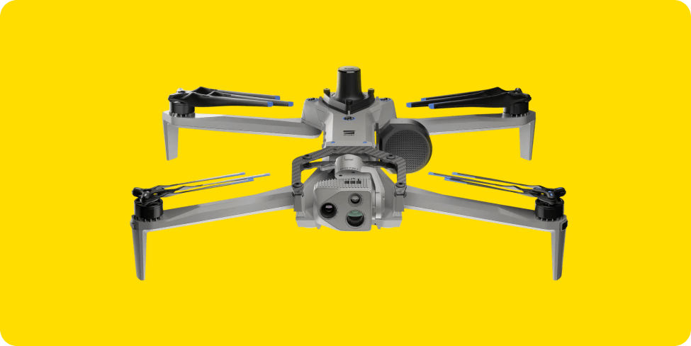
Choosing a drone
Once you’ve determined that your business can benefit from drone surveying, one of the first decisions to make is which drone is right for you. Whether you are looking to map complex terrain or survey sites faster and cheaper, there are a variety of options available and specific considerations to evaluate.
There are three main considerations when choosing a drone:
- Size of your survey area
- Camera selection
- Budget
Quadcopter drones, like DJI’s Phantom 4RTK, Mavic 3 Enterprise and Matrice 300, work like a mini-helicopter, with a central body and multiple motors that power the propellers. Multirotor drones are the most common drone used for most civil construction, mining, aggregates, and waste management companies.
Fixed-wing drones without Vertical Take-off and Landing (VTOL), like the Sensefly eBee X, have a fixed-wing structure and RTK capabilities and incorporate a catapult-style launch, but do not have the ability to vertically take off and land.
Fixed-wing drones with VTOL, like the WingtraOne GEN II and Quantum Systems’ Trinity F90+, combine features of both quadcopter and fixed-wing designs. They can take off and land vertically (thus the name) like a quadcopter, but the fixed wing design allows them to fly faster and farther than quadcopters, making them ideal for large-scale work sites, especially long corridor projects.
| Type of drone | Pros | Cons |
| Quadcopter | Less expensive Great control over positioning and framing Perfect for smaller sites or urban areas Easier to learn to fly |
Limited endurance and speed More parts that are susceptible to breaking |
| Fixed wing | Durable fiberglass design Faster and more efficient Longer flight times Ideal for fast and efficient mapping for large, open workspaces |
More expensive than quadcopters Larger and more difficult to transport than quadcopters More complicated to fly Require more space to operate |
Processing your drone data
With proper mapping and analytics software, you can calculate stockpile volumes in a couple of clicks; check road grades in seconds; monitor environmental zones over time and after big events; track compaction rates and remaining airspace accurately; and so much more.
Investing the time to find the right software for your needs pays off. Drone survey platforms are continually advancing, and while some are optimized for agriculture, utilities, inspections, real estate, or oil and gas, others are purpose-built to meet civil contractor and resources industry needs.
The Propeller Platform was built to serve the construction and resource industries and leverages PPK processing to ensure the most accurate survey data possible. Track progress and productivity on site, measure quality, and mitigate cost with simple tools anyone can use—all without downloading a single software program. Propeller is cloud-based, and does all the heavy lifting when it comes to data. No more expensive desktop machines that take days to process data.
Calculating how much work you have completed and how much work is left to do can be accomplished in a variety of ways within the Propeller Platform using the volume comparison tool. Here are some common workflows that earthmoving businesses can report on using their drone survey data processed by Propeller.
- Comparing the current surface to the original surface – Use this method of reporting to determine how much material you have moved since the beginning of work and if you are tracking correctly against your project milestones
- Comparing the current surface to the last surveyed surface – Use this information to understand how your site is progressing and determine if re-deploying workers or machinery is needed
- Comparing the current surface to the final design – Use this comparison to track how close you are to the earthworks completion for the project

Data analytics, planning, quality assurance, and progress tracking—those are the places to focus your time, those are the ways that you can make the biggest difference in efficiency and cost mitigation on your site. So if you’re on a mine, a quarry, a landfill, or a civil construction site, how do you go about picking the right software?
Common Questions
Here are the most common questions about drone surveying (and some about Propeller) from those looking to start a drone survey program or enhance an existing one.
We’re a smaller earthworks business. Can we afford a drone survey program?
You may think that you need an expensive drone, a highly trained pilot, special survey equipment or a costly web service contract to process data. However, it’s simple to add an affordable drone to help you collect topographic data. And with the right processing platform like Propeller, you’re able to obtain the data you need from each drone flight and ensure you get compensated for the work you complete, thereby realizing a significant return on your investment in a drone program.
How is the accuracy of the maps and models ensured?
Accuracy is the number-one priority in drone surveying operations, so make sure your vendor understands why ground control is so important. Surveyors overwhelmingly agree that, even when using high-end on-board RTK/PPK GPS, you still need a method of ground control or authentication for the drone data you collect. Accuracy is also influenced by how drone survey data is processed, and you can find more information on this below under the question titled “How is data processing quality ensured?”.
Will a drone surveying solution create another “data silo” in my business?
You likely have established processes you don’t want to disrupt. So, you’ll want to ensure the drone surveying software you choose integrates with existing workflows and makes your day-to-day workflow easier. Your data must be able to be imported, exported, transfigured, and manipulated to support sound decision making for your business operations.
With Propeller, all the data you generate, and every calculation you perform, can be exported and shared, either as a PDF report or a spreadsheet. You can download your data in a range of custom file formats to use in programs like Trimble Business Center, AutoCAD, Carlson, and AgTek.
Are local site calibrations supported?
If you operate on a local grid, make sure your software supports local site calibrations. Without that capability, you’d need someone in-house with the time and skills required to convert each piece of drone data into local grid coordinates. Processing platforms like Propeller support local coordinate systems through “drag-and-drop” of your site’s calibration file so all your data is delivered in your site’s own “language.”
How is data processing quality ensured?
Today’s processing platforms are expected to provide same-day processing and simultaneous job processing. But you don’t want speed at the price of quality.
Ask about how “automatic” processing actually works. If there’s a problem with your dataset, how will this be identified and communicated? Who will you be speaking to in this scenario and what are their qualifications? When will they be available to help?
As part of our quality assurance, Propeller’s geospatial specialists may step in to manually mark or verify ground control point (GCP) locations. Once your data processing is complete, it’s checked one more time before being released, to ensure the highest level of accuracy. This is where the processed data is compared to previously released surveys of the same site to verify if the changes between datasets look realistic. Propeller also checks to ensure data is internally accurate, based on the final GCP and checkpoint elevations.
Propeller has an in-house data success team, who are experts in surveying and photogrammetry. With world class 24/7 support, they personally check each and every job for quality.
How can I be confident in the measurements I make with the software?
A common concern about drone data adoption within the construction, mining, aggregates, and waste management industries is the predictability and repeatability of measurements. Data confidence comes from accuracy validation, both of your survey and individual measurements.
If vendors are slow to provide accuracy metrics, or platform tools don’t easily allow you to validate your own measurements, you should assume that surveys aren’t accurate and measurements won’t be reliable.
Drone survey resources
This is just the beginning, and there’s much more to learn about drone survey data and analytics. To learn more, check out our series of industry-specific guides to drones and our suite of ebooks on drone data analytics.
Construction
Mining
Aggregates
Waste Management