Beyond the well-known industries of mining, aggregates, waste management, and construction, there are a number of other sites that benefit from drone surveying—one of which is solar farms.
Today, AirBorn Insight’s Loren Otto writes this guest post on how their company uses drone surveying and Propeller to deliver value for solar farm customers.
AirBorn Insight is an experienced service provider in Australia serving major cities including Brisbane, Perth, Adelaide, Melbourne, and Toowoomba. We partner with businesses and decision makers in the natural resource, infrastructure, environmental, waste, and agricultural industries.
In the past three years, AirBorn Insight has delivered over 13,000Ha of aerial survey data for new solar farm developments in Australia.
AirBorn Insight was an early adopter of the Propeller Platform, having used it extensively since 2015. Further, having previously used traditional ground control survey methods, we quickly turned to AeroPoints in early 2017 knowing the time they would save in the field.
“The combination of these two products is ideal for fast turnaround of survey projects, including very large and high-value projects such as solar farm developments,” said Director Loren Otto.
As is typically the case for high-cost construction projects, time is of the essence. All aspects of the project need to happen “yesterday,” and mapping the topography prior to construction is no different.
Data turnaround is essential for design
Quick drone survey turnaround is critical because engineers rely on high-resolution, accurate topography maps to optimize the design of the solar panel support structures. They can’t finish their designs until it is done.
When you’re dealing with processing projects with up to 5,000 high-resolution aerial photos over areas up to 1000Ha, the power and speed of cloud processing platforms such as Propeller are indispensable.
Manual processing can take too much time for large-area sites
Setting up the project and processing on a desktop workstation could take a week due to manual steps involved to successfully merge the results. Then you could spend another week checking the results and reprocessing some areas.
By comparison, Propeller can process the data and provide a QA report with outputs available in 24 hours, even when dealing with massive projects captured with a fixed-wing drone.
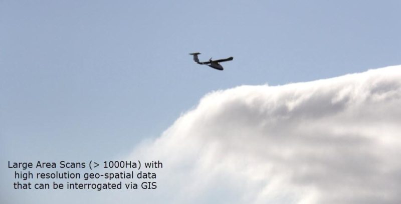 Fixed wing survey drone complimented with AeroPoints for high-accuracy projects.
Data platforms like Propeller provide secure data sharing
The added benefit of Propeller is that it allows the project to be shared securely with a customer as simply as sending an email with a link. No longer is there a need to manually share gigabytes of data, adding another time-consuming step.
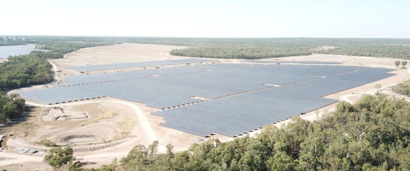
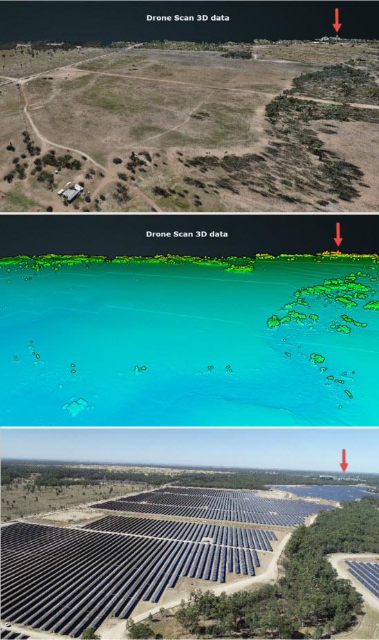
The first two images below show the drone survey data in 2016, prior to design and construction of the solar panels. The bottom image is the fully constructed project in 2018 viewed from the same angle for comparison. (For reference, the arrow is pointing to the existing power station.)
Drone surveying for solar farms has many uses
AirBorn Insight has also found that drone survey data can be used for the following purposes in solar farm developments:
- Contour mapping
- Feature mapping (roads, transmission lines, creek inverts, top of embankments, culverts, etc.)
- Tree location mapping for shadow analysis and conservation
- Visibility analysis and line-of-sight mapping
- Hydrology study and flood level modeling
- Erosion management
“Propeller is simply a game changer for mapping large, high-value projects where fast turn around and accurate data is essential,” said Otto. “Our 2016 customer was extremely impressed with the detail in the drone survey. This was at a time when drone mapping technology was still emerging and relatively unknown in general industry. This is no longer the case—drone surveying is fast becoming an indispensable tool across many industries.”