Drones cut down surveying times to hours instead of days or months, and they’re cheaper than traditional survey equipment. But there’s a whole lot more that drones can do for your construction site. Let’s look at workflows to see how you can use your UAV data to best effect.
Calculate volumes accurately and quickly
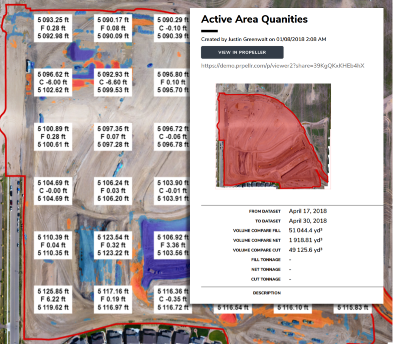
Volumetrics is the most popular use case for drones on any worksite. For many construction companies that operate their own quarries, drone-captured data is the affordable source of timely and accurate information on volumes.
Instead of relying on outsourced survey teams or walking around each site with a GPS rover, you can now fly a drone and capture an entire site usually in a couple hours or less, depending on the size. Once the data has been uploaded and processed, you can get accurate cut/fill volumes and other survey analytics necessary for planning and tracking job progress.
Capturing data regularly is also useful on site when it comes to earthwork. If you’re moving dirt around, you need to be able to quickly calculate the volume of material to be moved. 3D drone-data surveys let you track earth-moving operations safely and more economically than with traditional walkthroughs.
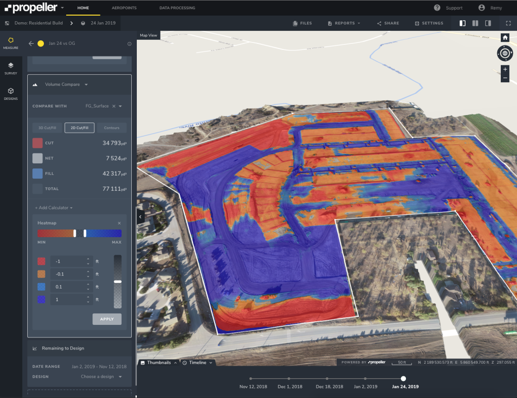
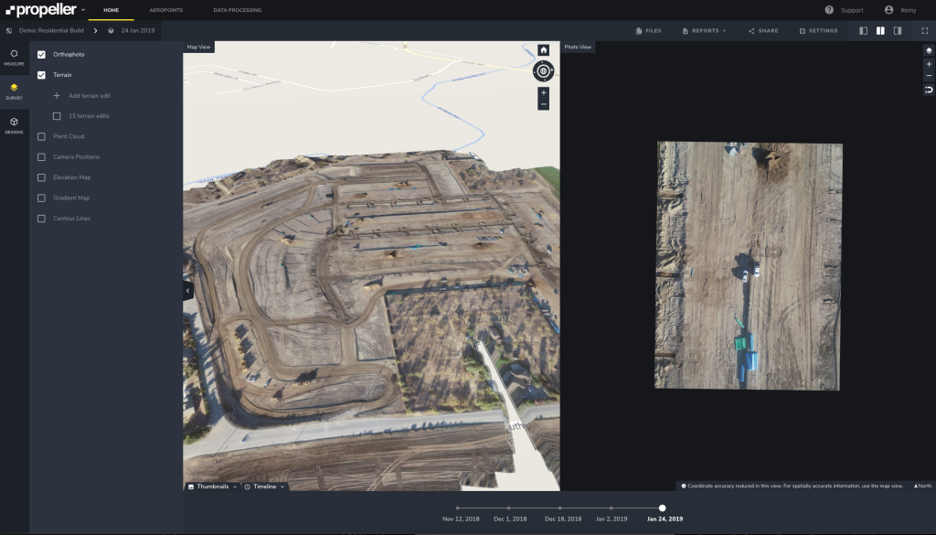
Compare your construction site against design
If you’re actively moving earth, regular drone surveys allow you to compare current ground levels against the plan and identify anything going off-track.
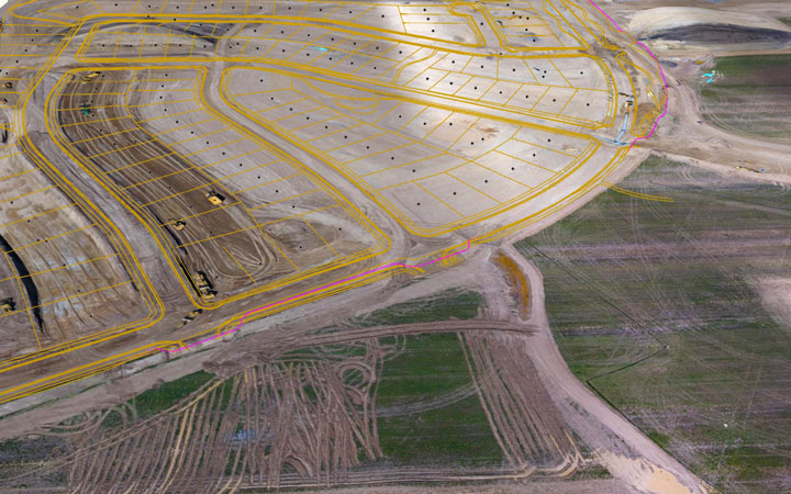
You can do this by overlaying design surfaces or linework on your 3D visualization. With all the information on one screen, it’s simple to understand if volumes and elevations are matching design or not. And since it’s a simple visual of the physical space, your findings are easy to communicate to others.
Track your construction progress and productivity
It’s an unfortunate fact, but most construction projects run over time and over budget. You want an easy way to visualize your site transformation as the project progresses. While it’s particularly important to make sure you’re on schedule and not running up costs, it’s also necessary to inform remote stakeholders on progress to date and monitor contractor work.
When you combine frequent and regular drone surveys with something like the Propeller Platform’s timeline tool, you can compare between multiple datasets and visually track onsite changes in a way that makes sense for everyone.
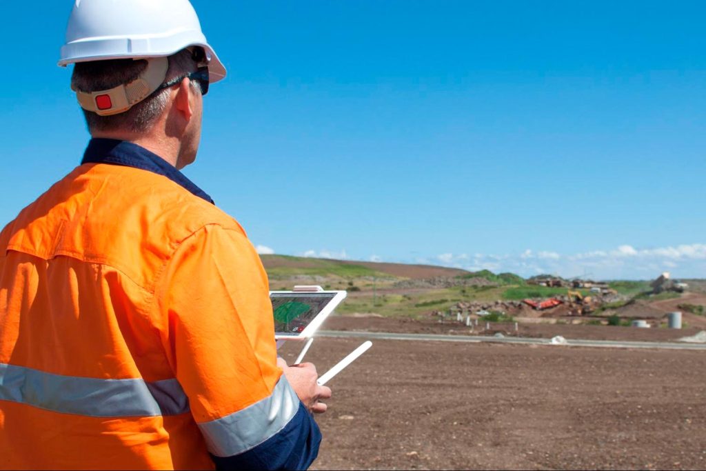
Inspect your assets remotely, faster
Depending on your company and the job itself, you might have assets to inspect on your construction site. Drones can quickly capture high-res photos that can be viewed in processing platforms like Propeller. There they can be annotated, then downloaded as a report and shared with contractors or project stakeholders.
Using drones for remote asset inspections not only saves money, but also reduces safety risks for employees and contractors by keeping them away from hard-to-reach or dangerous locations.
Resolve disputes more easily
No one wants to move dirt they don’t have to. Drone technology allows you to have more real-time control over a project and define how much you should pay your contractors based on the actual amount of work done.
Drone survey data and timeline features and reports can also be used as a tool to solve any disputes with contractors. Because they provide a paper trail of the physical state of the site at every survey, you can easily show where things went and when.
Export drone data into a CAD and BIM software
Some construction companies often require drone data to be exported into CAD or BIM software for further work. Processing engines like the Propeller Platform allow you to export high-resolution point clouds, TiFF, and DXF files, which can be used in a wide range of software applications.
Simplify reporting
Regular drone surveys help deliver up-to-date information to project stakeholders and contractors by providing visual data that they wouldn’t have seen from the ground. And processing your data with an online platform reduces the time and expenses associated with on-site visits.
For example, Propeller has PDF and CSV reports that are easy-to-create and share with your team or your boss.