Telecom Tower inspection using DJI Phantom 4 Pro: Step-by-step guide

Read Time: 5 mins
Quick links

    This guide walks through a telecom tower inspection using the DJI Phantom 4 Pro and DJI GO 4 App, from preflight setup through to uploading data and reviewing a 3D model in Propeller. Following a structured Interval Shooting setup and helical orbit pattern around the asset gives you 150–250 images with enough coverage and overlap to build a detailed point cloud ready for annotation and PDF reporting.
    The DJI Phantom 4 Pro is a capable platform for asset inspection work: 360-degree collision avoidance, 30 minutes of flight time, and a 20.1MP one-inch sensor that gives you the image detail needed for high-quality 3D model reconstruction.

    This guide walks through a telecom tower inspection in Kiama, NSW, using the Phantom 4 Pro and the DJI GO 4 App. Use it as a step-by-step reference, from preflight setup through to uploading your data to Propeller.

    Getting ready for drone inspection

    Before any inspection flight, cover these basics.

    Before you fly

    • Read your local drone regulations and confirm the area is not listed as restricted airspace
    • Notify local aviation authorities and obtain authorization if required
    • Check the wind and weather forecast for your planned date and time

    Preflight check

    • Confirm batteries are fully charged and propellers are mounted correctly
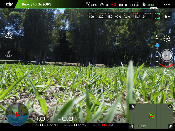
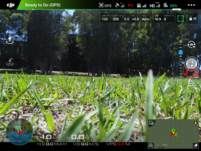
    • Confirm the drone status shows Ready to Go (GPS)
    • Check for errors on screen and confirm all systems are working
    • Perform a compass calibration
    Step 1

    Setting up interval shooting

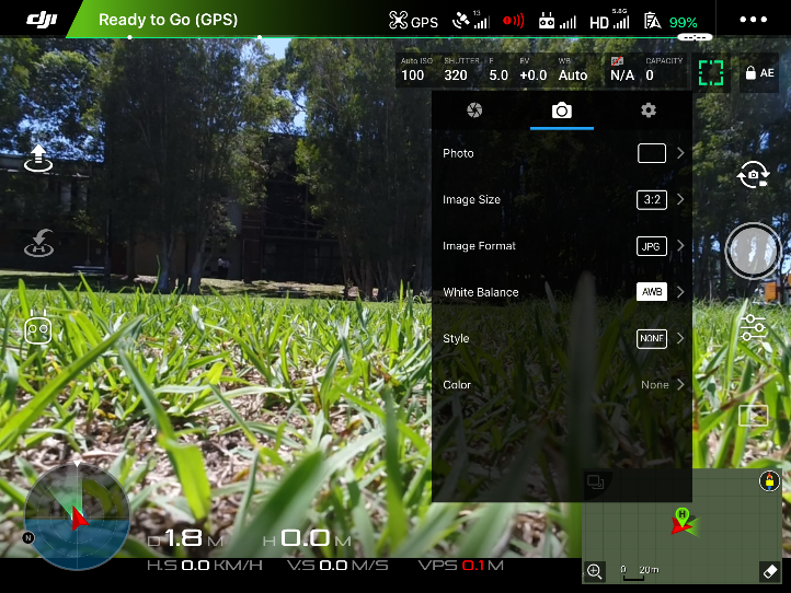
    Open the DJI GO 4 App and activate Interval Shooting mode. This removes the need to manually press the shutter during the inspection. A 2-second interval works well for this workflow on the Phantom 4 Pro.

    To start, click on the camera settings button.

    DJI GO 4 App camera settings button

    Go to the camera icon in the top menu and select the photo icon.

    DJI GO 4 App photo icon in top menu

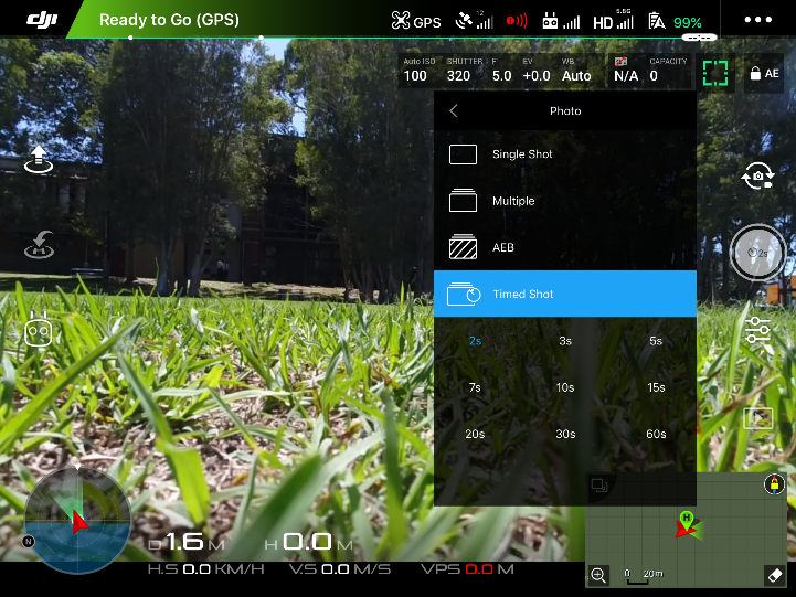
    In the Photo tab, select Timed Shot and set the interval to 2s.

    DJI GO 4 App timed shot interval setting at 2 seconds

    Interval Shooting is now active. Press the shutter button on the remote controller and the drone will capture photos at two-second intervals.

    Step 2

    In the air

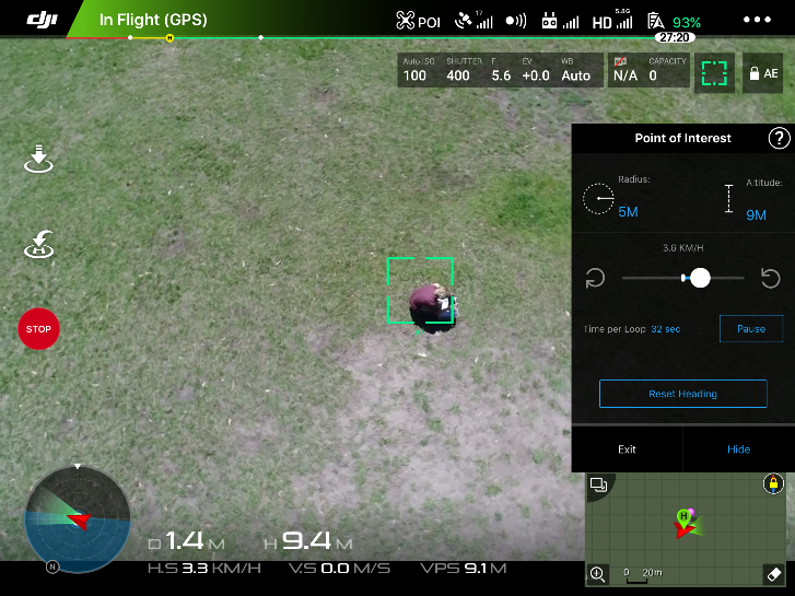
    Get the drone airborne and fly over the inspection asset. When hovering directly above it, hold an optimal distance of 5m. This ensures the camera captures the Point of Interest cleanly before the orbit begins.

    For telecom or broadcasting towers, maintain extra clearance to avoid signal interference. The higher the altitude, the more precise your position above the Point of Interest needs to be. Keep the aircraft as still as possible before entering Point of Interest mode.

    Note that inspection assets are often on hills or elevated terrain where wind is significantly stronger. Choose your flight window carefully, especially for smaller assets.

    Step 3

    Point of Interest flight path

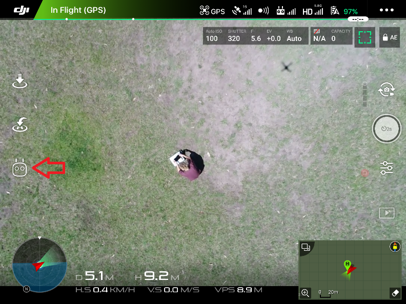
    Once 10m above the asset location, open smart flight modes from the bottom left of the app interface.

    DJI GO 4 App smart flight modes menu

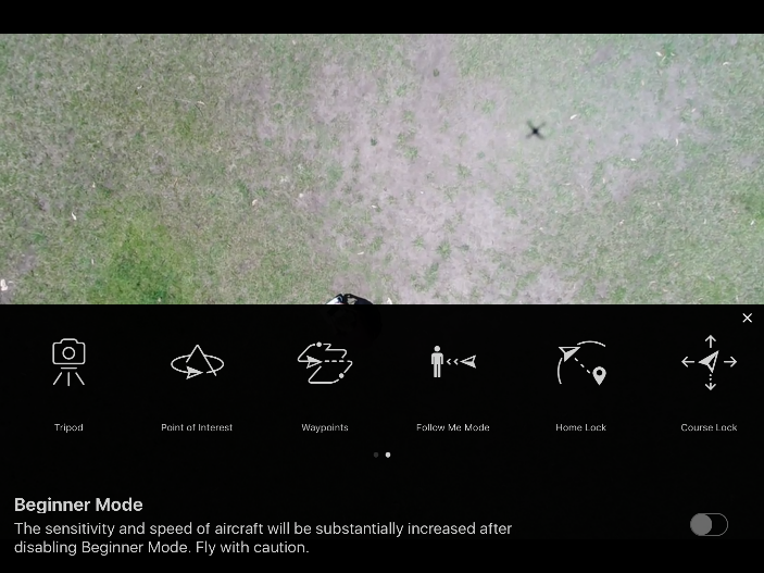
    This opens the smart flight feature menu. Select Point of Interest.

    Selecting Point of Interest in DJI GO 4 App smart flight menu

    Hover over the point of interest with the camera facing directly downwards and click Record POI.

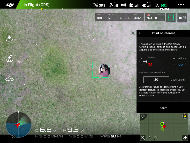
    Set the height and radius from the Point of Interest in the right-hand panel and click Apply.

    Setting Point of Interest height and radius parameters in DJI GO 4 App

    Once the Point of Interest is recorded, move the aircraft outward until the radius reading changes from red (0m) to blue (approximately 5m).

    Staying closer to the tower gives you more image detail, but keep at least 5m clearance when the drone is orbiting. This ensures each photo captures enough of the asset in the foreground and enough background context to produce a high-quality 3D model. The Phantom 4 Pro’s 20.1MP camera gives you more flexibility here, with detail to spare even at slightly greater distances.

    Collision avoidance is a practical asset during inspection flights. On this flight, the Phantom’s sensors helped maintain safe clearance from the tower while still capturing the shots needed for 3D model reconstruction.

    After setting the radius, set your orbit speed.

    Setting drone orbit speed in DJI GO 4 App for tower inspection

    A speed of 2.5km/hr gives clean, steady movement around the asset. Once the orbit begins, press the shutter button on the remote to start interval capture.

    Quality tips

    • Take around 150–250 images for a typical tower inspection
    • Capture from multiple altitudes, including overhead (top-down) shots and coverage of the tower base and surroundings
    • While in orbit, adjust altitude with the throttle stick to create a helical flight path around the tower
    • Adjust camera tilt throughout to keep the Point of Interest centered in frame
    Step 4

    Uploading your inspection data to Propeller

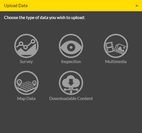
    Go to Propeller and create a new project. Upload your images and select the Inspection data type.

    Creating a new inspection project in Propeller

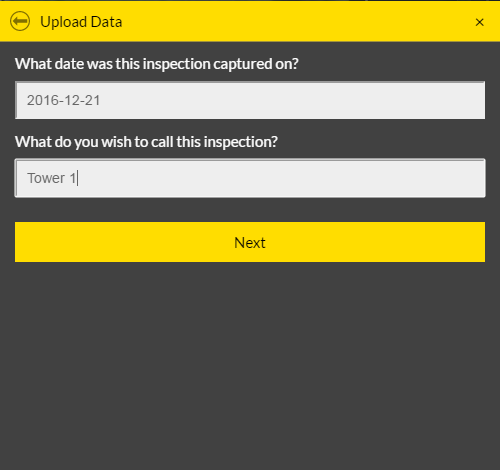
    Enter the date of capture and the inspection name.

    Setting inspection date and name fields in Propeller

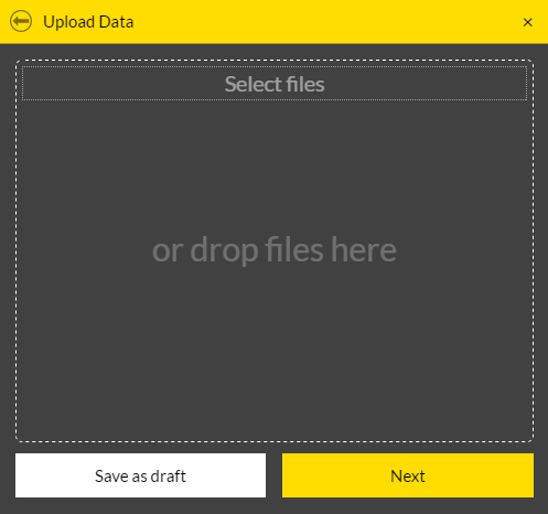
    Select and upload your images from the SD card. DJI drones automatically geotag photos. If you are using another drone, confirm your images are properly geotagged before uploading.

    Uploading geotagged inspection images to Propeller

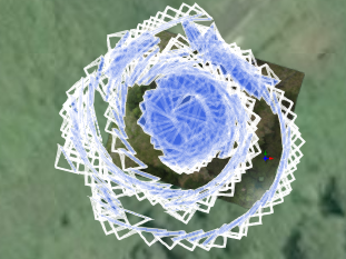
    Once processing is complete, your project becomes available in Propeller. The left-hand panel lists the images used to build the 3D model and point cloud.

    Inspection image flight path in Propeller showing windy capture conditions

    Note: this example was flown in windy conditions, which is reflected in the image path.

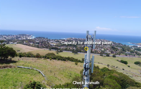
    From there, you can annotate tower components, generate detailed PDF reports, and invite team members to access the data.

    Annotating telecom tower components in Propeller inspection view

    Quick links

      Related articles

      Propeller automated haul road analysis for mining and aggregates

      Propeller and Spacesium: Automating the future of mining safety and operational intelligence

      At Propeller, our mission has always been to provide the most accurate, reliable, and actionable…
      How Drone Data Can Make Your Next Earthwork Project a Success

      With drone data quickly accessible in the cloud, and powerful, easy-to-use earthwork software like the…

      How to Survey Worksites with Significant Elevation Change

      To survey a site with significant elevation change you will need to fly two different…

      Ready to learn how Propeller can power up your worksite?

      We’re happy to show you how Propeller can power your worksite, and boost productivity.

      Related articles

      Things to know about ground control in drone surveying

      Getting ground control points right comes down to three things: choosing markers with high contrast…
      Survey drone flying over an active earthwork site with an illustrated flight path, capture points, and ground control markers

      Propeller’s Drone Guide: DJI Solutions for Commercial Operations

      Propeller’s verified DJI lineup covers five platforms: from the compact Mavic 3 Enterprise and purpose-built…
      A surveyor laying an AeroPoint on the ground stood next to a car.

      5 Ways to use your AeroPoints sets

      AeroPoints can be used five different ways depending on what reference data you have available,…