How Daracon Group built faster, safer workflows with real-time data

Daracon Group is one of Australia’s largest privately-owned civil construction contractors, with a reputation for delivering a wide range of complex infrastructure projects thanks to their extensive fleet of modern machinery and plant solutions. Their team is known for its commitment to developing cost-effective strategies and optimised solutions, and they continually look for opportunities to refine their workflow and leverage data more effectively.
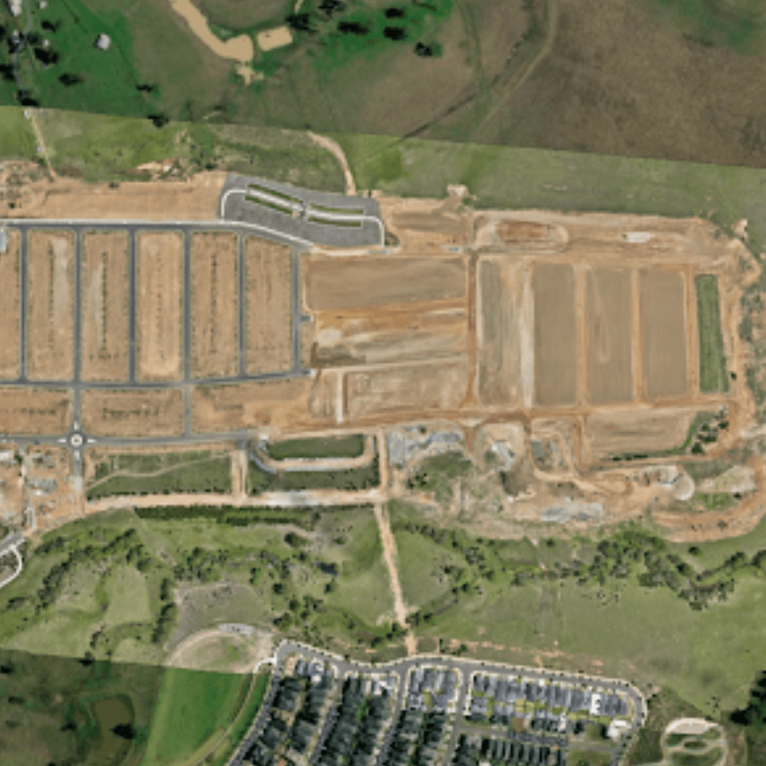
We partnered with Daracon Group to provide high-precision 3D mapping and analytics tools built for civil and earthmoving projects.
The result? A complete workflow overhaul that not only saved time and money but also empowered their entire team with real-time insights from site.
As of December 2025, Daracon Group have:
The challenge: Traditional processing & limited site access
Before adopting our platform, Daracon’s survey and project teams faced several roadblocks:
- Bottlenecks to decision-making. Their old workflow was a multi-step process. They would fly a site, bring the drone images back to the yard, and process the data on a “super-computer.” This process was cumbersome and could take anywhere from three to five hours. For large projects, it was simply unfeasible to follow this process more than a few times a month.
- Data was siloed. Project data lived on individual computers, making it difficult to share information across different teams. It was impossible for Engineers, Project Managers, or clients to access the survey data they needed without going through a Surveyor.
- Access on site: Traditional surveying methods required team members to access all parts of the construction site, this was challenging as often, depending on the complexity of the job, team members would visit sites in various stages of delivery. This included steep slopes, rocky terrain or navigation around contaminated materials.
The solution: A centralised, cloud-based platform
The Daracon team adopted Propeller as an integrated, cloud-based platform to streamline their workflows end to end. Since making the switch, they haven’t looked back.
Now, they simply fly a site, and their images are uploaded directly from the field via a stable internet or Starlink connection. Because the Propeller platform processes the data in the cloud, a 27-minute flight with 1,000+ images from a 60-hectare subdivision site can be processed in just 5.5 hours, allowing the team to get back to work faster.
With everyone on the same platform, the Daracon team – from Surveyors and Engineers to Safety and Environmental professionals – can access the information they need to do their jobs.
“We have a lot of people utilising our survey data on Propeller, from internal staff to consultants, and even some clients viewing the data.” says Malcolm Harvey, Survey Manager at Daracon Group.
Daracon’s most-used features and workflows:
- Volumes & planning: The team uses the platform for daily and weekly planning, quickly calculating volumes of material in stockpiles or a specific area. They also use it for end-of-month claims with the client and to aid progress tracking on site.
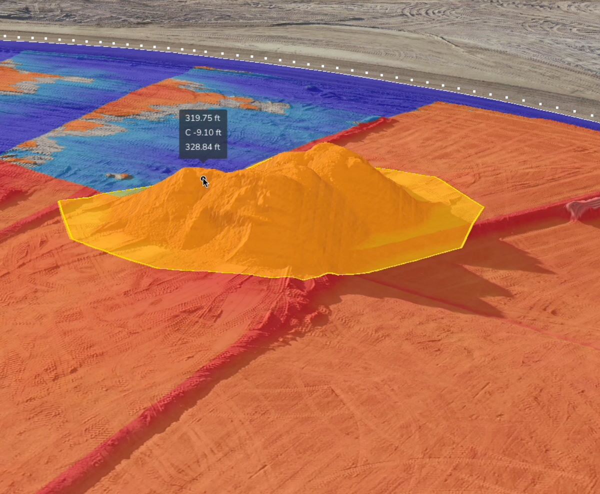
- Design visualisation & analysis: Daracon uses cut-fill heat maps and cross-sections to track progress against a final design to ensure they’re on program. This helps them quickly visualise what the site is doing and what needs to happen next.
- Environmental & safety: The team uses gradient maps to visualise where heavy machinery can safely operate. They also use hydrology tools to simulate rainfall and track water runoff, which is critical for their environmental monitoring across a range of projects.
- Centralised data: The mobile app allows team members to instantly geo-tag photos in their correct location on the site map, which has been invaluable for safety and site inspections.

The results: A new way of working
The impact on Daracon’s operations has been significant. By adopting Propeller, they’ve not only streamlined their workflows but also enabled team members to make confident and effective data-driven decision-making for the benefit of clients.
- Faster processing: What once took three to five hours can now be processed in a fraction of the time. This has allowed Daracon to move from processing surveys a few times a month to multiple flights daily. Increasing the team’s efficiency and resulting in less reliance on external Surveyors.
- Quality Assurance: The platform provides a traceable record of work completed over time. This has helped projects approve payment claims and variations, as they can quickly confirm exactly how much work has been done.
- Enhanced safety: By using slope analysis and geo-tagged photos, Daracon’s project teams are able to keep their personnel out of harm’s way and improve on-site safety procedures. The data is now a key part of their start-up communication on site.
- Trusted command centre: The platform has become the central hub for the entire project lifecycle, from project award to daily planning and final design checks. It’s no longer just a tool for Surveyors; it’s a resource used by everyone from Project Managers to Environmental teams.

Want to know how Propeller can help you?
Learn more about Propeller’s products, pricing, and how to get started on your site.