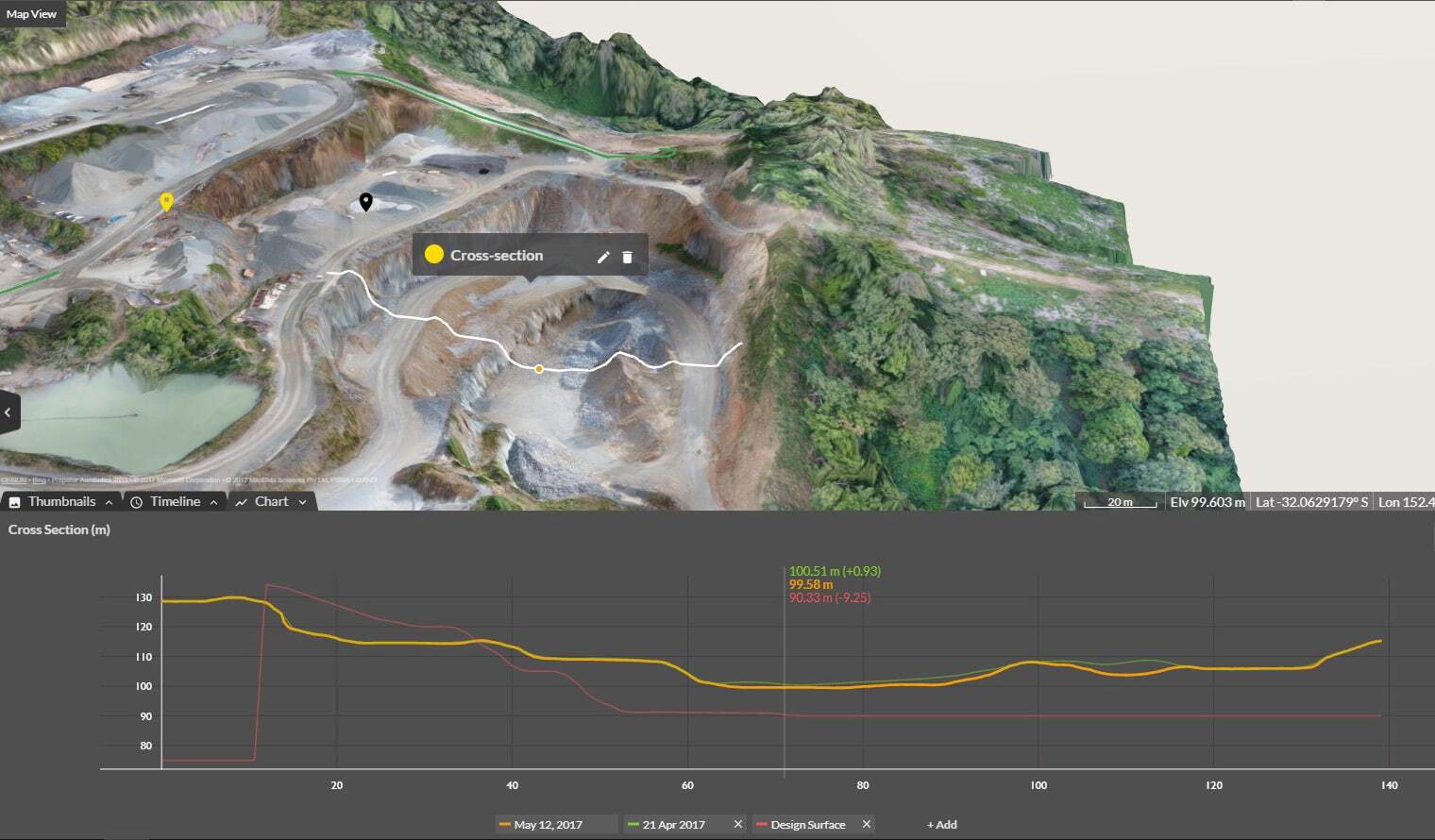
Cross Section Survey in a Matter of Minutes Using Drone Data
With the power of drone-captured data and the Propeller Platform, surveying cross sections becomes as…
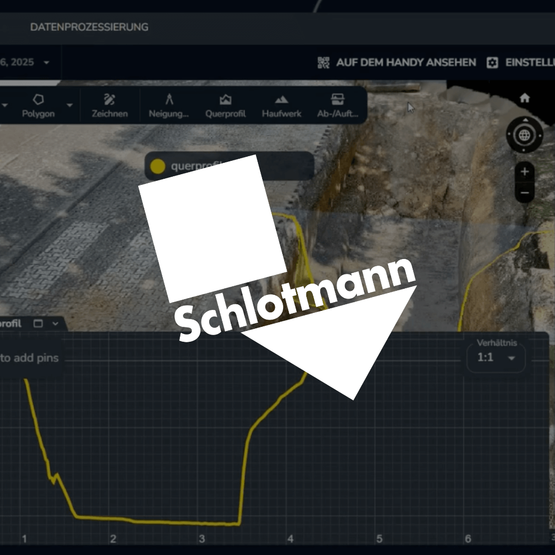
Before Propeller, construction company Schlotmann relied on traditional GPS rovers to manually capture points and create complex CAD drawings for volume analysis. Today, Propeller has completely transformed their workflow, enabling fast, accurate, and cloud-based 3D data capture and processing.
Now, Schlotmann captures data using drones for full-area mapping and handheld scanners—even in restricted areas or under trees. Their process allows them to collect photogrammetric data with an iPhone and viDoc, which is then automatically processed into high-precision 3D models right in the Propeller platform.
The result: operator efficiency is up , planning and cost control are improved, and the team has immediate access to project insights from anywhere to make smarter decisions.
Watch the full video to see how Schlotmann is leveraging Propeller to reshape their entire surveying operation:
Learn more about Propeller’s products, pricing, and how to get started on your site.